CCN Weather Update for Tuesday September 16, 2025.
This weather update is sponsored by Freedom Insurance of Whiteville. No weather worries with Freedom Insurance. For home, car, boat, or whatever you need, Freedom can provide customized coverage to keep you and your family safe. Contact Freedom today at 910-640-2828!
Here’s today’s Bottom Line
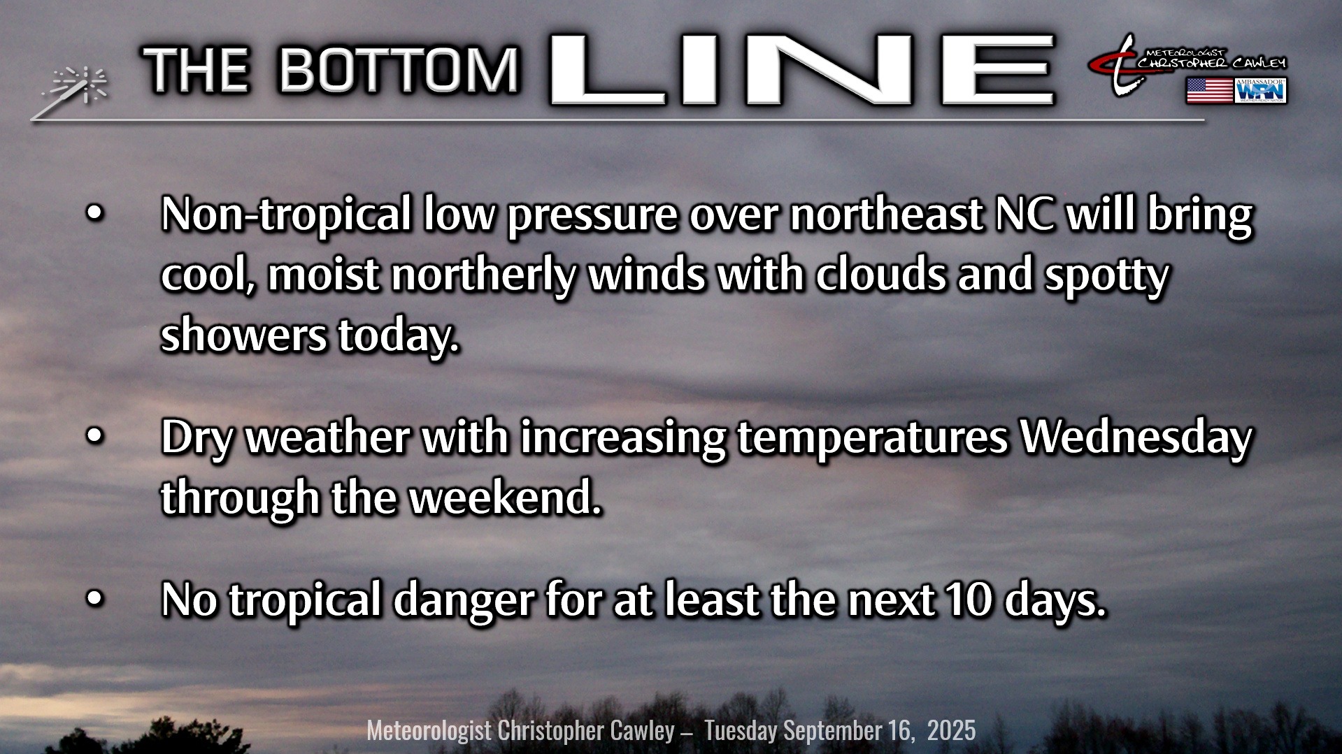
Non-tropical low pressure is impacting — significantly impacting — much of northeastern North Carolina and pretty much left us alone yesterday. While that resulted in a busted forecast on my part, I guess it’s better to call for clouds and spotty showers and end up sunny… than the other way around.
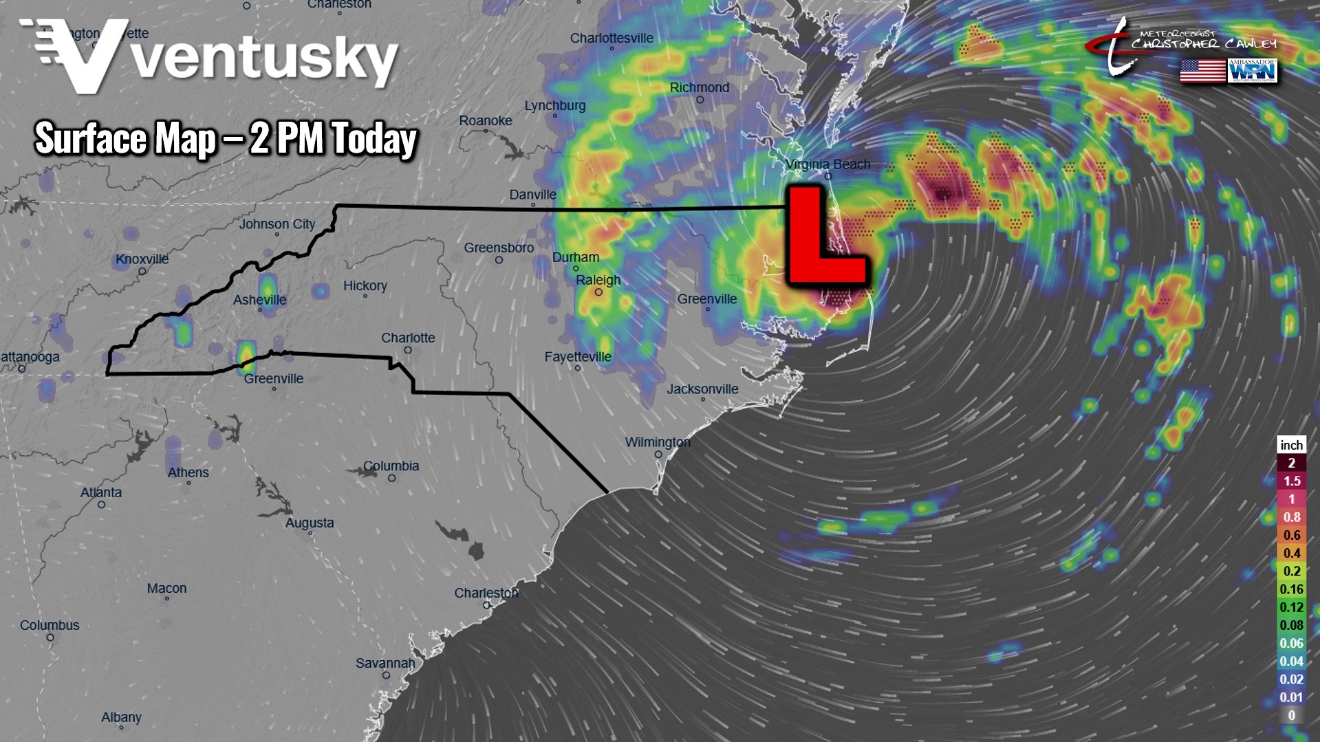
As you can see from the map above, there’s a northerly wind flow around the western periphery of this rather strong area of low pressure. This will bring cool, moist air southward into our area today, resulting in considerable cloudiness (some breaks of sunshine) and spotty shower chances. Rainfall won’t be robust; in fact, the model blend shows only trace amounts of rainfall across much of the area south of a line from Fayetteville through Elizabethtown and Wilmington (including Columbus county)… but dramatically higher rainfall totals if you’re traveling along and east of the I-95 corridor and north of the I-40 corridor. Rainfall amounts of 3-5 inches are likely across much of northeast NC.
We’re going to just miss this one.
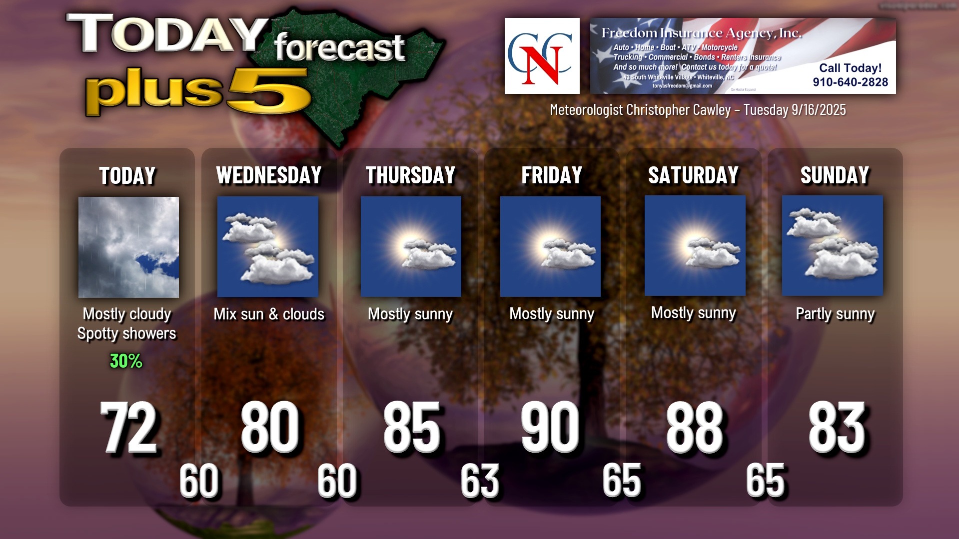
It will, however, be breezy at times with those northerly winds, and our highs today will only be in the lower to middle 70s.
Improving conditions on Wednesday as the low pulls away off to the north and east… much more sunshine with highs around 80.
High pressure then takes charge of our weather through Saturday with building heat, but humidity values should stay in check. We’ll peak around 90 degrees on Friday.
A backdoor cold front likely sweeps off the coast during the day Sunday. For now I’m going with a dry forecast with just some cloudiness with the front, along with cooler temperatures. Like the past several fronts, this one, too, should get “hung up” offshore next week, which will help impact the next tropical system……….
TROPICS: A tropical wave over the central Atlantic is becoming much more organized and is moving into an area quite favorable for development. This will likely end our “storm drought” at some point over the next 1-3 days as a depression should form somewhere near the “x” on the map below.

Very early modeling shows this taking a northwest trek, eventually turning to the north and the northeast, thereby staying harmlessly away from the US east coast.
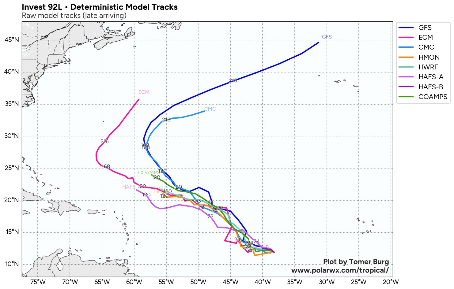
Remember the frontal boundary I spoke of earlier? That front, combined with a huuuuge area of high pressure over the north-central Atlantic, will likely work to “steer” whatever forms away from the east coast, very similar to what happened with Erin. I’ll still be watching it, though.
That being said, I don’t foresee any tropical danger to the Carolinas over the next 10 days.
Here is your Freedom Insurance Today-plus-Five Forecast:
–Meteorologist Christopher Cawley