CCN Weather Update for Tuesday September 23, 2025.
This weather update is sponsored by Freedom Insurance of Whiteville. No weather worries with Freedom Insurance. For home, car, boat, or whatever you need, Freedom can provide customized coverage to keep you and your family safe. Contact Freedom today at 910-640-2828!
Here’s today’s Bottom Line
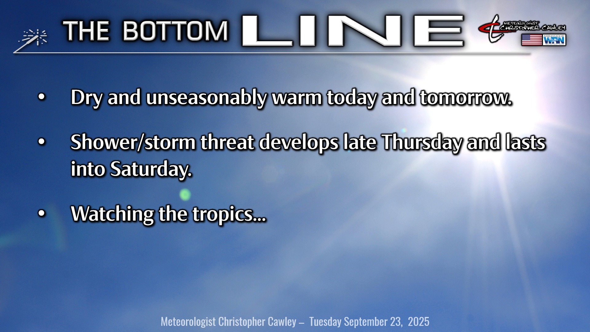
Summer continues to laugh at us hoping for cooler weather… it’s not happening today, tomorrow, or Thursday… maybe a little cooler by the end of the weekend.
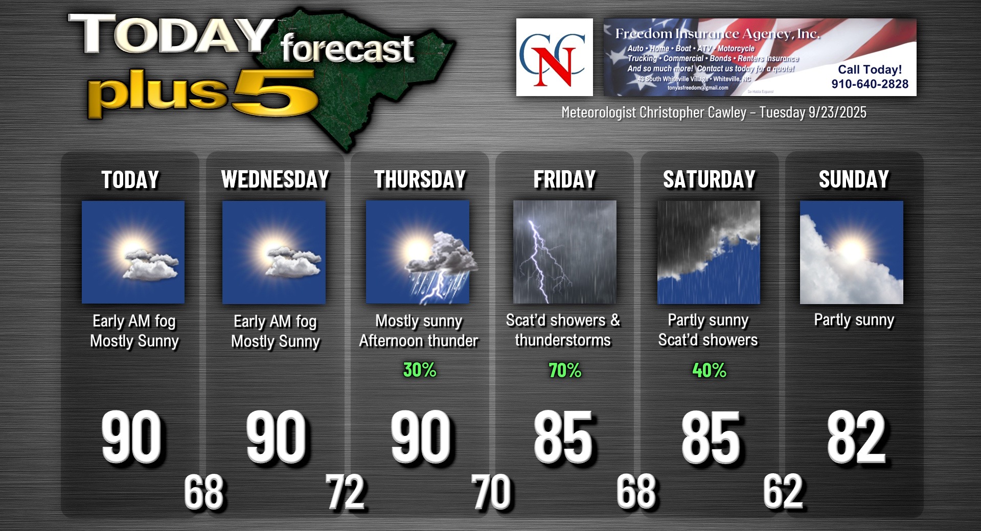
High pressure maintains control of our weather. Today and tomorrow will be carbon-copies (who remembers what carbon copies are?) of Monday. Some patchy early morning fog, then partly to mostly sunny with afternoon highs around 90.
A strong cold front starts to approach the area on Thursday. A warm and humid southerly flow sets up ahead of this front, and our first threat for showers and thunderstorms in a long time begins later Thursday afternoon. The front should be right along the coast by early Saturday with a wave of low pressure moving northward along it. The front then pushes offshore Sunday and stalls…. and interacts with something interesting in the tropics… see below.
TROPICS: Click HERE to view the very latest on Major Hurricane Gabrielle from the National Hurricane Center. She is currently located over the central subtropical Atlantic to the east of Bermuda and is pursuing an east-northeast course across the central Atlantic, eventually toward Europe. We’ll continue to have an increased rip current threat for the next few days along our east-facing beaches, but that’s about it.
The next system is likely to become a tropical depression by Wednesday or Thursday in the central Atlantic, and then from there likely to become Humberto. I don’t believe this will be a threat to the east coast, but Bermuda might be directly in the crosshairs as he, too, makes the “turn” to the north.
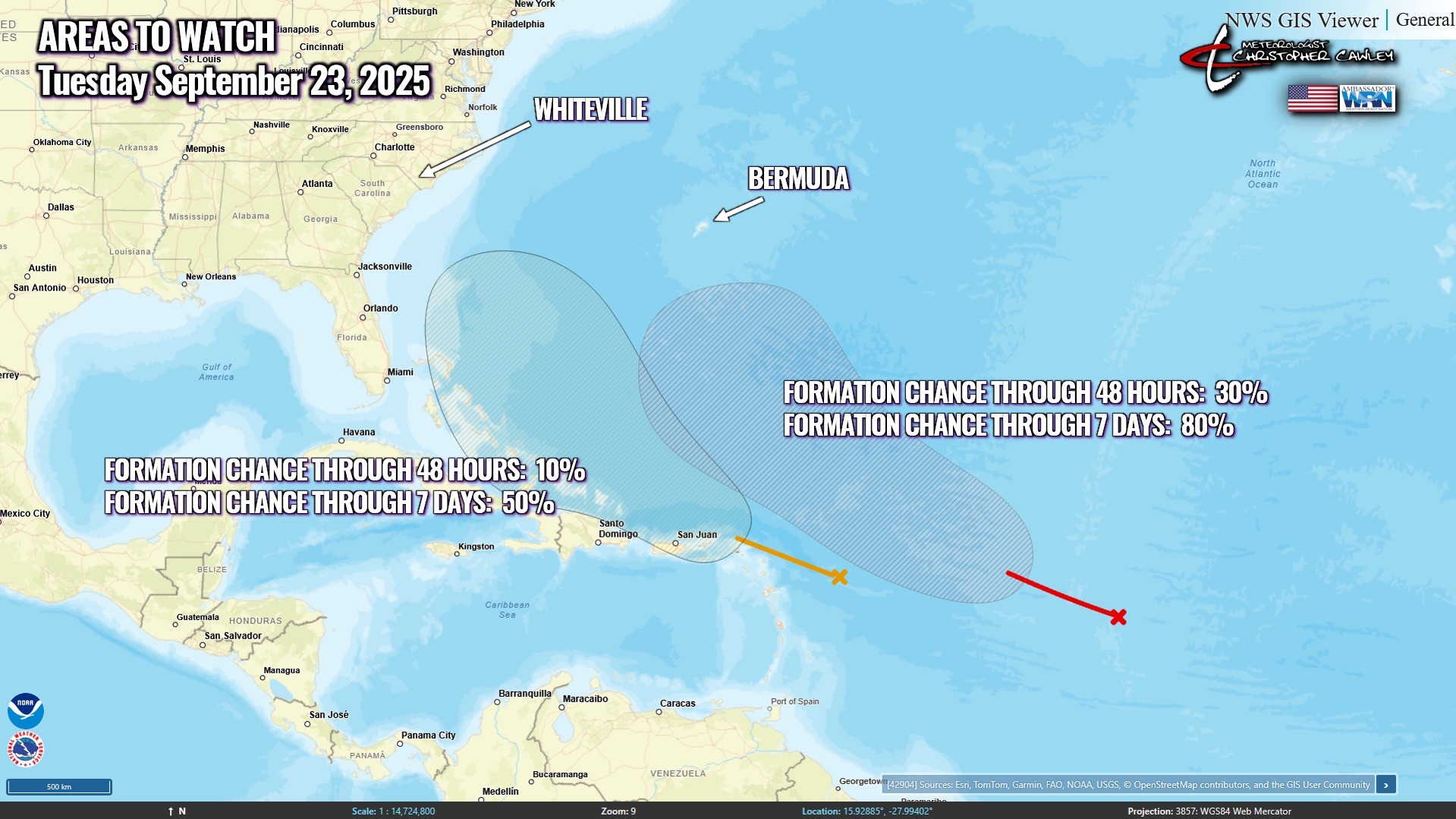
Finally, the NHC continues to monitor an area farther to the west (closer to the mainland). The center of the tropical wave is just east of the Leeward Islands. The area is favorable for development, and the NHC says a tropical depression could form near the Bahamas by the end of the week. From that point, the placement of a frontal boundary offshore *should* keep this potential system away from the mainland but it could be a rather close call. At this time, I believe the frontal boundary will keep us “safe” from any potential tropical impacts.
Here is your Freedom Insurance Today-plus-Five Forecast:
–Meteorologist Christopher Cawley