

CCN Weather Update for Friday October 17, 2025.
This weather update is sponsored by Freedom Insurance of Whiteville. No weather worries with Freedom Insurance. For home, car, boat, or whatever you need, Freedom can provide customized coverage to keep you and your family safe. Contact Freedom today at 910-640-2828!
Here’s today’s Bottom Line
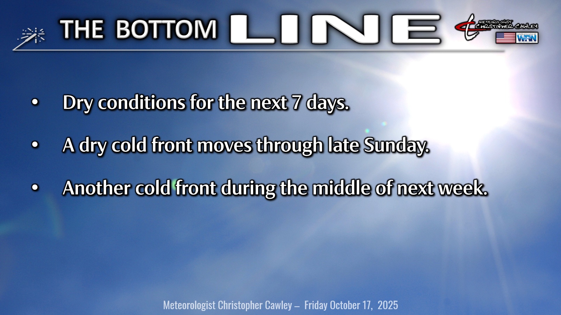
Dry conditions will continue for the next 7 days. Cool temps today will moderate through Saturday and Sunday before another cold front pushes through late Sunday evening. This will usher in a reinforcing shot of cooler air for Monday… before things warm up again on Tuesday… only for ANOTHER cold front to move through early Wednesday.
Model blends are showing zero to only trace precipitation chances through next Wednesday. I see no reason to disagree.
TROPICS: A couple areas have been outlined by the National Hurricane Center. The first one is located in the north Atlantic Ocean, where an area of low pressure, spawned out of the Nor’Easter, is developing and has a low chance of taking on tropical or subtropical characteristics as it moves over warm Gulf Stream waters. Eventually the system will exit that zone and that’ll be that.
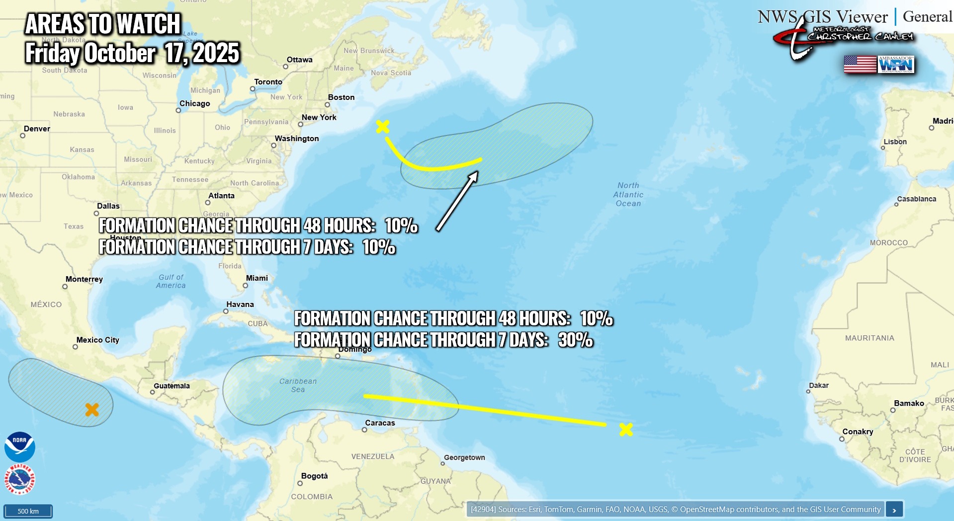
The next one… a bit more interesting in my opinion… as a wave of low pressure moving over the central Atlantic. This will move into the Caribbean, and if you’ve followed along for the past several days, I’ve been saying we need to watch the Caribbean. Conditions are going to be favorable for further development, and the NHC right now gives this a 10%/30% risk over the next 7 days. Plenty of time to watch this.
There are no tropical threats to the Carolinas for the foreseeable future.
Here is your Freedom Insurance Today-plus-Five Forecast:

–Meteorologist Christopher Cawley