

CCN Weather Update for Monday October 27, 2025.
This weather update is sponsored by Freedom Insurance of Whiteville. No weather worries with Freedom Insurance. For home, car, boat, or whatever you need, Freedom can provide customized coverage to keep you and your family safe. Contact Freedom today at 910-640-2828!
Here’s today’s Bottom Line
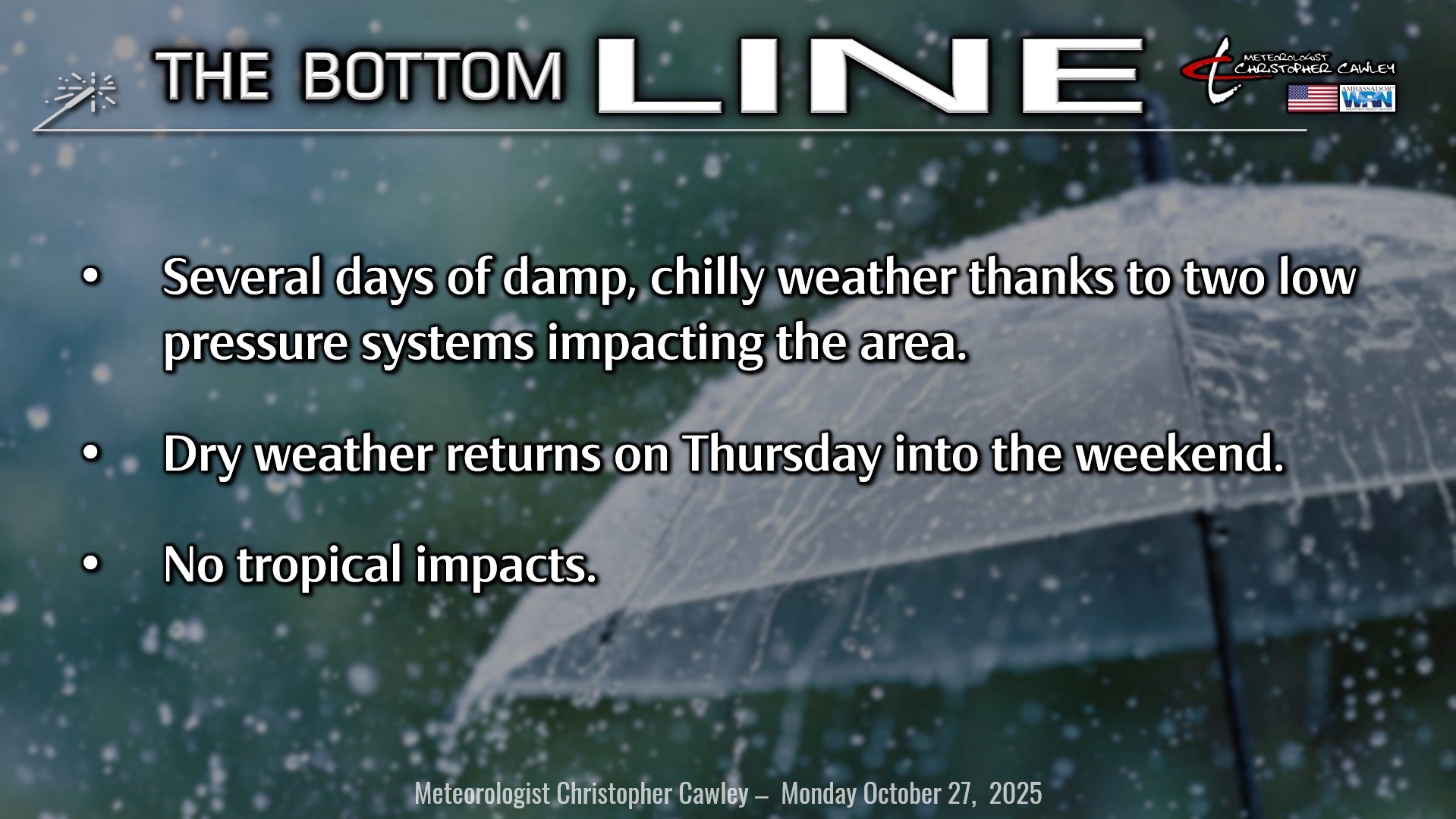
Well, folks, if this were January, we’d be talking about a blockbuster snowstorm, but alas, it’s only October.
Low pressure along a coastal trough will lift north/east from the GA/SC coast this morning to about a hundred miles off the Cape Fear coast by early Tuesday. Expect the showers to become more and more numerous as we move through the afternoon today, and then periods of steady rain this evening through roughly 2-4 AM Tuesday. Scattered showers are likely to continue through Tuesday morning before things quiet down…. for a minute.
Very quickly on the heels of this low will be another southern-stream system that, if this were January, we’d be talking significant snow. (I sure hope this pattern repeats itself this winter!) Anyway, another area of low pressure gathers energy just off the coast while a frontal system approaches from the west. Strong energy appears associated with this system, and in a big change from yesterday’s forecast, I’m going with the likelihood of rain Wednesday, especially in the afternoon through Wednesday night.
The front clears the area Thursday morning as yet ANOTHER area of low pressure gathers strength along the coast and lifts northeast… away from the Carolinas. We’ll be stuck with quite a bit of cloudiness on Thursday, and maybe some early showers, but a drying trend will take place.
Dry and rather cool conditions for later Thursday afternoon through Halloween and into the weekend. Temperatures will continue to run below normal.
Attached here is the National Blend of Models rainfall projection from now until 8 AM Friday. This shows a solid 1-2 inches of rain across the county. This is subject to some variability depending on the ultimate strength and storm track(s) this week. If storms hug the coast, we could see significantly more rainfall.
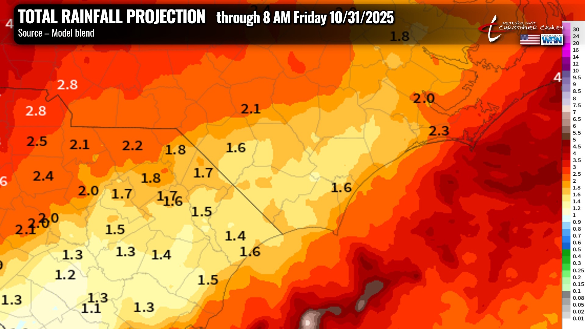
FLOODING: I don’t anticipate flooding concerns for the Whiteville area this week. There may be some areas of standing water in the usual places but unless the low pressure centers hug the coast, and unless a convergence band becomes established (which is nearly impossible to predict), I think we’ll be able to handle what’s coming this week.
I should add and make very, very clear that NONE of what is coming this week is in any way tropical-related.
TROPICS: Melissa cranked up the power and went from tropical storm strength to category-4 strength in the space of about 8 hours early Sunday. She is truly a beast and our friends in Jamaica are … in for a really rough time.
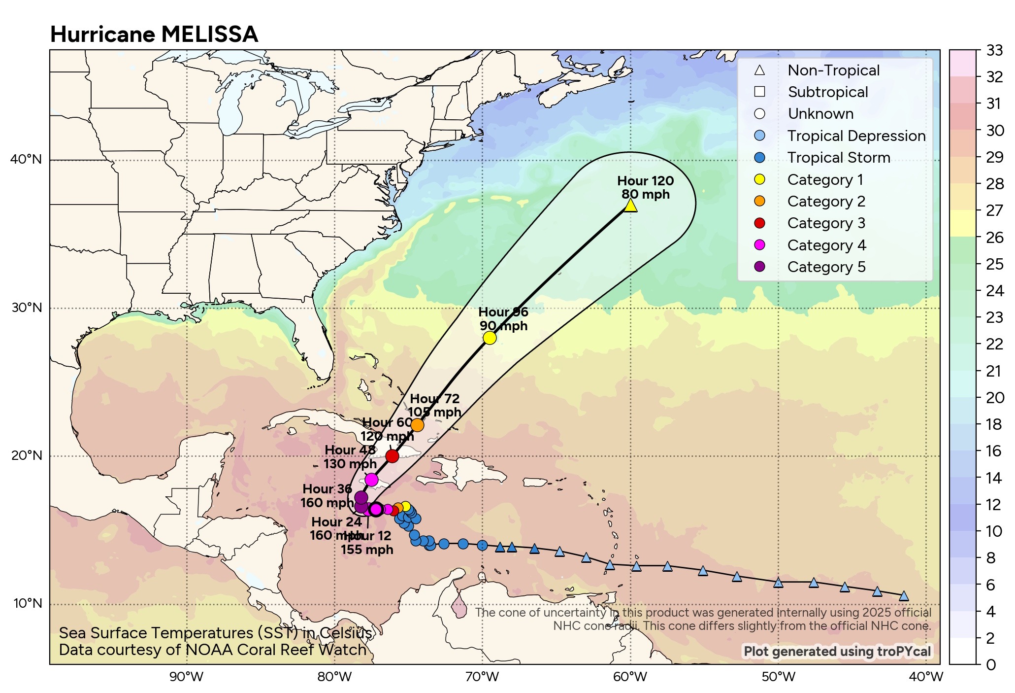
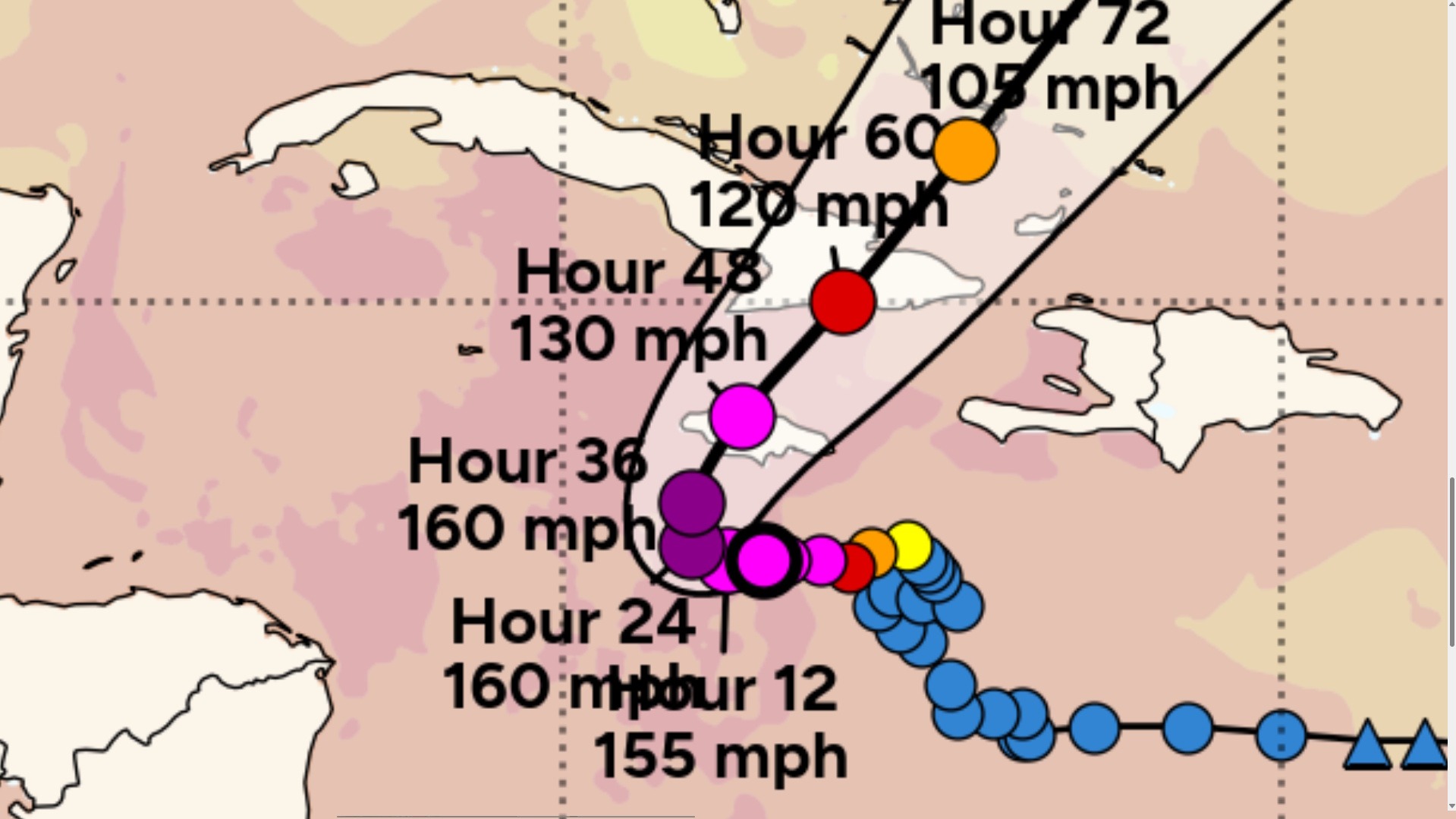
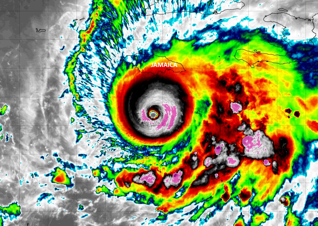
At one point, her eye was only 6 miles across… and the storm hunters measured a 15-degreee (C) temperature spike in the eye. This is indicative of a tremendous storm.
Winds in a hurricane swirl like water going down a drain. The strongest winds (cat 4 or 5 strength) only extend out a few miles from the eye wall, which is the most intense part of the storm. Then the winds decrease the farther outward you go… but not the rain. Portions of Jamaica are looking at 40+ inches of rain BEFORE the actual landfall — !!
Melissa will pose absolutely no threats to the continental United States… and no threat to the Carolinas.
The hurricane season continues until November 30th.
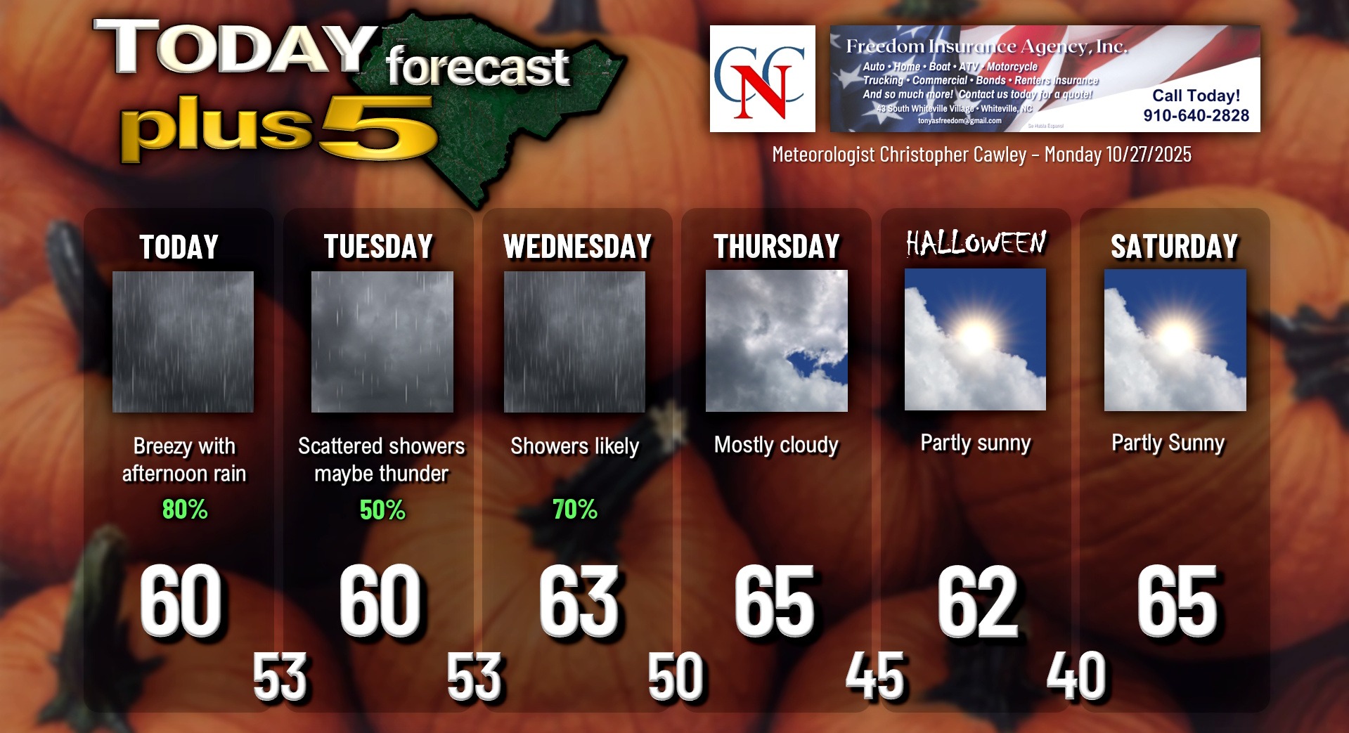
Here is your Freedom Insurance Today-plus-Five Forecast:
–Meteorologist Christopher Cawley