

CCN Weather Update for Monday October 6, 2025.
This weather update is sponsored by Freedom Insurance of Whiteville. No weather worries with Freedom Insurance. For home, car, boat, or whatever you need, Freedom can provide customized coverage to keep you and your family safe. Contact Freedom today at 910-640-2828!
Here’s today’s Bottom Line
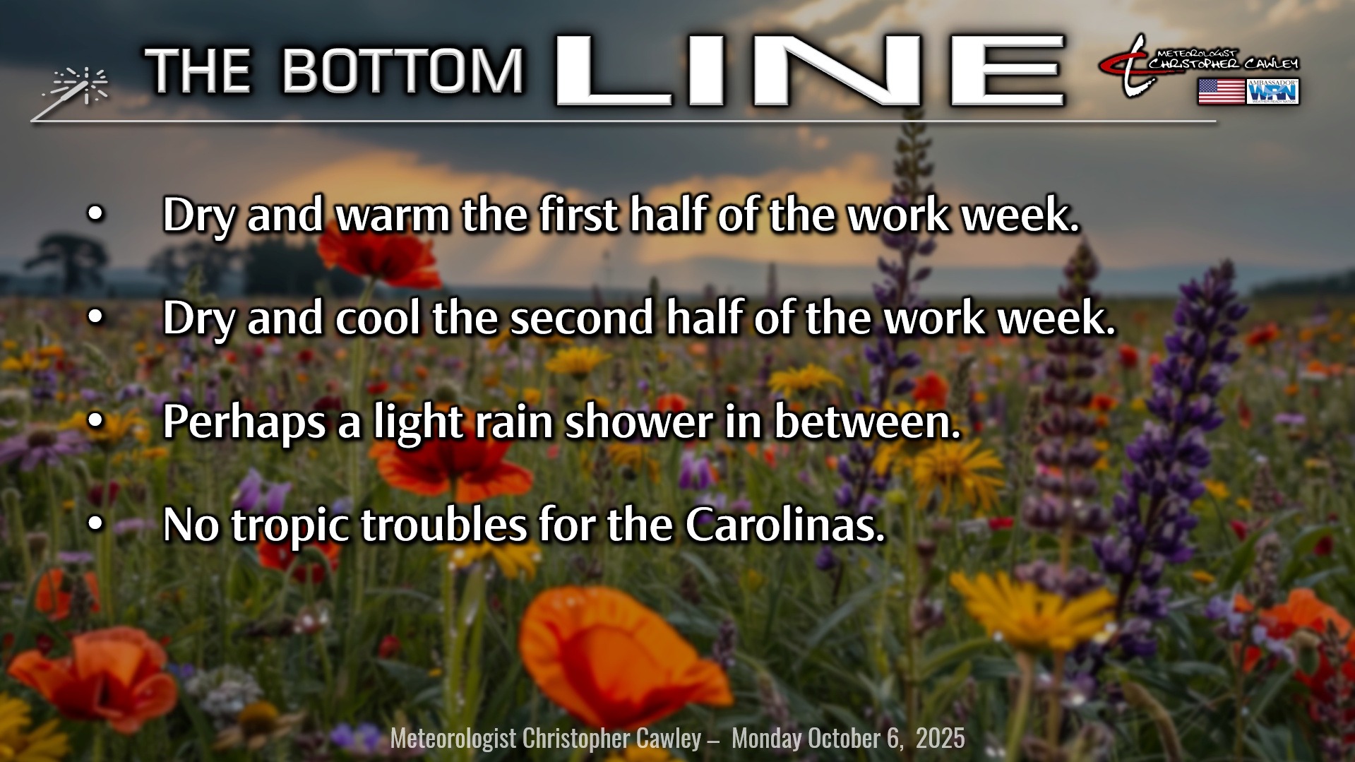
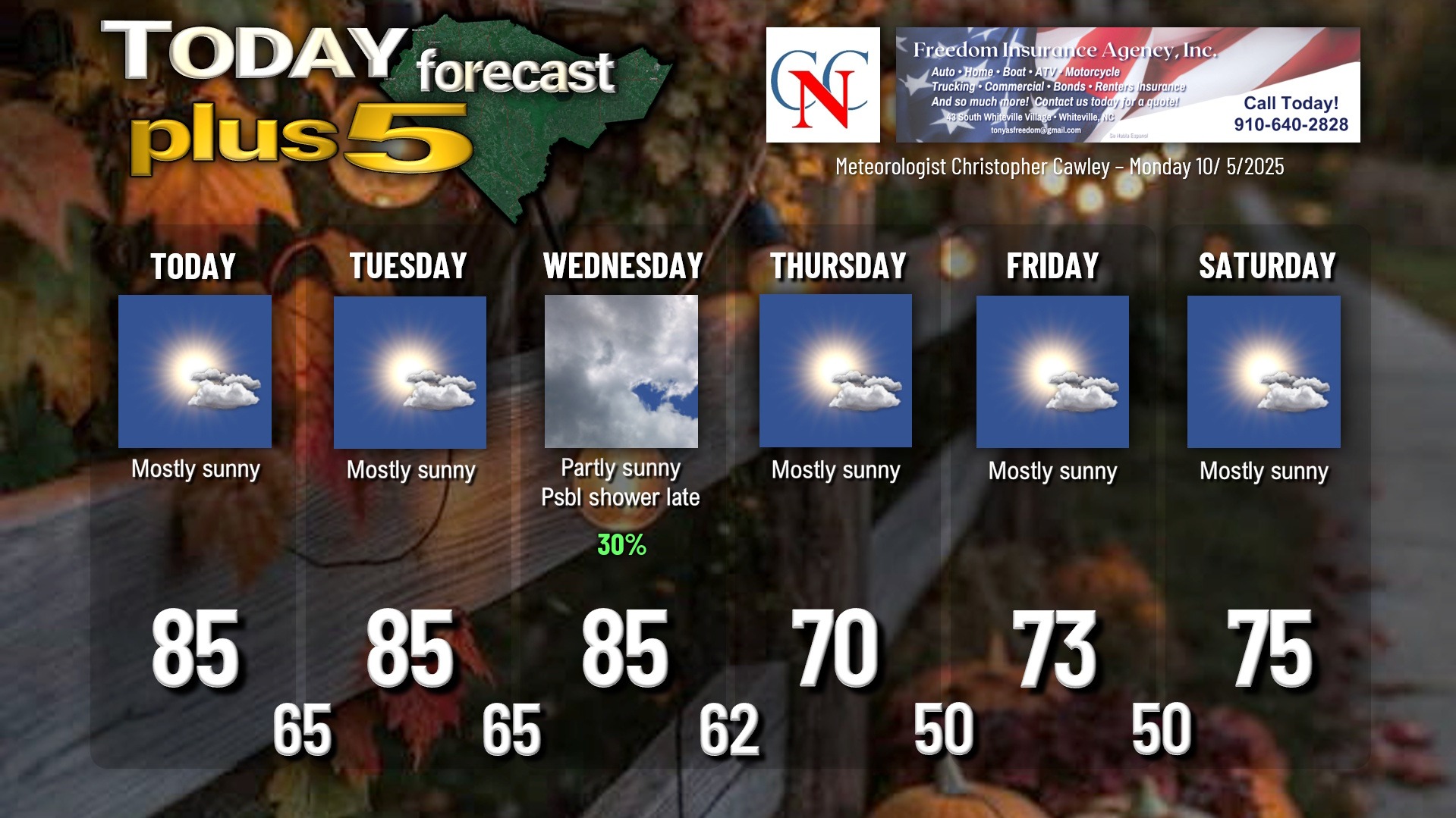
High pressure will ultimately remain in control through the midweek period.
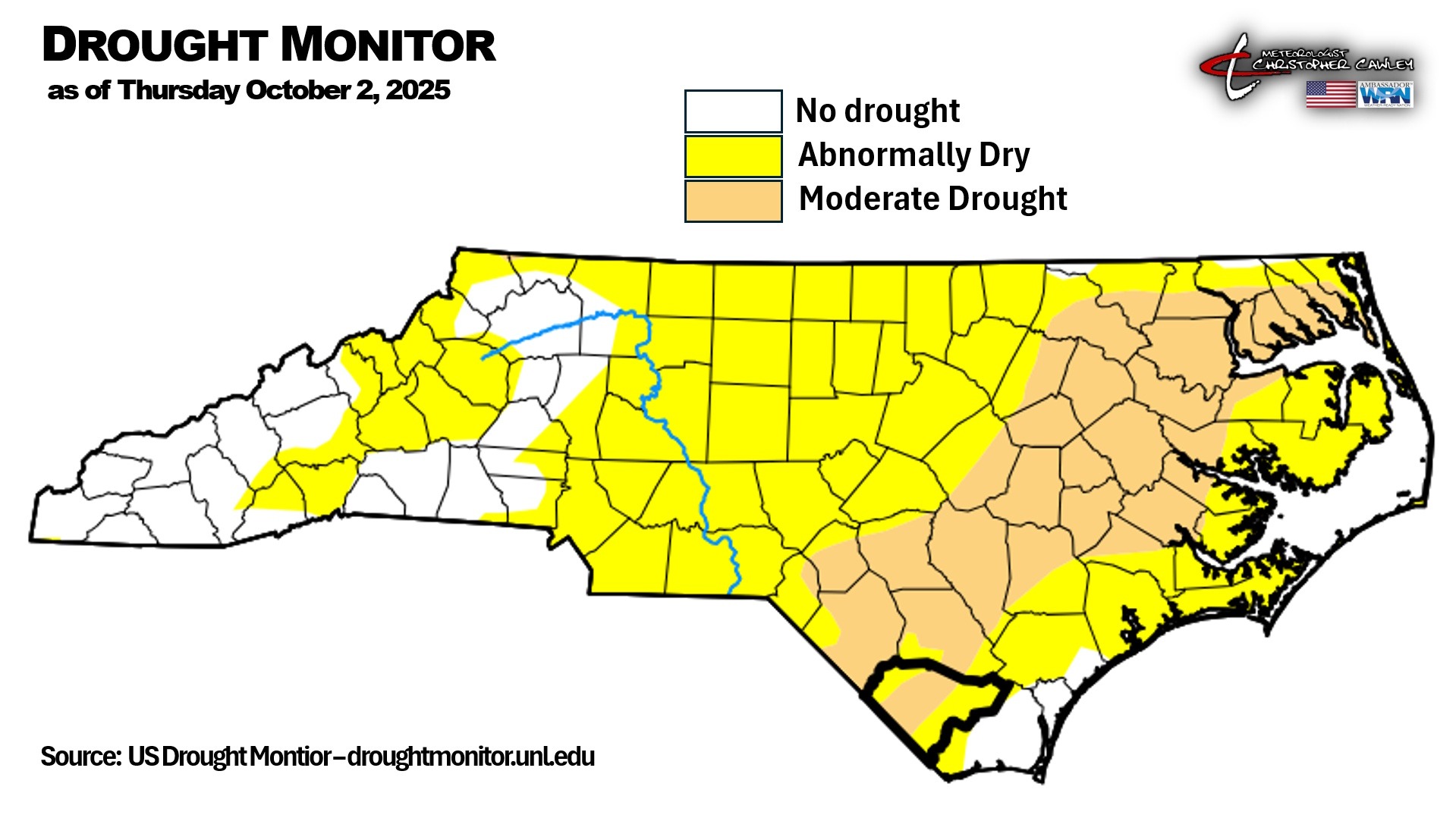
The central portion of Columbus County is in a D1 drought, so we need some rain, but unfortunately, we’re not going to get much (if any).
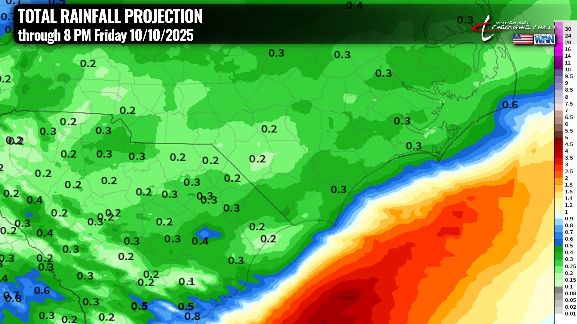
The only notable weather feature this week is a rather strong cold front that will sweep across the area Wednesday night. This frontal passage might trigger a few showers or even a thunderstorm, but as you can see by the model posted above, total rainfall amounts aren’t expected to be very much. So we’ll continue in the dry spell through next weekend.
I’ll be watching the tail end of the front by the end of the week, as some modeling suggests that an area of low pressure could spin up off the Georgia/SC coast. IF something develops, it COULD take on subtropical characteristics, but ultimately it SHOULD progress north/east away from the coast.
Otherwise, dry weather for the work week. Highs well into the 80s Monday through Wednesday will drop to the 70s Thursday through Sunday. Lows in the 60s for the first half of the week will drop to the lower and middle 50s by the end of the week through the weekend.
#snOMG!
Just for fun before we cover the tropics, the latest seasonal European model snowfall chart has just been released, showing what the Euro deterministic says the snowfall will be for the entire season. Now, I put as much faith in this as I do winning the lottery… but it’s fun to look at. It shows roughly 2 inches of snow for the area … which is actually close to the “seasonal normal value.”
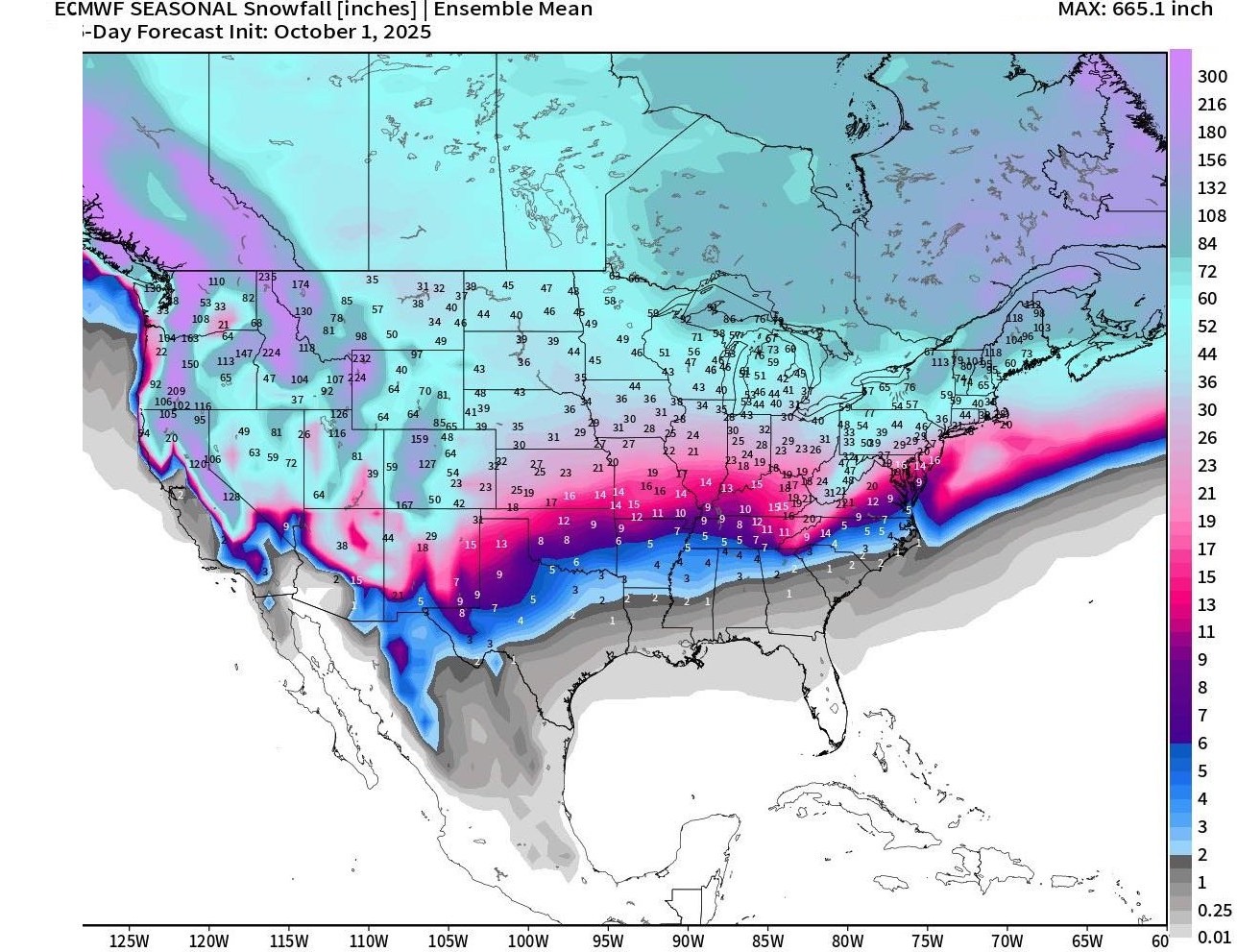
The model takes into account a rapid expansion of Northern Hemisphere snowpack that is currently occurring mainly over Siberia and into northern Alaska and extreme northern Canada. Again, posted just for fun. We’ll see.
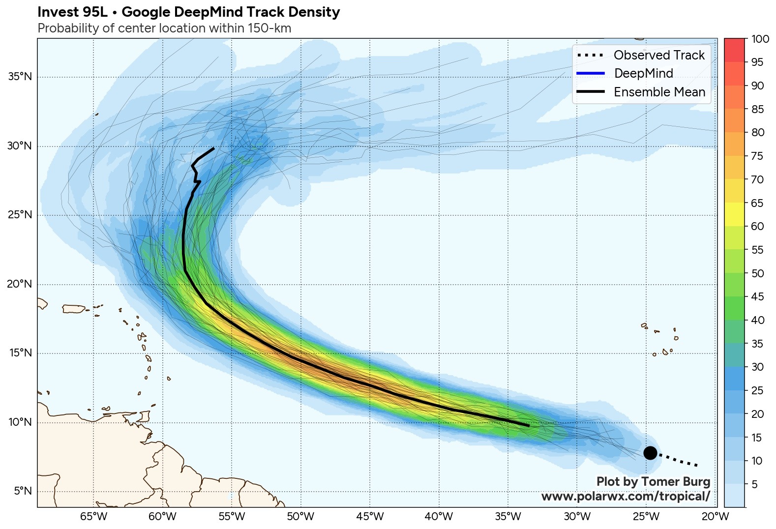
TROPICS: So we’re carefully monitoring the central tropical Atlantic for what will likely become the “J” storm — Jerry. The Google DeepMind modeling (and quite literally ALL of the other global models) show this progressing northwestward and then taking the familiar curve northward, resulting in no risk for the continental United States. For what it’s worth the Google DeepMind AI modeling has been – by far – the best performer this season.
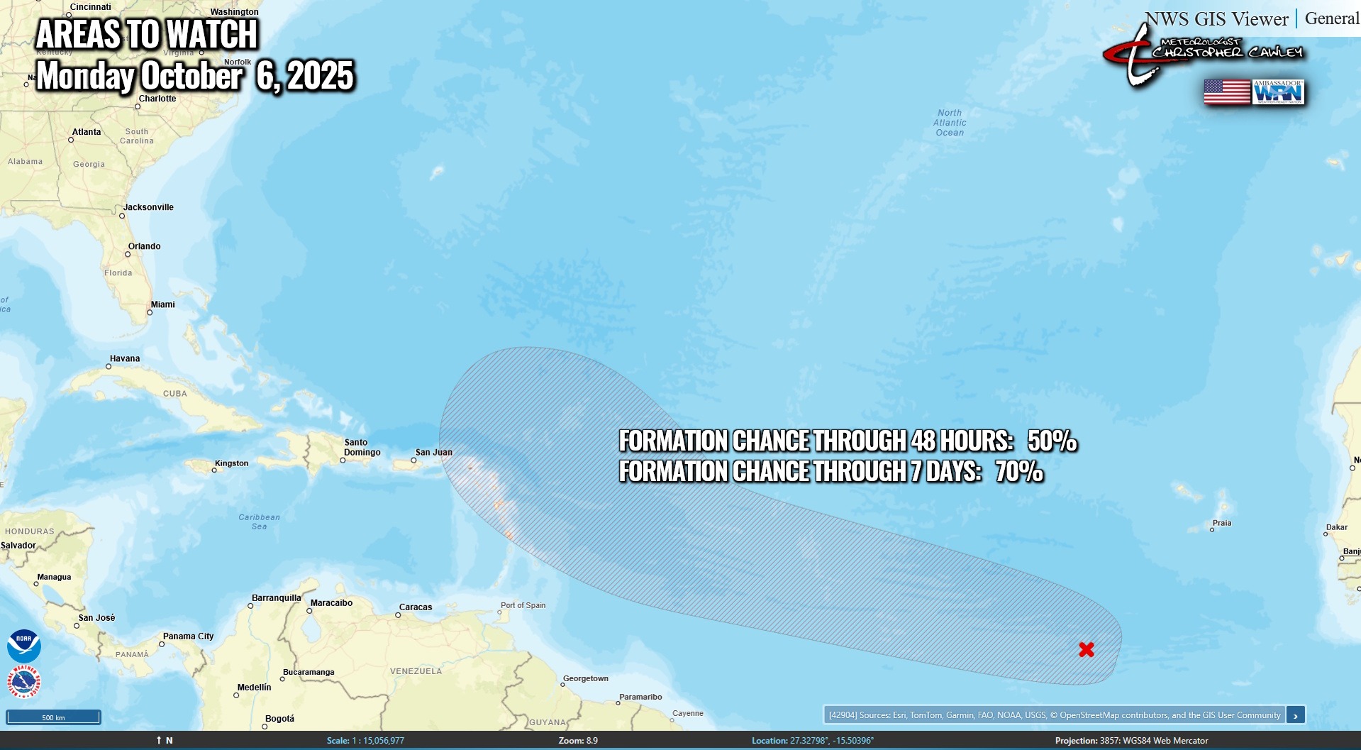
As mentioned above, there’s an area of low pressure that MIGHT develop on the tail end of a front off the GA/SC coast by this weekend. I’ll be watching that, but right now I don’t think it’ll be of any real concern here. Therefore, I’m sticking with the line that there are no threats to the Carolinas for the foreseeable future.
Here is your Freedom Insurance Today-plus-Five Forecast:
–Meteorologist Christopher Cawley