

CCN Weather Update for Saturday October 25, 2025.
This weather update is sponsored by Freedom Insurance of Whiteville. No weather worries with Freedom Insurance. For home, car, boat, or whatever you need, Freedom can provide customized coverage to keep you and your family safe. Contact Freedom today at 910-640-2828!
Here’s today’s Bottom Line
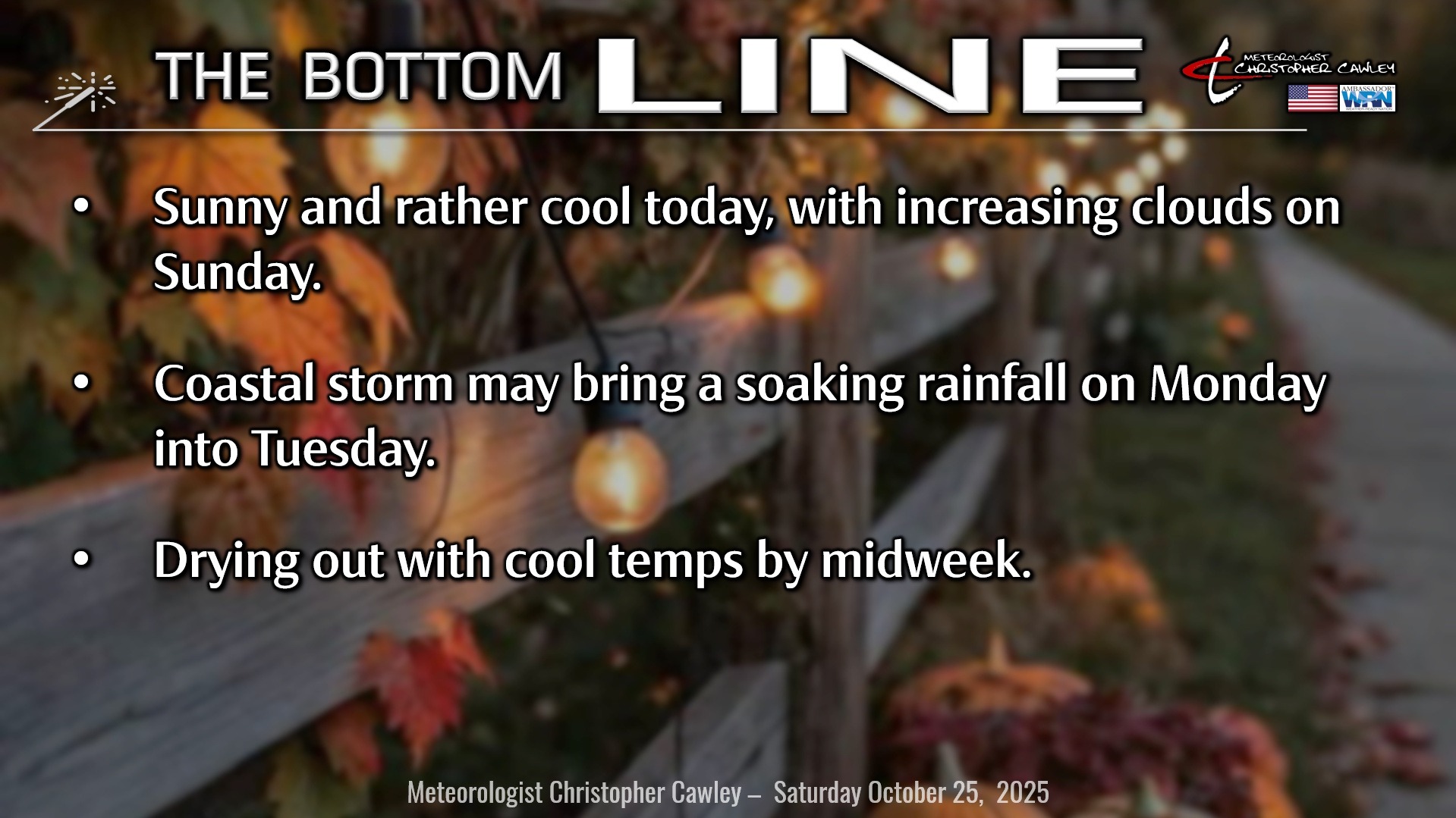
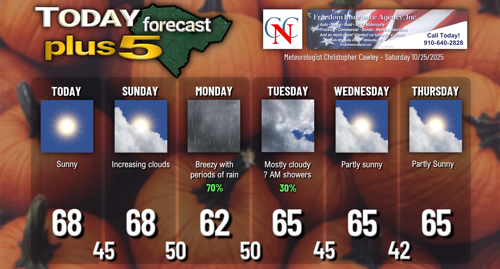
Another gorgeous day on tap… but we’ve had just a bit of reinforcement to the fall air from the north, so our highs today will be in the upper 60s. The full sunshine will help it feel warmer, but if you’re going to the Stallion Classic perhaps you might want a light jacket. Otherwise, no weather worries for the weekend.
Our story changes late Sunday night as low pressure becomes organized along a coastal trough. Just where the low comes together and how strong it will be is up for considerable debate at this time, as there’s a fairly wide model spread amongst the “big three.” Right now the ICON model has the low staying just inland from the coast, while the Euro is just off the coast, and the GFS is farther off the coast and farther to the south.
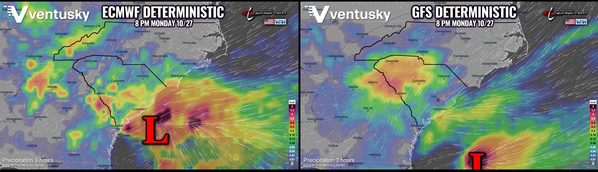
High confidence in a rather rainy and chilly day on Monday… but how much rain and the magnitude of that rain is still up for debate.
The whole thing comes to an end by Tuesday as the next push of cool/dry air moves in for the midweek period.
TROPICS: Melissa will continue to strengthen this weekend, likely reaching hurricane force possibly as early as this afternoon as she meanders just southeast of Jamaica. She will move extremely slowly to the west before the NHC anticipates a hard right turn, directly striking Jamaica (AFTER dumping an extraordinary amount of rainfall on the island). It will be an absolutely devastating blow to Jamaica… and then Melissa makes a beeline over southeastern Cuba before emerging into the Atlantic.
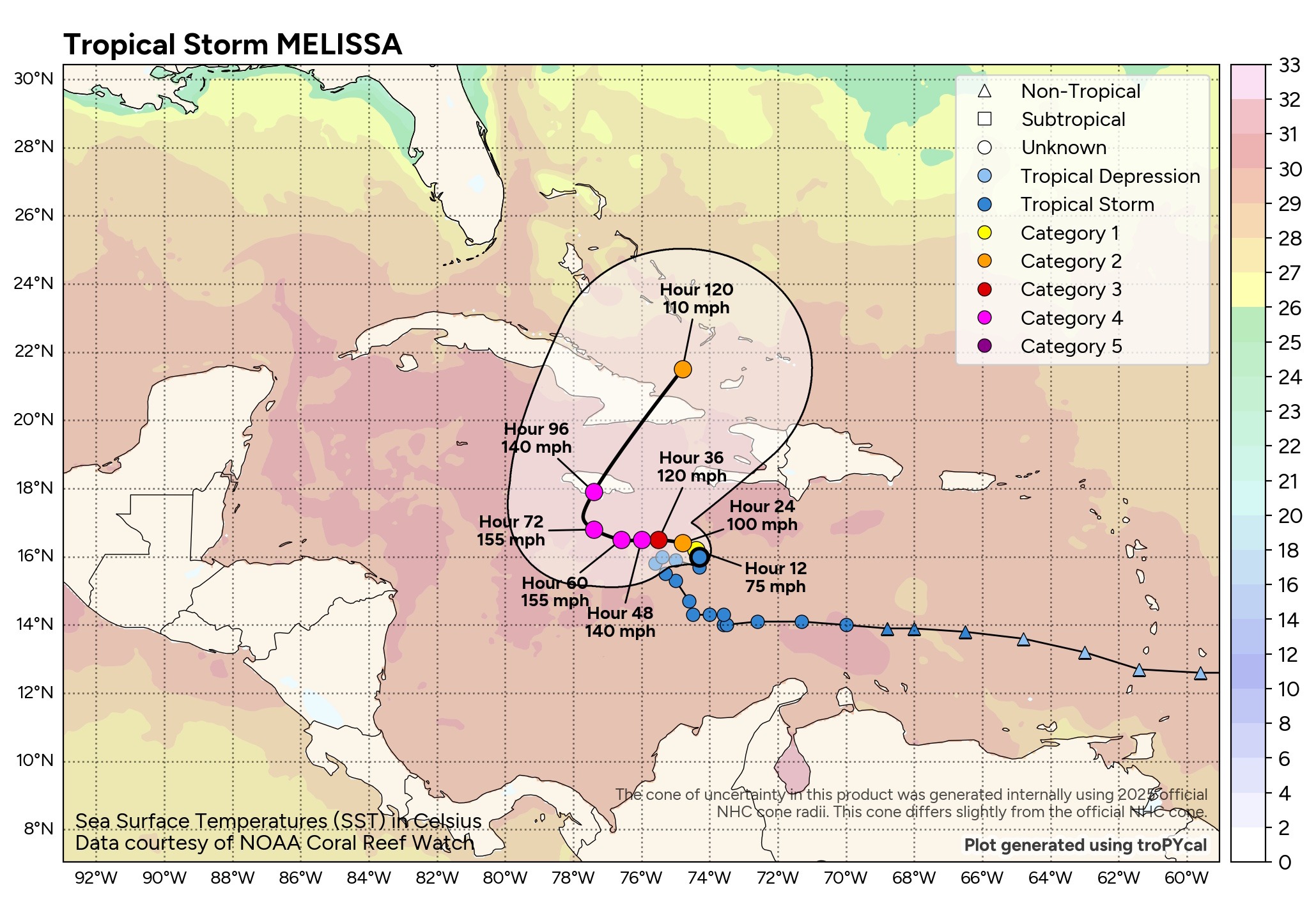
She will be AT LEAST a strong cat-4 at landfall. Some of the modeling, though, has her strengthening to a high-end-5 before striking Jamaica. I’m doubtful… the water is relatively shallow south of Jamaica, and while the water temps are in the high 80s/lower 90s, I just don’t think there’ll be enough fuel to push extreme levels. I agree with the NHC assessment at a high-end-4 at landfall. It’s still going to be a devastating blow to Jamaica.
Here is your Freedom Insurance Today-plus-Five Forecast:
–Meteorologist Christopher Cawley