
CCN Weather Update for Tuesday October 21, 2025.
This weather update is sponsored by Freedom Insurance of Whiteville. No weather worries with Freedom Insurance. For home, car, boat, or whatever you need, Freedom can provide customized coverage to keep you and your family safe. Contact Freedom today at 910-640-2828!
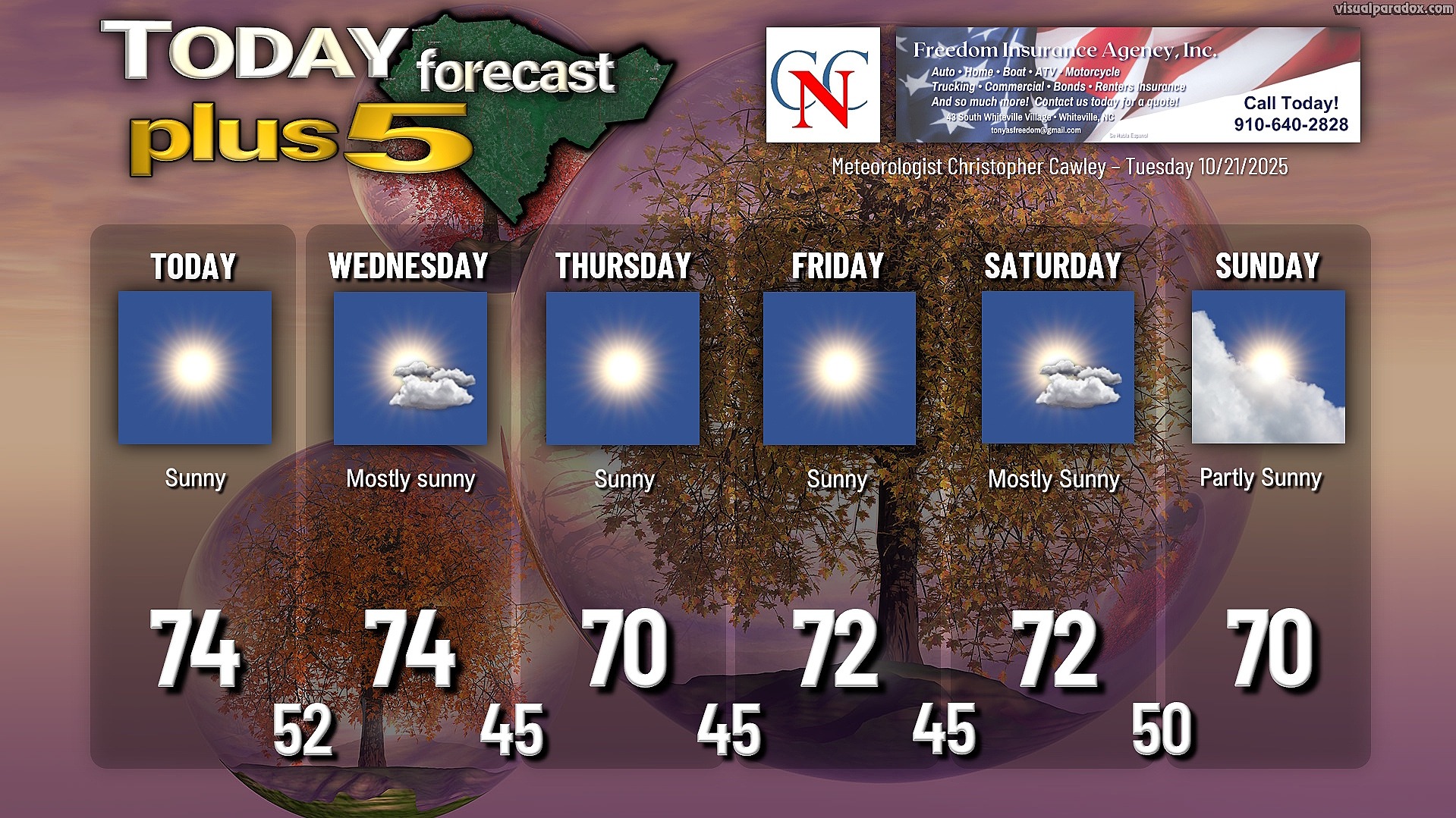
Here’s today’s Bottom Line
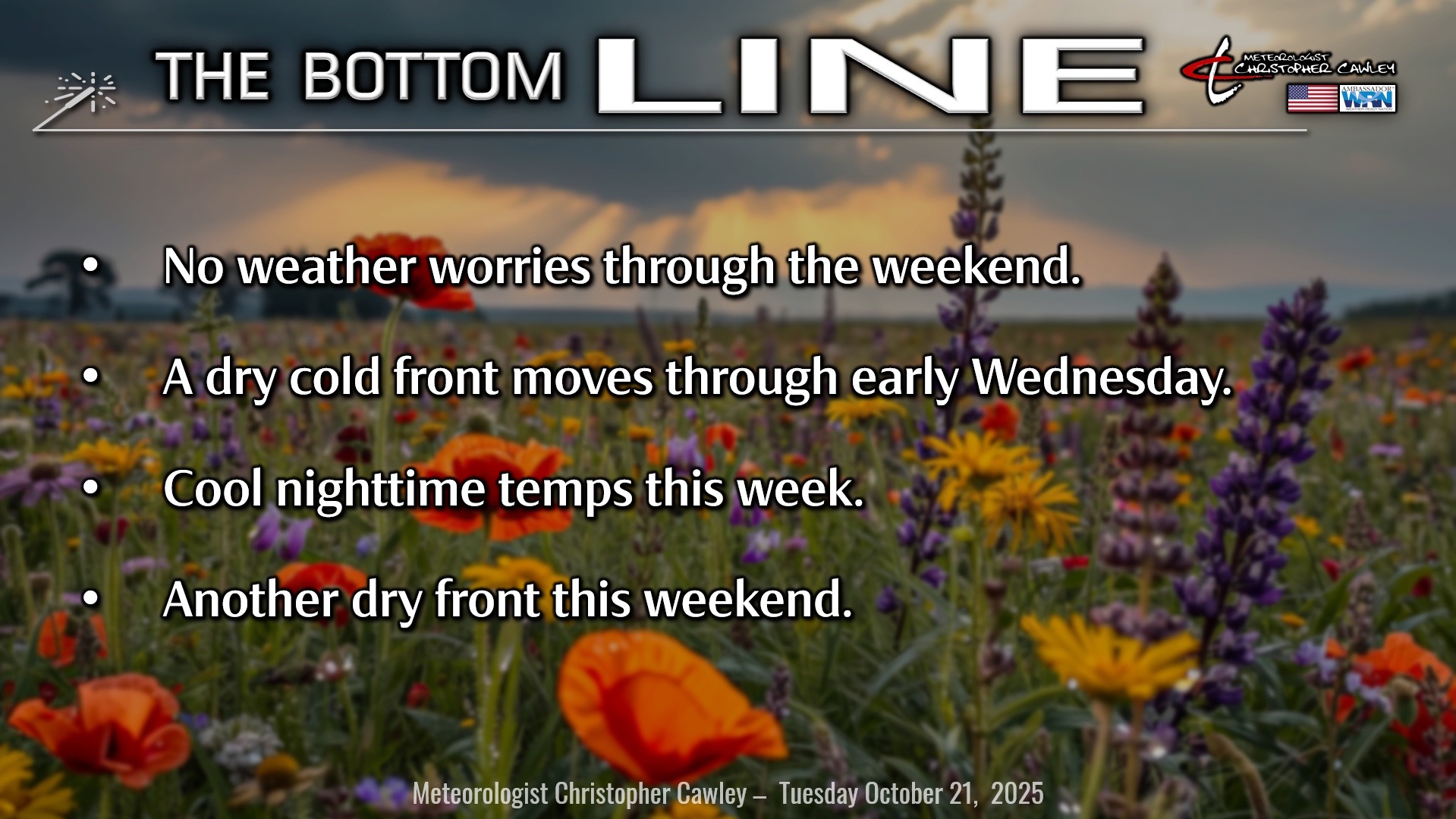
Not much to talk about today. We’re going to enjoy an absolutely picture-perfect fall day across the County with bright blue sunny skies, highs in the lower to middle 70s, and light winds.
It won’t be as chilly tonight thanks to a gentle southerly flow ahead of our next frontal boundary. Lows tonight will be in the lower 50s with a mainly clear sky.
The front passes by early Wednesday, but you’re not going to notice anything right away. Another spectacular day… perhaps a few clouds from time to time… but highs will be in the lower to middle 70s.
We cool down back into the mid 40s for Wednesday night / early Thursday, and the same will be the case into the weekend thanks to strong high pressure in place. Highs will be from around 70 to possibly the lower 70s downtown going into the weekend.
We’ll see a bit more cloudiness this weekend as yet another dry front moves over the area. Some of the modeling does paint a few showers over the area on Sunday into Sunday night but I’m going to hold off on putting them in my forecast for now. Like the other systems, most of the energy is going to the north.
TROPICS: All eyes are on the likely area of development in the Caribbean. This will likely become Melissa … maybe even later today.
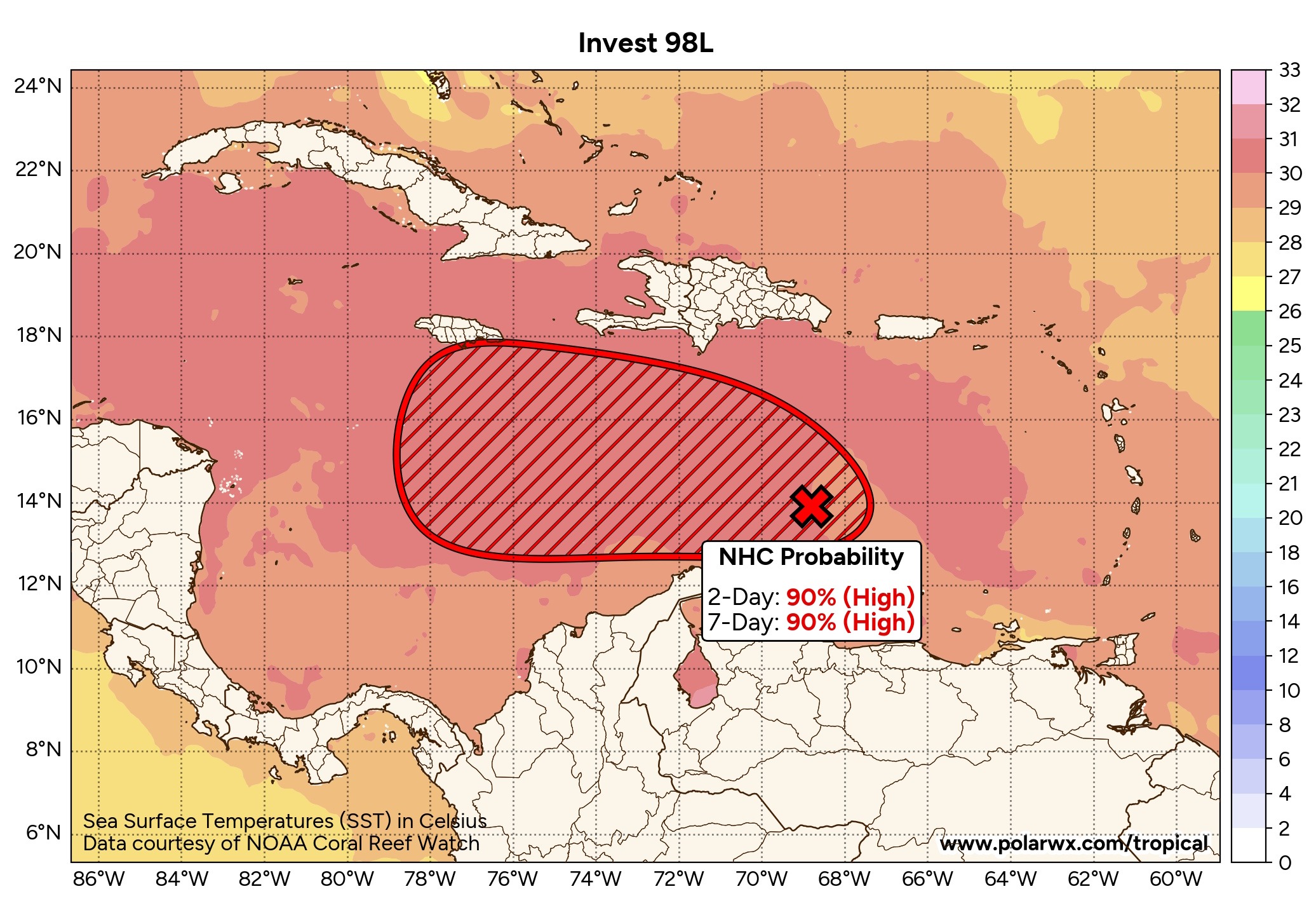
I have attached here four of the various ensemble packages, one legacy and three AI choices. These are essentially representative of all of the available modeling. There is some uncertainty on a) how fast Melissa develops, and b) how strong Melissa becomes.
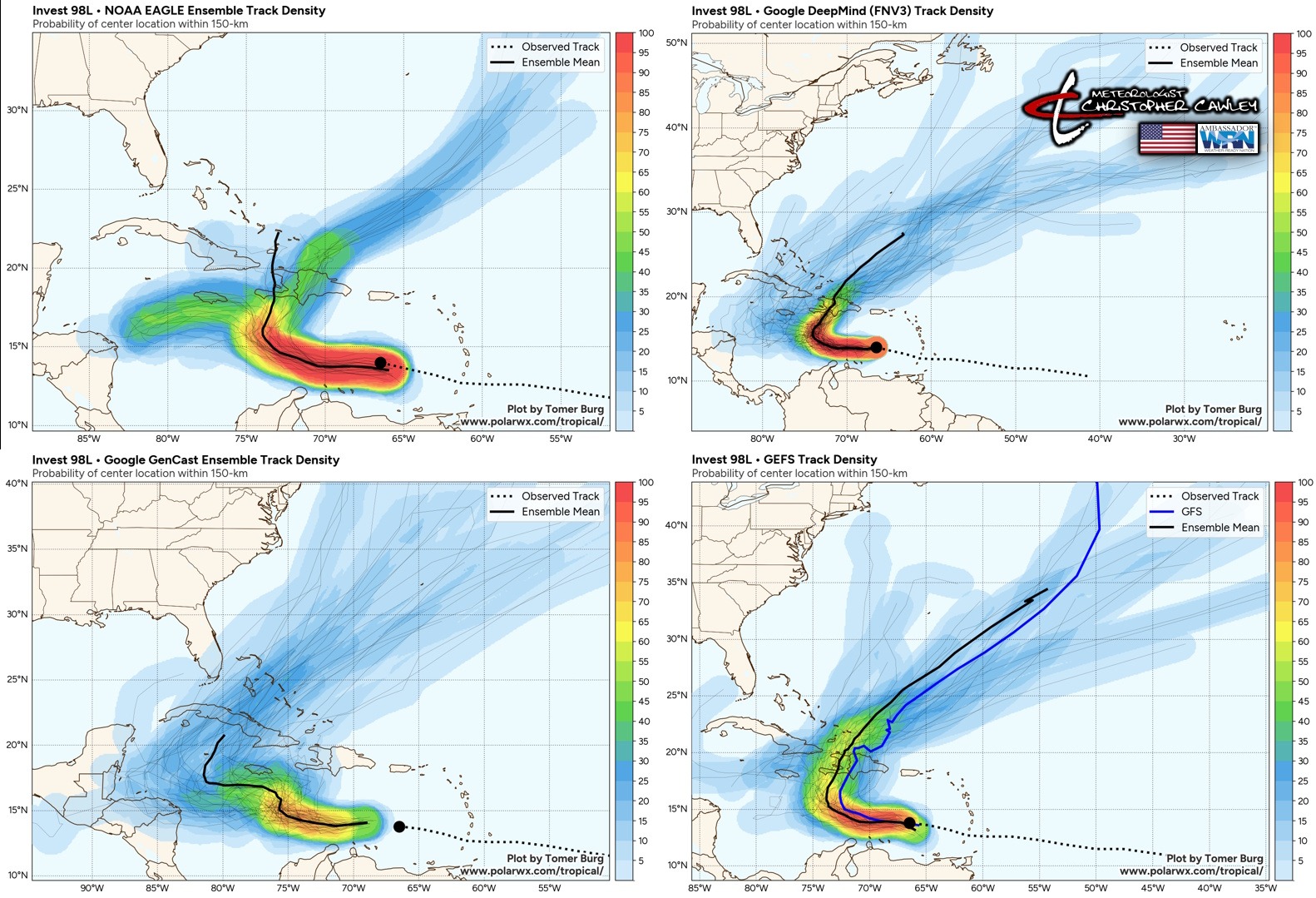
A faster-developing storm will be a weaker one, and will make an early hard-right turn, likely hitting Haiti and the Dominican Republic.
A slower-developing storm will eventually be a stronger storm and will likely push farther west before a turn to the north. This would impact Cuba … and depending on where she ends up, southern Florida could be in the eventual cone.
Melissa will pose no threat to the Carolinas.
Here is your Freedom Insurance Today-plus-Five Forecast:
–-Meteorologist Christopher Cawley