

CCN Weather Update for Wednesday October 22, 2025.
This weather update is sponsored by Freedom Insurance of Whiteville. No weather worries with Freedom Insurance. For home, car, boat, or whatever you need, Freedom can provide customized coverage to keep you and your family safe. Contact Freedom today at 910-640-2828!
Here’s today’s Bottom Line
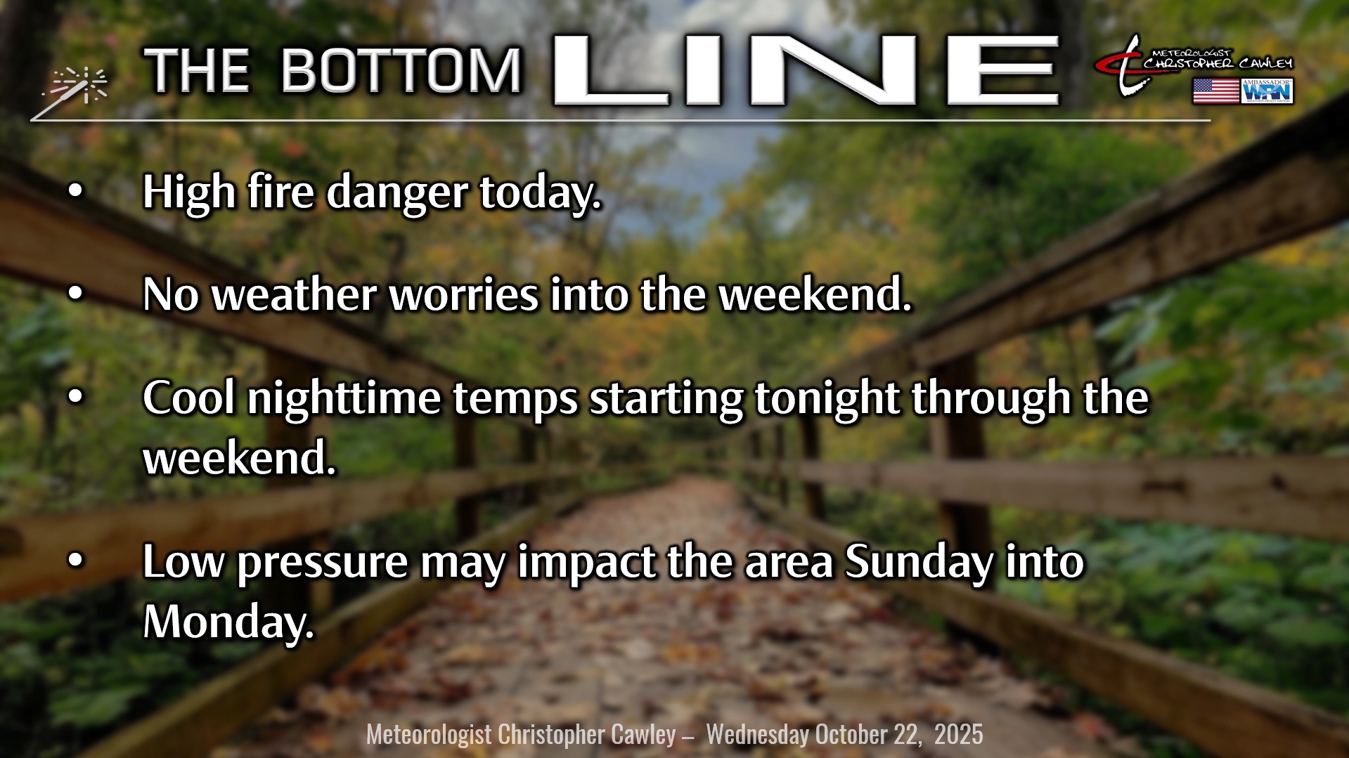
We do have a high fire danger for today, given low humidity and gusty westerly breezes.
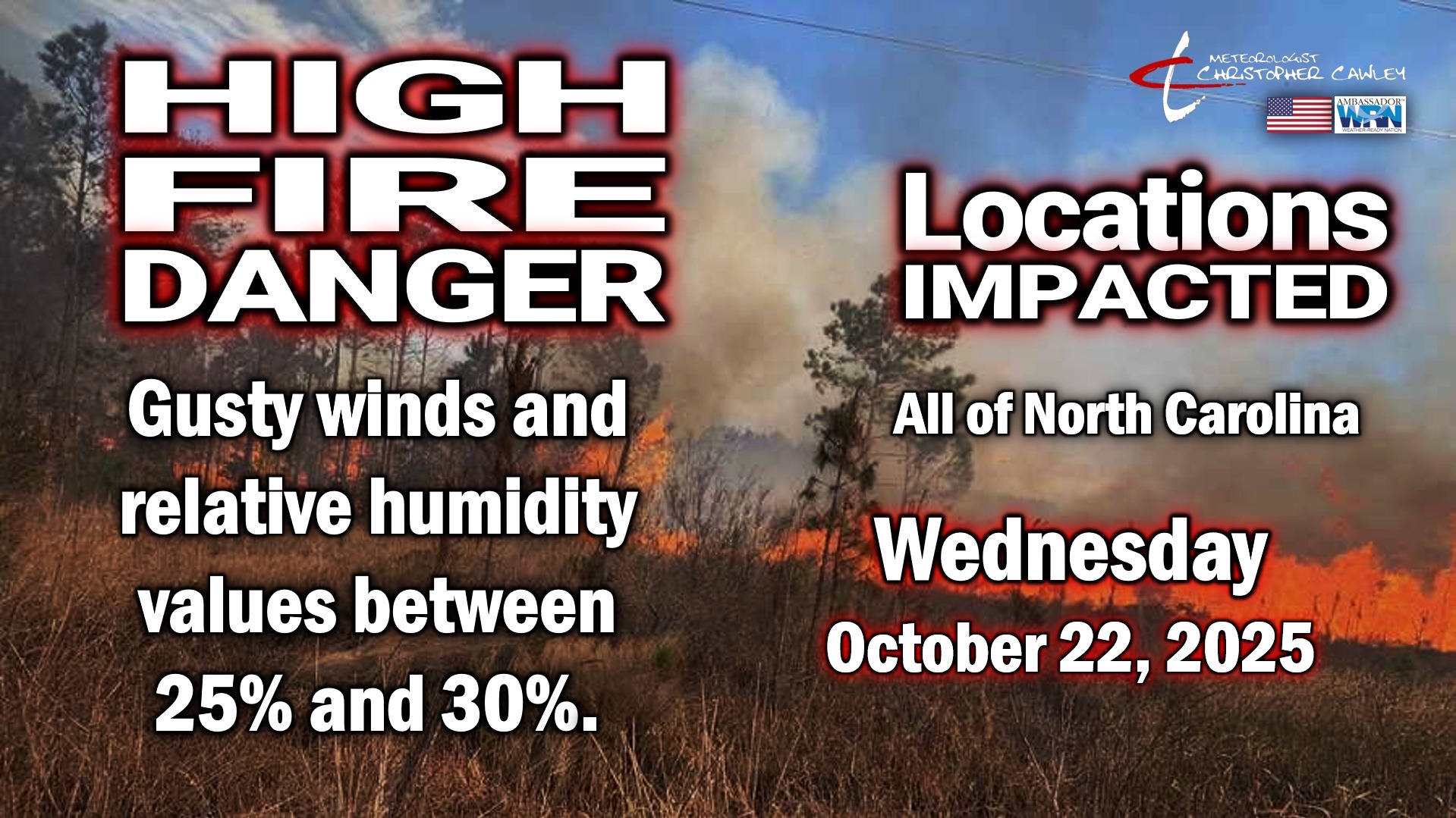
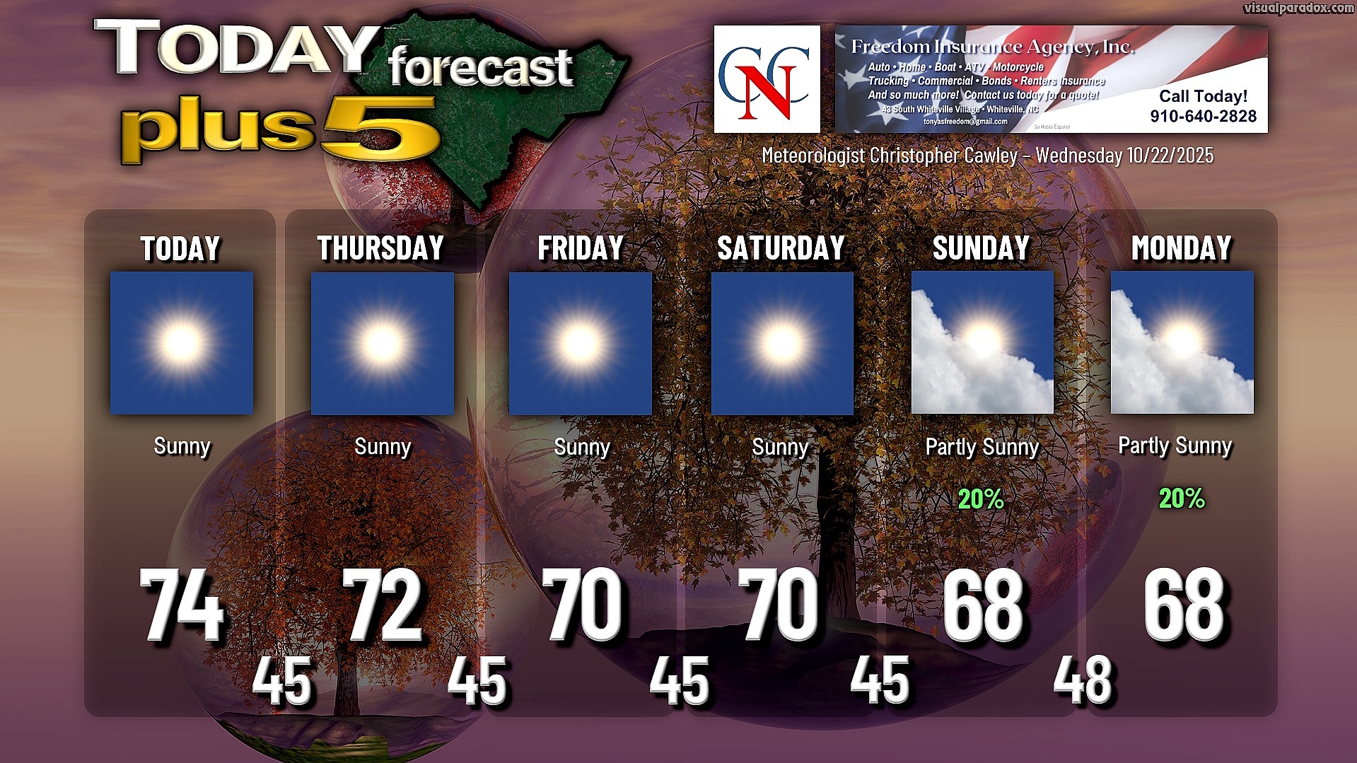
Otherwise, the remarkably unremarkable weather pattern will continue into the weekend. A cold front will cross the area this morning, followed by relative humidity dropping to between 25% and 30% this afternoon with winds 15-20 mph. Highs will still reach the mid 70s.
Clear and crisp tonight as cooler, Canadian air filters in. We’ll drop well into the 40s across the area, and some of the typically colder spots across the county could dip as low as 40-41 degrees.
Temperatures Thursday through next Monday will run a little bit below seasonable levels. A dry “frontal boundary” (if you want to call it that) reinforces the cooler air going into the weekend. Meanwhile, hints of a storm system developing on the southern jet start to unfold late in the weekend. Models are all over the place on this, with regards to strength, location, and even development in the first place. A few of the outliers suggest a soaking rainfall here Sunday into Monday but those solutions are in the high minority right now.
So for now, for Sunday and Monday I’m going with partly sunny with a 20% chance for rain. But that’s up for debate.
TROPICS: Let me preface this by stating that I believe Melissa will pose absolutely no threat to the Carolinas.
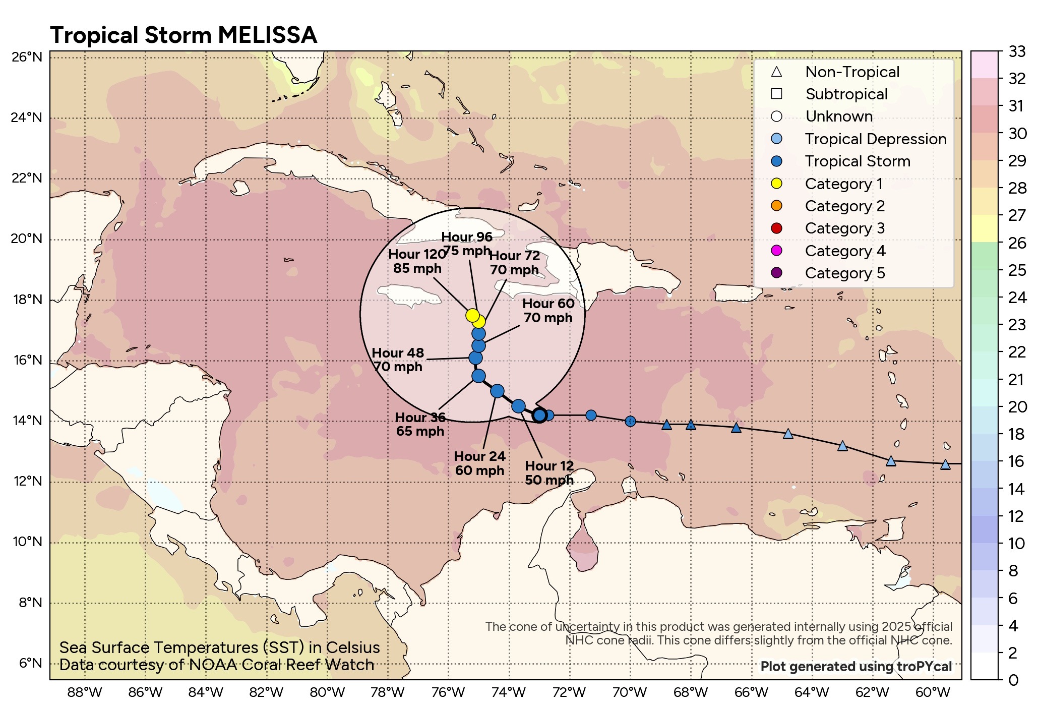
She WILL pose a HUGE threat to Jamaica, Haiti, and the Dominican Republic as she meanders almost nowhere through at least Saturday.
Where she goes will greatly depend on how strong she gets. The models really diverge on the solutions. If Melissa organizes like the GFS predicts, it could turn northeastward over Hispaniola. If Melissa remains rather lopsided (as she is now), it will likely stall and drift westward as a high pressure ridge builds to the north. The official Hurricane Center track very closely resembles the short-term of the Google DeepMind.
If Melissa gets “stuck” in the Caribbean into next week, look out. The latest European deterministic model paints an ugly picture of what could happen if Melissa stalls over the near-record warm Western Caribbean. This has “major hurricane” written all over it if that’s the case.
She’ll definitely be interesting to watch over the next week or so while things unfold.
No tropical threats to the Carolinas.
Here is your Freedom Insurance Today-plus-Five Forecast:
–Meteorologist Christopher Cawley