

CCN Weather Update for Wednesday October 29, 2025.
This weather update is sponsored by Freedom Insurance of Whiteville. No weather worries with Freedom Insurance. For home, car, boat, or whatever you need, Freedom can provide customized coverage to keep you and your family safe. Contact Freedom today at 910-640-2828!
Here’s today’s Bottom Line
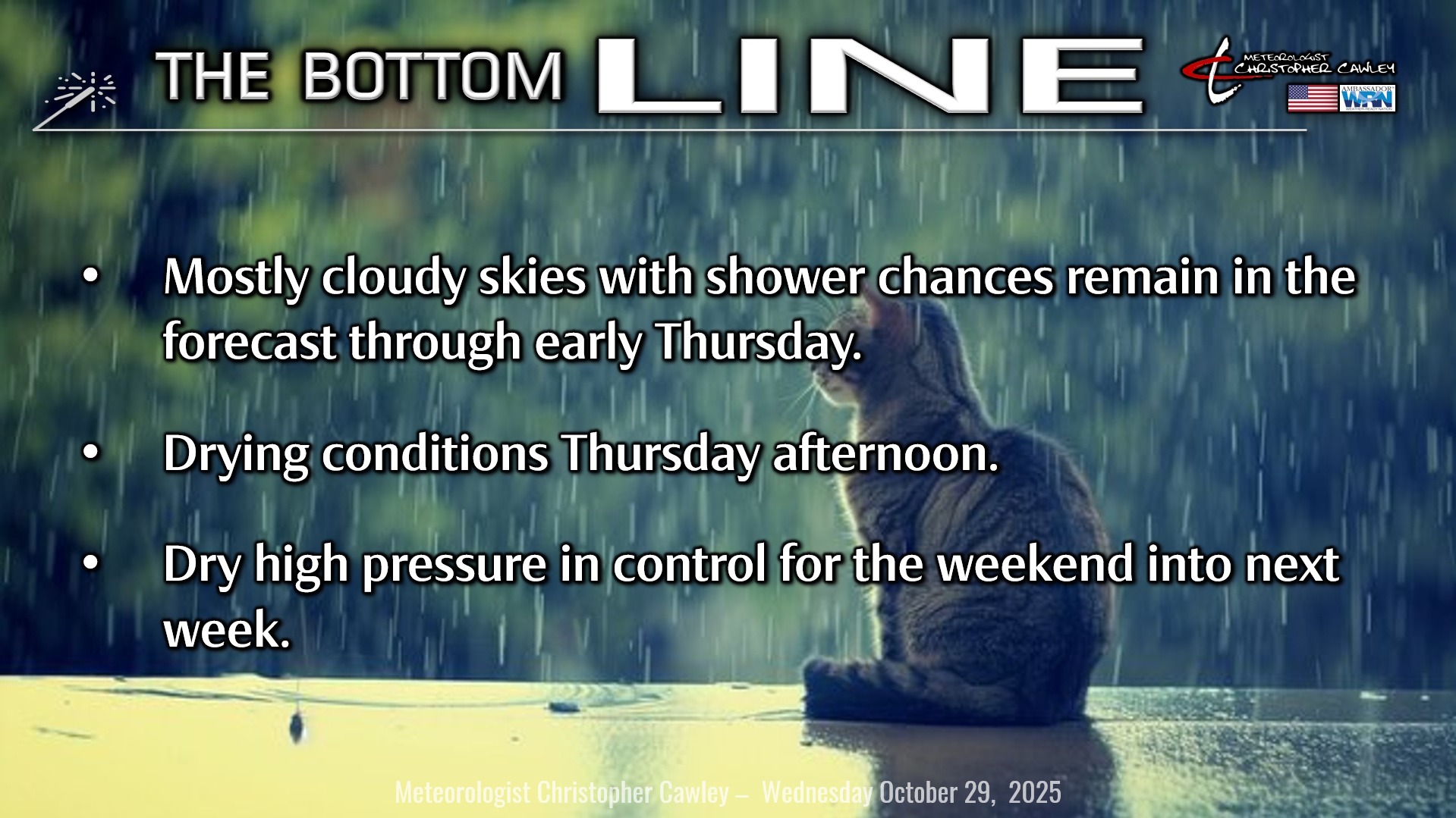
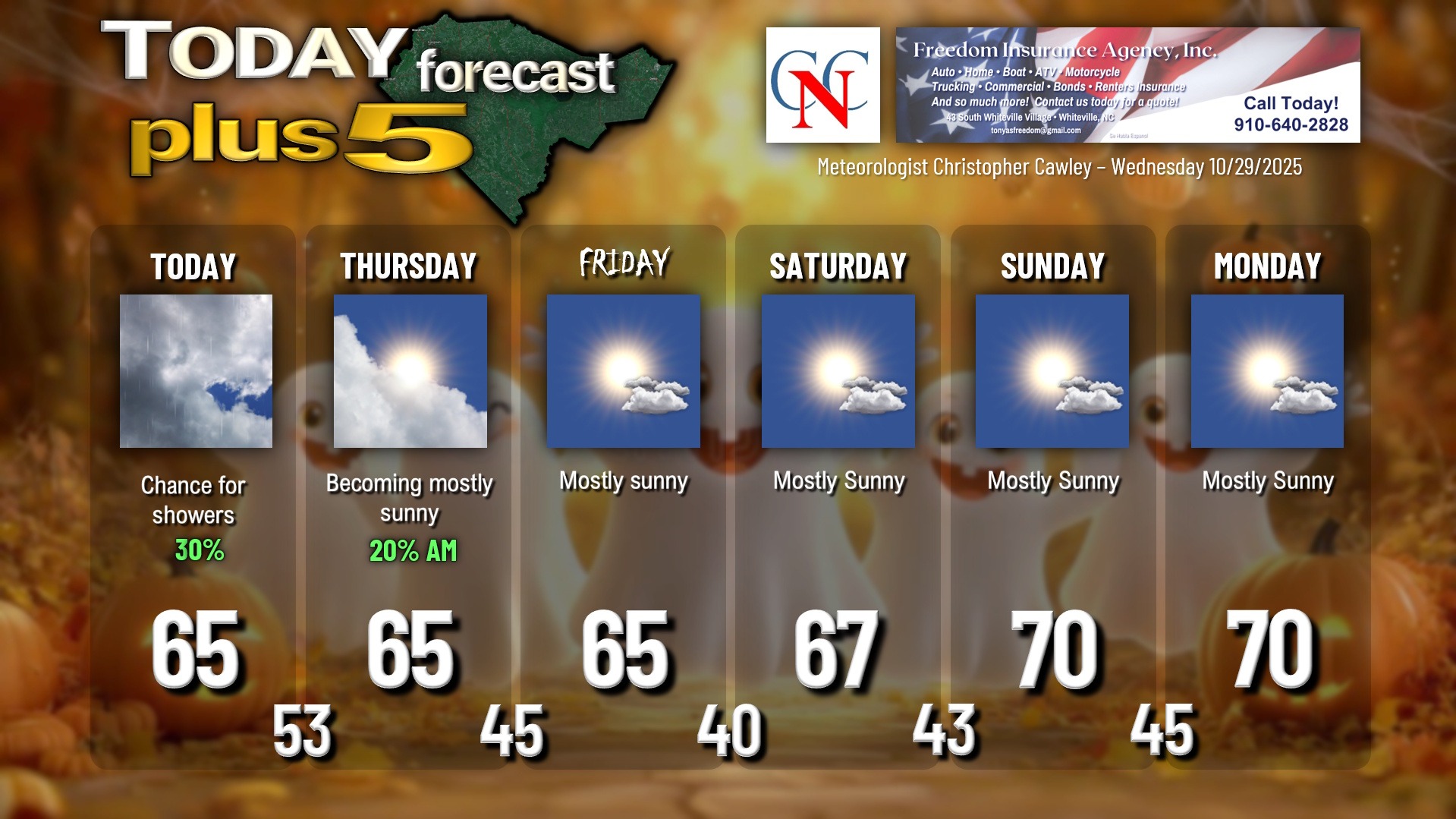
We’ll have one more day featuring lots of clouds (but some breaks of sunshine) and shower chances. Low pressure off the Cape Fear coast will “connect” with another low pressure and frontal system moving over South Carolina by this evening. The whole system will lift northward up the eastern seaboard, dragging a cold front across the area early Thursday. Shower chances will continue until this front moves through, after which we will see rapidly clearing skies. Thursday should turn out quite nice by the afternoon with sunshine and temps in the mid to upper 60s.
Halloween will feature abundant sunshine with highs in the mid to upper 60s. Once the sun goes down, expect temps to drop quickly into the 50s, and we’ll wake up Saturday morning with temps around 40… some upper 30s are possible in outlying areas… and with a slight frost potential early Saturday.
Dry high pressure will remain in place well into next week with pleasant fall temperatures.
TROPICS: Melissa absolutely ravaged Jamaica on Tuesday, and was (by preliminary values) the strongest landfalling storm in the Atlantic… in history.
Now she will smash the southeast segment of Cuba and the southern Bahamas before RAPIDLY moving northeast over the open Atlantic. She will bring some elevated rip currents to the Carolina coast, but otherwise will have no impacts to the U.S.
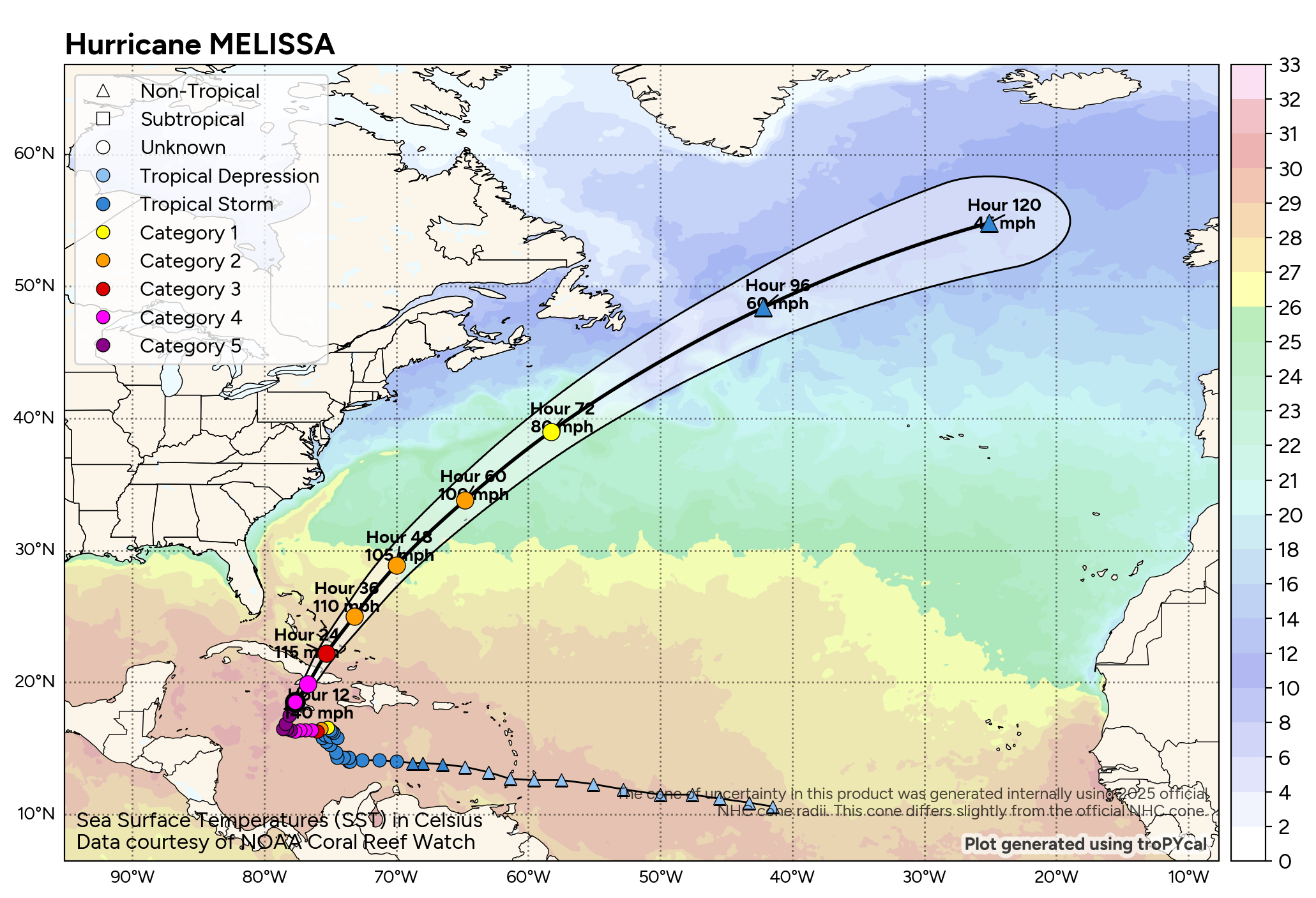
There are no tropical threats to the Carolinas for the foreseeable future, and no other areas being monitored at this time by the National Hurricane Center.
Here is your Freedom Insurance Today-plus-Five Forecast:
–Meteorologist Christopher Cawley