CCN Weather Update for Sunday November 8, 2025.
This weather update is sponsored by Freedom Insurance of Whiteville. Trust Freedom Insurance to give you clear blue skies when it comes to home, car, boat, or whatever insurance you need. Let Freedom provide customized coverage to keep you and your family safe. Contact Freedom today at 910-640-2828!
Here’s today’s Bottom Line
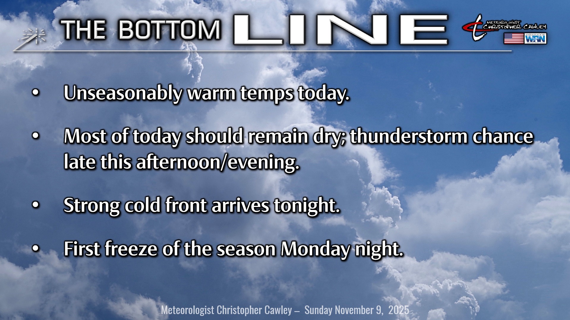
One more unseasonably warm day across Columbus County before the bottom drops out.
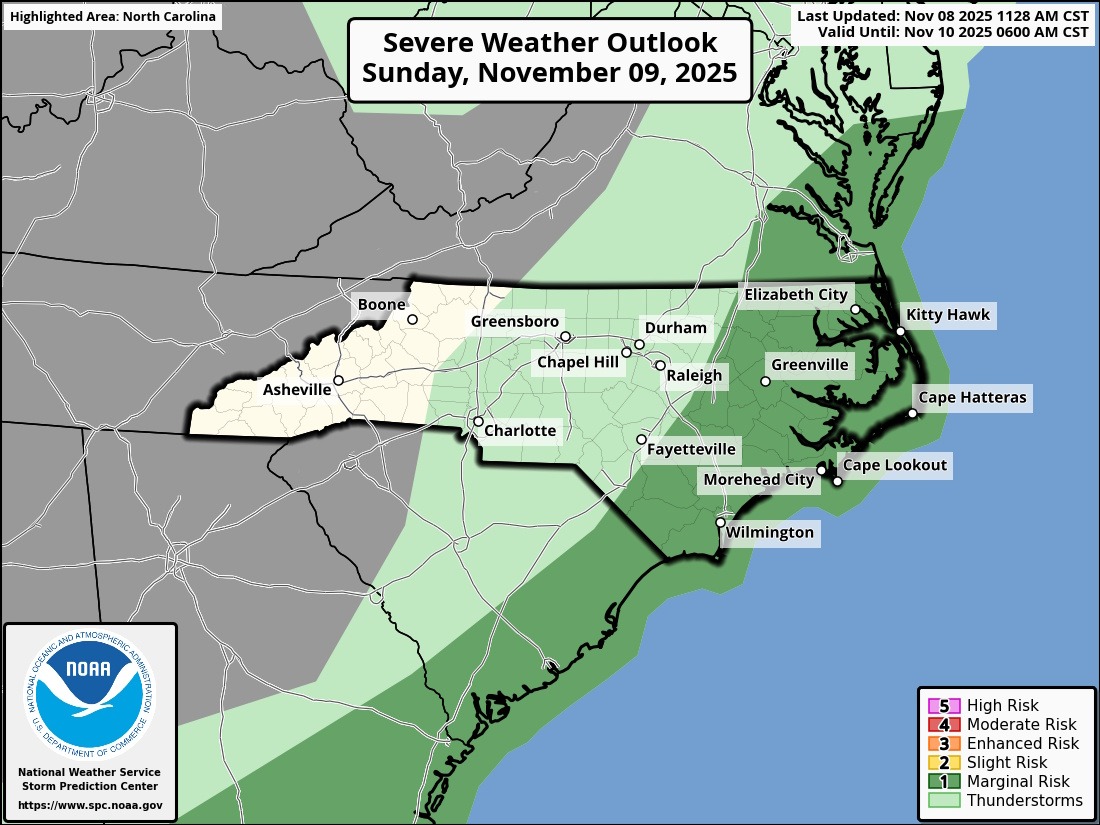
A robust southwest flow of warm and muggy air will continue today ahead of a powerful cold front which will cascade over the area tonight. We should be dry through much of the daylight hours but there is the chance for thunderstorms late this afternoon through the evening hours.
Enough instability and shear may be present that the storm threat could include an isolated damaging wind gust or some hail… the NWS Storm Prediction Center has placed eastern NC under a “marginal risk” (level 1 out of 5) for severe weather late this afternoon and this evening.
After the front moves through, rain chances drop to zero through the coming week.
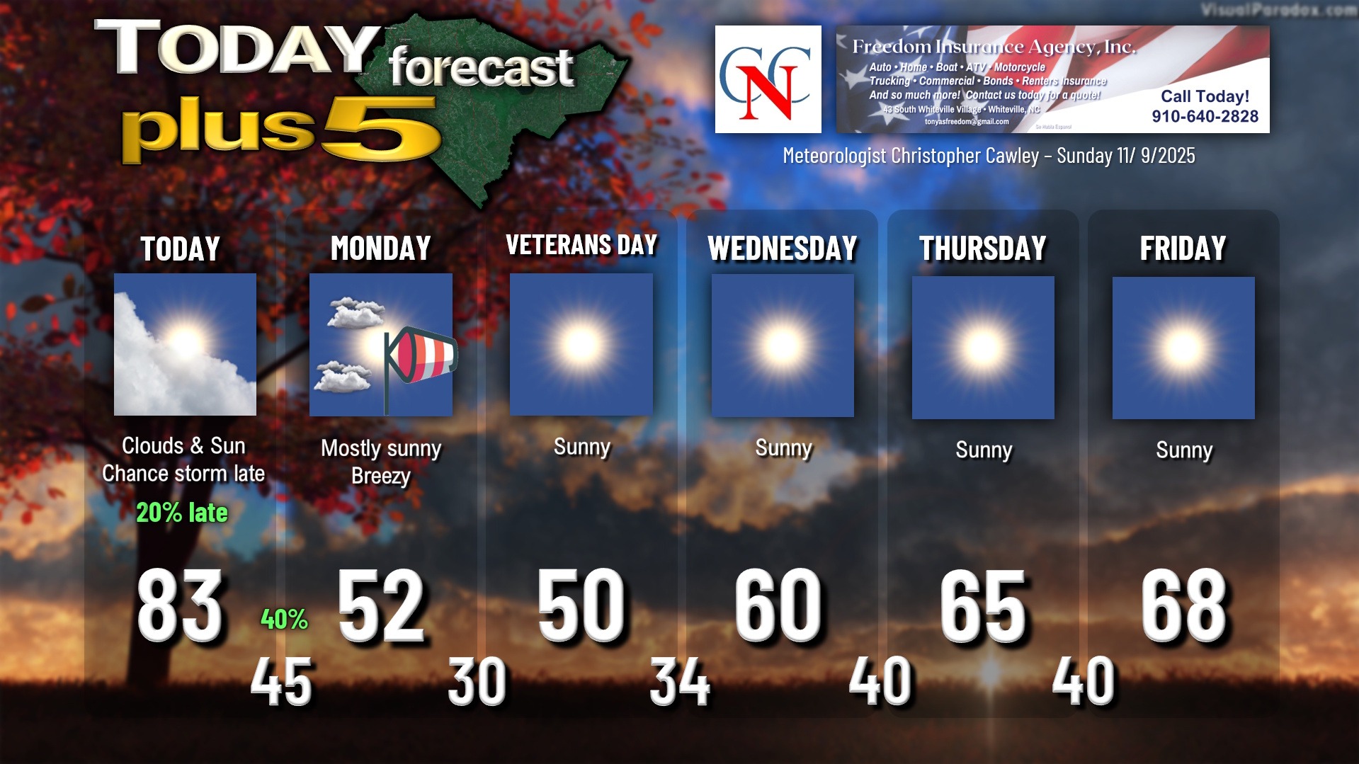
Temperatures fall to the lower and middle 40s early Monday morning. Monday will be rather windy (blustery) and about 30 degrees colder than today, with highs struggling into the lower 50s.
SUB-FREEZING TEMPERATURES LIKELY MONDAY NIGHT. Once the sun goes down on Monday, so will the temps… but fortunately the winds will likely not completely go calm. If they did, we’d be talking about temps spiraling down to the lower 20s, but instead we should stay generally between 28-32 for the county, with warmest temps in the center of town. I believe that most areas will experience at least 2-3 hours of sub-freezing temperatures. The lowest temps will occur within 30 minutes either side of sunrise.
Frost potential is relatively low given very dry air in place and the elevated winds, but you can still expect scattered areas of frost about the area.
The 2025 growing season will end, and climatologically it’s about a week later than usual for the Whiteville area.
Veterans Day will feature full sunshine but with that Canadian high pressure centered right overhead, highs will only be around 50… some areas probably won’t get out of the 40s. Another cold one Tuesday night but the high slips off the coast. This results in a gentle southwesterly flow, but we’re still going deep into the 30s… probably some areas dipping below freezing again. A much higher / widespread frost risk for Tuesday night into early Wednesday.
Temps through the rest of the week rebound closer to seasonal normal values with dry conditions.
TROPICS: No tropical areas being monitored by the National Hurricane Center. Running the longer-range modeling, both the Euro and GFS, hint at some disturbances over the western Caribbean but nothing too terribly organized, and certainly nothing that would be a threat to the United States. For all intents and purposes, we’re done with the tropical threats for the season.
Here is your Freedom Insurance Today-plus-Five Forecast:
–Meteorologist Christopher Cawley