
CCN Weather Update for Wednesday November 19, 2025
This weather update is sponsored by Freedom Insurance of Whiteville. Trust Freedom Insurance to give you clear blue skies when it comes to home, car, boat, or whatever insurance you need. Let Freedom provide customized coverage to keep you and your family safe. Contact Freedom today at 910-640-2828!
Here’s today’s Bottom Line
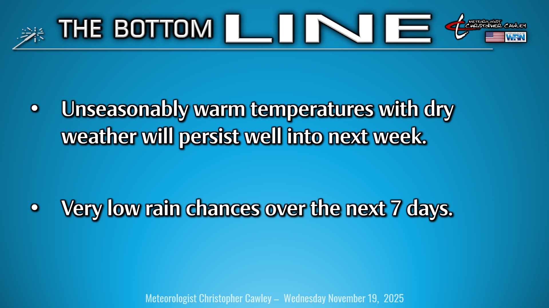
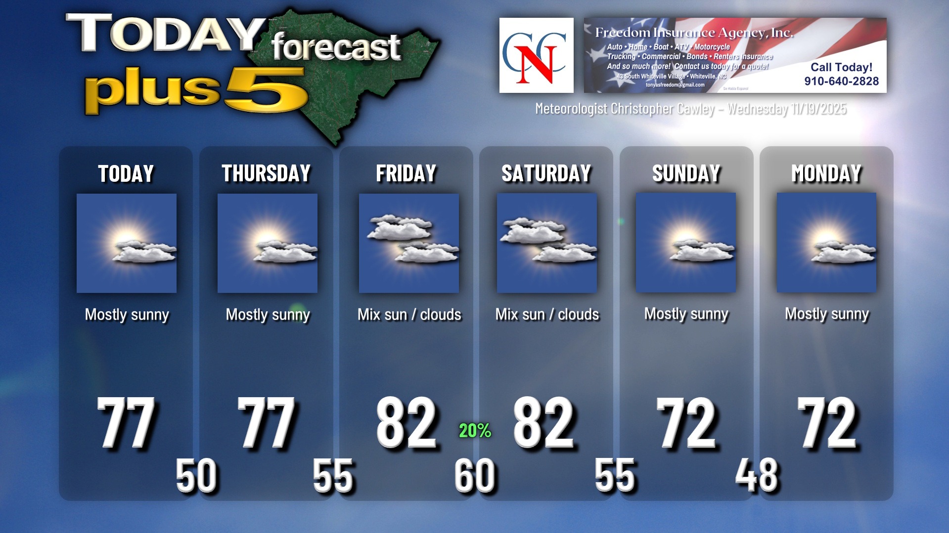
A weak cold front will pass through the area today… but we’re not really going to notice anything with it other than some cloudiness. Several days of unseasonably warm temperatures lasting into the weekend will become established today.
A frontal system will pass through the area late Friday night and this will bring with it the slight — SLIGHT — chance for some spotty light rain showers, but I doubt it. It appears to be very moisture-starved, and the latest model blends suggests just a trace of precipitation over the area. I think we’ll see more clouds than anything, mainly from Friday afternoon through Friday night into Saturday morning.
Temperatures jump into the 80s Friday and Saturday before a secondary frontal boundary, this one entirely dry, moves through late Saturday night or early Sunday, knocking our temps back into the lower 70s, still a good 5 degrees or so warmer than normal.
A way-too-soon look at Thanksgiving modeling shows that temperatures should remain at or slightly above normal until the actual weekend. The European deterministic suggests a significant rain event with cooler temps beginning on Black Friday while the GFS model has a rain event Saturday into Sunday with sharply colder temps behind a front. Like I said, way too soon to call.
The latest Euro ensembles has one (out of 50 members) painting a trace of snowfall around the 2nd/3rd of December. Just thought I’d mention that. (GEFS says nope.)
Here is your Freedom Insurance Today-plus-Five Forecast:
–Meteorologist Christopher Cawley