CCN Weather Update for Saturday December 27, 2025.
This weather update is sponsored by Freedom Insurance of Whiteville. You can trust Freedom Insurance to give you clear blue skies when it comes to home, car, boat, or whatever insurance you need. Let Freedom provide customized coverage to keep you and your family safe. Contact Freedom today at 910-640-2828!
Here’s today’s Bottom Line:

Our temperature trends will continue up and down like a bouncing rubber ball. While it was a bit on the chilly side yesterday (actually it was what would be considered “normal”)… today will be unseasonably to near-record warm… followed by a bit cooler temps on Sunday… then warm again on Monday… before the bottom drops out. Let’s get into the deets, shall we?
While you were sleeping, a frontal boundary… the same one that made it all cloudy and chilly yesterday… has lifted back to the north. Don’t be surprised if you see some fog very early this morning, but otherwise it’s going to be sunny and very warm today. Highs will jump into the upper 70s.
Then tonight the bouncing ball drops back down. The front slides back down over the area and essentially dissipates right over us during the day on Sunday. We’ll see a mix of sun and clouds but it’ll be a little cooler with temps in the mid 60s.
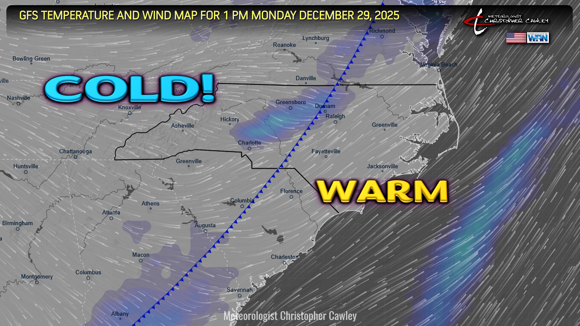
A strong south/southwest flow starts to take shape Sunday night and especially on Monday ahead of a powerful REAL cold front. That front will crash our party at some point Monday afternoon. We’ll have some breezy conditions ahead of and behind the front, and possibly a few rain showers with the front. Highs jump deep into the 70s but we’ll see temps start to fall behind the front…
…and by time we wake up Tuesday morning, it’s about 30 degrees outside. Brrr. The “brrr” is going to continue Tuesday as our highs stay in the upper 40s.
Temps Tuesday night fall into the lower and middle 20s … upper 20s Wednesday night into New Years.
If you have New Years Eve plans, make sure you’re bundled up because, friends, it’s going to be cold.
The cold really isn’t going anywhere either. In fact, a reinforcing shot of colder air looks to hit just after the New Year (not shown on the forecast graphic) with highs only in the lower to middle 40s next Friday. Brrr indeed.
Here is your Freedom Insurance Today-plus-Five Forecast:

–Meteorologist Christopher Cawley