
CCN Weather Update for Sunday December 14, 2025.
This weather update is sponsored by Freedom Insurance of Whiteville. You can trust Freedom Insurance to give you clear blue skies when it comes to home, car, boat, or whatever insurance you need. Let Freedom provide customized coverage to keep you and your family safe. Contact Freedom today at 910-640-2828!
Here’s today’s Bottom Line
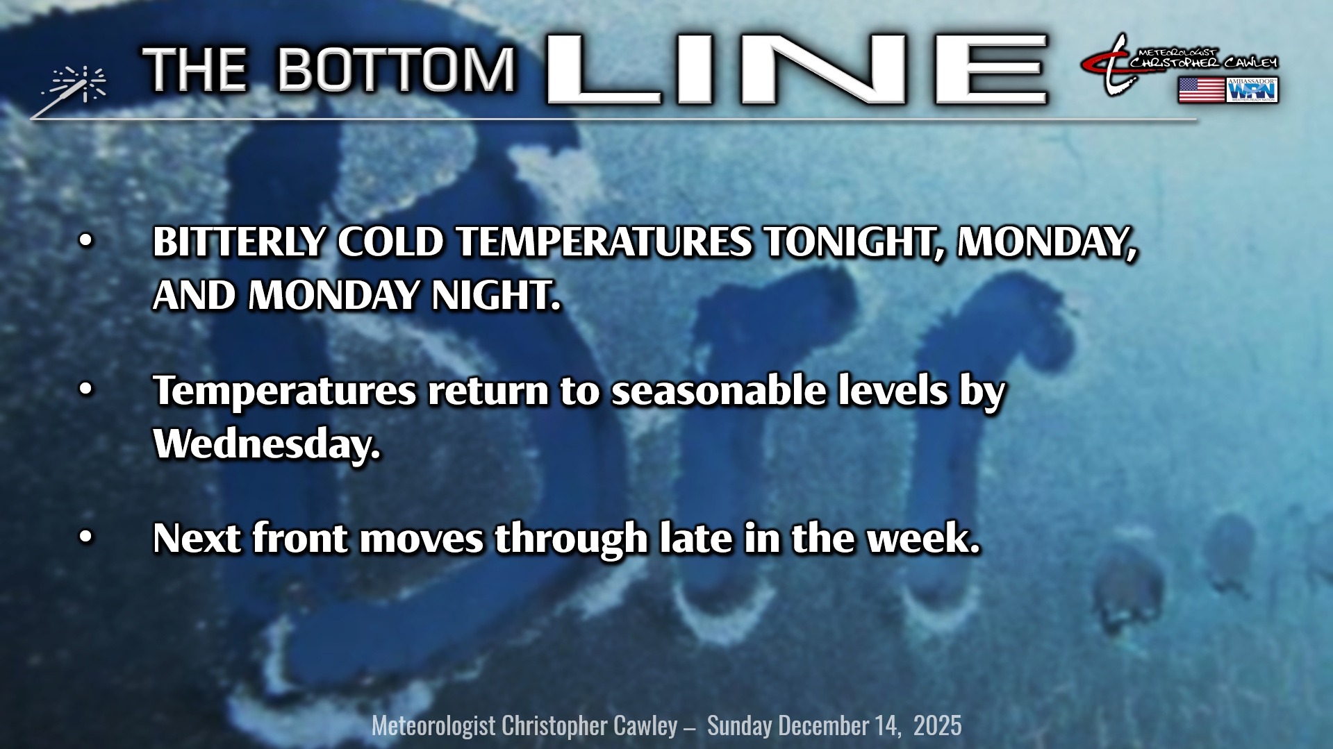
ARCTIC FREEZE TONIGHT
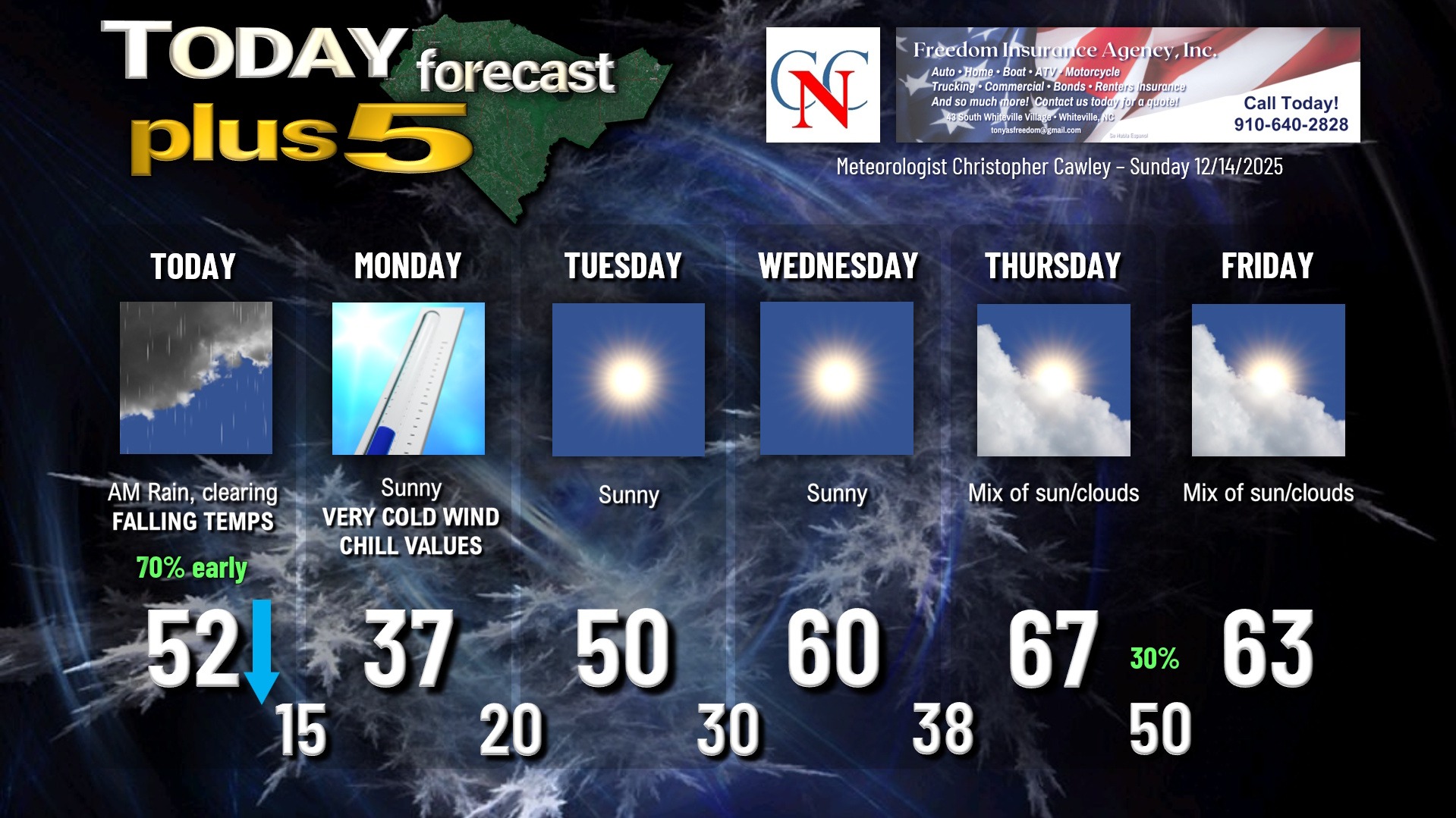
A monster cold front will sweep across the area by lunchtime. Periods of light rain can be expected through the morning, but once the front passes, the rain shuts off, the winds pick up, the skies start to clear, and the temperatures go down, down, down.
Gusty northwest winds of 15-25 mph, possibly up to 30 mph, will prevail later this afternoon through tonight and into Monday morning. Bundle up if you’re going to the parade tonight in Whiteville, it’s going to be blustery with temperatures falling through the 30s.
Expect temps between 13-17 early Monday morning. Wind chill values will be between 5 and 10 above zero.
Remember… people, pets, and pipes.
People: Check on vulnerable family, friends, and neighbors (including elderly, children). If you must be outdoors, dress in layers and avoid prolonged exposure to the cold.
Pets: Bring pets indoors… if it’s too cold for you, it’s too cold for them, and they need shelter. Ensure they have enough adequate food and unfrozen water.
Pipes: Insulate exposed pipes in unheated areas such as crawlspaces, attics, and under sinks. Disconnect hoses and use insulated faucet covers. Let faucets drip slightly to prevent freezing. Open cabinet doors under sinks to allow warm air to circulate.
The Arctic high crests over the area during the day Monday. The winds will relax, but even with full sunshine, our highs will only reach the upper 30s. We’ll drop back down to the upper teens to around 20 on Monday night/early Tuesday.
By the midweek period, the high starts to sink to our south and offshore allowing a more west-to-east wind pattern to set up. Temperatures will rise from about 50 on Tuesday to around 60 on Wednesday… and possibly near 70 on Thursday.
The next cold front moves through Thursday night with a chance for showers… but this front will be nothing compared to what we’re experiencing today. Only slightly cooler temps can be expected on Friday.
Longer-range modeling suggests temperatures running above normal through Christmas.
Here is your Freedom Insurance Today-plus-Five Forecast:
–Meteorologist Christopher Cawley