CCN Weather Update for Thursday December 11, 2025.
This weather update is sponsored by Freedom Insurance of Whiteville. You can trust Freedom Insurance to give you clear blue skies when it comes to home, car, boat, or whatever insurance you need. Let Freedom provide customized coverage to keep you and your family safe. Contact Freedom today at 910-640-2828!
Here’s today’s Bottom Line
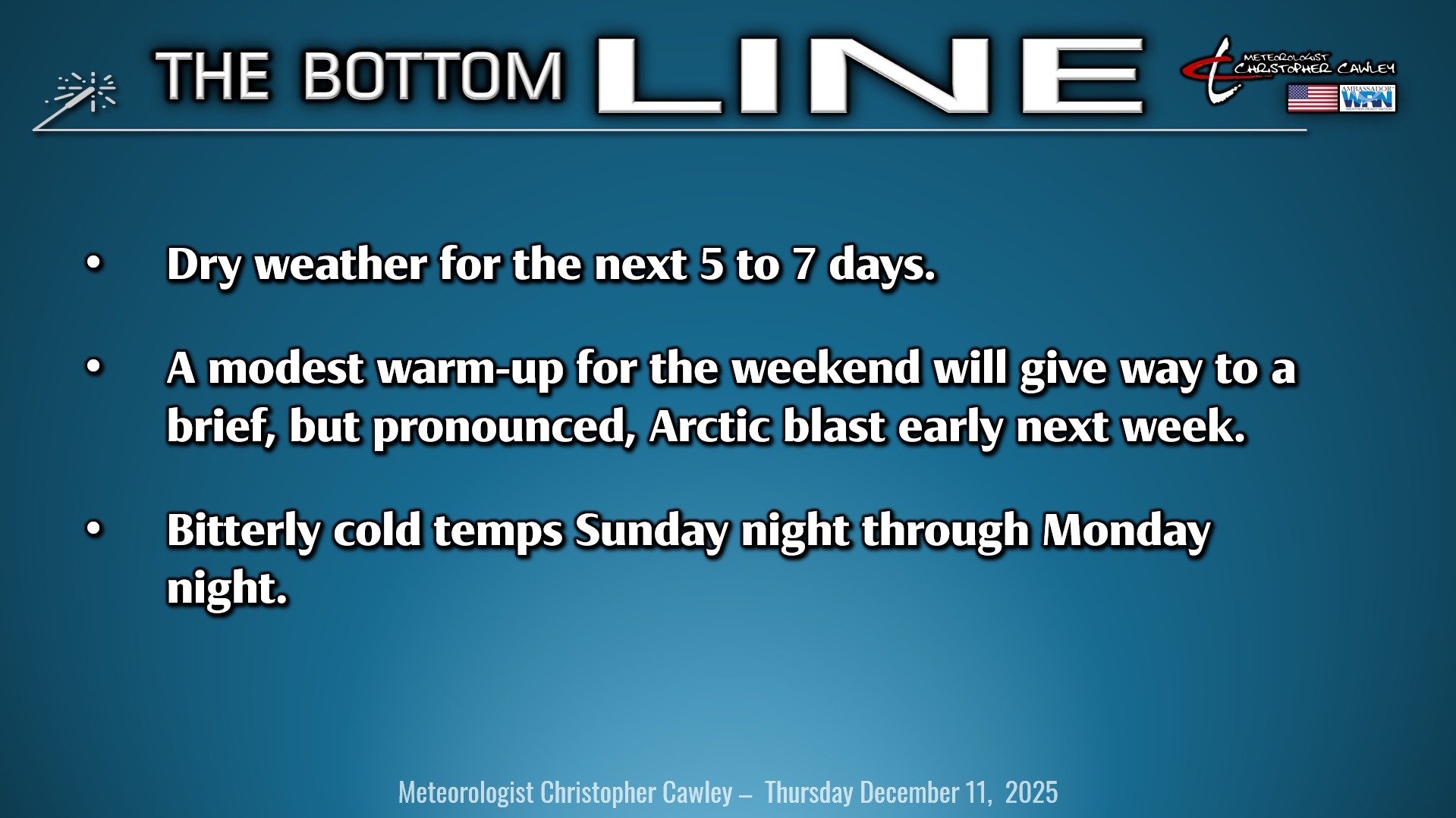
A quiet, benign overall weather pattern will be the rule well into next week, with no precipitation anticipated.
It’s really a temperature forecast as we consider several frontal passages over the next 5-7 days.
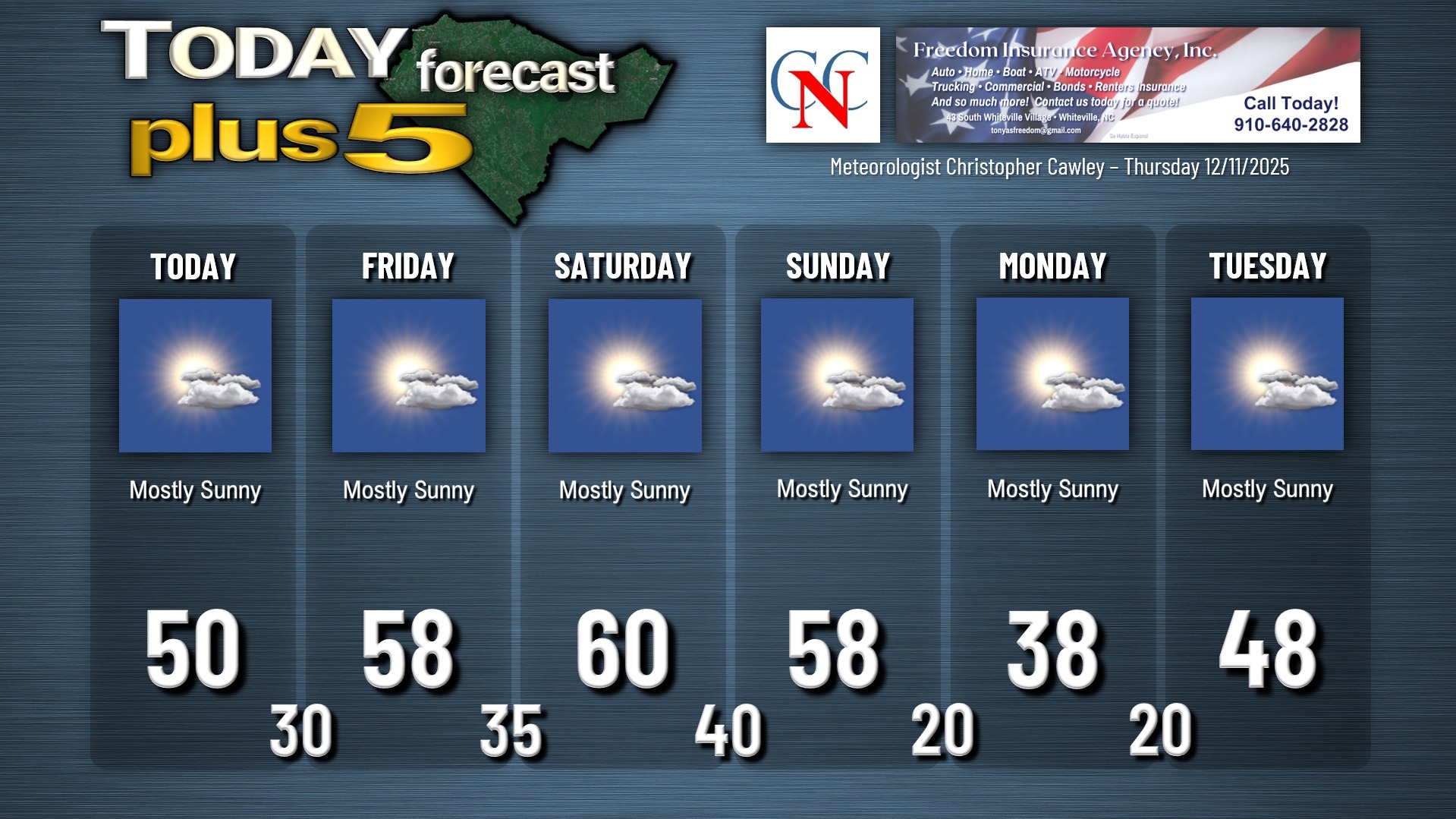
Today will be rather chilly thanks to a cold front that has passed over the area. It’ll be sunny but rather cool with our temps cresting at about 50.
The “pressure pattern” (highs and lows) will be quite weak into the weekend. We’ll experience a return to seasonable temps on Friday as a warm front lifts north over the area. The wind flow will be west-to-east and Friday should end up being a fairly nice day with highs in the upper 50s… right where they should be this time of year.
It turns milder for the weekend. Saturday is going to be a nice day, though not quite as warm as I thought for yesterday’s report. I think we’ll hit the 60-degree mark for the first time all month.
Sunday also previously looked to be a warm day ahead of an incoming Arctic cold front, but now things appear to be moving a bit more quickly. The high temperature forecast on Sunday is tricky… a frontal passage later in the day means highs may still approach 60, but if things speed up even more, we’ll be stuck in the 50s with falling temps through the afternoon.
Cold air comes cascading into the area Sunday night. Temperatures absolutely tumble and by time we head out to work or school on Monday, temps will be a few degrees either side of 20. Yes, you read that right. The coldest air of the season to date will be over the area… and our highs on Monday probably won’t even reach the 40-degree mark. Monday night will be brutally cold once again with lows deep into the 20s.
Then the warm-up begins by Tuesday. We’ll still be below normal on Tuesday with highs in the upper 40s to around 50… but the longer-range modeling points to a dramatic warm-up for the 2nd half of next week, with above-normal temperatures lasting possibly all the way to Christmas.
Precipitation chances through the entire forecast period are essentially zero.
Here is your Freedom Insurance Today-plus-Five Forecast:
–Meteorologist Christopher Cawley