
While Southeastern North Carolina missed most of the mess last weekend, a new system brewing could bring snow to the area Saturday into Sunday – along with record cold temperatures.
Last weekend’s winter storm brought very limited freezing precipitation to parts of Columbus, while much of the state was hit by sleet, freezing rain and ice. Western portions of the Columbus saw more wintry mix than the rest of the county. Bitterly cold temperatures and wind chills followed the storm event, and have set up housekeeping in the entire Cape Fear region.
The National Weather Service issued a brief today that wind chills will likely dip below 15 degrees Friday night, and potentially as low as 0 to 5 degrees Saturday and Sunday. That would be the coldest the area has seen since 2018. During the early January storm of that year, Lake Waccamaw froze completely over on Jan. 7, for the first time since 1989.
Snowfall varied widely across the area with the 2018 snow event, ranging from one half inch to four inches in some areas.
In addition to dangerously cold temperatures through the weekend, the NWS is confident that some amount of snow will cross our area, but how much cannot be determined.
“There’s probably going to be some significant differences in snowfall amounts from place to place, even within the same county,” the briefing said. “We don’t feel comfortable talking about specific amounts just yet, but even when we get there, please know this is a moving target (it is predicting the future, after all).”
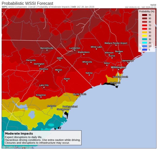
There is a 50 to 70 percent chance of moderate impacts that could create hazardous driving conditions Saturday into Sunday.
Meteorologist Christopher Cawley is monitoring the storm, and will have a live broadcast on Facebook Thursday if conditions warrant. Catch his daily weather blog at columbuscountynews.com for all the latest updates.