CCN Weather Update for Friday January 16, 2026.
This weather update is sponsored by Freedom Insurance of Whiteville. You can trust Freedom Insurance to give you clear blue skies when it comes to home, car, boat, or whatever insurance you need. Let Freedom provide customized coverage to keep you and your family safe. Contact Freedom today at 910-640-2828!
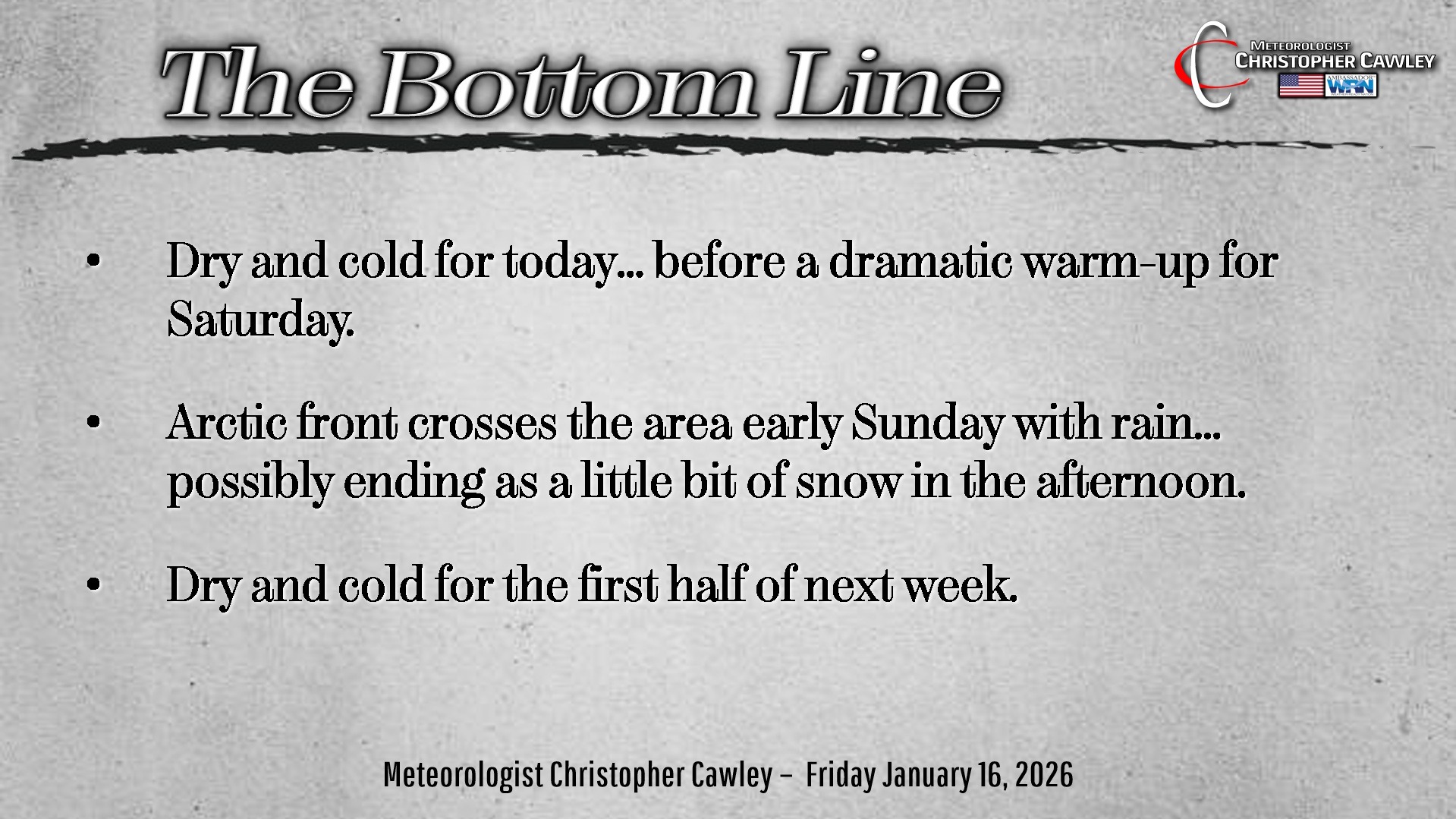
Here’s today’s Bottom Line:
Allllllrighty let’s cut right to the chase, because I know that’s what everyone wants to know about.
IS IT GOING TO SNOW ON SUNDAY?
Well…. probably. Will it accumulate? Probably not much. But it could.
How’s that? Vague enough?
The thing is, vague is about the best we can do right now.
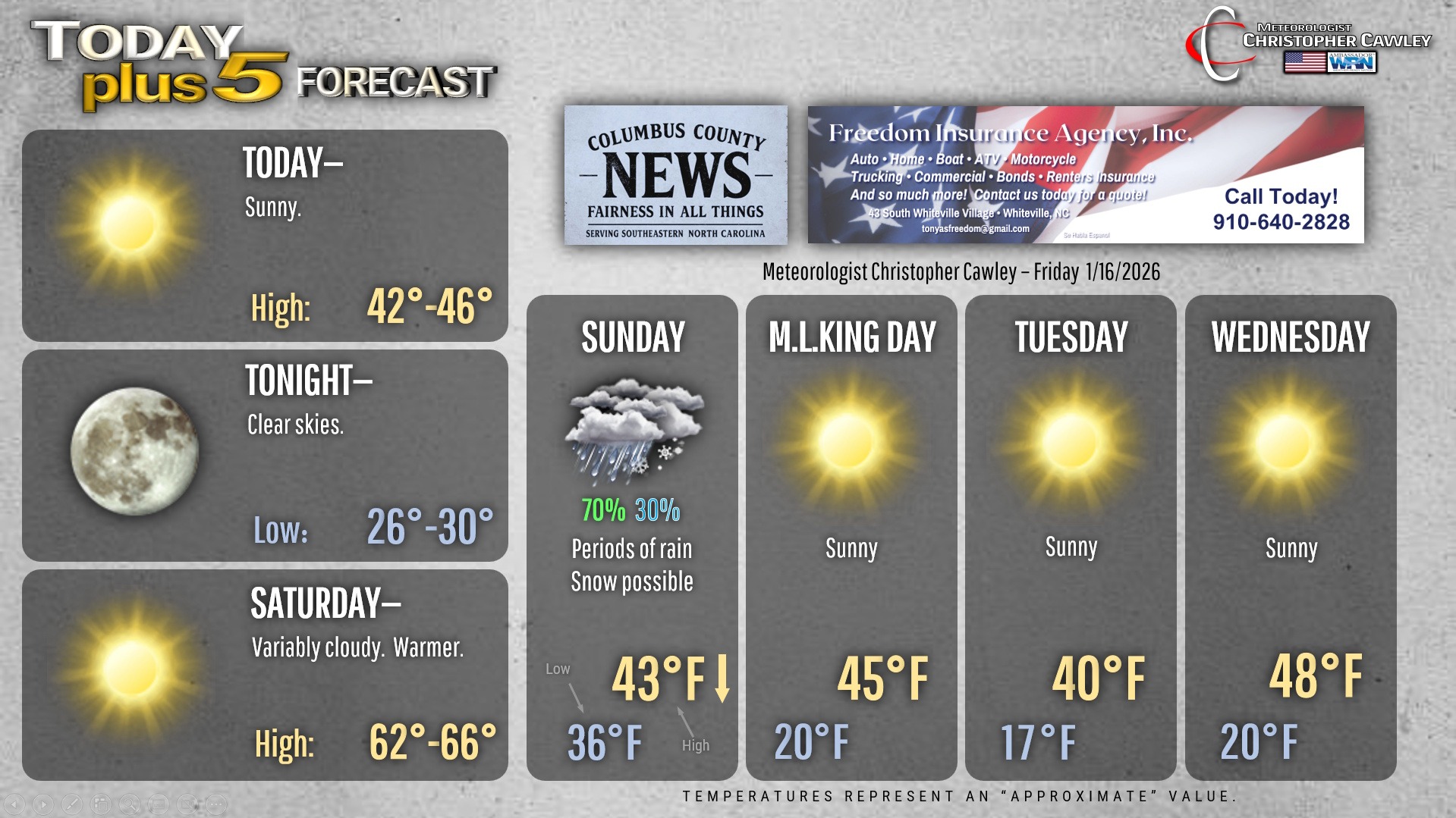
First though, lets look at today. Sunny skies with highs in the mid to upper 40s. Then, in typical Carolina fashion………
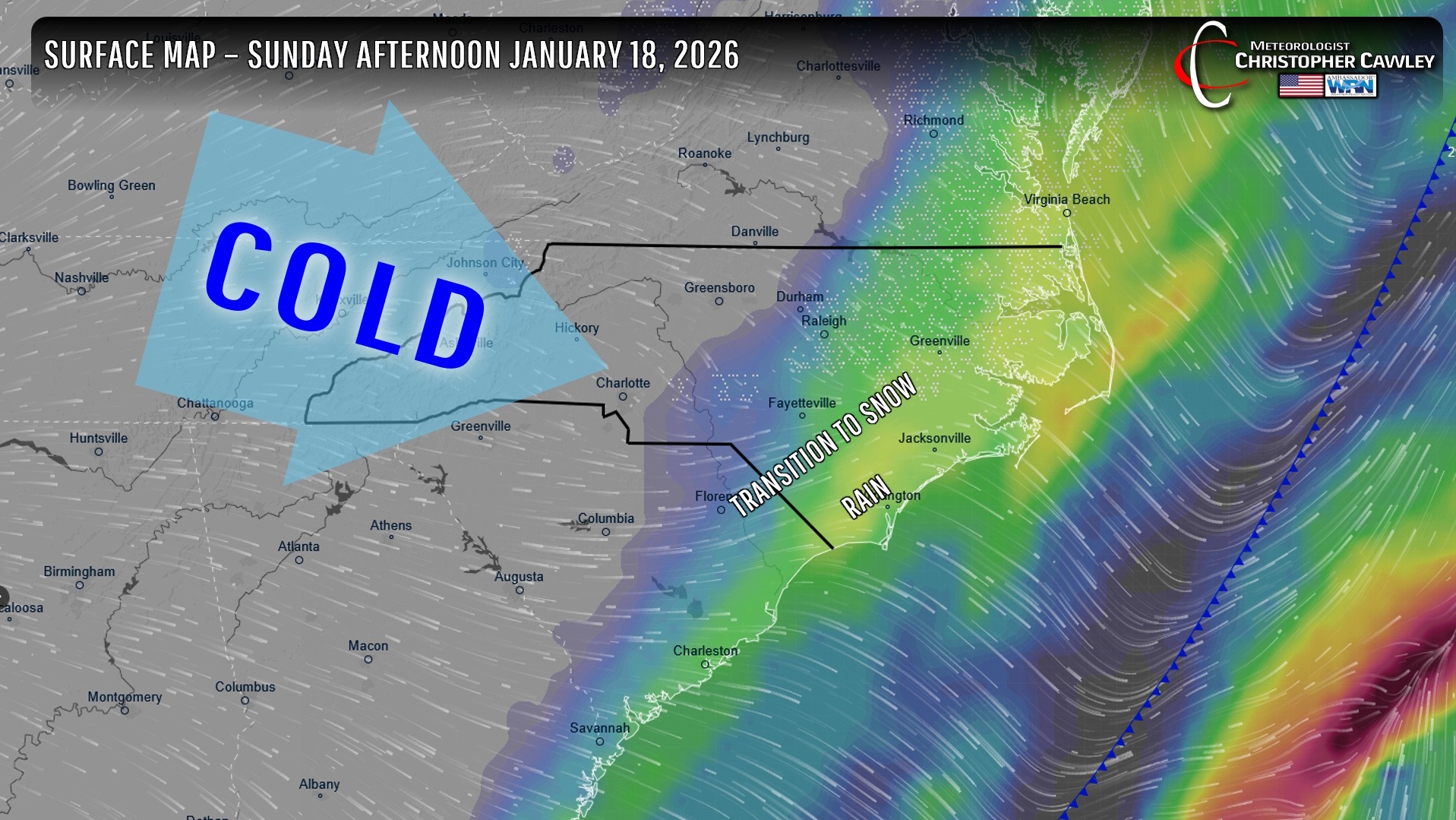
……..Saturday will be warm … into the 60s … ahead of an Arctic cold front. The front will move through the area Saturday night, and an area of low pressure is expected to form somewhere along the front.
The latest modeling is suggesting the low will be a) close to the coast, and b) lift rather quickly off to the north-northeast on Sunday.
Colder air will push in behind the front but it’s going to be a case of how MUCH cold air gets here before the precipitation moves off to the northeast. Indications are that enough cold air pushes into the area that the periods of rain Sunday morning will transition to a rain/snow mix and then possibly a period of wet snow during the afternoon hours.
There is the potential for SOME accumulations, but there’s just a lot of uncertainty with that. The National Weather Service has a 10% chance that most of Columbus County receives half an inch of snow. There’s a 10% chance of 1 inch or higher from White Lake and Elizabethtown northward into Sampson county, as well as areas west of I-95 from Laurinburg to Fayetteville and northward from there. So yeah, there’s a chance.
Successful (measurable) snow “events” consisting of cold air chasing precipitation are relatively rare here… the last one occurring back in the early 2010s. More often than not, the cold air arrives just a little too late, and all we get are a few flurries. Every once in a while, though, it works out that we could end up with some accumulation.
The other thing working AGAINST accumulating snow is that it’s going to be warm on Saturday. Like I said, highs will be in the lower to middle 60s on Saturday. So the ground is going to be warm… and then wet as rain develops during the overnight. Rainfall amounts up to a quarter of an inch are possible from this event.
When (IF) the transition does occur, it’s going to have to actively snow for a while for it to begin to stick to grassy surfaces. I really think that the precipitation will be exiting stage-right by that time so accumulations are likely to be a slushy “whiteness” in the grass and on things like cars, garbage can lids, etc.
Again, better chances of snow exist west of I-95 and north of a line from Lumberton through Elizabethtown to Jacksonville.
That’s the only game in town weather-wise through much of next week. Below normal temperatures … very cold nights … in the Monday through Wednesday timeframe before temps possibly return to seasonal normal values toward the end of next week.
Here’s your Freedom Insurance Today-plus-Five Forecast!
–Meteorologist Christopher Cawley