CCN Weather Update for Monday January 19, 2026.
This weather update is sponsored by Freedom Insurance of Whiteville. You can trust Freedom Insurance to give you clear blue skies when it comes to home, car, boat, or whatever insurance you need. Let Freedom provide customized coverage to keep you and your family safe. Contact Freedom today at 910-640-2828!
Here’s today’s Bottom Line:
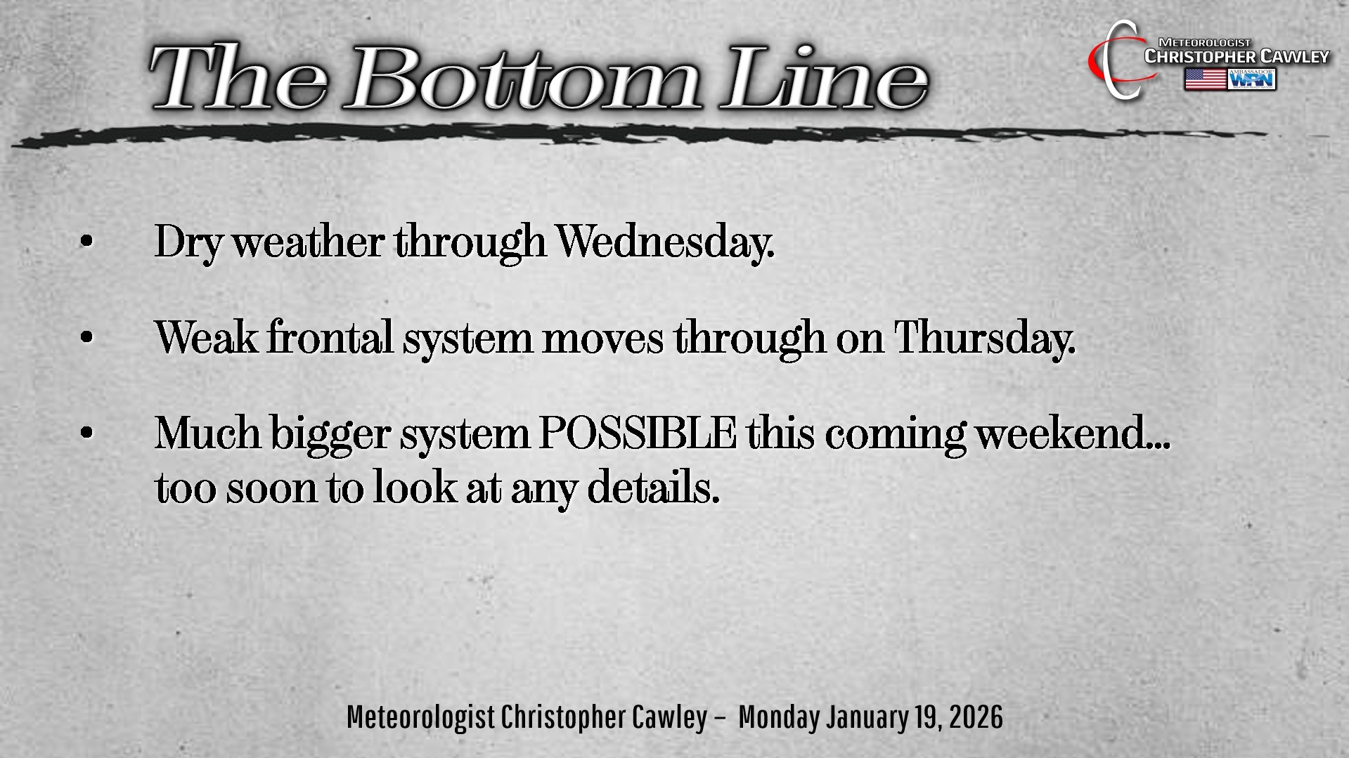
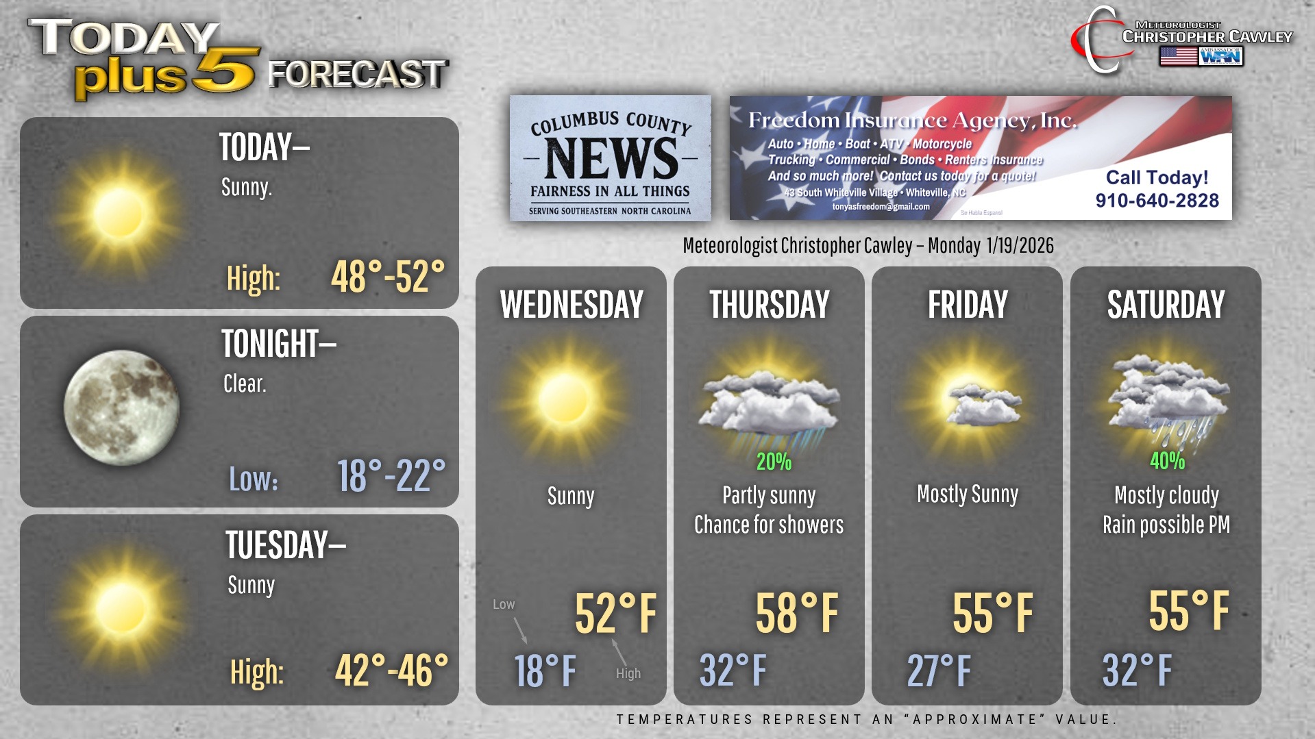
Some patchy black ice still possible this morning, but that concern will end pretty quickly.
Quiet weather on the whole this week, but a few chances for precipitation exist.
First up, a dry cold front will sweep across the area on Tuesday. This will lead to breezy conditions and chilly temps.
The National Weather Service is considering issuing a “cold weather advisory” for both late tonight and late Tuesday night.
Another front drops through on Thursday. This will be mostly dry but there may be enough moisture available that a few light rain showers occur in the afternoon.
High pressure then briefly settles in for Friday before things become rather interesting over the weekend.
A cold front crosses the area early Saturday. Cold air will take “a minute” to push in… but the longer-range modeling suggests an area of low pressure forms on the southern jet stream.
I’m putting in the “chance” for some rain Saturday afternoon… but the more interesting situation occurs on Sunday.
Deterministic models, both the GFS and EURO, paint a rather “sensational” snow/ice event over the Carolinas next Sunday. Or at least they are showing that as of this writing.
Since we’re 7 days out, I’m not going to forecast snow or ice or impacts. It’s a matter of simply recognizing a pattern that can support winter weather. No maps. No inches. No hype.
Right now, this is firmly in the “possible winter storm” category — with a big emphasis on POSSIBLE. It’s too early to say whether this would be light, impactful, or even wintry at all in many spots. Long-range guidance is notorious for flipping solutions this far out, especially in the Carolinas, where temperature profiles matter down to a degree or two.
The main point is this: No matter what you see posted by the social media-ologists out there, or on your (worthless) phone app, a) the pattern supports watching, b) uncertainty is extremely high, and c) the details are going to change many, many times.
Active weather pattern means a whole lot of “stay tuned.”
Here’s your Freedom Insurance Today-plus-Five Forecast!
–Meteorologist Christopher Cawley