CCN Weather Update for Friday February 27, 2026.
This weather update is sponsored by Freedom Insurance of Whiteville. You can trust Freedom Insurance to give you clear blue skies when it comes to home, car, boat, or whatever insurance you need. Let Freedom provide customized coverage to keep you and your family safe. Contact Freedom today at 910-640-2828!
Here’s today’s Bottom Line:
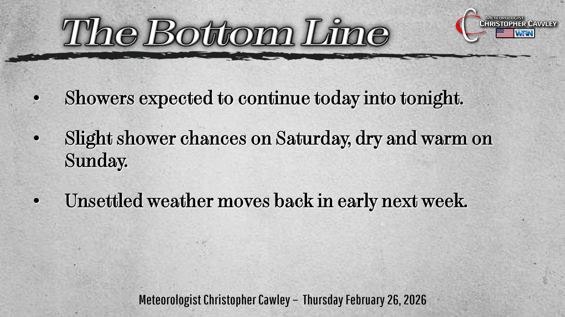
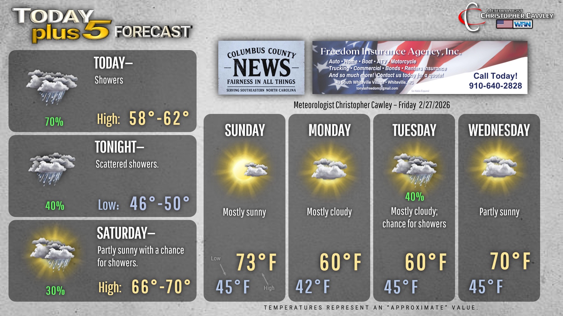
Several waves of low pressure will ripple along a frontal boundary that continues to push slowly southward. This will keep showers across the area for today. It won’t be raining all the time but, again, intervals of rain are likely so keep the umbrella handy. Highs will be seasonable, right around 60.
The showers will be diminishing through the evening, leaving us with mostly cloudy skies for tonight. However, some modeling insists on keeping a shower chance into at least Saturday morning, so I grudgingly put in a shower icon for Saturday. Highs will be in the upper 60s.
Your Sunday will be a beautiful, springlike day with lots of sunshine and warm temps into the lower and middle 70s. Get out and enjoy it.
A cold front will drop across the area on Monday. This will bring lots of clouds, but I believe that most of the energy will remain off to our north. An area of low pressure then forms on the front by Monday night bringing shower chances back to the area.
High pressure wedges into place for Tuesday into Wednesday with some shower chances and lots of clouds dominating. Guidance suggests we bump back up to 70 on Wednesday… I put that on the graphic below but I’m not all that confident thanks to the high pressure wedge in place. We’re more likely to be socked in with clouds and slightly cooler temps.
Here’s your Freedom Insurance Today-plus-Five Forecast!
–Meteorologist Christopher Cawley