CCN Weather Update for Monday February 2, 2026.
This weather update is sponsored by Freedom Insurance of Whiteville. You can trust Freedom Insurance to give you clear blue skies when it comes to home, car, boat, or whatever insurance you need. Let Freedom provide customized coverage to keep you and your family safe. Contact Freedom today at 910-640-2828!
Here’s today’s Bottom Line:
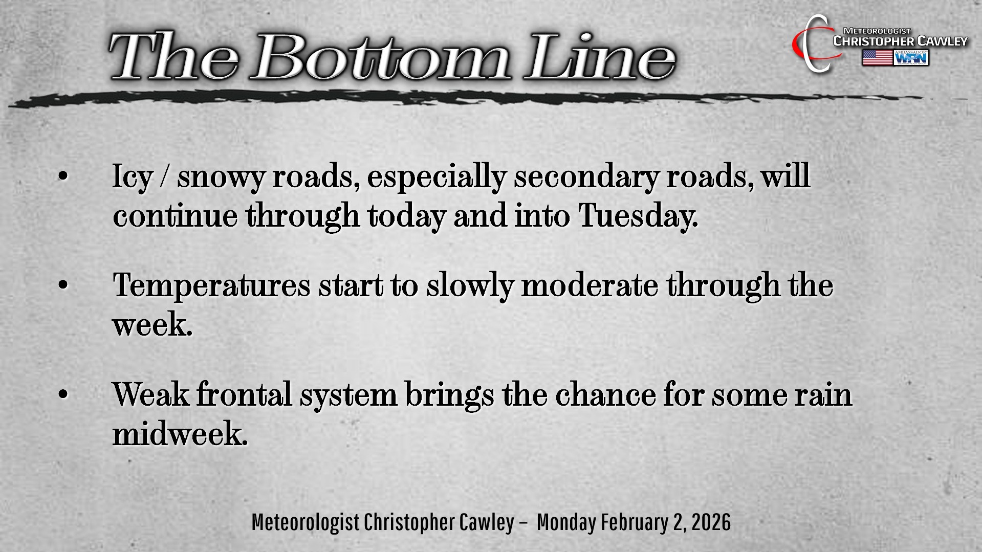
The Extreme Cold Warning and Winter Weather Advisory are in place this morning… because mercy it’s cold outside… and there’s a TON of ice and mess on area roads (especially secondary roads).
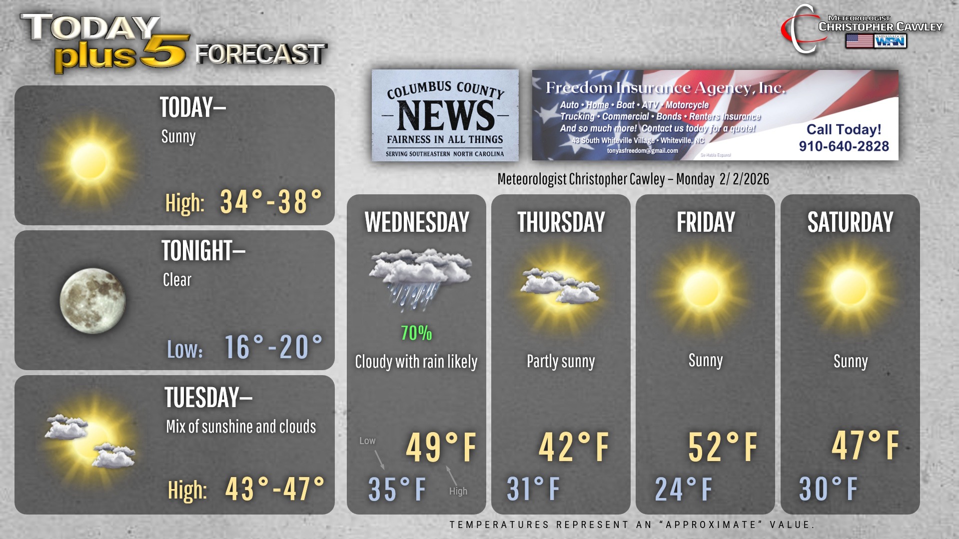
Most places are closed for today, so stay home. Especially this morning. There will be some melting and sublimation for today thanks to the solar radiation from a full sunshine. Highs will be a few degrees above freezing, but “shady” areas on secondary roads will remain vicious today.
Then the cycle repeats itself tonight as we drop back into the mid teens. If it’s wet and/or slushy, it’s going to become a sheet of ice once again. So Tuesday morning travel may be dicey in spots.
Much milder temps arrive on Tuesday ahead of our next frontal system. With a mix of sunshine and clouds, temps easily rise to the mid 40s.
The next weather system starts to move in late Tuesday night with increasing clouds and a slight chance for rain during the overnight. We’ll stay all liquid as lows only drop to the mid 30s.
Wednesday will be a cloudy, damp day with periods of light rain. We’re not looking at a lot of rain, about a quarter of an inch at this standpoint, but that, combined with temps near 50, will be the death knell for the majority of the snow on the ground.
A cold front crosses the area Wednesday night. Cold air will be “chasing” the moisture headed offshore. Some of the modeling indicates a bit of a lag where some moisture hangs around over the area as surface temps approach the freezing mark. If we get any wintry precipitation, it’ll be minimal… very minimal… and confined to an area north of Fair Bluff through Whiteville to Delco.
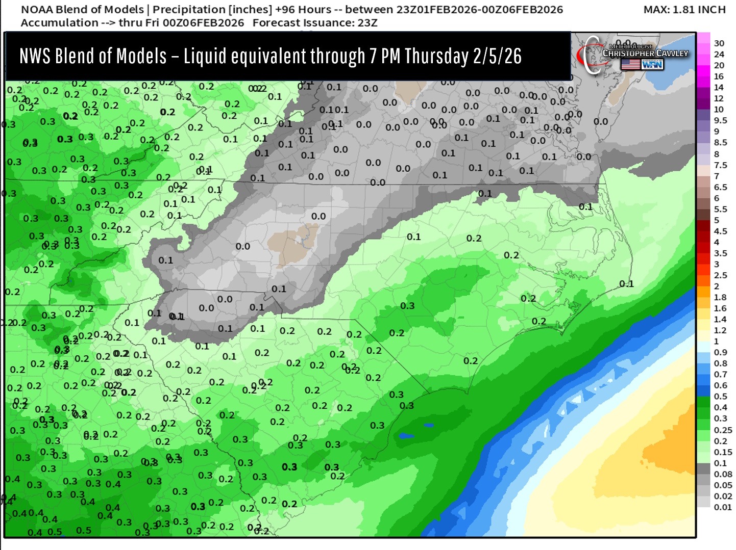
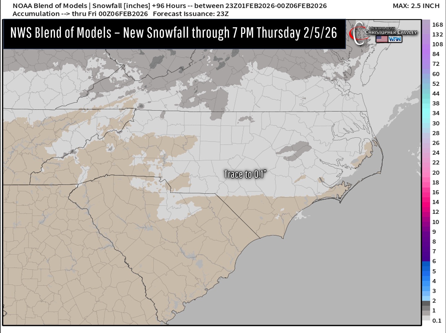
Of course, things could change, but I’m quite confident that the vast majority of what falls this week will be liquid. If there is some mixing, no meaningful accumulations or impacts are expected at this time.
We clear out for the rest of the work week… and the weekend should be DRY for a nice change of pace. Temps continue to run below seasonal normal values (normal highs are in the mid to upper 50s, normal low in the lower 30s).
Some of the social media keyboard warriors are starting to post model graphics hinting at a storm on the 13th/14th. Have we not learned anything from the past two storms? Keep on scrolling.
Here’s your Freedom Insurance Today-plus-Five Forecast!
–Meteorologist Christopher Cawley