


CCN Weather Update for Saturday February 21, 2026.
This weather update is sponsored by Freedom Insurance of Whiteville. You can trust Freedom Insurance to give you clear blue skies when it comes to home, car, boat, or whatever insurance you need. Let Freedom provide customized coverage to keep you and your family safe. Contact Freedom today at 910-640-2828!
Here’s today’s Bottom Line:
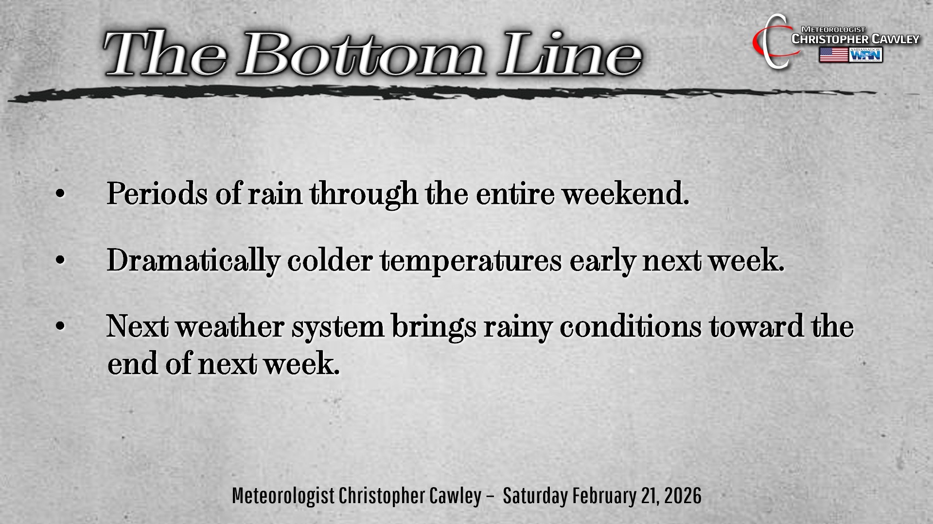
Greetings to a rainy, damp weekend … one in which we are slated to receive some much-needed rainfall.
A low pressure center is situated over Atlanta, Georgia this morning. This has a frontal boundary extending northeastward across central South Carolina and then off the Cape Fear coast, while a second area of low pressure is getting organized over extreme eastern Texas.
Meanwhile, a weak area of high pressure will wedge in near Virginia Beach, keeping an easterly wind flow over our area.
These areas of low pressure aren’t really in any hurry thanks to that high just off to the north… and by this evening the primary low is likely to be positioned near Charleston, while the secondary low enters west-central Georgia, and a third area of low pressure organizes along the Gulf coast.
The primary low moves slowly up the coast, and by time we sit down to breakfast on Sunday morning, it should be located somewhere along the Cape Fear coast, while the second low plays a bit of “catch-up” over central South Carolina.
The coastal low is likely to rapidly strengthen and become the primary storm system as it lifts northeastward off the Virginia coast by Sunday night.
By that time, the precipitation should be ending.
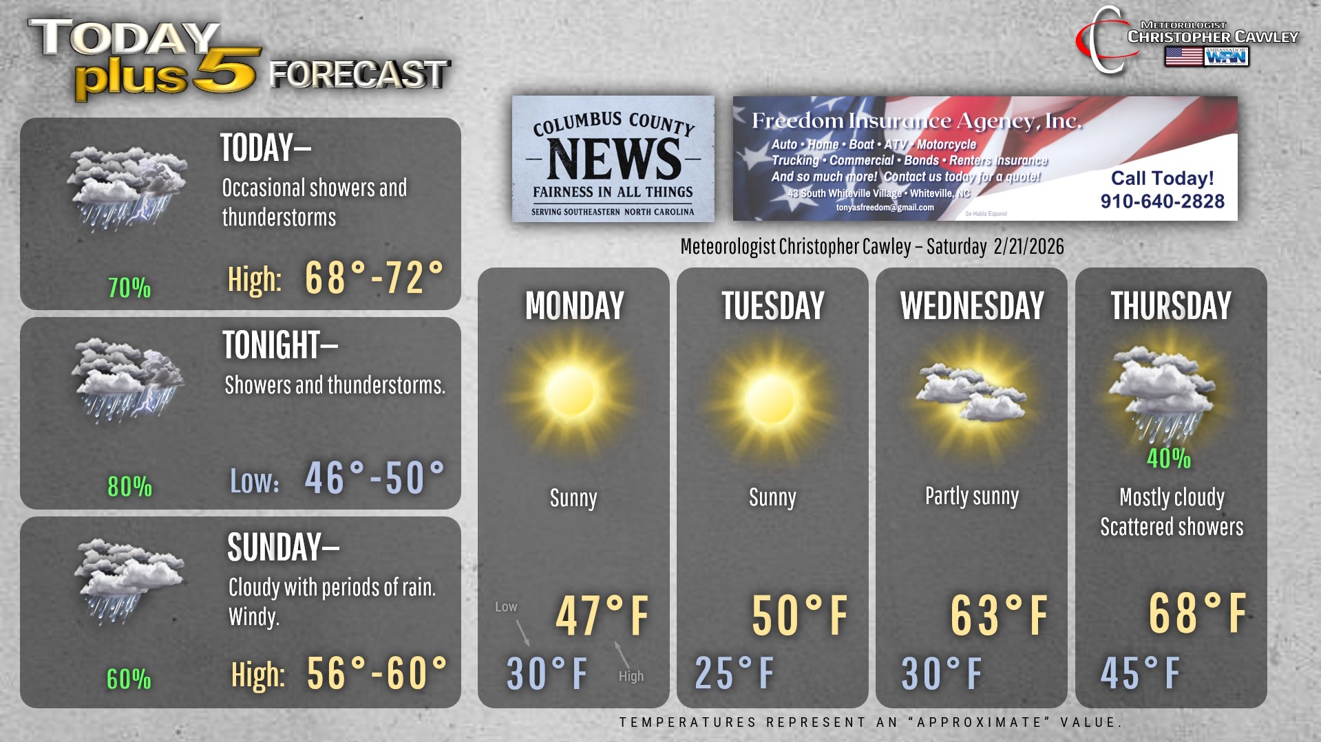
I expect showery conditions for today… a good portion of the day may end up dry but I’m not confident enough to say that for certain. Showers and the threat for thunderstorms will increase this afternoon. The Storm Prediction Center has removed our area from the severe weather threat, keeping it much farther to the south, over southern South Carolina and southern Georgia.
Showers and the chance for thunder continue tonight… when most of the rain will occur.
Periods of rain are likely to continue through Sunday morning, tapering off by the afternoon. It will become quite windy as the low off the coast rapidly strengthens… we could see wind gusts on the order of 30-35 mph at times Sunday afternoon. We should see some breaks of sunshine Sunday afternoon, but temperatures will start to fall later in the day.
Skies clear out for your Sunday night, temps will fall back to around 30 by Monday morning. Winds will remain rather gusty at times through the evening hours.
Deep, Arctic cold air will be pulled down by the departing nor’easter leading to temperatures running much below seasonal normal values… even with full sunshine, Monday and Tuesday will struggle to reach the upper 40s to around 50… and lows Monday night will dip into the mid 20s. That will feel rather shocking compared to the 80-degree weather we experienced yesterday.
The cold snap will be relatively short-lived as temps rebound by midweek. High pressure slipping off the east coast of Florida will allow a warmer and more humid southerly flow to become established ahead of our next weather system… a cold front slated to drop through the area by the end of next week.
Here’s your Freedom Insurance Today-plus-Five Forecast!
–Meteorologist Christopher Cawley
