CCN Weather Update for Friday March 6, 2026.
This weather update is sponsored by Freedom Insurance of Whiteville. You can trust Freedom Insurance to give you clear blue skies when it comes to home, car, boat, or whatever insurance you need. Let Freedom provide customized coverage to keep you and your family safe. Contact Freedom today at 910-640-2828!
Here’s today’s Bottom Line:
I could easily cut-and-paste yesterday’s blog entry here, as the deets are the same.
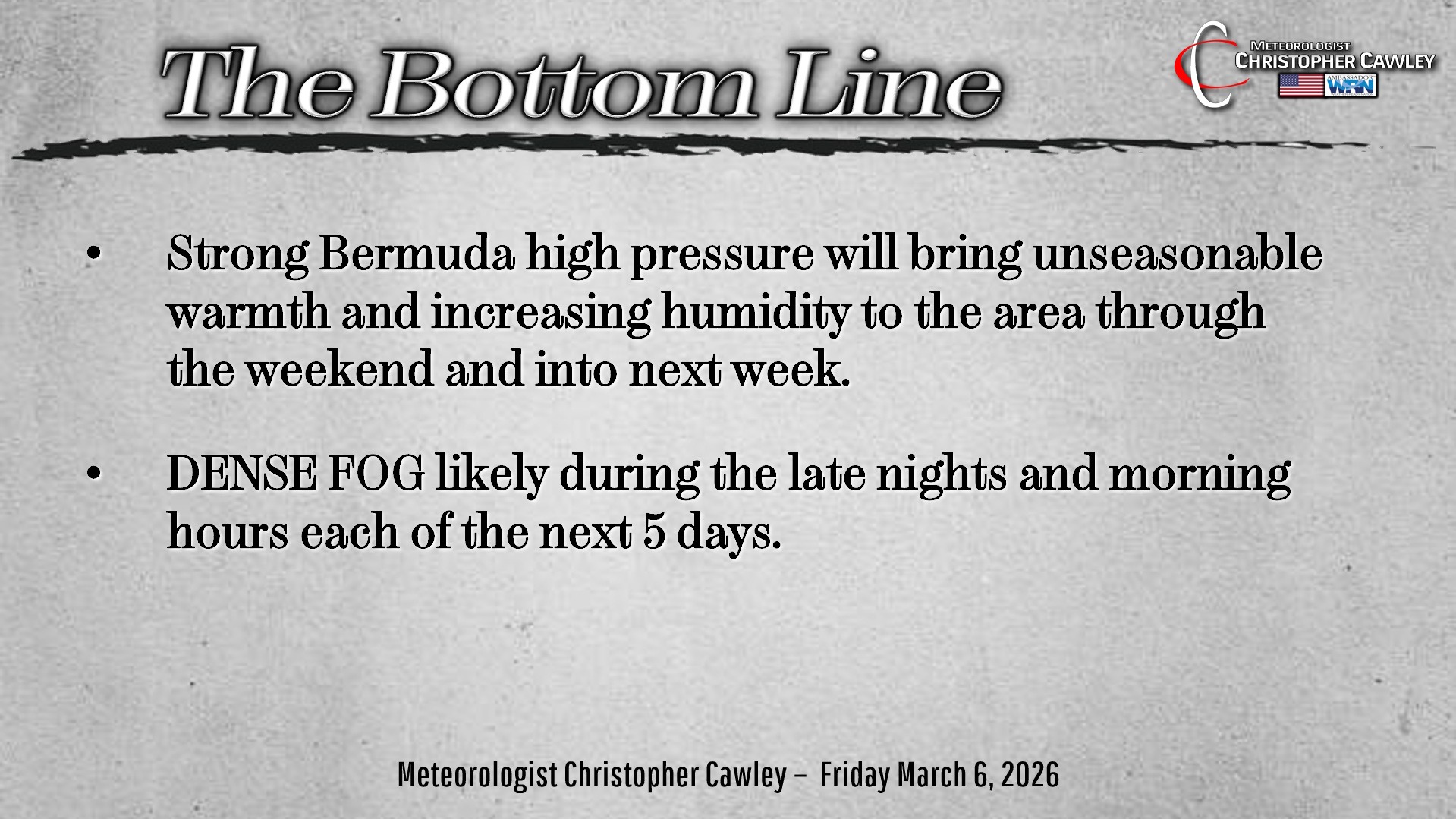
Unseasonably warm and rather humid conditions can be expected over the next 6 days thanks to a huge ridge of high pressure offshore, known as a Bermuda High pressure center. These typically occur during the late spring through the summer months… not during the early springtime. But here we are.
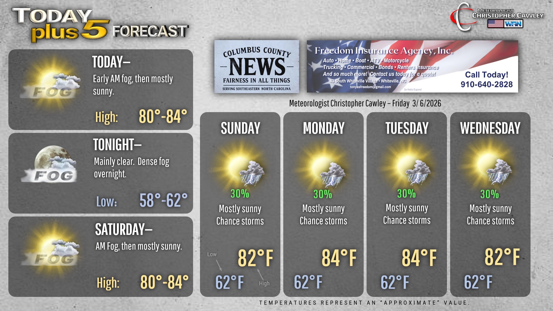
Our temperatures will be north of the 80-degree mark each day through the forecast period, with lows dropping to the lower 60s — which is our normal high temps.
In terms of actual “weather” … like yesterday’s blog, there just isn’t much to say. We’ll have some dense fog forming during the nighttime hours each night over at least the next 3-5 nights, with some fog lingering each morning. This is because of the high pressure ridging and the unseasonably humid air mass in place.
The sea-breeze boundary will be robust and push inland during the afternoon hours. This may trigger a pop-up shower or thunderstorm during the afternoon hours Sunday through Wednesday. The coverage will likely be isolated, hit-or-miss in variety, but that’ll be about it.
The unseasonable warmth will likely come to a rather sudden conclusion later NEXT week (next Thursday) as modeling suggests a fairly strong cold front is able to break down the high pressure ridge. Until then…. it’s unseasonable heat and humidity.
Here’s your Freedom Insurance Today-plus-Five Forecast!
–Meteorologist Christopher Cawley