CCN Weather Update for Monday March 9, 2026.
This weather update is sponsored by Freedom Insurance of Whiteville. You can trust Freedom Insurance to give you clear blue skies when it comes to home, car, boat, or whatever insurance you need. Let Freedom provide customized coverage to keep you and your family safe. Contact Freedom today at 910-640-2828!
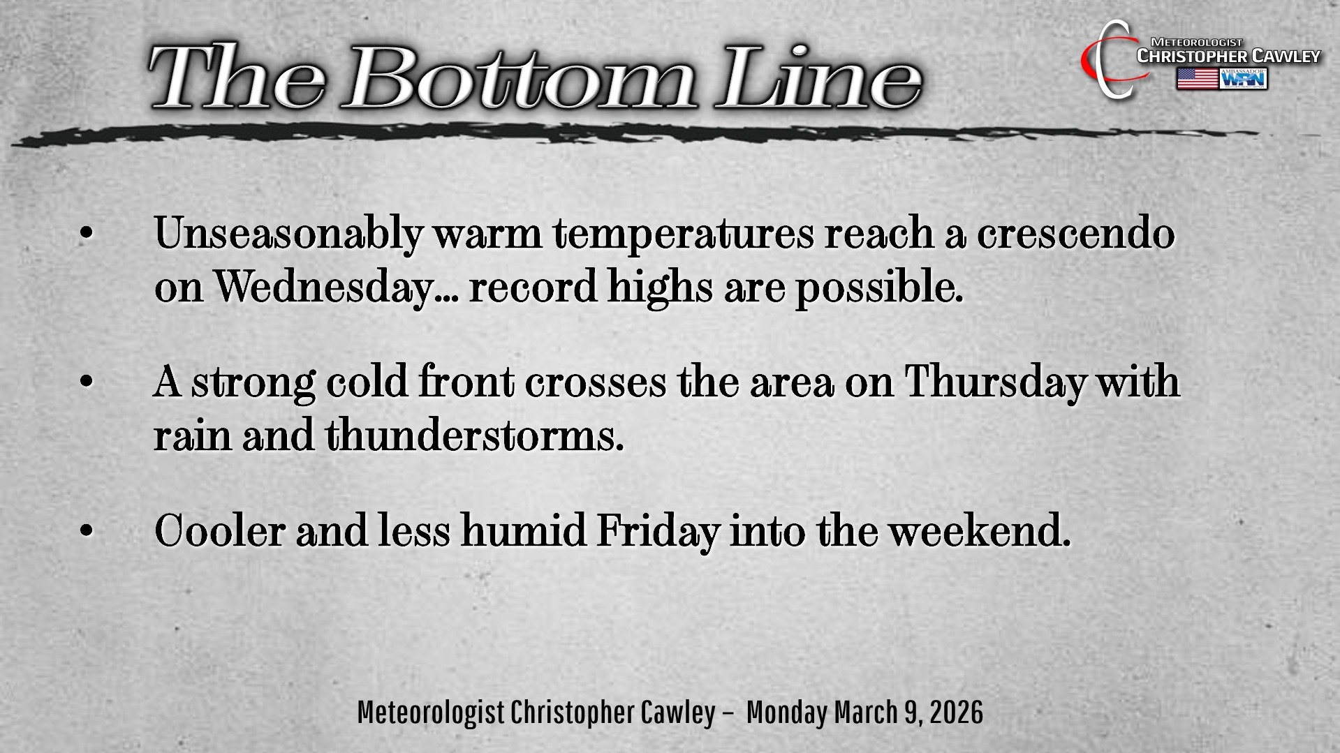
Here’s today’s Bottom Line:
Unseasonably warm and humid conditions will prevail through Wednesday. That’s the “big picture.”
The weak frontal boundary that brought the thunderstorms on Sunday is fading away offshore as the high pressure ridge reasserts control for a few more days.
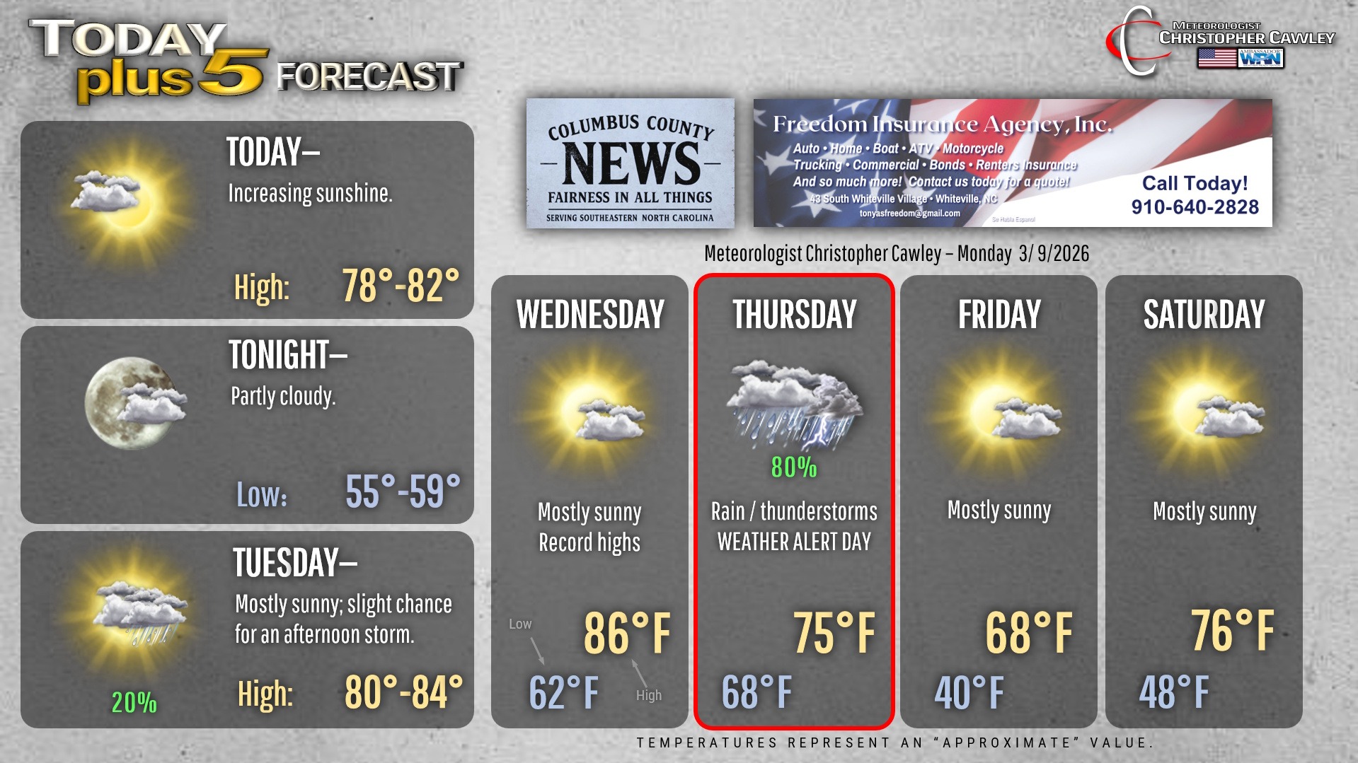
Today and Tuesday will feature a mix of sunshine and clouds, with the warm and humid conditions continuing.
The unseasonable warmth will reach a crescendo on Wednesday with record high temperatures looking more and more likely. The record high for Whiteville on Wednesday is 84, recorded in 2000. I feel fairly certain that will fall.
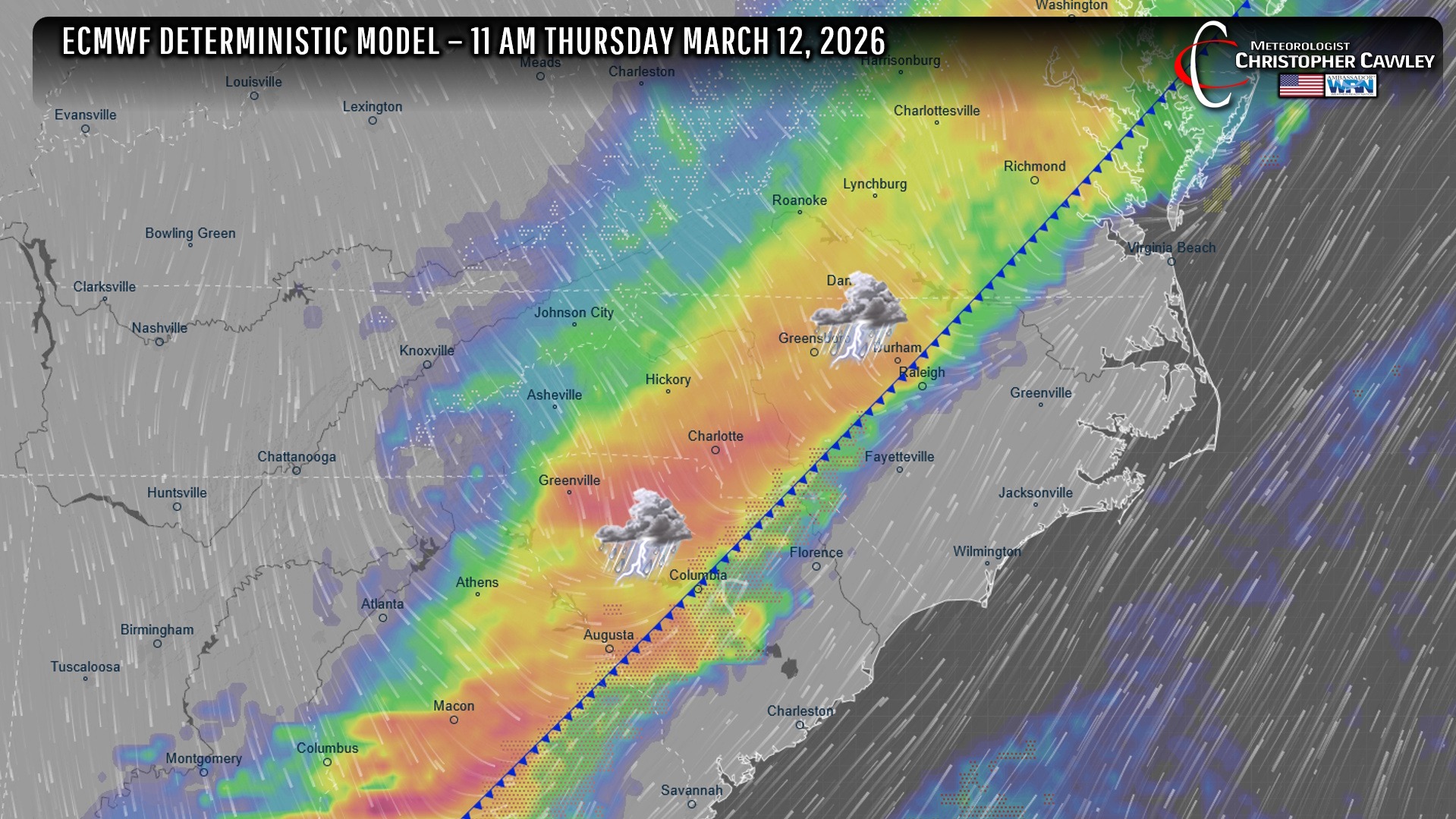
Then everything changes as a cold front… a strong one… pushes through during the day on Thursday. There’s quite a bit of discrepancy regarding timing within the global models, but suffice it to say that we’ll receive some much-needed rainfall on Thursday, and the unseasonable warmth ends. I’m making Thursday a “weather alert” day.
We’ll have a brief cool-down on Friday but then return back well above normal for the weekend.
Looking real-super-long-term, a weather system is likely to bring a cold front to the area NEXT week (along the 17th to the 18th) and this will likely usher in much-BELOW-normal temperatures for the end of the 3rd week in March…. preliminary modeling suggests highs in the 50s with lows in the 30s…. which means an increasing frost threat. We’ll have to wait and see on that.
Here’s your Freedom Insurance Today-plus-Five Forecast!
–Meteorologist Christopher Cawley