CCN Weather Update for Saturday March 28, 2026.
This weather update is sponsored by Freedom Insurance of Whiteville. You can trust Freedom Insurance to give you clear blue skies when it comes to home, car, boat, or whatever insurance you need. Let Freedom provide customized coverage to keep you and your family safe. Contact Freedom today at 910-640-2828!
Here’s today’s Bottom Line:
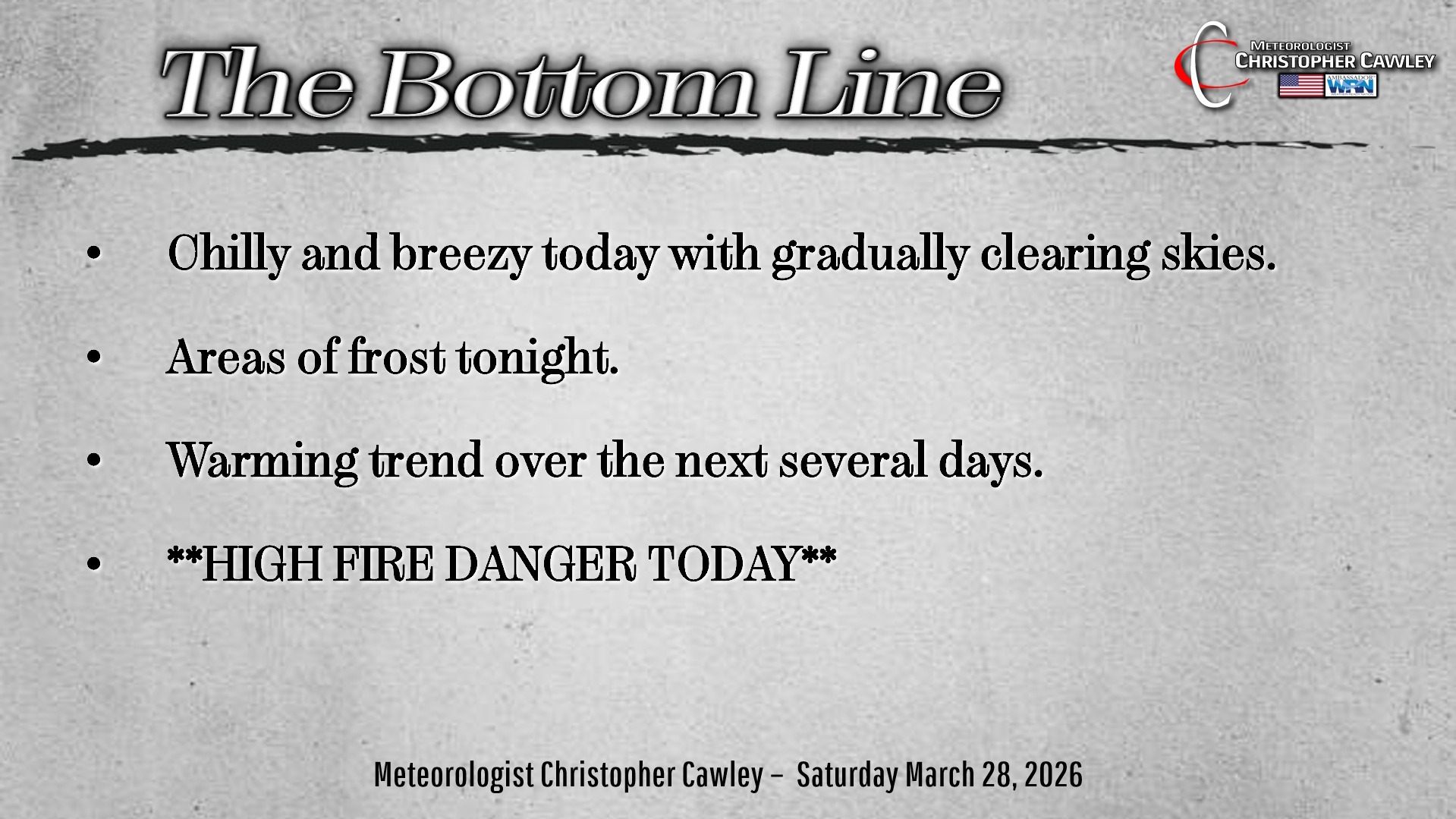
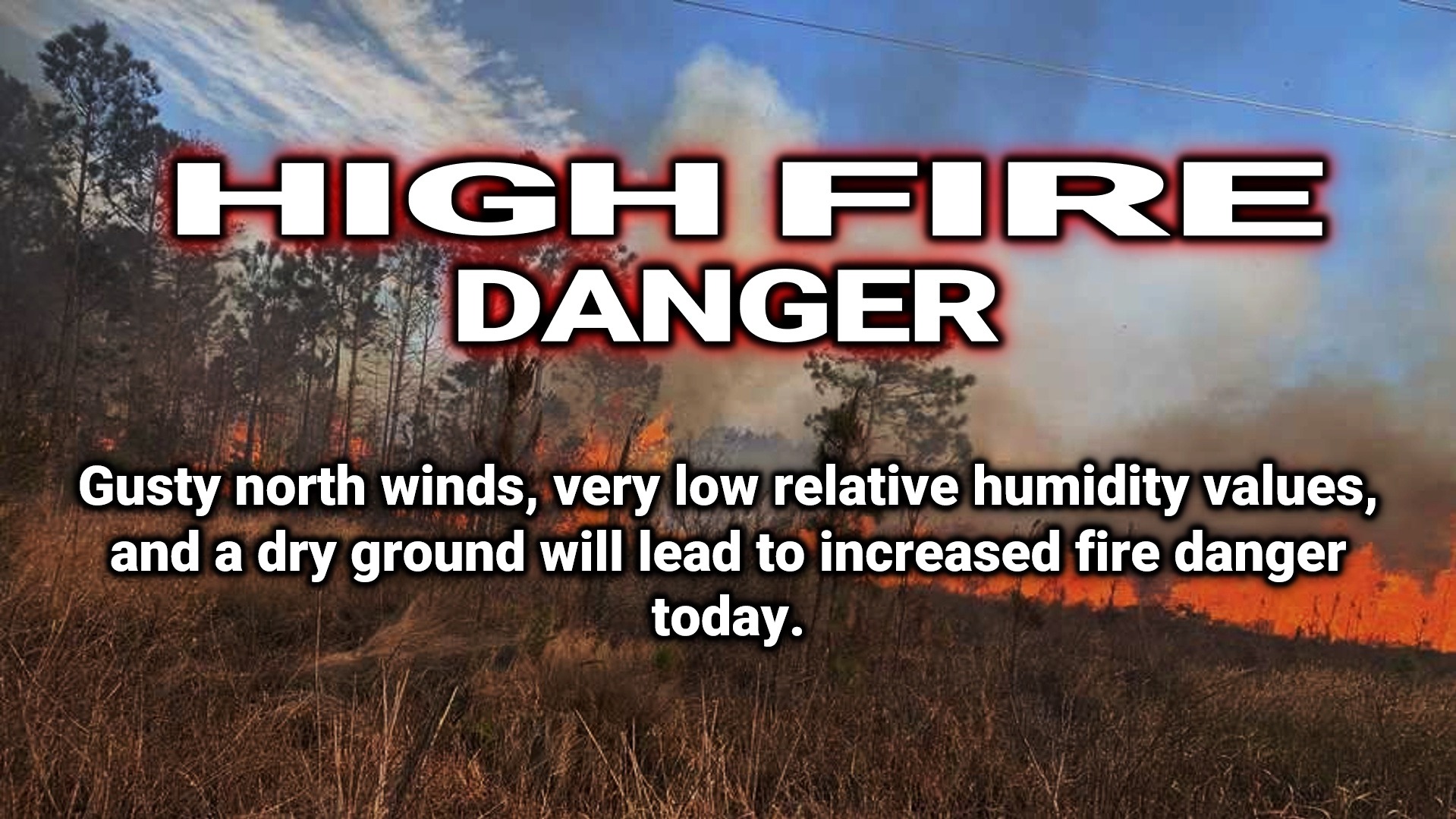
The fire danger for today is no joke, folks. Please, please be EXTRA CAREFUL outdoors, even with things as innocent as cigarette butts. It will take very, very little to get a brush fire going, which could lead VERY QUICKLY to a full-fledged forest or grass fire.
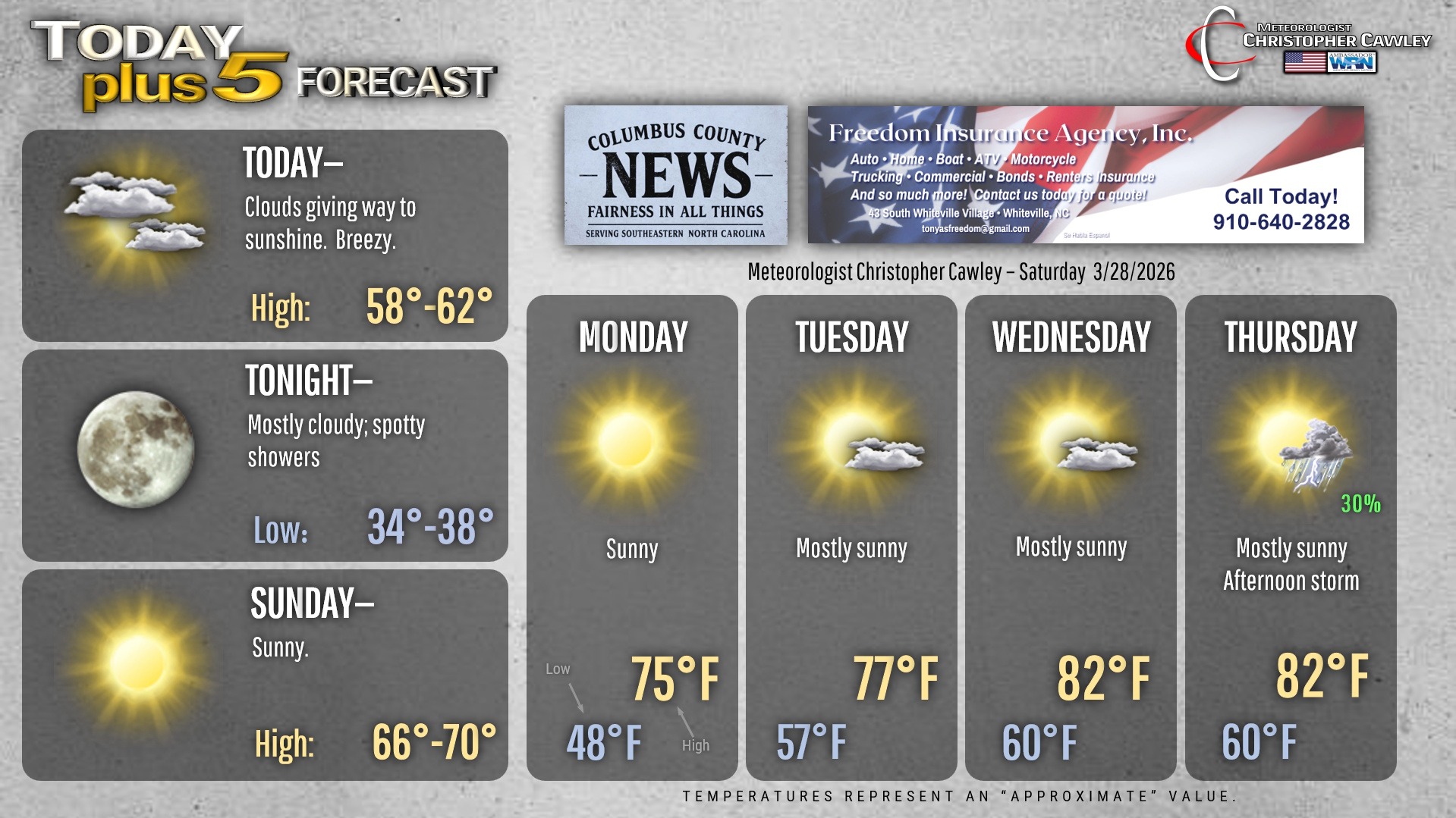
Blustery and … rather cold for today in the wake of our cold front. North winds will make it feel quite raw indeed, especially until those clouds break up later on.
Tonight will be quite cold indeed; our temps will dip well into the 30s. The big question is the frost potential. With low (and I do mean LOW) relative humidity values, and winds of 5-10 mph at the surface, we might escape what would normally be a very frosty night. That being said, though, I wouldn’t be surprised if there are some areas of frost toward daybreak in the typically colder spots around our area.
Temps rebound nicely on Sunday, upper 60s to near 70, with bright sunshine. Plenty of sunshine with incrementally warmer temps will prevail through the next work week. Bermuda high pressure will become established and with that will come the threat for afternoon thunderstorms by the end of the work week. No significant, widespread, drought-busting rain anywhere on the horizon.
Here’s your Freedom Insurance Today-plus-Five Forecast!
–Meteorologist Christopher Cawley