CCN Weather Update for Saturday March 7, 2026.
This weather update is sponsored by Freedom Insurance of Whiteville. You can trust Freedom Insurance to give you clear blue skies when it comes to home, car, boat, or whatever insurance you need. Let Freedom provide customized coverage to keep you and your family safe. Contact Freedom today at 910-640-2828!
Here’s today’s Bottom Line:
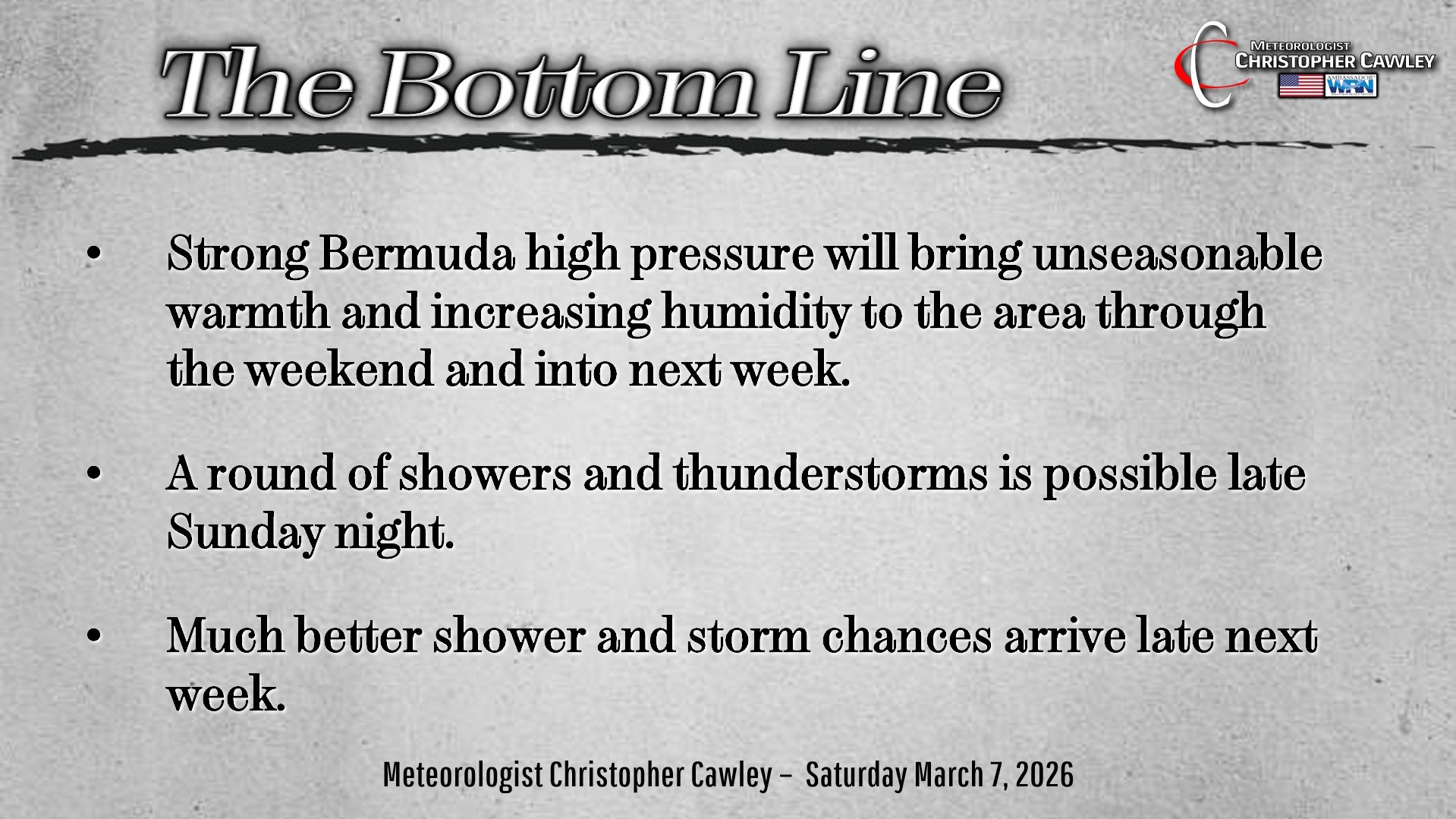
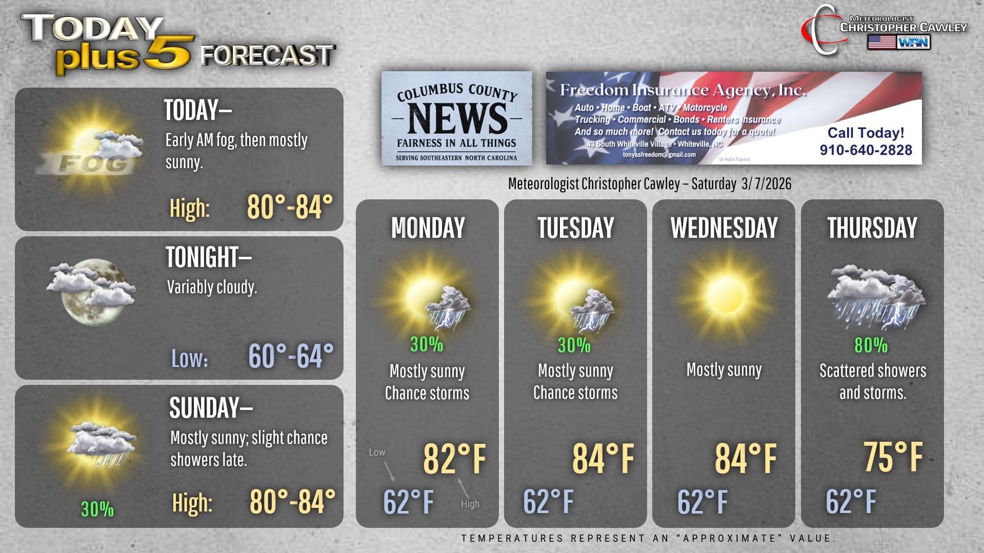
Unseasonably warm and humid conditions will prevail through next Wednesday. That’s the “big picture.”
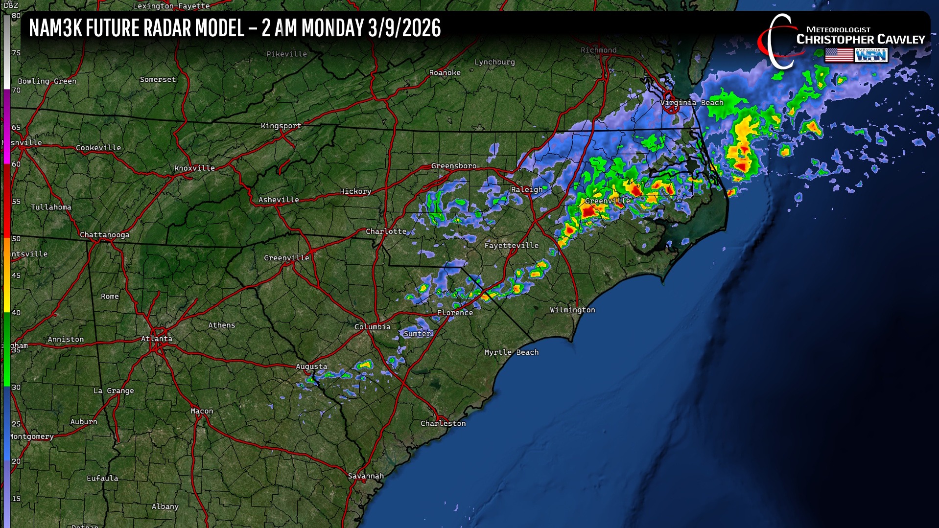
A weak frontal boundary will try to push across the state late Sunday night but will essentially “wash out” over the area. Short-term high-res modeling suggests that we may see some showers and thunderstorms with this front late Sunday evening or during the overnight.
Isolated pop-up showers/storms are possible Monday and Tuesday, with dry conditions likely for Wednesday.
Then… a much stronger front will break through the high pressure ridge on Thursday. This will bring an end to the unseasonable warmth, and bring the threat for more showers and thunderstorms. It’s too early to call whether or not we see any severe weather with this… it’ll depend on the timing and dynamics with the frontal boundary.
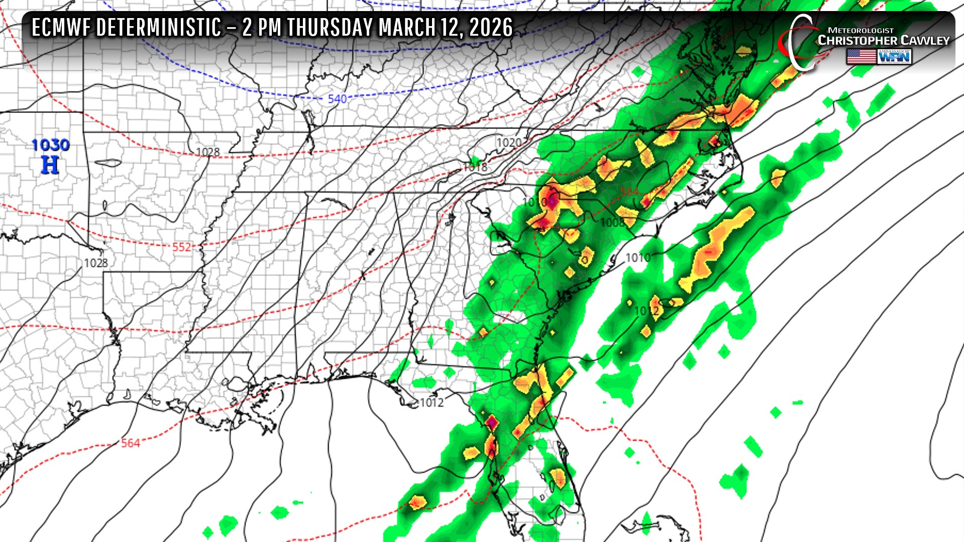
Behind this front, temperatures will drop to seasonal normal values … lower to middle 60s by day, upper 30s to lower 40s for lows.
The longer-range modeling does not show any temperatures concerning for frost through at least the 22nd of March, but that’s a “best guess” at this point as modeling beyond 5-6 days is sketchy.
Here’s your Freedom Insurance Today-plus-Five Forecast!
–Meteorologist Christopher Cawley