

CCN Weather Update for Sunday March 15, 2026.
This weather update is sponsored by Freedom Insurance of Whiteville. You can trust Freedom Insurance to give you clear blue skies when it comes to home, car, boat, or whatever insurance you need. Let Freedom provide customized coverage to keep you and your family safe. Contact Freedom today at 910-640-2828!
Here’s today’s Bottom Line:
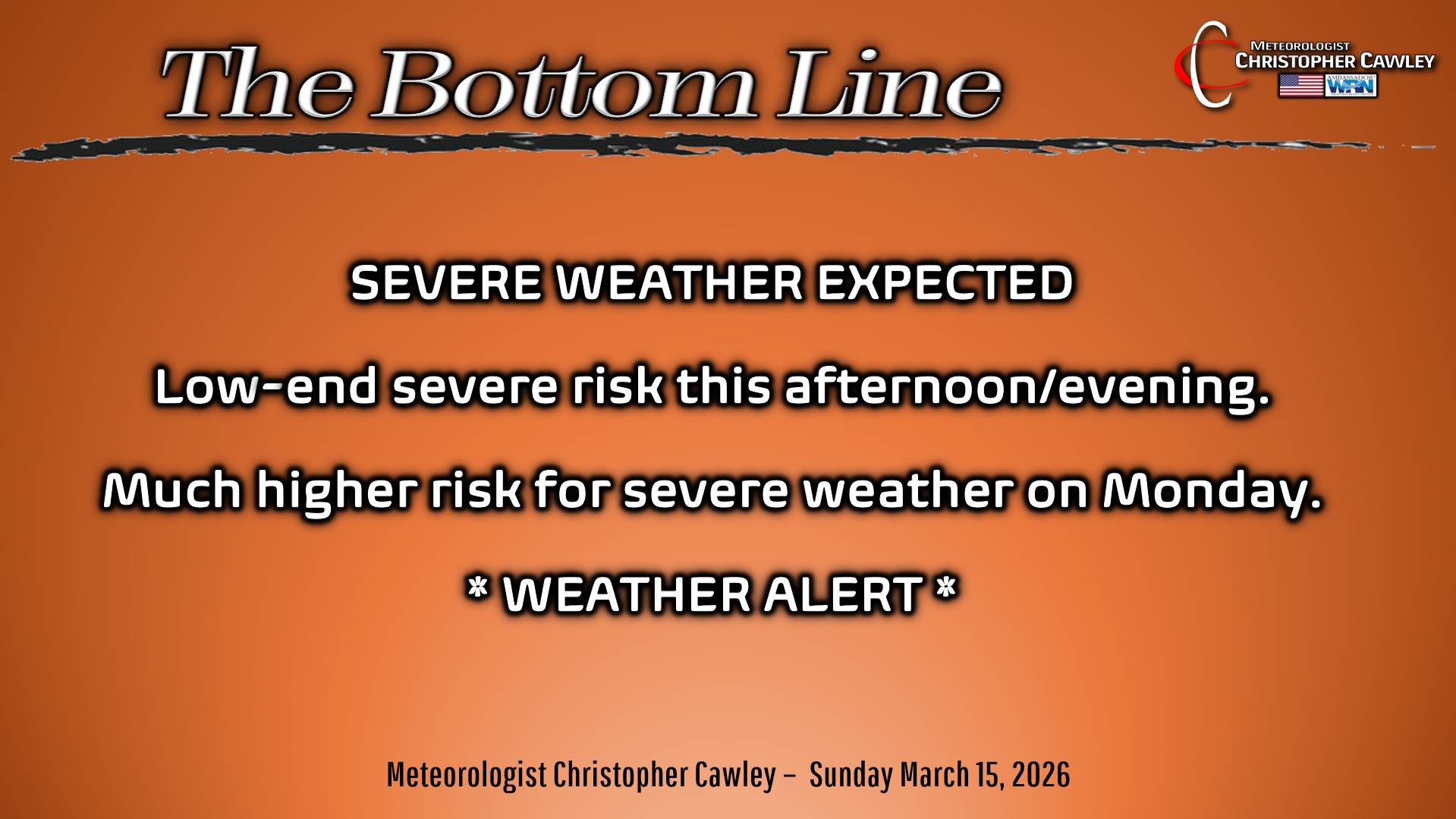
Severe weather threat for today.
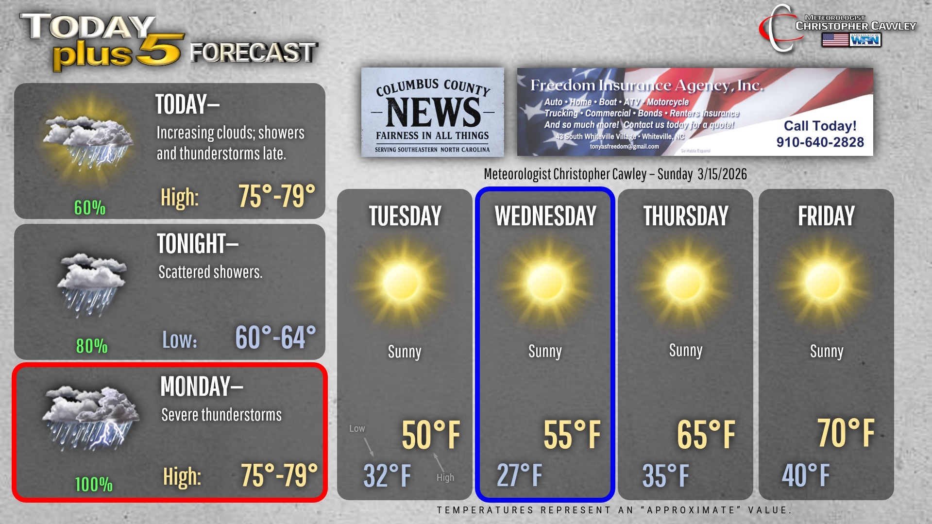
A warm front will lift northward late this afternoon or early this evening. Temps will actually rise after this frontal passage, and it will become increasingly humid. This will lead to the development of weak surface-based instability. A few rounds of showers/thunderstorms are expected to develop and track northward during the late afternoon or evening hours. Some of these storms could produce some isolated damaging winds or even an isolated tornado, but overall the threat is relatively low. The NWS SPC has the area under a “marginal” risk for this evening. It’s worth noting, too, that NWS Wilmington’s chat mentioned the possibility of supercell structures developing in the low-level shear.
Scattered showers are expected tonight in the robust warm and humid southerly flow.
Monday. Alert day. Game day. Whatever you want to call it.
A very impressively deep trough will dig southward and push a cold front toward/through the area. Windy conditions are likely ahead of this front — non-thunderstorm winds could reach 40-45 mph. Strengthening “convergence” (basically upward movement in the atmosphere that creates clouds and precipitation) will likely lead to bands of showers and possible supercell thunderstorms lifting rapidly northward ahead of the front. These storms may actually do us a favor and limit the amount of instability (storm fuel) that develops before the frontal passage.

At any rate, there will be tons of low-level shear in place, which is a situation favorable for supercell thunderstorms. Supercell storms bring the threat for damaging winds, large hail, and tornadoes. These storms will likely be moving RAPIDLY from south to north, so any rotating storms will have VERY LITTLE WARNING LEAD-TIME.
Then we have the front itself and that it will likely be producing an impressive squall line. Even with limited instability, this squall like is likely to be packing a tremendous punch with damaging to destructive straight-line winds (60-75+ mph) along with embedded “spin-up” tornadoes.
The front is likely to cross the area during the afternoon hours.
IT IS VERY IMPORTANT THAT YOU HAVE MULTIPLE WAYS OF RECEIVING WARNINGS.

I will be doing a Facebook LIVE on the CCN Facebook page at 7 PM this evening.
It’s all a memory by Monday night, and temps fall.
FROST / FREEZE — Frosty conditions are possible Tuesday morning…. frost and freeze conditions LIKELY Wednesday morning…. and frost is possible early Thursday morning.
A large, sprawling area of high pressure will dominate our weather after the storm on Monday. Temps will be in the lower 30s by sunrise Tuesday morning.
The much more impactful night is expected to be Tuesday night as the high pressure crests overhead. With very dry air in place, temps should easily fall into the upper 20s early Wednesday morning… and there’s the potential that some spots could drop into the mid 20s. Freeze warnings are likely to be issued.
Temps warm up toward the end of the week.
Here’s your Freedom Insurance Today-plus-Five Forecast!
–Meteorologist Christopher Cawley