CCN Weather Update for Sunday March 29, 2026.
This weather update is sponsored by Freedom Insurance of Whiteville. You can trust Freedom Insurance to give you clear blue skies when it comes to home, car, boat, or whatever insurance you need. Let Freedom provide customized coverage to keep you and your family safe. Contact Freedom today at 910-640-2828!
Here’s today’s Bottom Line:
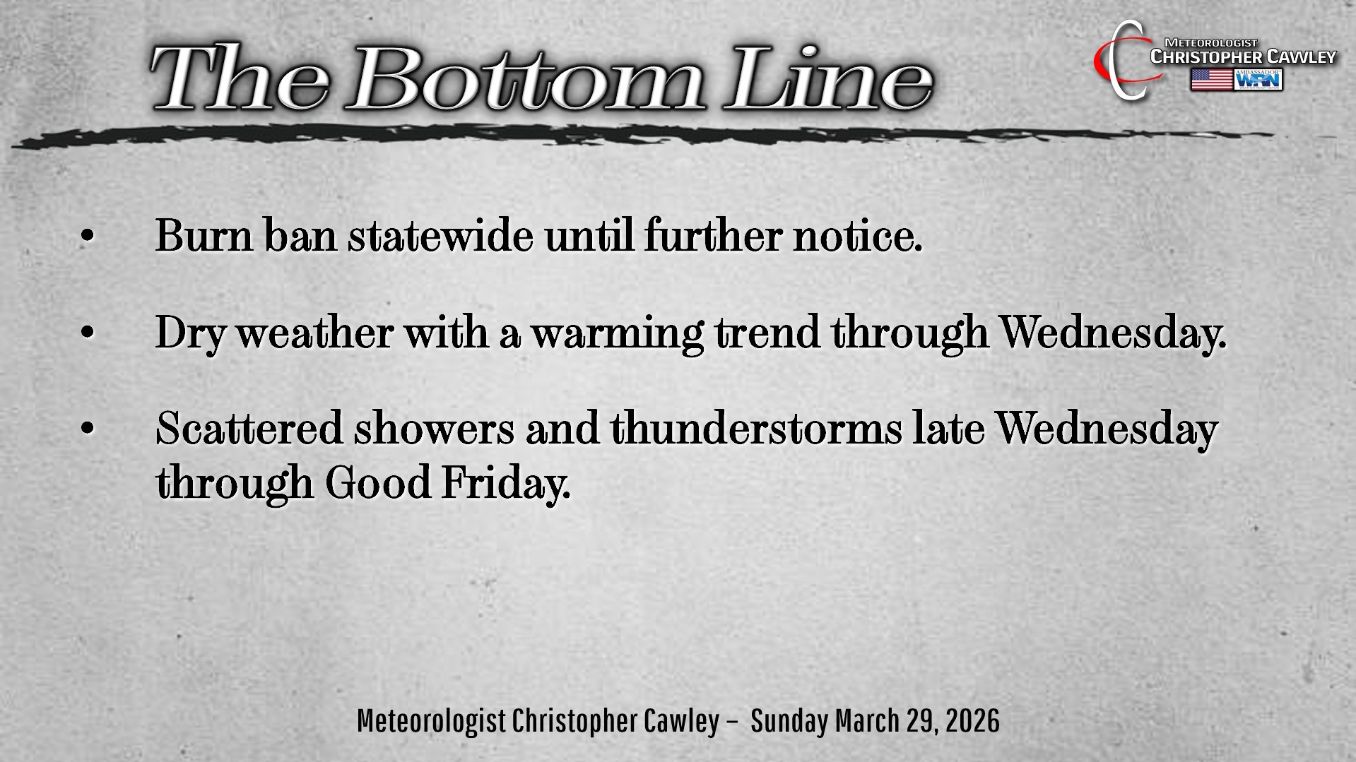
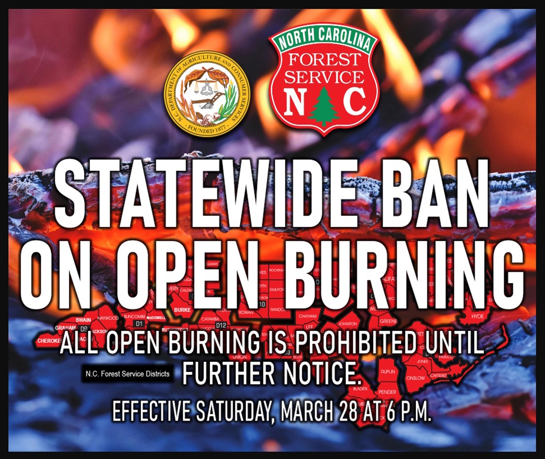
The fire danger remains no joke, and as such, the NC Forest Service has issued a STATEWIDE BURN BAN until further notice. All burn permits have been canceled. DO NOT DO ANY BURNING!
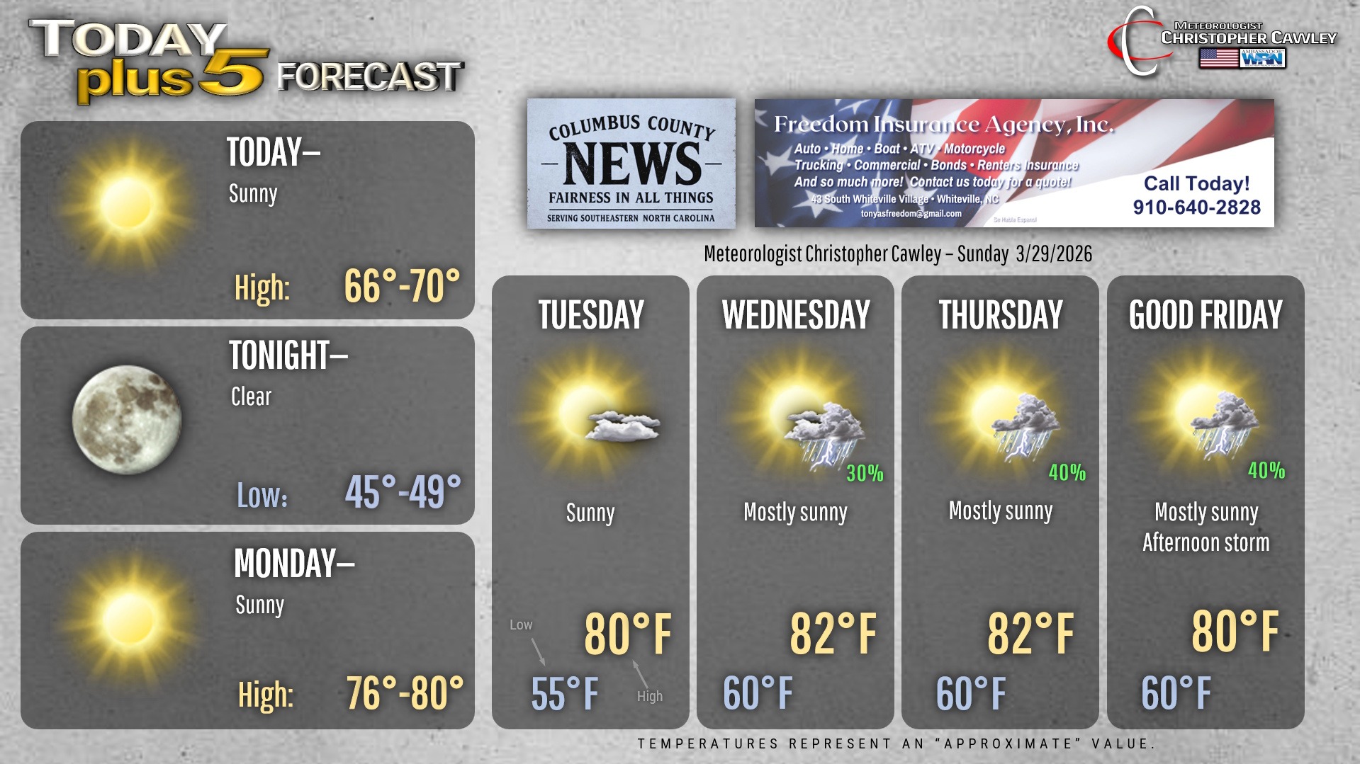
Weather-wise, there’s not much to talk about. We’re starting off this Palm Sunday with c-c-c-cold temperatures but they’ll rebound nicely this afternoon back to seasonable levels. It’s going to be a really pretty afternoon, so get out and enjoy it!
I truly think this will be the last risk for frost/freeze for the season.
Warmer temps with continued dry weather on Monday. Bermuda high pressure will take hold and dominate through Tuesday as well.
Then things start to get a little tricky for the second half of the work week. A rather complicated upper-level weather pattern is likely to take shape, which will result in a frontal boundary extending from the lower Mississippi Valley into the mid-Atlantic. The Bermuda high will pump in plenty of warmth and humidity. A strong system looks to arrive in the Pacific northwest on Wednesday night. This may eventually work to “push” the frontal boundary into our area for the weekend.
There is a lot of uncertainty in the modeling and it’s really way too soon to make any deterministic call for Easter weekend, but there is the potential that it could be showery-and-thunderstormy at times. We’ll watch and see.
Here’s your Freedom Insurance Today-plus-Five Forecast!
–Meteorologist Christopher Cawley