CCN Weather Update for Thursday March 5, 2026.
This weather update is sponsored by Freedom Insurance of Whiteville. You can trust Freedom Insurance to give you clear blue skies when it comes to home, car, boat, or whatever insurance you need. Let Freedom provide customized coverage to keep you and your family safe. Contact Freedom today at 910-640-2828!
Here’s today’s Bottom Line:
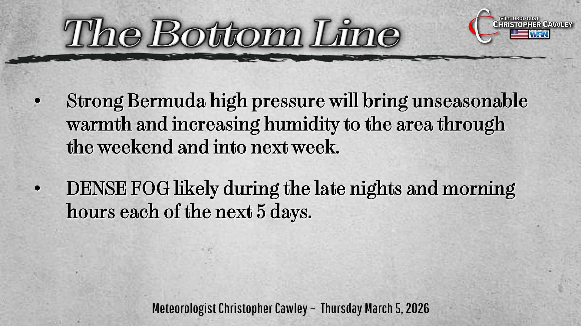
A weather pattern that looks more like Memorial Day weekend than early March will continue for the next 5-7 days. A western Atlantic ridge supporting Bermuda high pressure at the surface will continue to support southerly to southwesterly low-level winds, thereby maintaining an unseasonably warm and rather humid air mass.
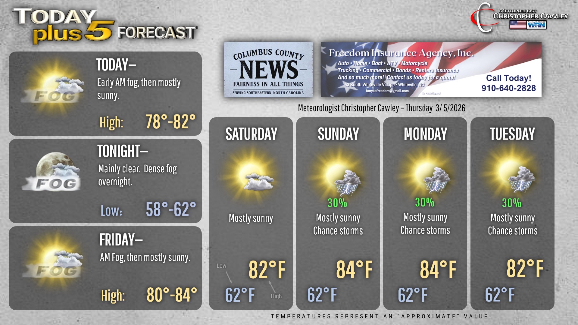
Our temperatures will be north of the 80-degree mark each of the next 5 to 7 days, with lows only dropping to around 60 — which is just a few degrees cooler than our normal high temps.
In terms of actual “weather” … well there really isn’t much to say. We’ll have some dense fog forming during the nighttime hours each night over at least the next 3-5 nights, with some fog lingering each morning. This is because of the high pressure ridging and the unseasonably humid air mass in place.
The sea-breeze boundary will be robust and push inland during the afternoon hours. This may trigger a pop-up shower or thunderstorm during the afternoon hours Saturday through Tuesday. The coverage will likely be isolated, hit-or-miss in variety, but that’ll be about it.
The unseasonable warmth will likely come to a rather sudden conclusion later NEXT week (next Thursday) as modeling suggests a fairly strong cold front is able to break down the high pressure ridge. Until then…. it’s unseasonable heat and humidity.
Here’s your Freedom Insurance Today-plus-Five Forecast!
–Meteorologist Christopher Cawley