

Columbus County NEWS Weather Update for Friday July 31, 2026.
This weather update is sponsored by Freedom Insurance of Whiteville. Trust Freedom Insurance to give you clear blue skies when it comes to home, car, boat, or whatever insurance you need. Let Freedom provide customized coverage to keep you and your family safe. Contact Freedom today at 910-640-2828!
Here’s today’s Bottom Line

July will fade off into history with quiet and seasonable weather… with fairly low relative humidity levels for this time of year.
It has been a hot July though… with 7 days of temps 100 degrees or higher. Couple this with the 5 that we had over 100 in June … by my mathemagic that equals TWELVE days.
It has been hot.
And there are signs that the month of August could feature above-normal temps as well.
Ugh.
It’s going to be “seasonably hot” today with highs in the lower 90s. We’re actually starting the down-turn in our normal highs… it’s exactly 90 for today… and we’ll be dipping below the 90-degree mark tomorrow. By the end of August, the normal high is 87.
Anyway, dry weather will be in place today and tomorrow… before a rather complicated weather scenario unfolds Sunday through at least Tuesday-Wednesday.
A strong middle-atmosphere disturbance (a trough) will dive into the area. Moisture skyrockets over the area going into Sunday as a frontal boundary pushes slowly northwestward onshore over the area. There is the potential that a cut-off low forms over the area (an area of low pressure that is “cut off” from the main atmospheric flow… left to just meander). Whether or not this happens is somewhat inconsequential, as an extended period of showers and thunderstorms will be the dominant factor into next week.
Model projections show the potential for a good bit of rainfall over the area:
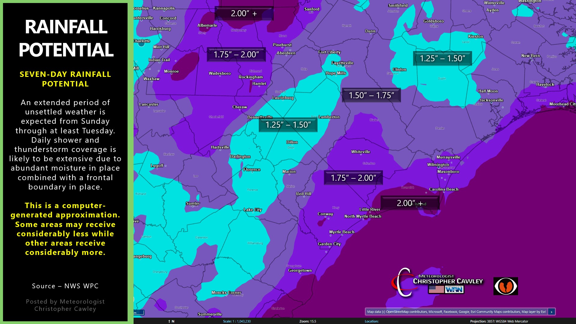
However… where the trough ends up situated, and if a cut-off low evolves out of the trough… will determine who gets the feast-or-famine with regards to rainfall. The model image above is a computer projection … but some areas could receive significantly more rainfall while other areas receive little to nothing.
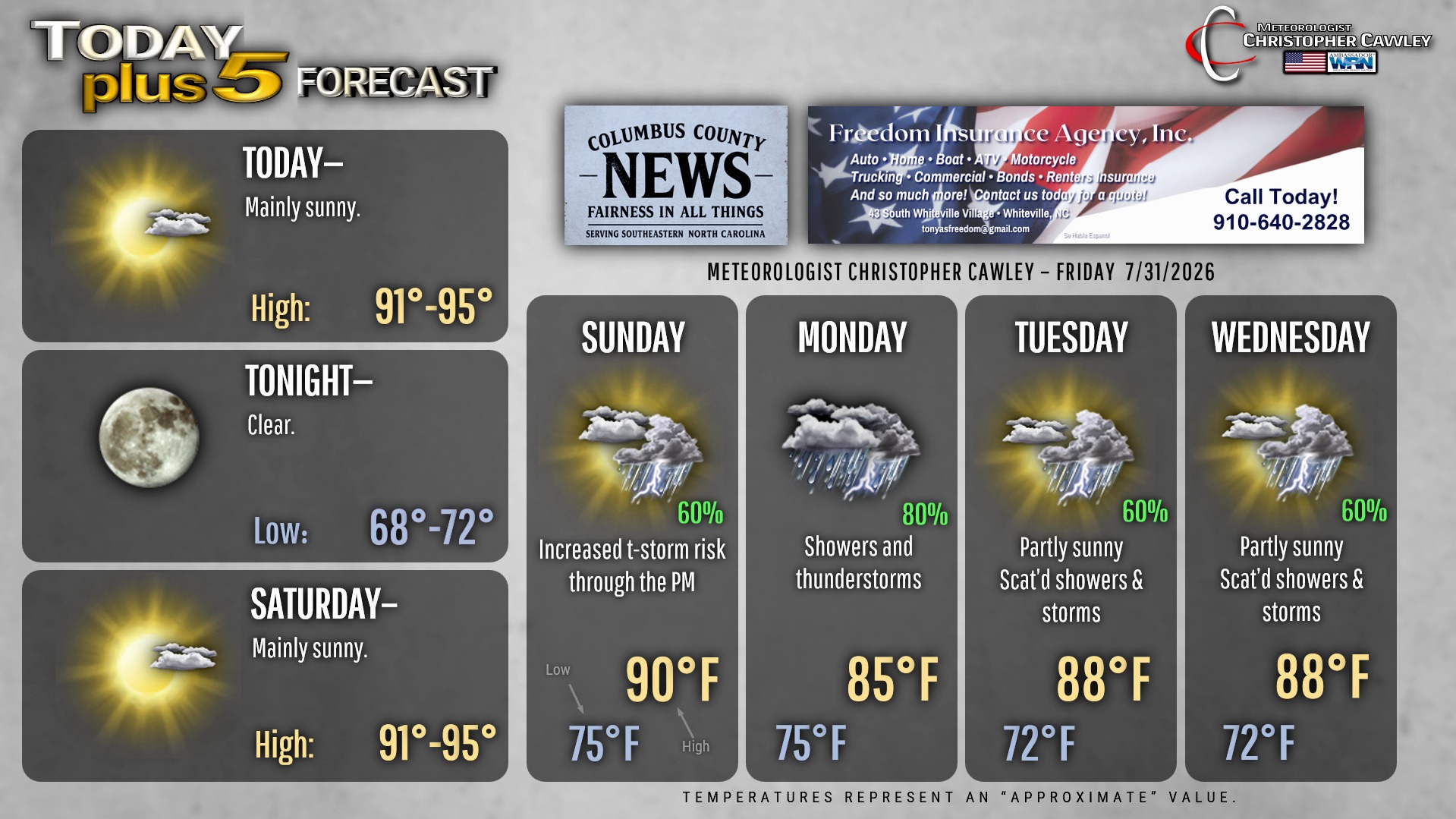
At this point, I’m going with a 60% chance for rain/storms later Sunday afternoon, rising to about 80%-90% Sunday night through Monday, slowly reducing back into the 60% range by Tuesday. We still have today and tomorrow to tweak those details. I don’t believe we have a severe weather risk at this point; in fact, the SPC does not have any portion of the area outlined for severe storms. However, the situation may be favorable for thunderstorms to produce intense local rainfall.
Things SHOULD start to calm down for the second half of next week.
Here is your Freedom Insurance Today-plus-Five Forecast:
–Meteorologist Christopher Cawley