
Columbus County News Weather Update for Saturday September 19, 2026.
This weather update is sponsored by Freedom Insurance of Whiteville. Trust Freedom Insurance to give you clear blue skies when it comes to home, car, boat, or whatever insurance you need. Let Freedom provide customized coverage to keep you and your family safe. Contact Freedom today at 910-640-2828!
Here’s today’s Bottom Line
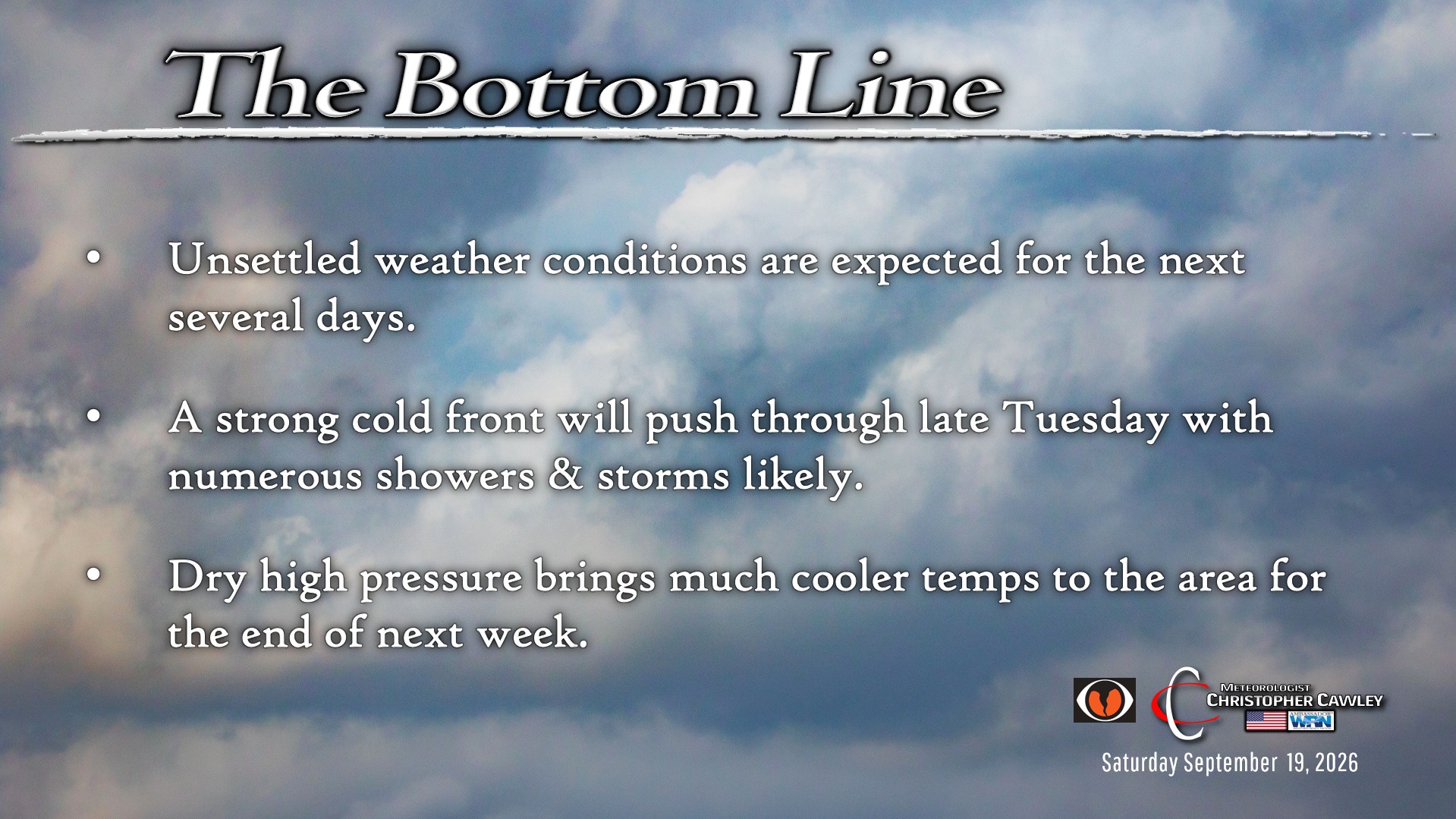
A weak frontal boundary will linger just to our south through today and most of tomorrow. This front will lift back to the north early Monday, before sweeping back off the coast as a bona fide cold front Tuesday evening.
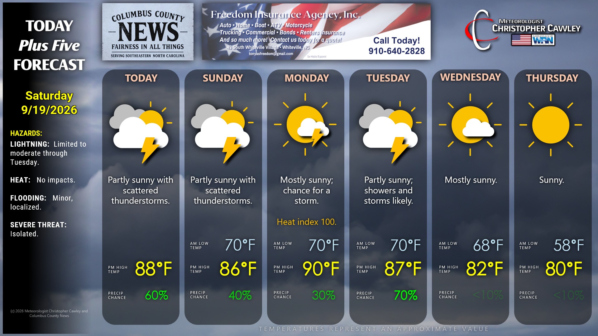
Despite a northeast flow with limited instability, and despite lack of overall model support, I still think the conditions are ripe today for at least a few scattered showers and thunderstorms. Today isn’t going to be a washout by any means, and many areas probably won’t see anything at all, but I’m going with a 50/50 chance for today.
A bit lesser chances for Sunday… at least during the day. As the front pushes back north later Sunday we could see a few scattered showers and storms.
Monday will be a hot and humid day with considerable sunshine. Can’t rule out a shower or storm, but most of the day should be dry. Heat index values on Monday should be at or above 100 once again.
Thunderstorms are likely on Tuesday afternoon with the passage of the cold front. There may be a severe threat in the afternoon; I’ll be watching for that potential.
Dry, COOL high pressure builds in for the second half of the week with mostly sunny skies. Highs will be in the lower 80s with lows dipping into the 50s by early Thursday morning.
National Blend of Models rainfall expectation through Tuesday evening is around an inch for most of the county. This would be an AVERAGE; individual thunderstorms may drop a quick inch of rain in and of themselves. There’s also the potential that some areas receive very little.
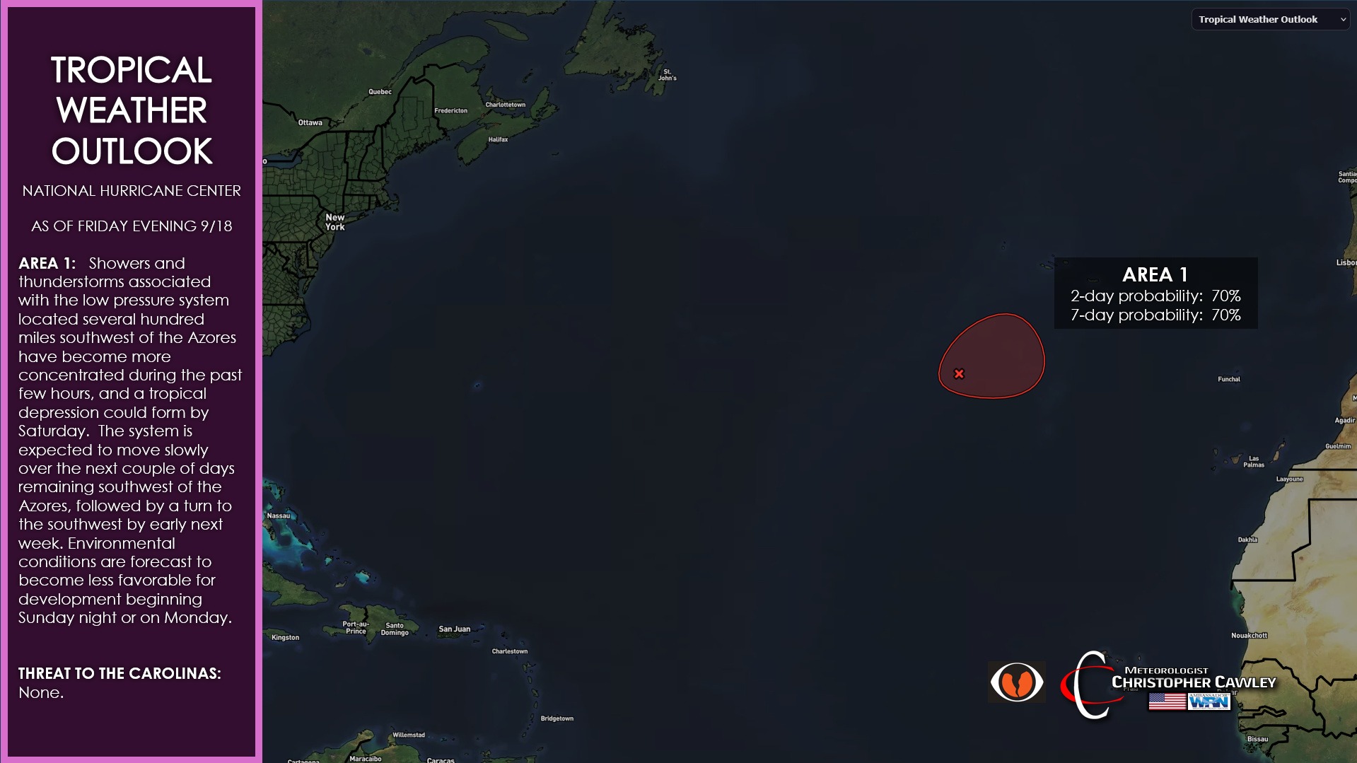
TROPICS: Showers and thunderstorms associated with the low pressure system located several hundred miles southwest of the Azores have become more concentrated during the past few hours, and a tropical depression could form by Saturday. The system is expected to move slowly over the next couple of days remaining southwest of the Azores, followed by a turn to the southwest by early next week. Environmental conditions are forecast to become less favorable for development beginning Sunday night or on Monday.
Here is your Freedom Insurance Today-plus-Five Forecast:
–Meteorologist Christopher Cawley