Welcome to your CCN Daily Weather Update for Wednesday February 19, 2025.
Your CCN Weather Update is sponsored by Freedom Insurance in Whiteville. When winter weather strikes, with the experts at Freedom Insurance you can rest assured that you are covered in the event of an accident. Give them a call at 910-640-2828 or stop in today (before the weather turns nasty).
STATISTICS FOR WHITEVILLE – Tuesday February 18, 2025.
High: 55.8°F at 3:57 PM (normal is 59)
Low: 30.7°F at 7:22 AM (normal is 34)
Precip: 0.00 in
View live, real-time weather data for Whiteville on my College Street Weather Station.
Here’s your Bottom Line for today…
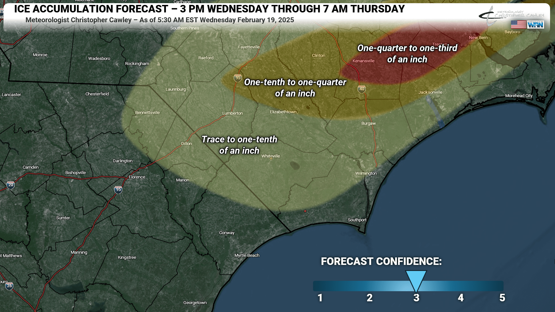
WEATHER ACTION DAY TODAY – WINTER WEATHER ADVISORY POSTED
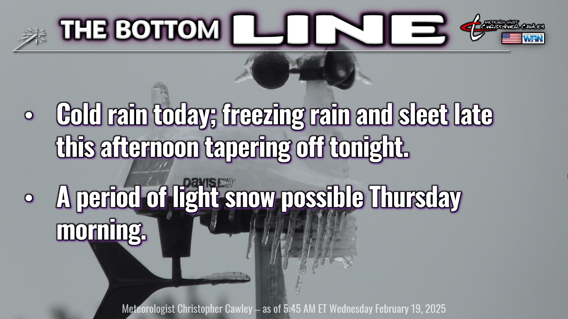
Low pressure has formed along the Gulf coast. The energy transfers to the Georgia coastline this morning, and the low begins to lift northeast along the coastline. Spotty light rain this morning will become more widespread as we move through the day, and by this afternoon I expect a good coverage of miserably cold rain.
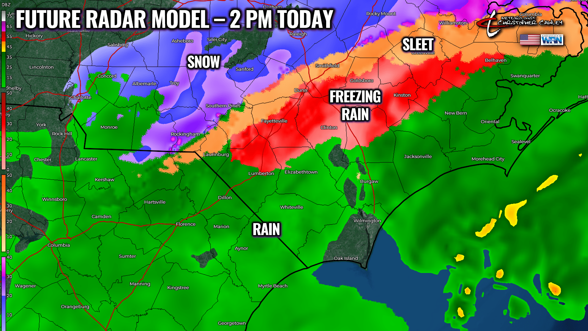
As the low moves up the coast, it drags more offshore throughout. This helps to drag in more cold air from the north, which is where frozen precipitation comes into play. Our highs will be in the mid to upper 30s, probably by lunchtime, followed by temperatures slowly falling this afternoon. We may drop below freezing at the surface as early as 4-5 PM, while air temperature a couple hundred feet off the ground remains in the 36-40 degree range… setting the stage for freezing rain.
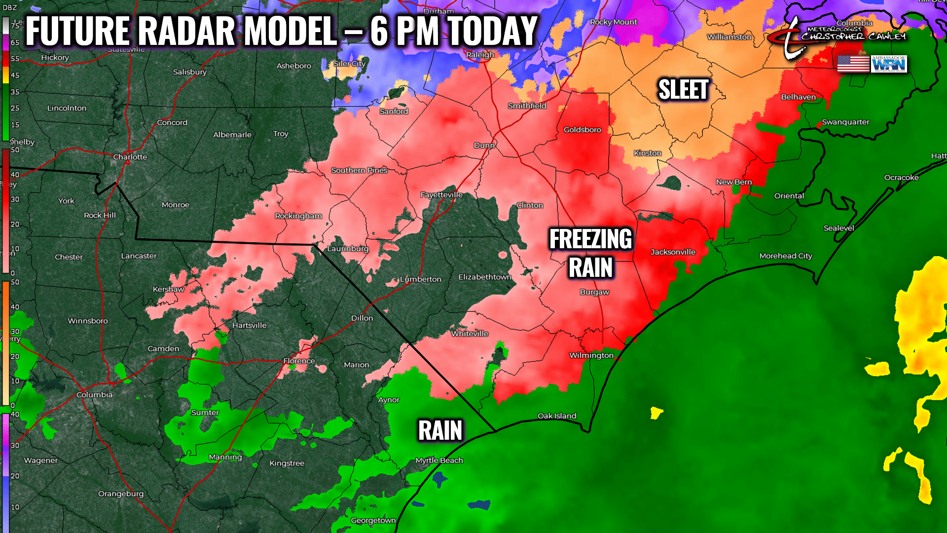
With the surface low strengthening offshore, surface temperatures will continue to slowly fall this evening. Warmer air remains higher up, keeping us in a freezing rain/sleet regime into the overnight hours.
I expect our ice accumulations to range from trace amounts (barely noticeable) to as much as a tenth of an inch.
Abundant moisture in the lower levels of the atmosphere remains in place on Thursday… and a mid-level atmospheric disturbance drops southeast across the state. Short-term guidance suggests an area of light snow will drop east-southeast across the area through about lunchtime. Extremely dry air in an area called the “dendritic growth zone,” will work against the development of snow crystals, so whatever does occur will be “showery” and light.
(The “dendritic growth zone” is an area in the atmosphere where conditions are optimal for snow crystal development. This area is typically between 1,000 and 3,000 feet above the ground. The best snow crystal growth occurs when temperatures in this area are between 10°F and 0°F, and relative humidity values are 70% or greater.)

I did paint the county for trace to half-inch snow amounts on Thursday. I think we’ll be closer to “trace” amounts that you can see in grassy areas, and that’ll be that.
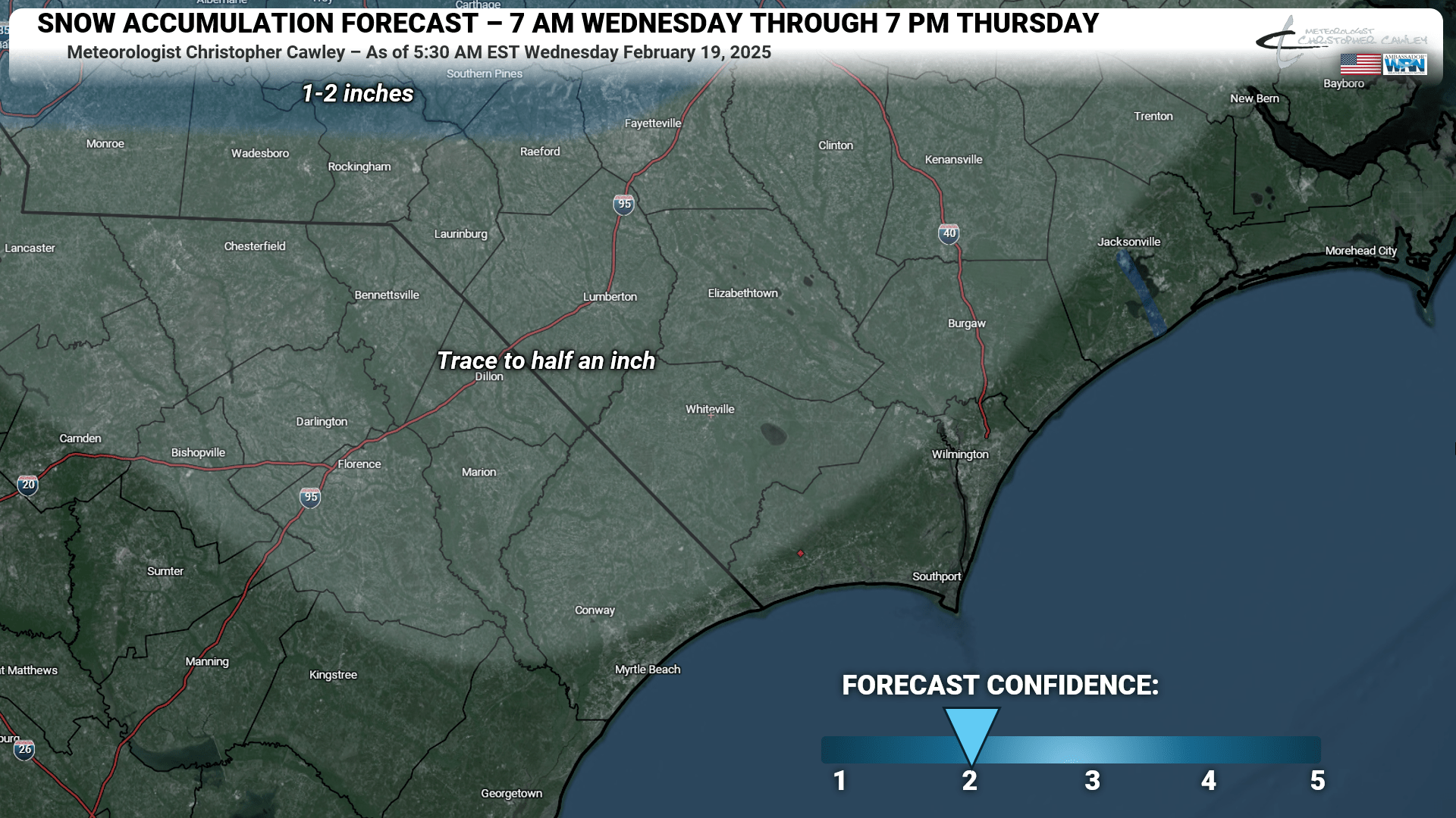
Dry air really funnels in by Thursday afternoon leading to clearing skies.
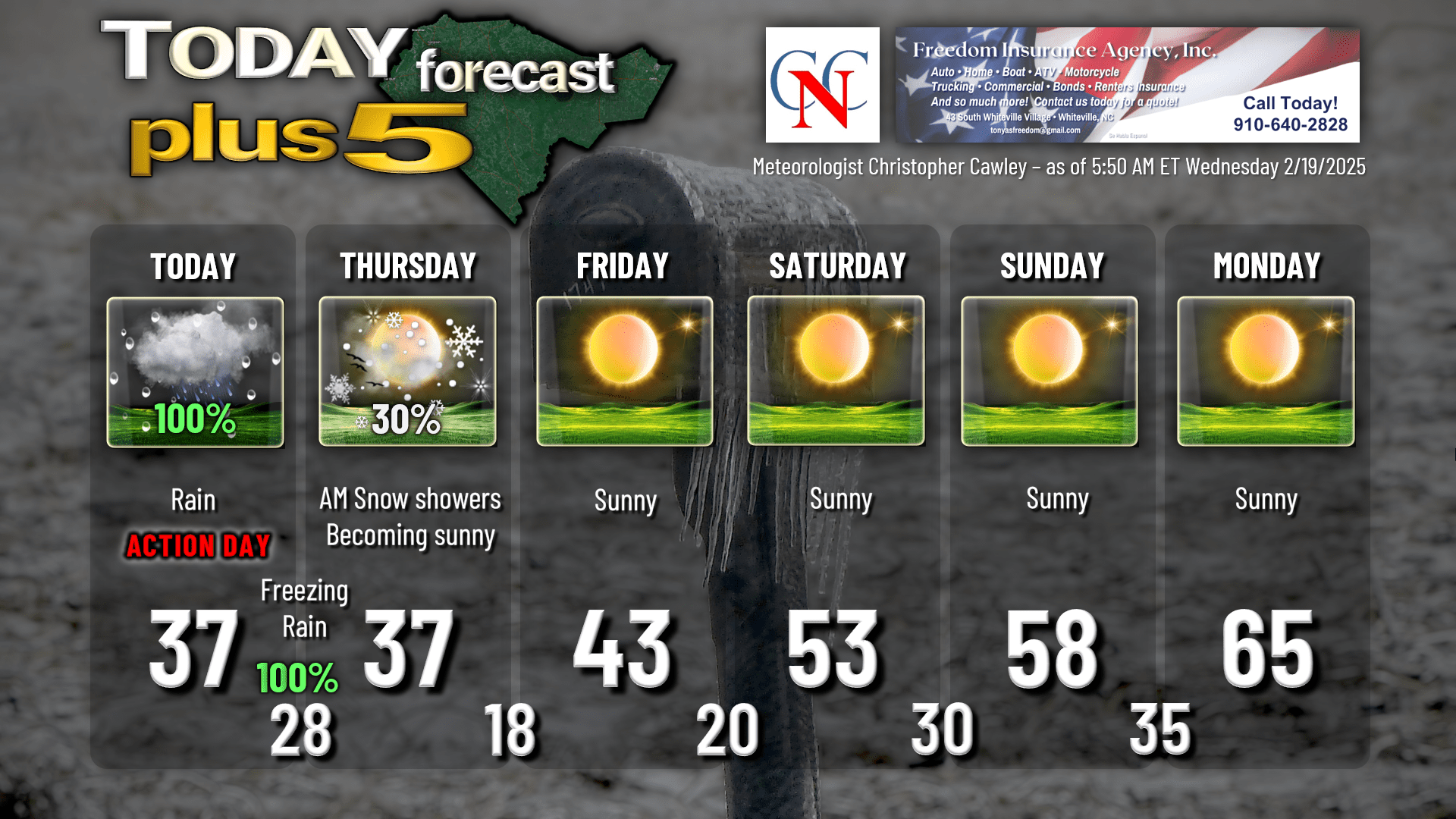
Cold air pouring in causes our temperatures to TUMBLE Thursday night. The NWS is hinting that Cold Weather Advisories will be posted as our lows drop to the upper teens, and wind chill values drop to around 10 above zero. Brrr.
Dry high pressure builds in for real on Friday, and dry weather should continue through the weekend. We’ll have a nice warming trend as we go into next week, but before then, Friday night and Saturday night will be quite cold. Dry weather looks to continue through at least the first half of next week.
Here’s your Freedom Insurance Today-Plus-5 forecast for Columbus County.
That’ll do it for today. Thanks for reading, and as always, take care!
~Meteorologist Christopher Cawley