Hello everyone and good day to you! Welcome to the CCN Weather Update for Saturday May 10, 2025.
This weather update is sponsored by Freedom Insurance of Whiteville. Protect what matters most with Freedom Insurance. Life can be full of surprises, but with Freedom Insurance, you will always be prepared. Whether it’s your home, car, business, or health, we provide customized coverage to keep you and your family safe. Contact Freedom today at 910-640-2828!
STATISTICS for Friday 5/9/2025
High: 83.7°F at 4:41 PM (Normal 82)
Low: 61.6°F at 7:03 AM (Normal 59)
Precip: 0.90 in
View real-time data from the weather station at College Street Weather Station.
Here’s today’s Bottom Line
A cold front has pushed well to our south this morning and is expected to stall somewhere just north of the Florida/Georgia line, and then curve northeastward along the South Carolina coast later today. A wave of low pressure will move along this front.
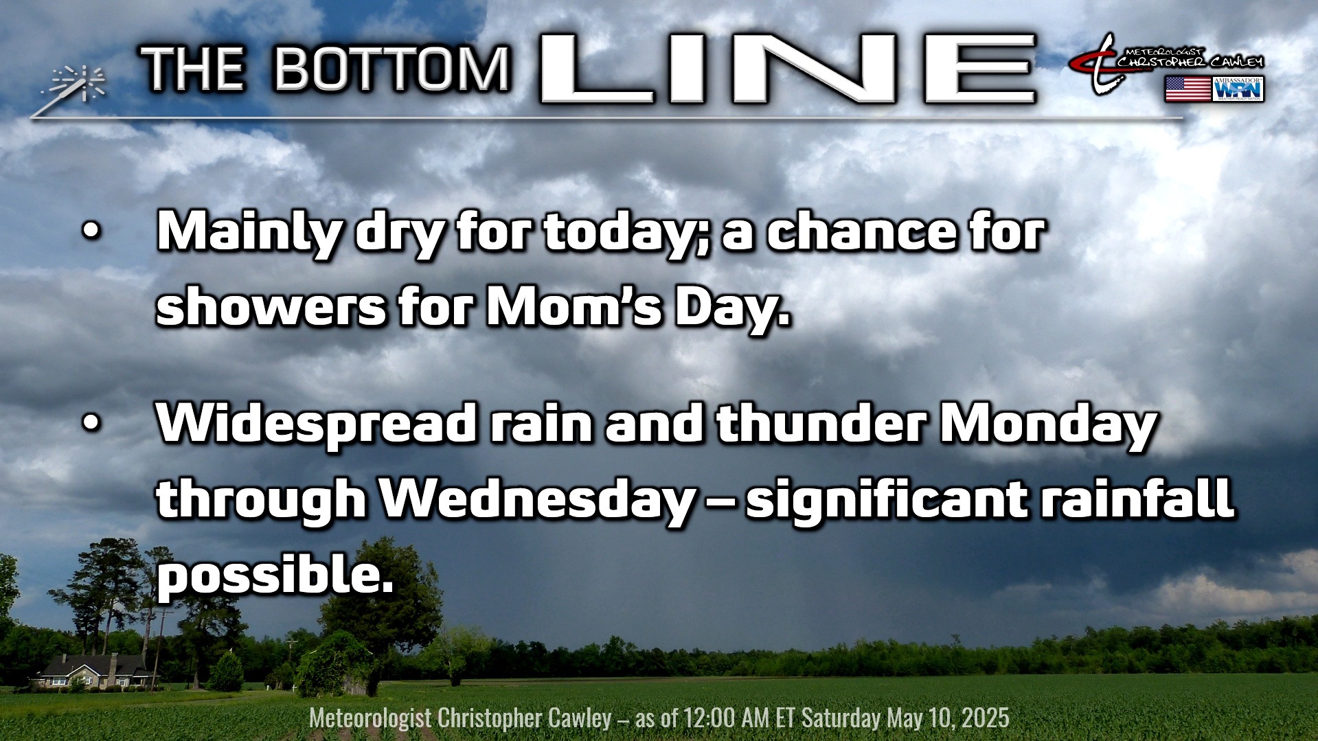
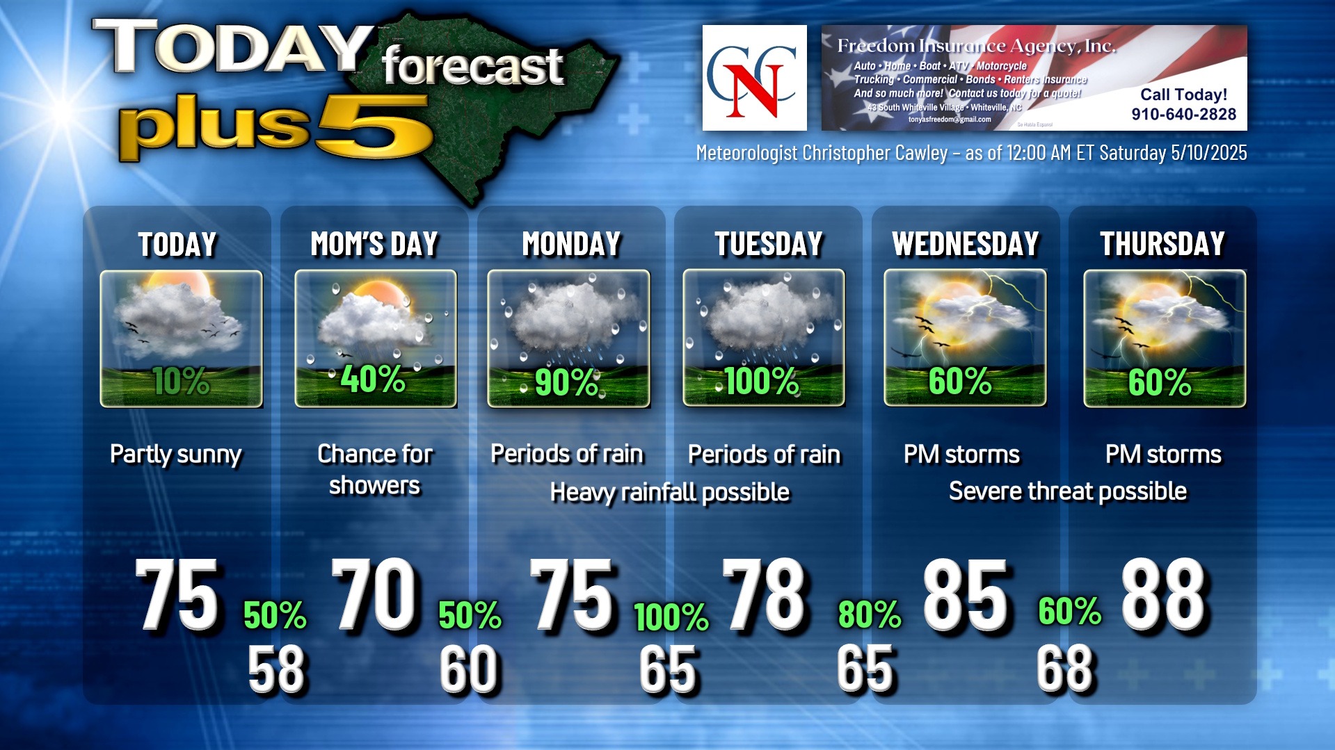
We should be mostly dry for today, with cooler temps and lower humidity thanks to an area of high pressure nudging down over the Appalachian mountains today. However, with the front to our south and that wave of low pressure, I can’t in clear conscience go with a totally dry forecast… I put a faint “10%” on the graphic for this afternoon.
As that wave of low pressure pushes offshore tonight, some light rain showers are possible overnight… with a better chance for showers and maybe some thunder on Mom’s Day during the afternoon hours. Lots of clouds will be the rule for Mother’s Day.
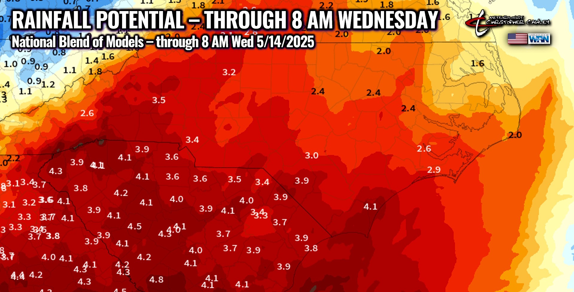
An unseasonably strong southern-stream system develops over Mississippi late Sunday night; two distinct lows will bring copious rainfall to the area for late Sunday night through Tuesday night. These lows will lift northeast through the western Carolinas and Tennessee through Tuesday night, and available guidance suggests the lows merge over central Virginia by Wednesday morning.
Significant rainfall is expected Sunday night through early Wednesday, and national blend of models is still pointing to at least 3-4 inches of rain across the county. It wouldn’t surprise me if we go even higher than that… much-needed rainfall. Unfortunately the rain may come so quickly and so hard at times late Monday into Tuesday that low-lying and poor-drainage flooding becomes a concern. Heavy rainfall over very dry ground will not truly break a drought, even though “by the numbers” we trend back up toward normal (if that makes sense). To truly break a drought, you need that 3-4 or 4-5 inches of rain to fall in a relatively slow and steady process, not coming in bursts of intense rainfall. At any rate, the stage is set indeed for significant rains early in the week.
As the lows move to our north, a warm front is pushed northward over the area on Wednesday. This will result in a significant jump in temperatures for Wednesday and Thursday, as well as a severe weather threat as afternoon and evening thunderstorms are likely. The modeling is concerning this far out in time for severe threat, and this is something I’ll be watching very carefully. Model blends show highs deep into the 90s by the end of next week with heat index values north of the Misery Mark (100).
Here is your Freedom Insurance Today-plus-Five Forecast:
That’s going to do it for today’s report. As always, thank you for reading and for supporting Columbus County News. Have a great day!
–Meteorologist Christopher Cawley