Hello everyone and good day to you! Welcome to the CCN Weather Update for Monday May 12, 2025.
This weather update is sponsored by Freedom Insurance of Whiteville. When severe weather strikes, with Freedom Insurance you will always be prepared. For home, car, boat, or whatever you need, Freedom can provide customized coverage to keep you and your family safe. Contact Freedom today at 910-640-2828!
STATISTICS for Sunday 5/11/2025
High: 75.3°F at 4:36 PM (Normal 82)
Low: 59.6°F at 12:04 AM (Normal 59)
Precip: 0.87 in
Precip – Month: 4.55 in
View real-time data from the weather station at College Street Weather Station.
Here’s today’s Bottom Line

Copious moisture thanks to a deep upper-level atmospheric low pressure area will be pumped northward over our area for the first half of the work week. This will lead to periods of rain and thunderstorms, along with moderate to heavy rainfall at times. This is drought-busting rainfall, folks, much needed rainfall.
It’s hard to describe today, tonight, and Tuesday as anything other than a washout. Any outdoor plans you might have had will need to be postponed. A stationary frontal boundary curving from just off the NC coast, southward across central SC and GA, will move very little as we progress into Tuesday morning. A triple-point low (see “Science Moment” below for definition) takes shape over central Georgia Tuesday morning, and this low will lift northeastward over western NC through Tuesday afternoon. The stationary front to our south begins to lift northward as a warm front, pushing over Columbus County Tuesday afternoon. By Wednesday morning the low pressure center is likely to be over central NC, and ColCo is firmly in a warm (and unstable) quadrant of our system.
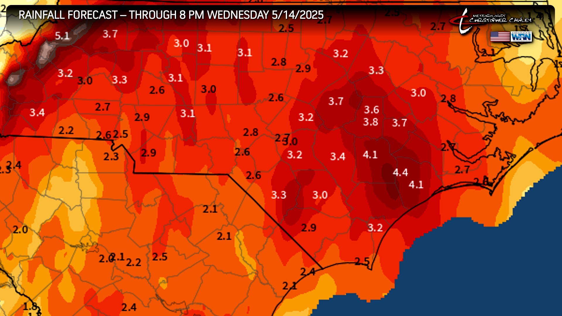
Rain and thunderstorms will be the rule today, tonight, and Tuesday, with rainfall amounts generally in the 2-4 inch range. There may be some varying in those amounts; some areas could see dramatically higher totals if thunderstorms repeatedly develop and move over the same areas.
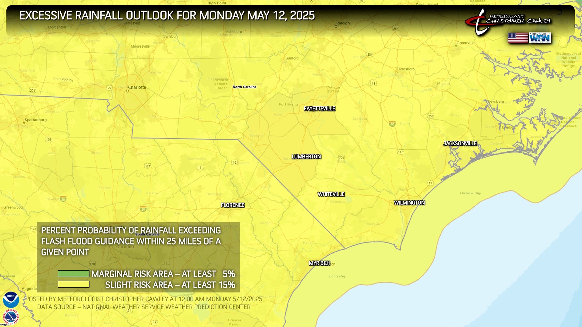
The NWS Weather Prediction Center has essentially all of North and South Carolina under a 15% excessive rainfall risk. This means that there’s a 15% risk that rainfall will exceed flash flood guidance within 25 miles of any given point.
The storm system finally lifts northward and away from the area late Wednesday leading to drying conditions. High pressure builds in and pushes just offshore to our east. This will set the stage for real summer-like conditions Thursday through Saturday. Very low (isolated) thunderstorm chances Thursday and Friday… with slightly better storm chances on Saturday as a backdoor cold front drops over the area. I put a pair of 93’s on the graphic for Friday and Saturday… but some of the guidance is suggesting we go into the middle 90s on Friday. Heat index values will likely push 100 for this season’s first true heatwave.
SCIENCE MOMENT — A “triple point low” in meteorology refers to a low-pressure area that forms at the intersection of three different weather fronts (warm, cold, and occluded).
Three basic frontal types you will see drawn on surface maps are the warm front, cold front and occluded front. The warm front is generally found to the right of the low pressure center. It is where the warm sector is wrapping around the low pressure system. The cold front is typically on the left side, wrapping colder air around the low pressure system. Since the cold front typically moves faster than the warm front, the location at which the cold front “lifts” (overtakes) the warm front will result in an occluded front. The triple point is where the occluded front, cold front and warm front all intersect. This intersection point will have a great amount of lifting. If enough moisture is wrapping in from the warm sector, significant rainfall and thunderstorms can fire along the triple point and along the fronts, and wrap into the low pressure. There is also a great amount of wind shear near the triple point and fronts. Severe weather can also develop up ahead of the cold front, along the warm front and near the triple point where shear is enhanced.
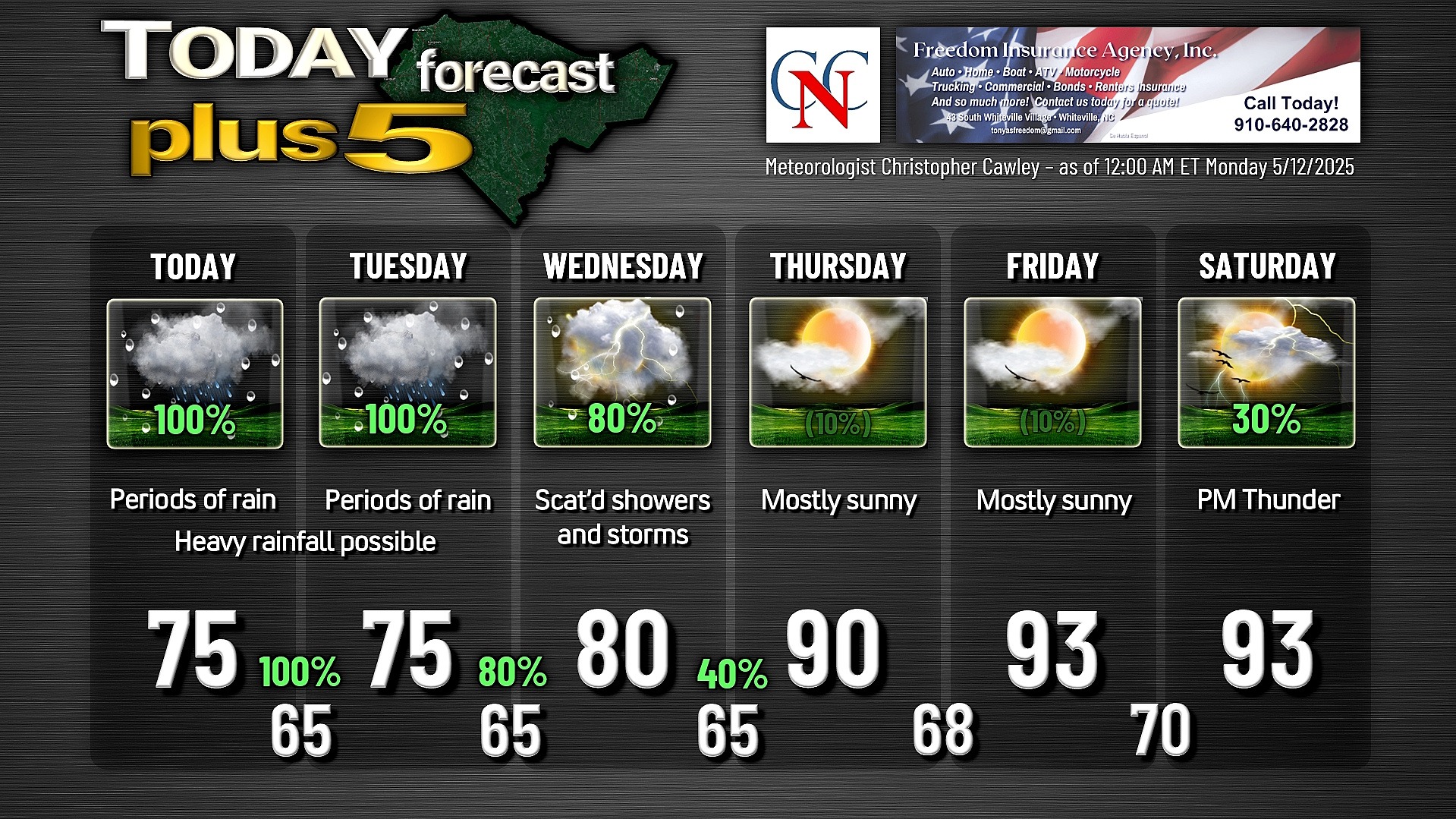
Here is your Freedom Insurance Today-plus-Five Forecast:
That’s going to do it for today’s report. As always, thank you for reading and for supporting Columbus County News. Have a great day!
–Meteorologist Christopher Cawley