Hello everyone and good day to you! Welcome to the CCN Weather Update for Monday May 12, 2025.
This weather update is sponsored by Freedom Insurance of Whiteville. When severe weather strikes, with Freedom Insurance you will always be prepared. For home, car, boat, or whatever you need, Freedom can provide customized coverage to keep you and your family safe. Contact Freedom today at 910-640-2828!
STATISTICS for Monday 5/12/2025
High: 76.2°F at 2:14 PM (Normal 82)
Low: 67.6°F at 1:12 AM (Normal 60)
Precip: 0.65 in
Precip – Month: 5.20 in
View real-time data from the weather station at College Street Weather Station.
Here’s today’s Bottom Line
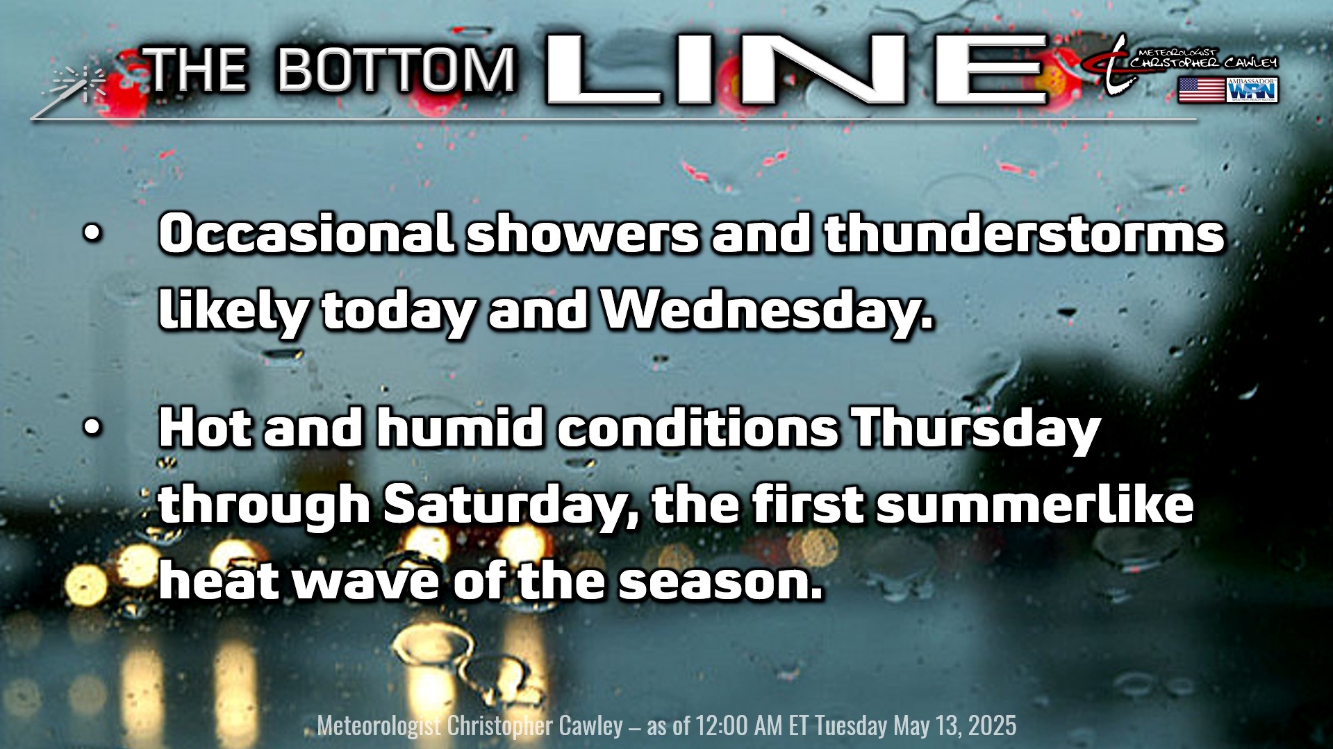
Streams of moisture will continue to pump northward into the area through today, gradually tapering off tonight.
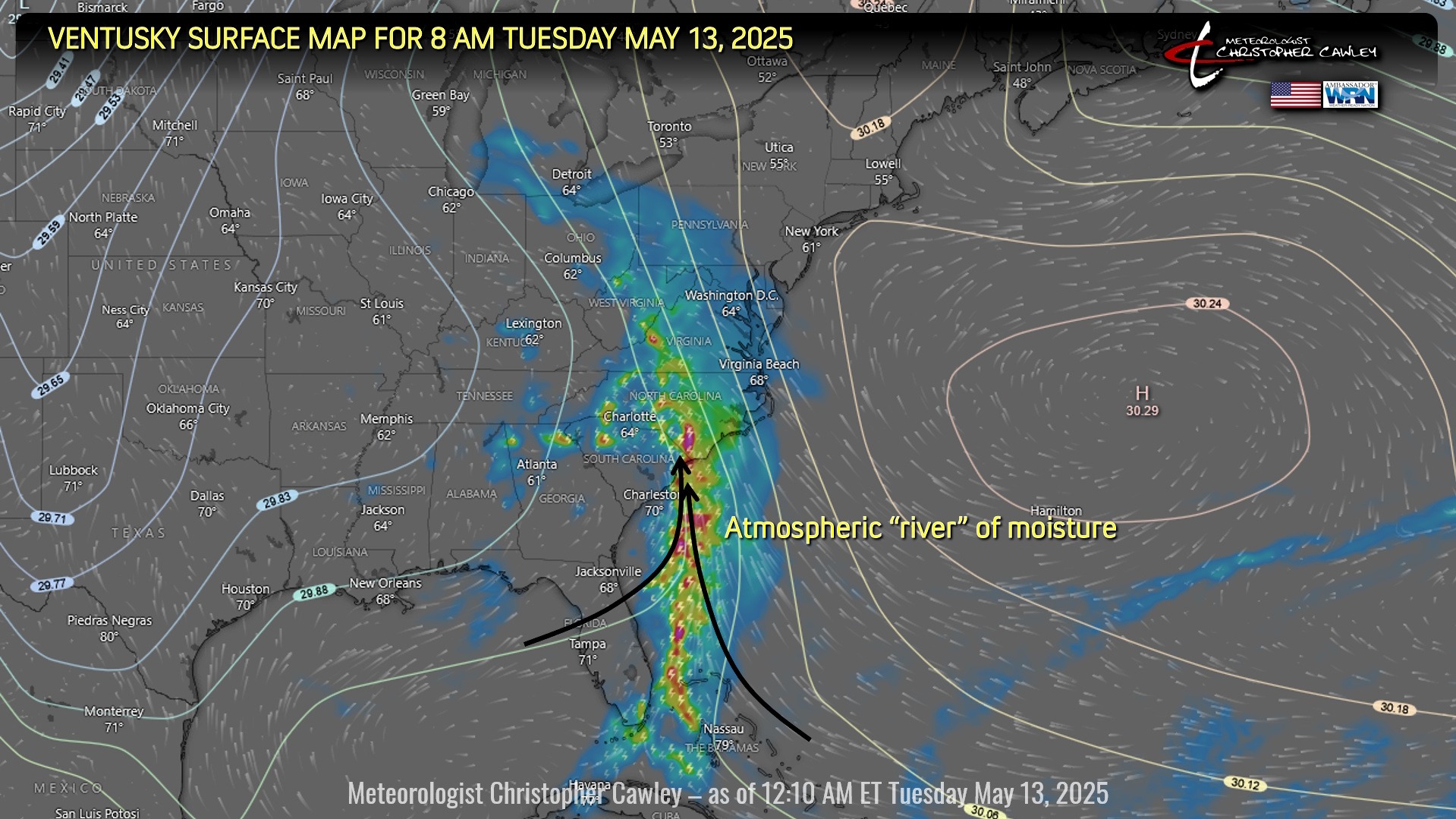
An atmospheric river became established yesterday and this lead to a few flash flood warnings just northeast of Columbus County… Onslow, Duplin, and northern Pender counties, and points north, really took a beating with reports of 4-6 inches of rainfall in those areas.
Rainfall amounts varied quite significantly over Columbus County on Monday. I measured 0.65″ on my weather station in Whiteville; however, Doppler radar estimated about 1-2 inches of rain across the county, particularly south and east of Whiteville.
Here’s a visual of the “atmospheric river” impacting the Carolinas. An atmospheric river is a narrow corridor of concentrated moisture in the atmosphere. They consist of narrow bands of enhanced water vapor transport, typically along the boundaries between large areas of divergent surface air flow, including frontal boundaries (such as what we’re experiencing).
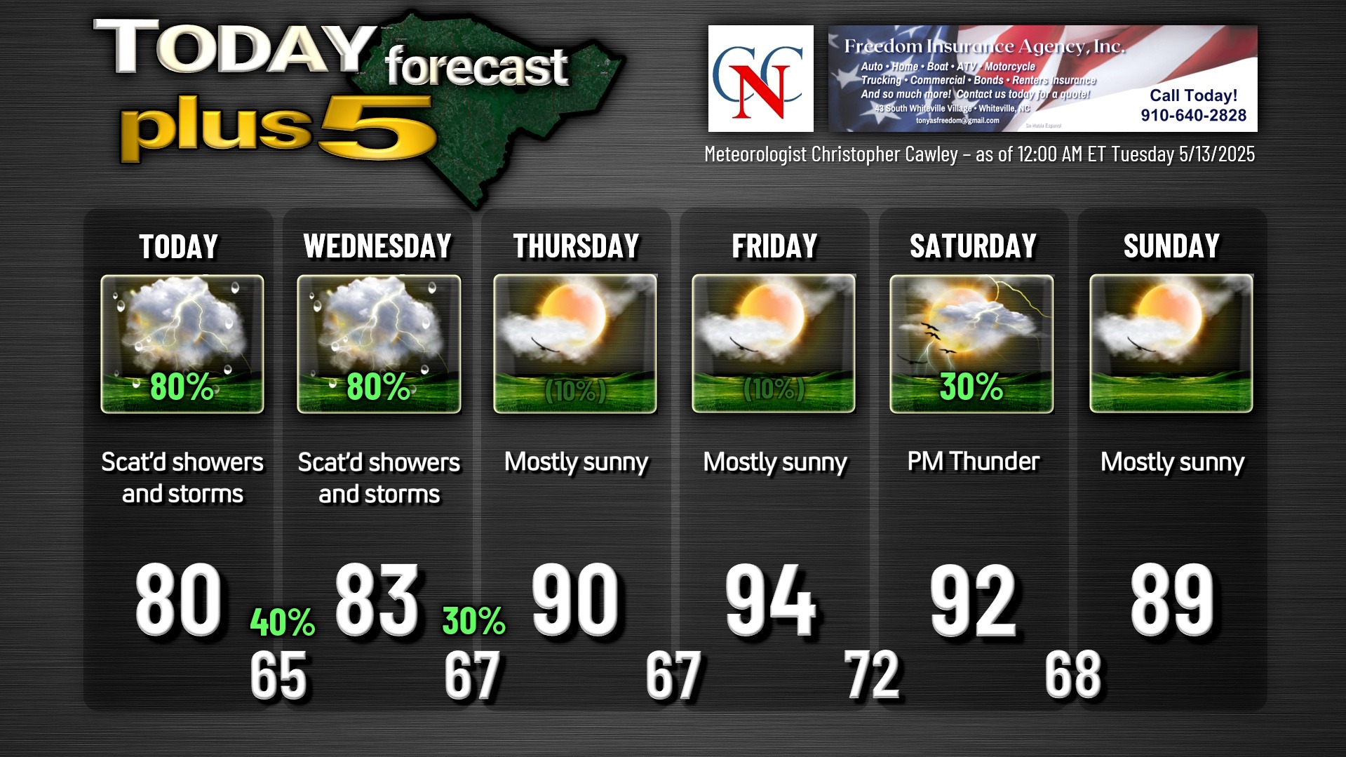
Showers and thunderstorms will once again impact the area today. It’s, again, impossible really to predict exactly where these plumes of moisture will go… there’s the potential that some areas of the county get very little rainfall today, while others experience repeated showers and storms with heavy rainfall.
All of this should taper off a bit after midnight tonight, leading us to have a mostly cloudy sky and very humid conditions overnight.
Wednesday will feature even more in the way of sunshine, but a warm front will lift north over the area and this will be the trigger for MORE showers and thunderstorms. Some of these storms could be on the heavy side once again.
After all of that comes to an end Wednesday night, high pressure starts to build in over the area, and quickly pushes offshore. This sets the stage for our first true summer heatwave of the season beginning Thursday, peaking Friday, and lasting into Saturday. A fairly weak cold front is expected to drop down from the north on Saturday, triggering some thunderstorm activity (possible severe concerns), with ever-so-slightly cooler temps on Sunday.
Heat index values Friday and Saturday will likely crest over the Misery Mark (100°F).
Slightly cooler temps look to carry into next week with typical summertime afternoon storm chances.
Here is your Freedom Insurance Today-plus-Five Forecast:
That’s going to do it for today’s report. As always, thank you for reading and for supporting Columbus County News. Have a great day!
–Meteorologist Christopher Cawley