CCN Weather Update for Monday August 4, 2025.
This weather update is sponsored by Freedom Insurance of Whiteville. No weather worries with Freedom Insurance. For home, car, boat, or whatever you need, Freedom can provide customized coverage to keep you and your family safe. Contact Freedom today at 910-640-2828!
Here’s today’s Bottom Line
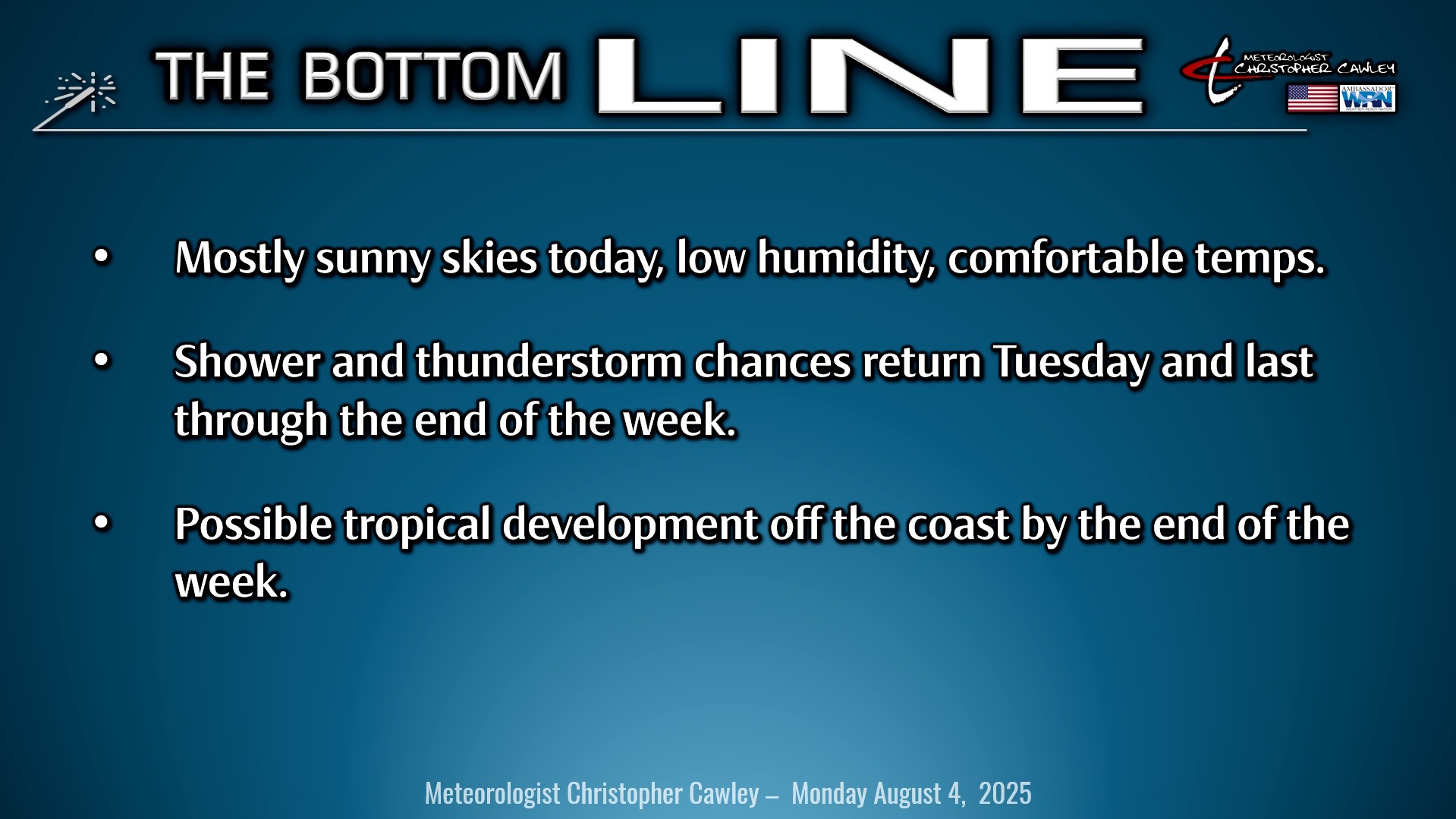
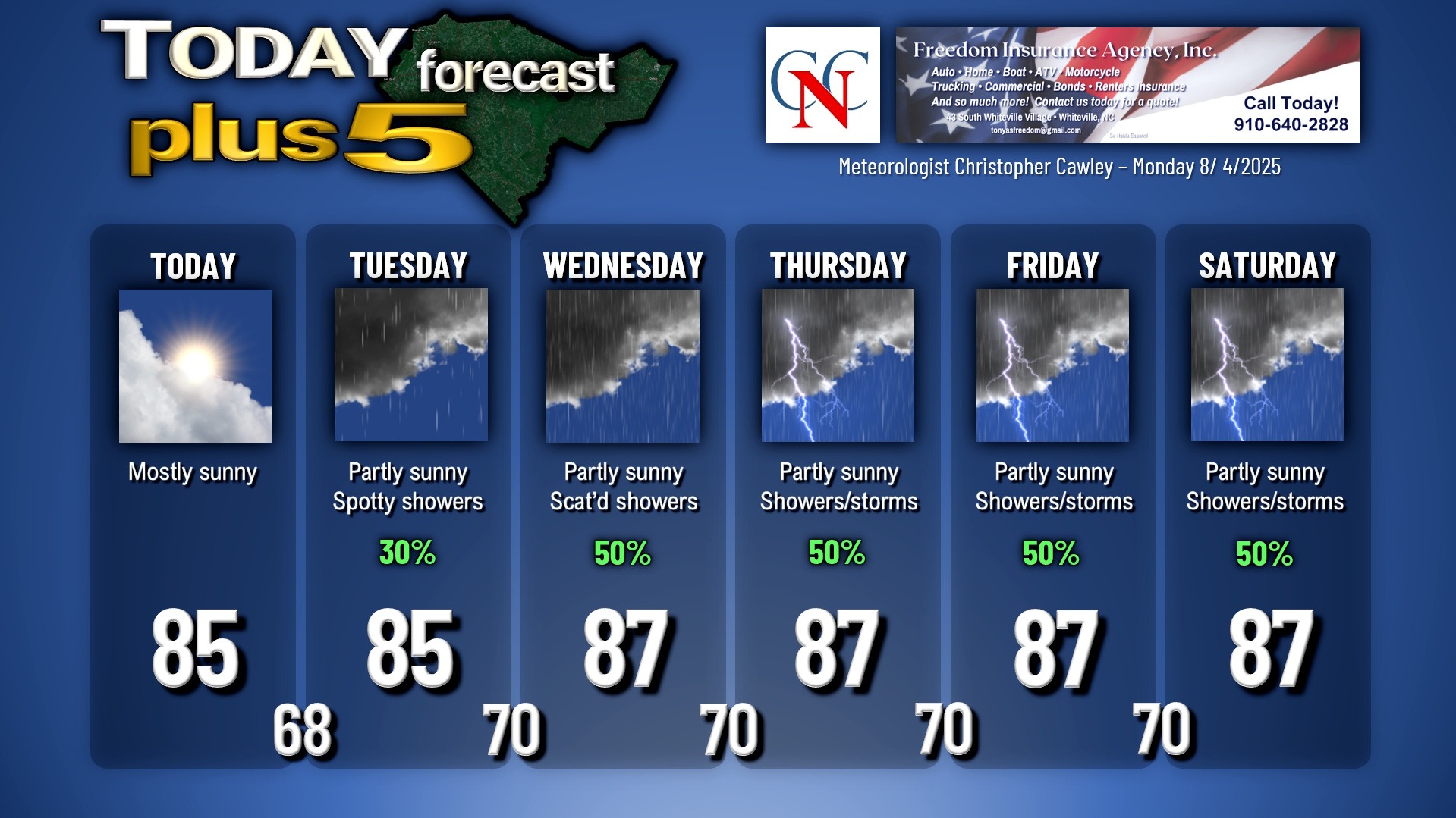
Yesterday was an absolutely beautiful day with low humidity, cooler-than-normal temps, and dry weather. We’ll enjoy another dry day today starting off with some sunshine but some cloudiness builds in during the afternoon. Humidity remains low and our highs remain below normal — peaking in the mid 80s (normal is around 90).
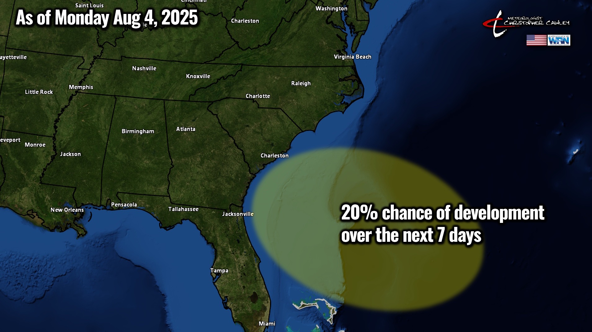
A cold front moved through the area Friday night and that has pushed southward to northern Florida, and then curving northeastward about a hundred miles or so off the South Carolina coast. One wave of low pressure pushed along the front on Saturday and has now become an Atlantic Invest (more in the tropical discussion below). No matter what it does, it’ll continue to push away from the coast.
For today, high pressure over central New York will continue to push a northeast flow of air over the area setting up a rare August “cold”-air damming “wedge.” This wedge will stay largely in place through tomorrow, but should begin to break down a little bit as a coastal trough sets up. This could kick off a few scattered showers tomorrow afternoon but I’m keeping our chances low, at roughly 30%.
By Wednesday a renewed push of moisture lifts “up and over” the front (still located roughly along the FL/GA line), and “up and over” the wedge. More moisture in the area means more cloudiness and a greater chance for shower activity. Some thunder possible, too, but I think the thunderstorm threat remains low.
Thursday and Friday start to become rather interesting as modeling suggests another area of low pressure forms on/near the frontal boundary, as the front lifts back northwest, closer to the coast. The NHC is highlighting this area for potential tropical development. Either way, the low is modeled, mainly by the GFS, to linger just off the coast of eastern North Carolina as we go into Friday and Saturday. The proximity of the low and frontal boundary will mean a greater chance for showers and thunderstorms Thursday, Friday, and Saturday. We’ll have to wait and see what this coastal low / potential tropical low does and what impacts we may have by next weekend.
TROPICAL OUTLOOK: Invest 95L has come together off of the low that moved along the cold front from this past weekend. Regardless of development, the system will move away from the Carolinas.
Another wave of low pressure is expected to develop along the frontal boundary later this week. The National Hurricane Center has an area off the South Carolina coast outlined in a 20% probability of tropical or subtropical development.
Finally, in the central Atlantic, a wave of low pressure pushing off the Africa coast will enter a region favorable for tropical development, and the latest NHC outlook has a 40% probability of this developing into a tropical system later this week. If this does develop, the upper-level patterns should steer this away from the east coast.
Here is your Freedom Insurance Today-plus-Five Forecast:
–Meteorologist Christopher Cawley