CCN Weather Update for Saturday September 6, 2025.
This weather update is sponsored by Freedom Insurance of Whiteville. No weather worries with Freedom Insurance. For home, car, boat, or whatever you need, Freedom can provide customized coverage to keep you and your family safe. Contact Freedom today at 910-640-2828!
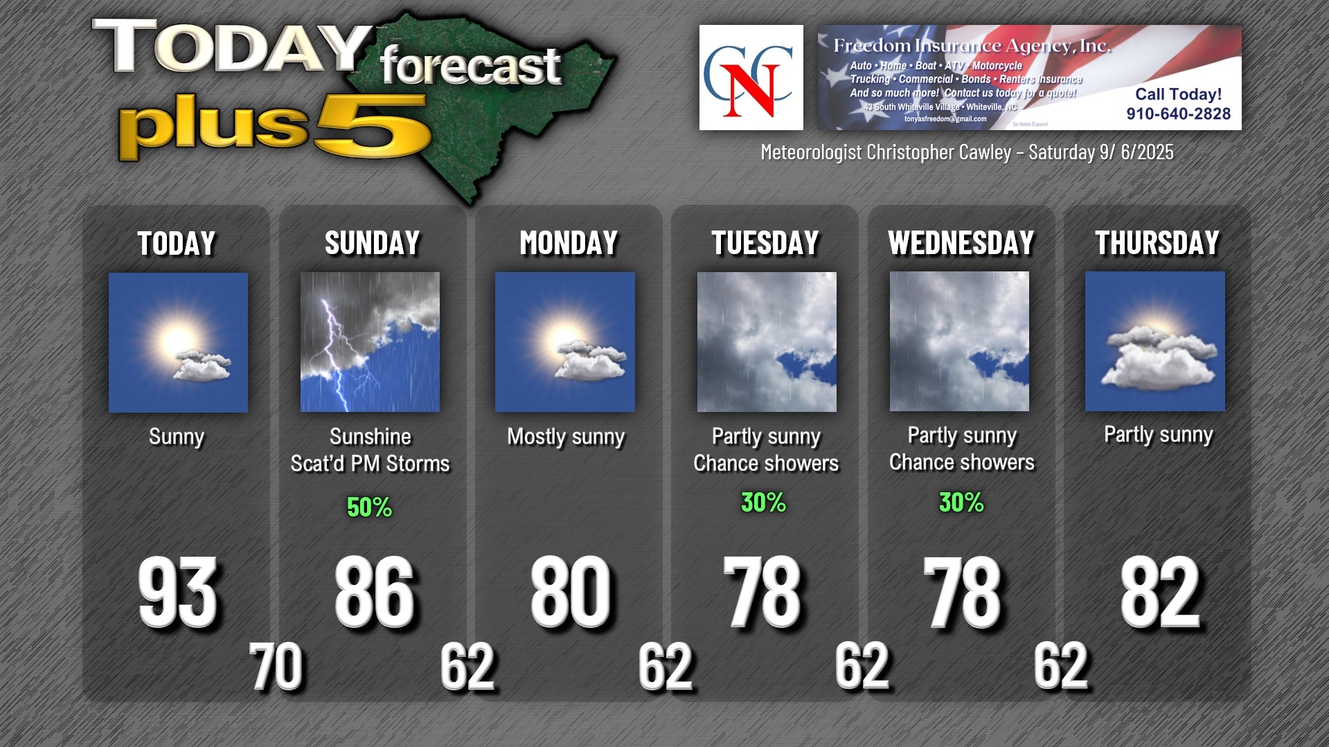
Here’s today’s Bottom Line
One last hot (90+) day with Bermuda high pressure influencing our weather pattern.
A cold front will start to make the journey through the Appalachians… but won’t quite make it through the area today. A warm, southerly flow will pump in moisture with humidity noticeably higher this afternoon. As stated, highs jump well into the 90s for the 2nd day in a row (we made it to just under 94 degrees on my station on Friday).
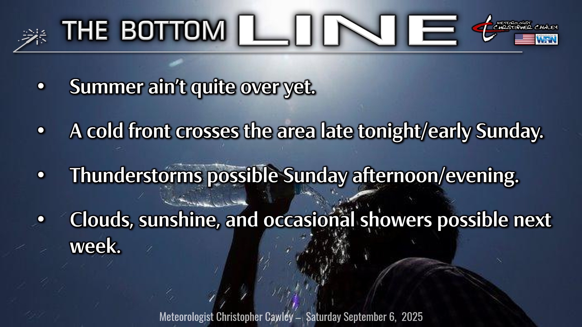
The front finally pushes all the way through the area late Saturday night into early Sunday, but the cooler/drier air mass will lag by about 12 hours. There may be a few spotty showers with the front itself early Sunday, but the focus will be Sunday afternoon when modest instability appears to develop about the area. The frontal boundary and/or the sea-breeze will be the foci for scattered showers and thunderstorms to develop. Some of the guidance that I look at seems to imply that some of the storms could be on the strong side late Sunday afternoon with gusty winds and torrential rainfall. There’s still some uncertainty with all of this, so I’m going with a 50% probability on the graphic below.
A robust push of cooler and drier air arrives Sunday night. This “shoves” the front offshore … but the front will stall somewhere off the coast by early Monday.
As we turn the page into next week, a rather unusual pattern will become established with the front stuck offshore. High pressure to our north will set up a northerly/northeasterly wind flow and a “wedge” pattern takes shape… something that we normally see in the early spring months. This will also likely bring extensive cloud cover and occasional light rain… but I think the best rain chances will be closer to the coast. That being said, at this point I think the majority of the work week will feature a mix of sun and clouds (probably more clouds than sunshine) along with at least spotty light rain showers from time to time. Temperatures will run quite a bit below normal with highs in the upper 70s to lower 80s.
TROPICS: What was looking to be a near-certainty with the development of our next tropical system is looking a little less so as of this writing. The showers and thunderstorms associated with the tropical wave I’ve been talking about for several days… has become quite disorganized, and a bit of a dry air mass has made the general area less favorable for tropical development—at least over the next few days. I still expect this to develop into a tropical depression at some point early next week, and then we’ll have to watch where it goes from there.
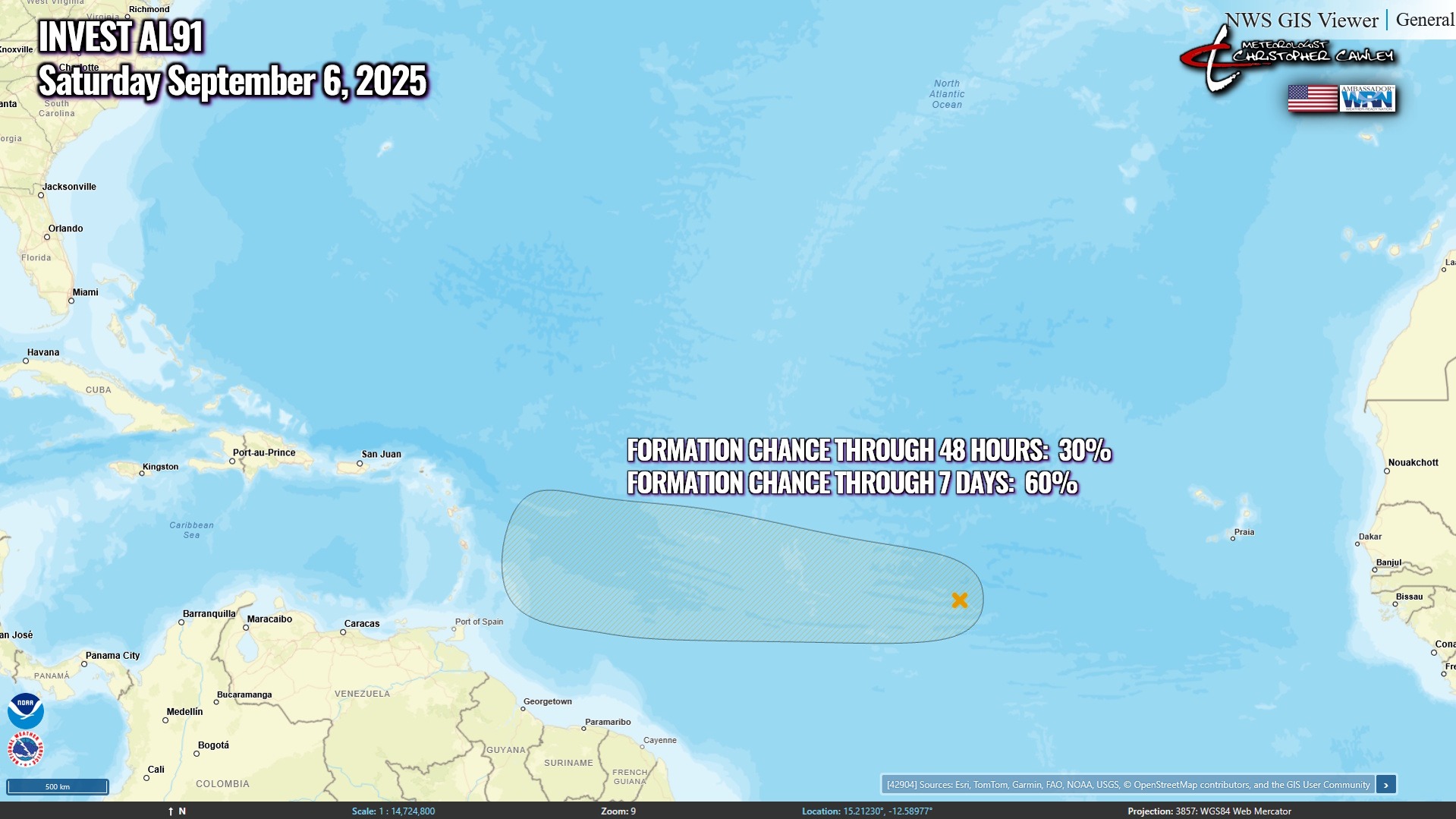
The latest analytical chart shows whatever develops here will head west and then probably curve northward. It should be noted, though, that the computers are modeling a “speculated storm,” in other words, one that hasn’t truly developed yet. So, take this chart with a huge grain of salt.
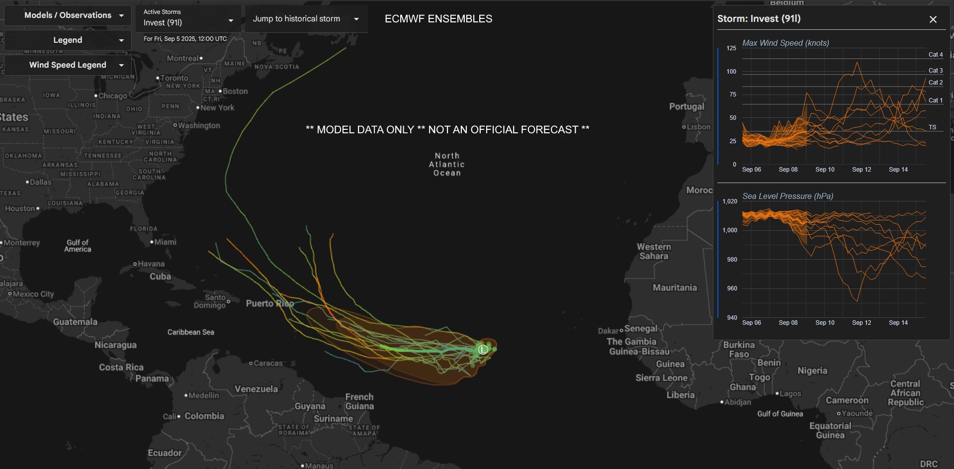
As I’ve said, trust your local meteorologists before believing the random stuff you see by so-called “expects” on social media (even if they have the blue check-mark). I’ll be watching it, but as of right now, there are no tropical threats to the Carolinas for at least the next week-plus.
Here is your Freedom Insurance Today-plus-Five Forecast:
–Meteorologist Christopher Cawley