CCN Weather Update for Saturday October 4, 2025.
This weather update is sponsored by Freedom Insurance of Whiteville. No weather worries with Freedom Insurance. For home, car, boat, or whatever you need, Freedom can provide customized coverage to keep you and your family safe. Contact Freedom today at 910-640-2828!
Here’s today’s Bottom Line
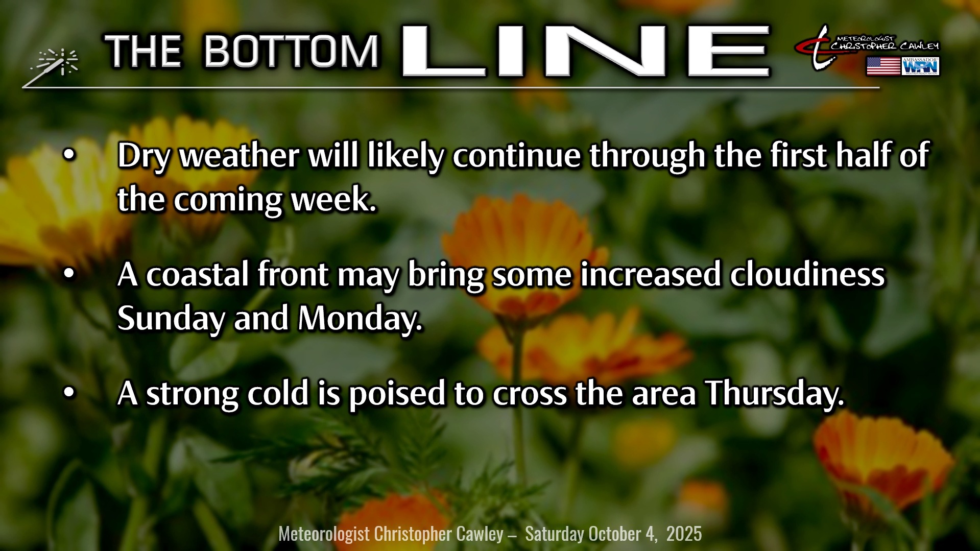
High pressure will ultimately remain in control through the midweek period.
This morning the high is centered off the Virginia coast, extending southwestward to the NC/SC/TN border area. Over time it will tend to drift to the east, to a position well off the Delmarva coast by Monday. A weak coastal frontal boundary is expected to develop Sunday into Monday and this may bring more in the way of cloudiness, but at this point I don’t think we’ll see much (if any) rainfall from this… not even enough to put it on the graphic or in the radio forecast.
A more humid south-southwesterly flow becomes established Tuesday and Wednesday ahead of a strong cold front. This front crosses the area late Wednesday into Thursday. Modeling is suggesting that the front will be starved of moisture but I’m not going to rule out an isolated thunderstorm or two along the actual frontal passage.
As for our temperatures, we’ll be in the lower to middle 80s today through Wednesday… with nighttime lows in the lower to middle 60s. Fairly strong colder air advects into the area Thursday resulting in highs barely reaching the lower 70s.
TROPICS: Still watching two areas of potential interest… one off the east coast of Florida and the other in the south-central tropical Atlantic.
For the Bahamas and Florida, an area of low pressure is trying to come together on a decaying front. This low is likely to drift to the west-northwest into southern Florida. Overall environmental conditions are not expected to be conducive for any real development of this system. It’ll bring some good rainfall to central and southern Florida. The NHC gives this a 10%/10% chance for development.
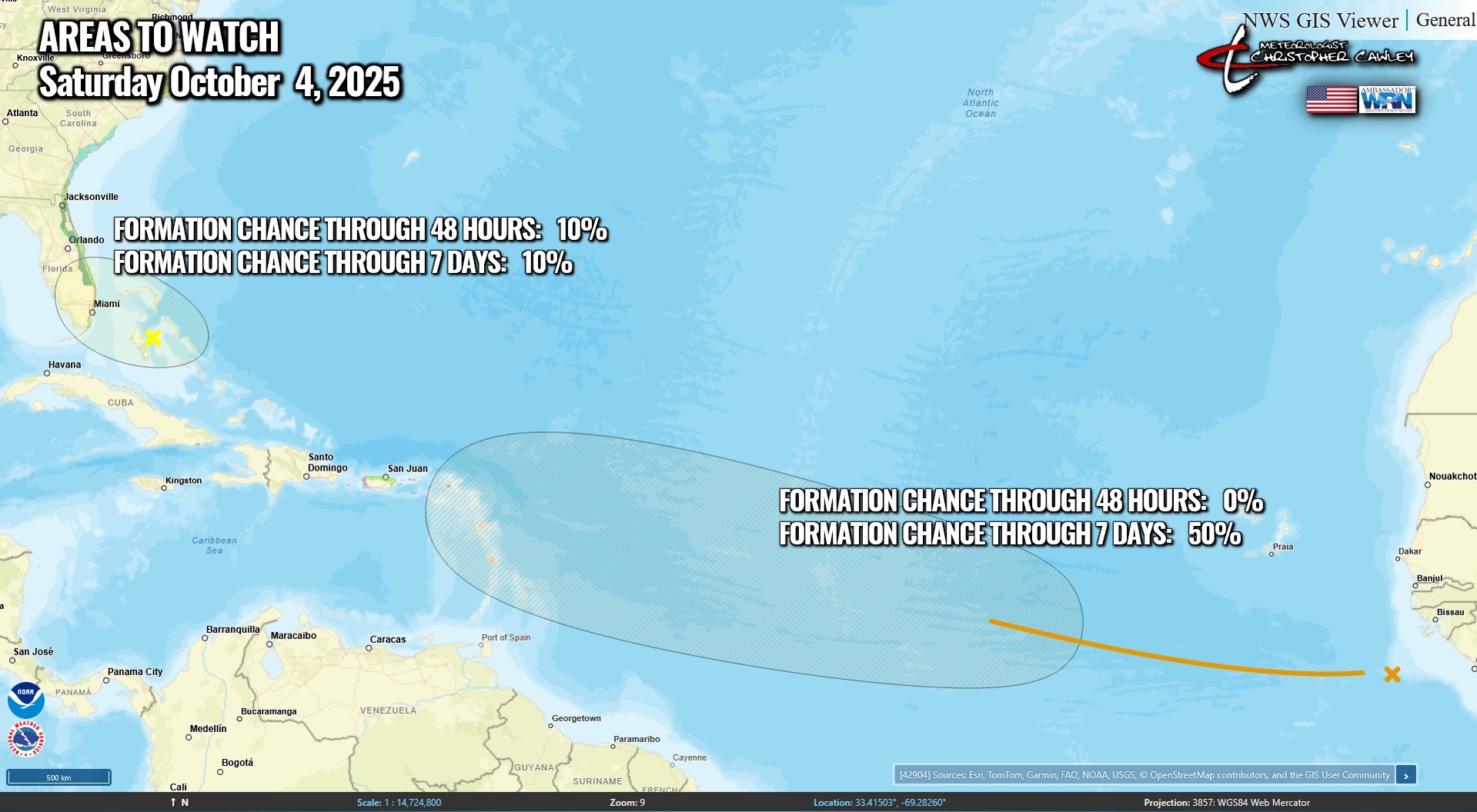
The other area is a tropical wave moving off the coast of Africa, and is ragged and disorganized (for now). The wave will kind of merge with another disturbance over the tropical Atlantic in the highlighted area on the map above. Conditions are somewhat favorable for this area to develop, and the NHC gives it a 0%/50% chance for development.
No threats to the Carolinas for the foreseeable future.
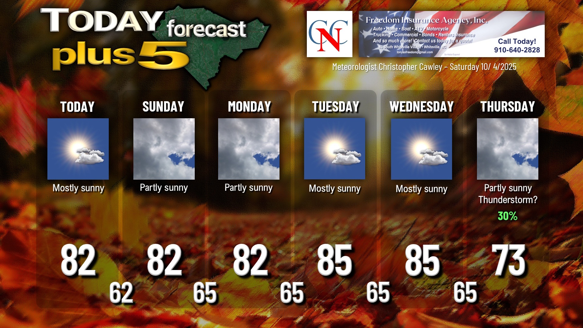
Here is your Freedom Insurance Today-plus-Five Forecast:
–Meteorologist Christopher Cawley