

CCN Weather Update for Thursday October 9, 2025.
This weather update is sponsored by Freedom Insurance of Whiteville. No weather worries with Freedom Insurance. For home, car, boat, or whatever you need, Freedom can provide customized coverage to keep you and your family safe. Contact Freedom today at 910-640-2828!
Here’s today’s Bottom Line
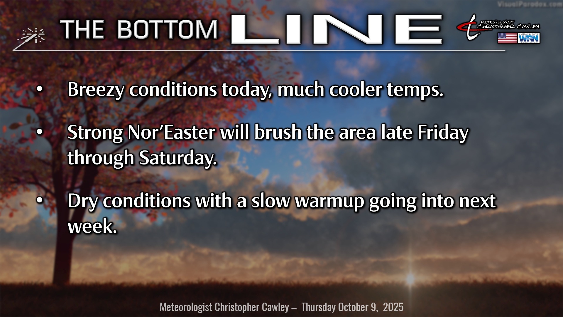
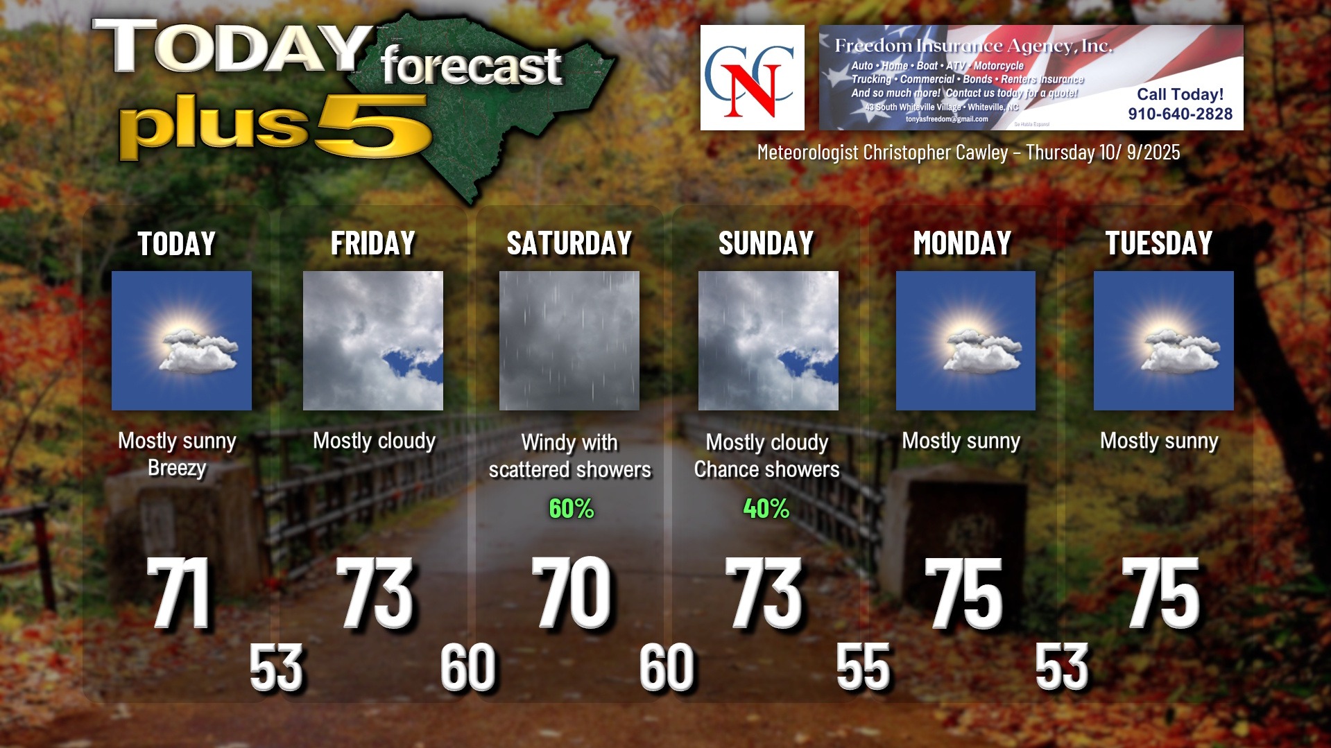
It’s going to be a whole different climate today thanks to a strong cold front that crossed the area. It’s going to be blustery and a bit on the cool side today… but the sun will shine. Expect highs a degree or two either side of 70.
That front stalls off the coast, and by a combination of various weather factors, low pressure will form on the front. Hazardous beach conditions develop Friday afternoon, especially through Friday night and the weekend, so if you’re traveling to the coast, prepare for that.
As for Columbus County, I expect we’ll see an increase in cloud coverage on Friday with breezy conditions continuing, but I think most of the day stays dry.
The low rapidly strengthens into an early season Nor’easter. There’s still some uncertainty around where the low will track, with the largest model consensus agreeing that it will remain just offshore from our area, passing close to Cape Lookout and possibly directly over the Outer Banks… before quickly moving northeast and away.
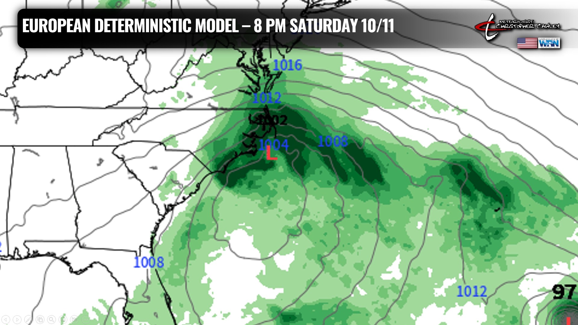
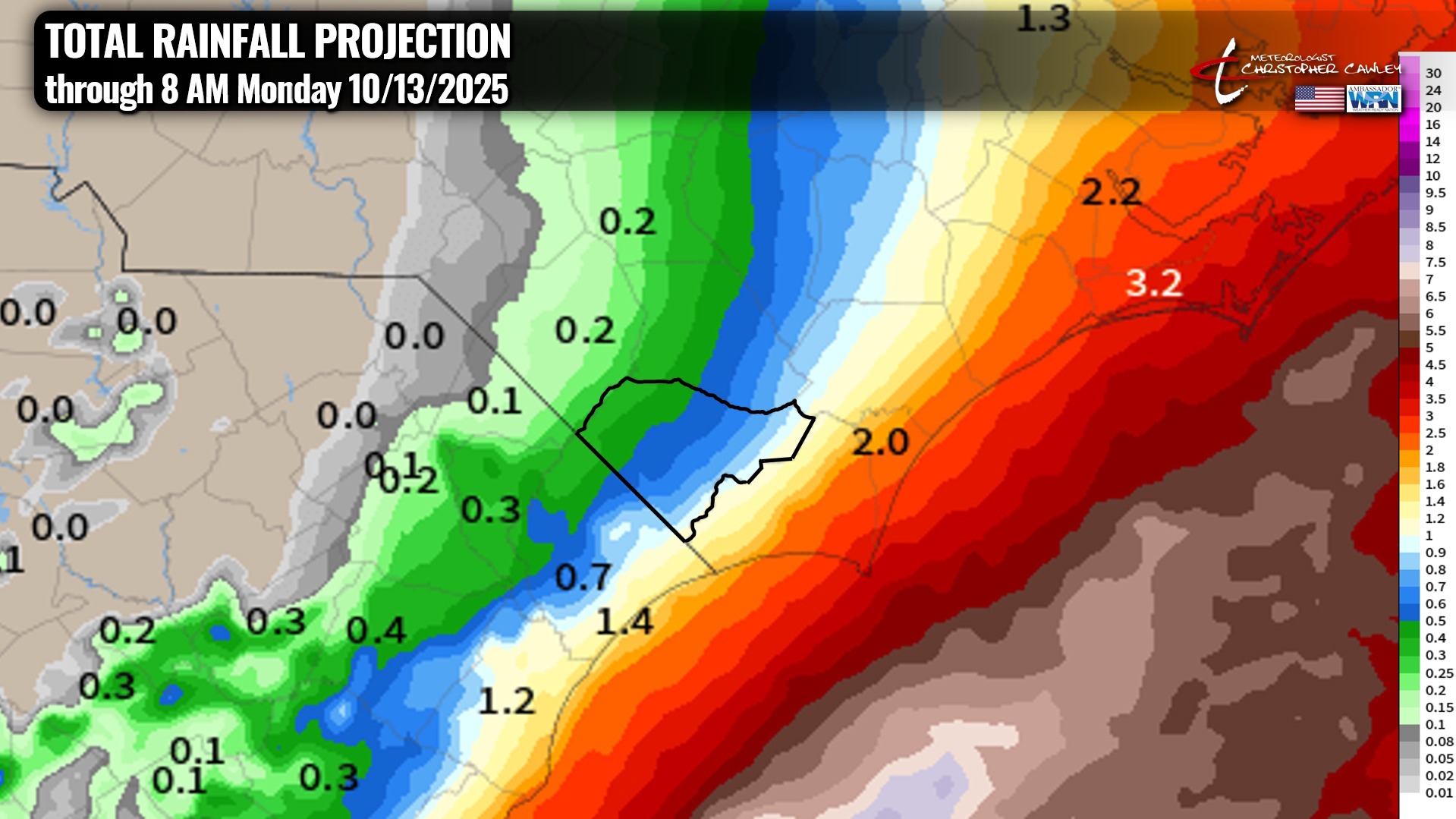
Showers… to periods of rain… can be expected Friday night through Saturday night. Rainfall looks to have quite the gradient… from just a few tenths of an inch for the western portion of the county… to well over an inch of rain across eastern portions of the county. Any shift in the storm track of even 25-50 miles could mean huge differences in rainfall totals about the area.
Oh, and it’s likely to be rather windy Friday night through Saturday night. North winds sustained 15-25 mph with gusts 35-40 mph are possible, especially across the eastern half of the county. Higher winds if the storm tracks closer to the coast, less winds if the storm tracks farther offshore.
Once that moves away, dry high pressure takes control for much of next week with temps returning closer to seasonal normal values.
TROPICS: Jerry will likely strengthen into the next Atlantic hurricane… and will remain over the open ocean with no worries to anybody (other than ocean shipping).
There really aren’t any other areas too concerning right now. An area of low pressure will lift westward into central Mexico.
Another area the hurricane center has outlined is in the far north Atlantic is being labeled as a “gale-force non-tropical area of low pressure.” There’s a 10% risk for subtropical development before this really lifts north of the Gulf Stream into cold water.
There are no tropical threats to the Carolinas for the foreseeable future.
Here is your Freedom Insurance Today-plus-Five Forecast:
~Meteorologist Christopher Cawley