

CCN Weather Update for Wednesday November 5, 2025.
This weather update is sponsored by Freedom Insurance of Whiteville. Trust Freedom Insurance to give you clear blue skies when it comes to home, car, boat, or whatever insurance you need. Let Freedom provide customized coverage to keep you and your family safe. Contact Freedom today at 910-640-2828!
Here’s today’s Bottom Line
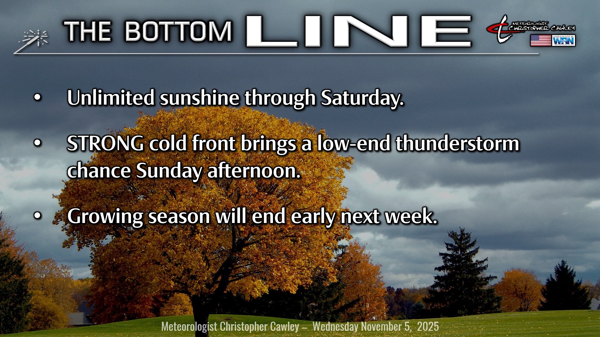
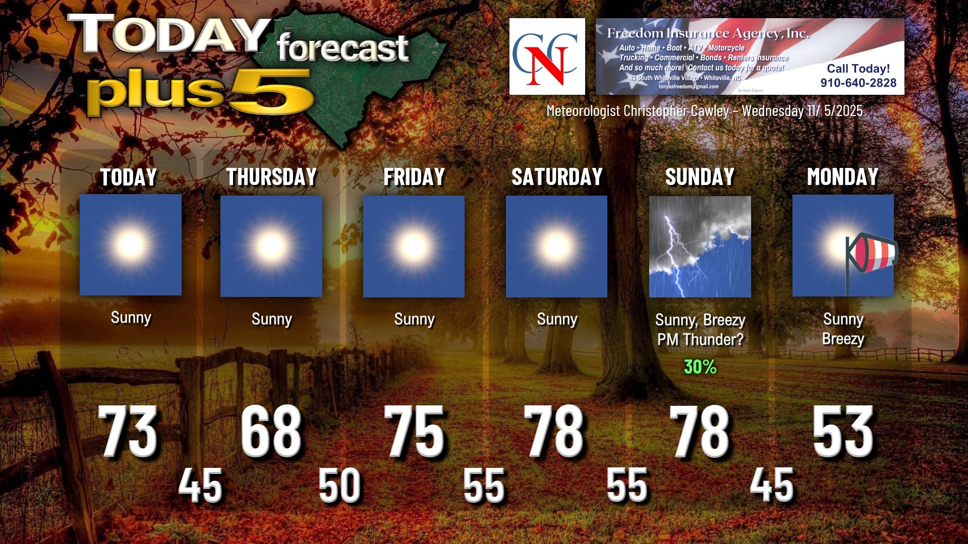
There are no weather concerns … at all … through Saturday.
The only thing worth talking about is a little cold front that will drop down from the north early Thursday. That will mean our highs are a few ticks below 70. That’s about it.
Strong warm air advection will push our temps well above seasonal normal values into the weekend before the all-capital-letters COLD FRONT moves through Sunday.
Some of the guidance is hinting at a thunderstorm threat Sunday afternoon. That’s kind of sketchy at the moment but with the ferocity of the cold front, it wouldn’t surprise me in the least.
After the cold front, temperatures take a nose dive early next week. Highs on Monday will struggle to the lower 50s… and while it’s not shown on the graphic below, we’re likely to dip below freezing early Tuesday morning (some modeling is showing temps 29-31 for Whiteville).
The cold snap shouldn’t be long-lived though as there are some indications at warming temperatures later on next week.
TROPICS: There are no areas of tropical interest and no tropical formation is expected through the next 7 days.
Here is your Freedom Insurance Today-plus-Five Forecast:
–Meteorologist Christopher Cawley