CCN Weather Update for Wednesday January 21, 2026.
This weather update is sponsored by Freedom Insurance of Whiteville. You can trust Freedom Insurance to give you clear blue skies when it comes to home, car, boat, or whatever insurance you need. Let Freedom provide customized coverage to keep you and your family safe. Contact Freedom today at 910-640-2828!
Here’s today’s Bottom Line:
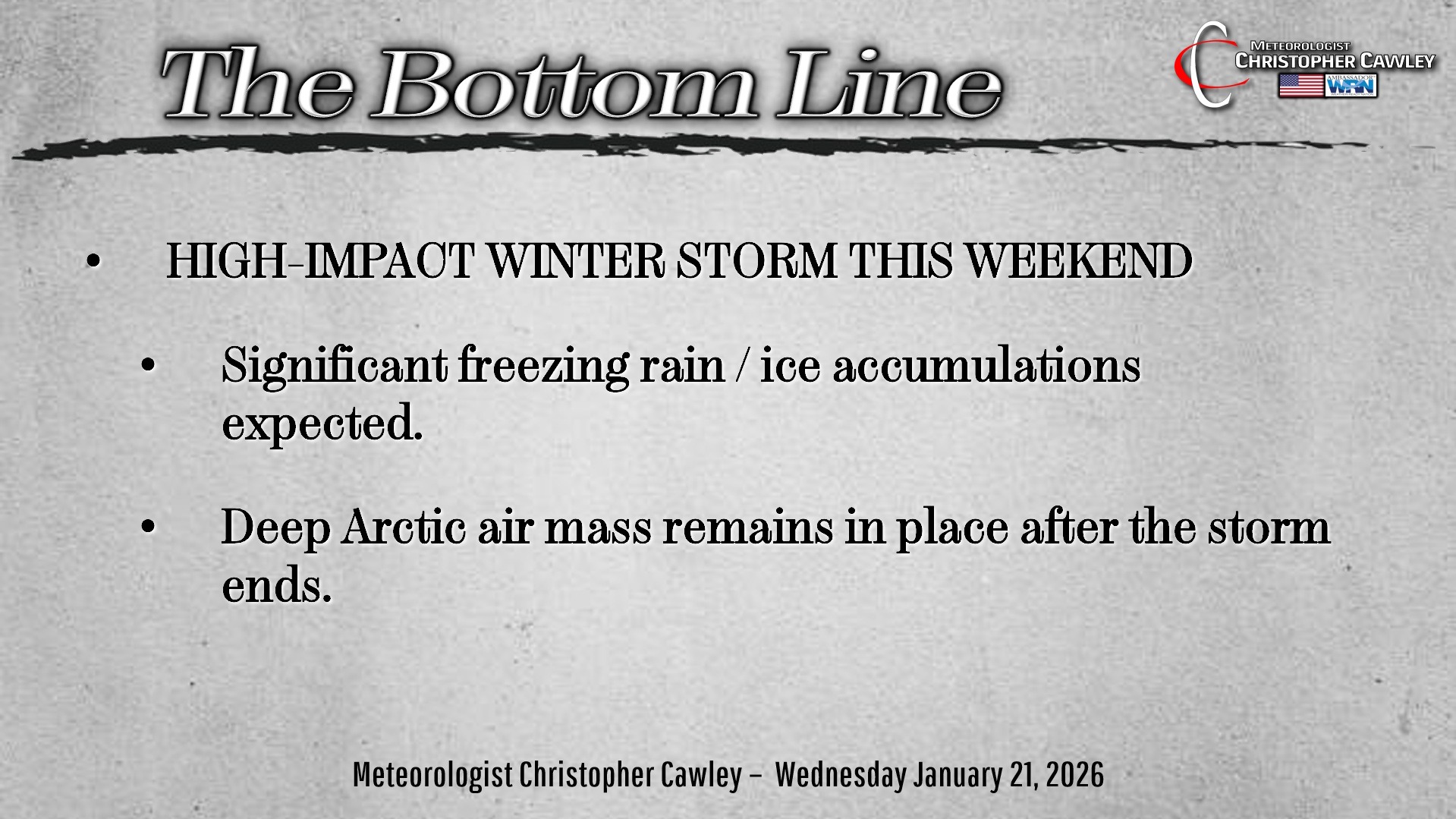
HIGH-IMPACT WINTER STORM TO HIT THE AREA THIS WEEKEND.
WHAT IS KNOWN:
— Arctic high pressure brings extremely cold surface air to the area.
— A “fire hose” of deep moisture from the tropical Pacific ocean will lift across Texas, Louisiana, Mississippi, Alabama, Georgia, Tennessee, South Carolina, and North Carolina.
— Low pressure areas on this moisture boundary will bring significant precipitation to much of the mid-south and mid-Atlantic region.
WHAT IS NOT KNOWN:
— Exact timing of the storm, including duration of wintry precipitation.
— Dominant precipitation type (snow vs freezing rain vs sleet), and whether it will alternate between types… although confidence is increasing that the predominant precipitation will be freezing rain.
— Overall amount of freezing rain.
WHAT SHOULD YOU DO?
— Continue to stay up to date with the latest information from the National Weather Service. Please check timestamps with all posts you see.
— Review your severe winter weather preparedness plan.
— Be prepared for an extended period of bitterly cold temperatures during and after the storm.
— Be prepared for prolonged power outages, tree damage, and difficult travel.
OVERVIEW: The “big picture” is unchanged from yesterday’s report. A huge area of high pressure to the north will bring very cold air down into the Carolinas over the weekend. At the same time, moisture will be lifting northward from the Gulf with areas of low pressure pushing east over the area, pushing off the South Carolina coast sometime on Sunday.
A high-impact snowstorm will occur for most of central and northern North Carolina with the potential for FEET of snow.
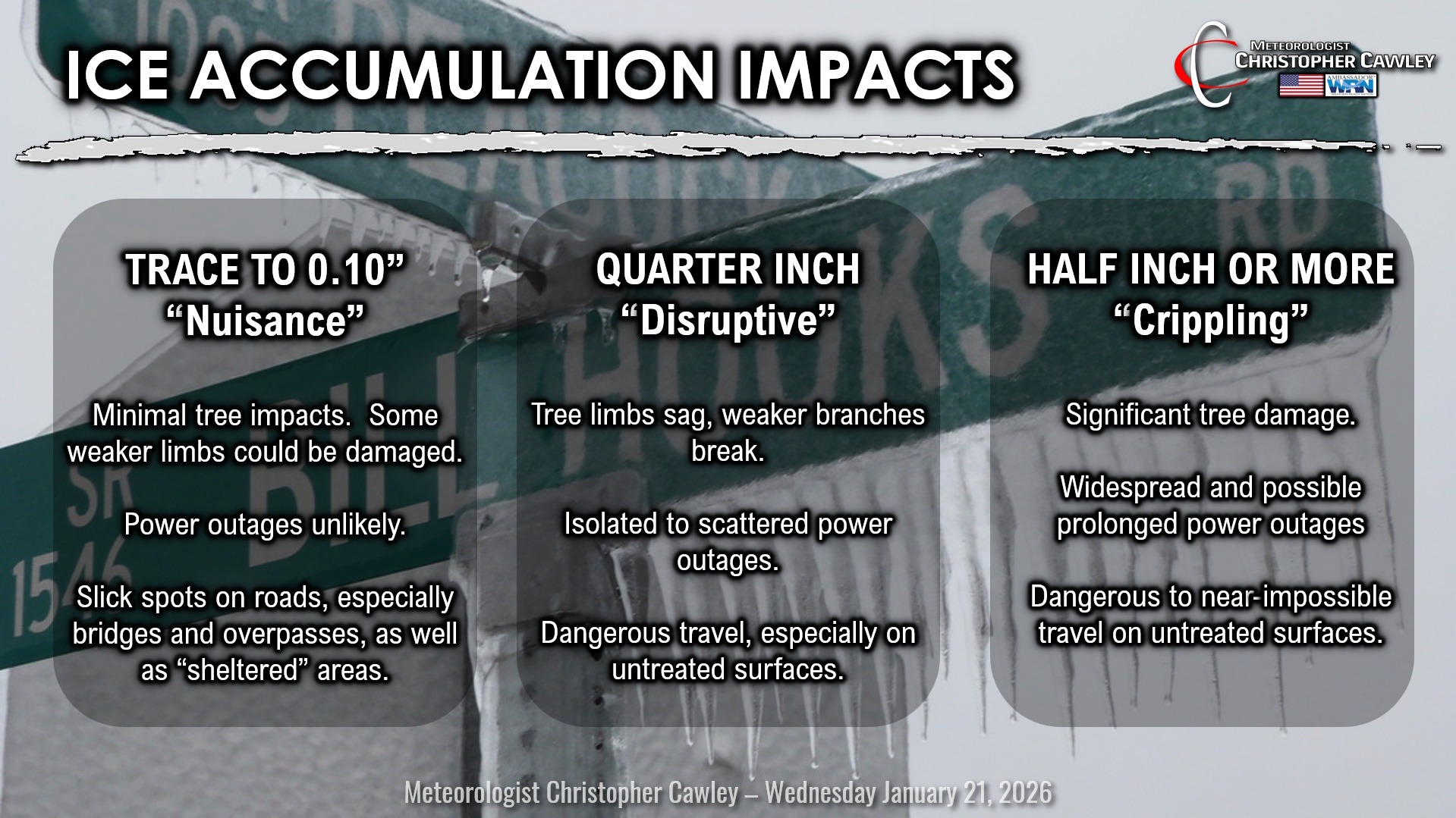
A moderate- to high-impact ice storm is likely to occur over our area. This is because the “depth” of the cold air will be shallow, and trapped mainly at the surface. Precipitation will fall through an atmospheric column that is above freezing for most of the journey, until hitting frigid air within the first few hundred feet of the surface.
There is some disagreement in the modeling with regard to the cold air depth. The GFS modeling has a relatively shallow area of above-freezing temps in the middle atmosphere, only 1-2 degrees above freezing, but just enough to melt snowflakes into raindrops. The model depicts a thicker cold layer closer to the surface, which may allow the raindrop to re-freeze into a sleet pellet. The model shows a significant sleet and freezing rain event.
The European is full-tilt ice storm, with what would be historic and absolutely devastating ice totals. I question how realistic some of these totals are — it’s hard to jump on board with what would be unprecedented totals. I just don’t think it’s reasonable. If the European model verifies, I can safely say we’ll be dealing with the impacts for weeks.
The latest NWS Blend of Models (which is just that — a blend of all the modeling) shows generally between one-half and two-thirds of an inch of ice across the county from this event. I believe that to be a reasonable estimate.
Take all of this with a grain of salt as well, because there are still several days for things to evolve and change. Hurricane Hunter aircraft will be investigating this system as well, and the information they acquire will be ‘fed’ into the model computers, resulting in a much better look at what is coming.
It is my plan to do some live sessions on the CCN Facebook page Thursday and Friday evenings.
It is IMPERATIVE that you begin preparations for a severe winter storm. “Prepare for the worst,” and make sure you have flashlights, batteries, nonperishable food, medicine, pet food/supplies, blankets, etc. Prepare for what could be several days home-bound. I’m not saying that’s a certainty, but it would be best to be fully prepared. Make sure your vehicle has a full gas tank, and make sure you have cash — ATMs and debit card point-of-sale terminals won’t be available in power outages. Keep your electronics charged as well.
Yes… there’s a “chance” that things could change and we get more cold rain than anything frozen. There’s also a chance the storm pushes a bit farther south and we end up with a dramatic snowstorm.
Either way, it would be a foolish to take this storm lightly.
Here’s your Freedom Insurance Today-plus-Five Forecast!

–Meteorologist Christopher Cawley