
CCN Weather Update for Sunday January 25, 2026.
This weather update is sponsored by Freedom Insurance of Whiteville. You can trust Freedom Insurance to give you clear blue skies when it comes to home, car, boat, or whatever insurance you need. Let Freedom provide customized coverage to keep you and your family safe. Contact Freedom today at 910-640-2828!
Here’s today’s Bottom Line:
This ridiculous weather pattern continues today through tonight before we finally calm things down a little bit by Monday afternoon.
Then it’s just going to be COLD. All-capital-letters C-O-L-D.
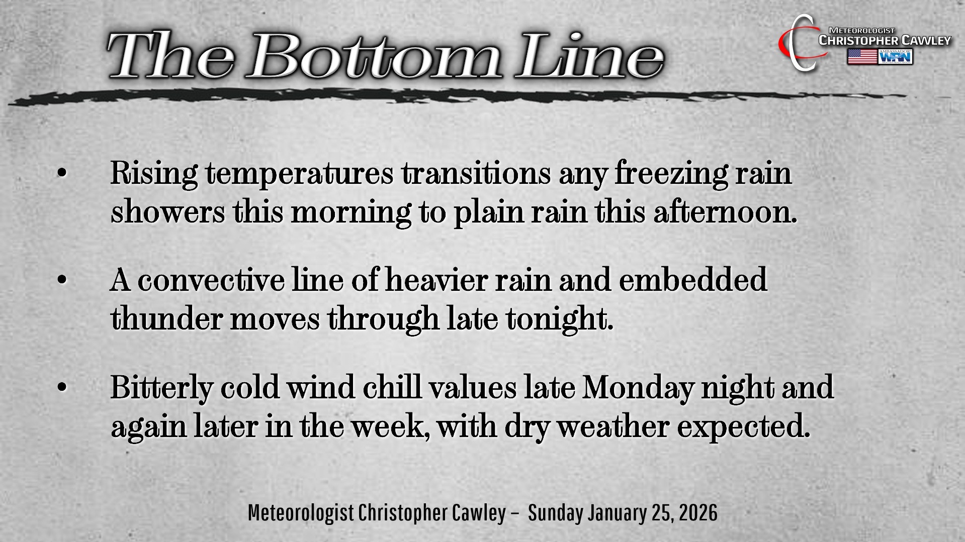
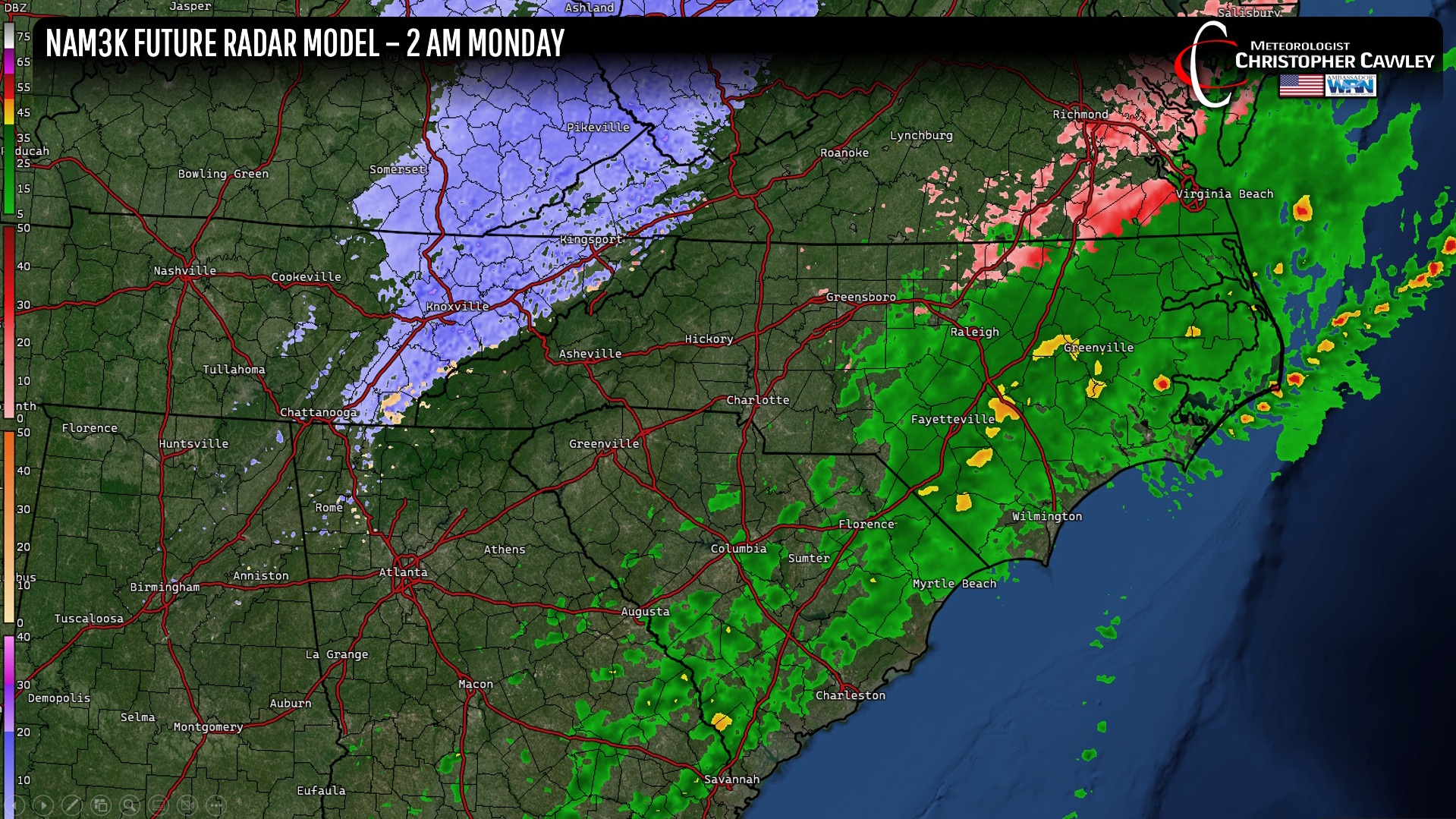
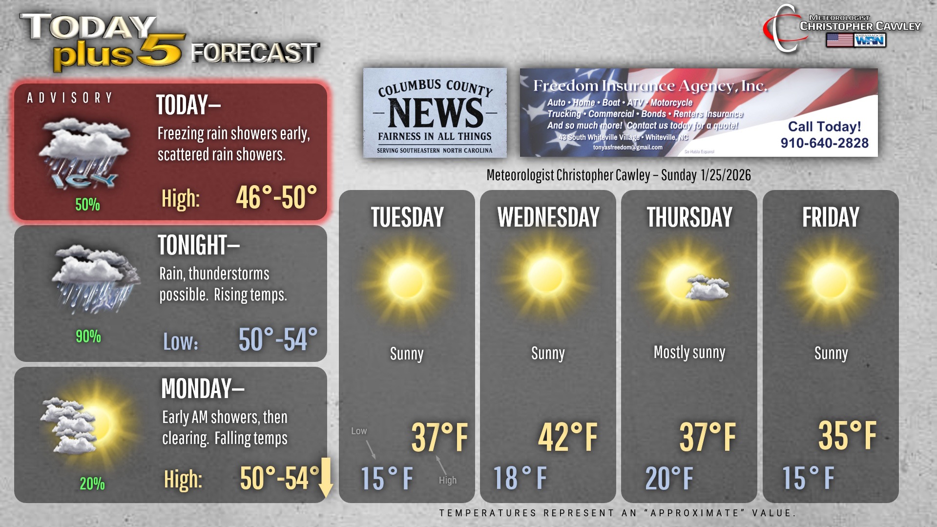
An impressively complex weather system continues to ravage the eastern half of the country with winter storm warnings and ice storm warnings all over the place… except here. Fortunately an area of dry midlevel air is funneling up from the south, almost directly over Columbus County. There are still freezing rain showers around … they’ll transition over to just plain rain as our temps go above freezing by mid- to late-morning.
For this afternoon through this evening, strong south to southwest winds above the cold air at the surface will be eroding it away from the top-down. As this occurs, a sudden warmup into the 50s is probable, and a sudden increase in south to southwest winds is also probable. A strong cold front will approach from the west. The front is likely to bring a band of moderate to heavy rain showers and possibly some embedded thunderstorms during the overnight hours tonight into early Monday morning!
That will be the final hurrah for this system.
We’ll see increasing sunshine on Monday with falling temperatures.
DANGEROUSLY COLD WIND CHILL TEMPERATURES MONDAY NIGHT INTO EARLY TUESDAY.
Well-below-normal temperatures are likely the entire week. A few cold fronts will pass over the area reinforcing the Arctic air. Several nights this week will feature very cold temps; the NWS will likely be issuing cold weather advisories or even extreme cold warnings. Wind chill values could be as low as 5 above zero.
Dry weather is expected through the week as Arctic high pressure will dominate, especially late this week. Temperatures will run some 20 degrees below seasonal normal values.
A bit of a wave on the southern jet starts to form by next Saturday but as of right now all indications are that it will be staying well south of the area. We’ll remain dry and unseasonably cold.
Here’s your Freedom Insurance Today-plus-Five Forecast!
–Meteorologist Christopher Cawley