
CCN Weather Update for Friday January 30, 2026.
This weather update is sponsored by Freedom Insurance of Whiteville. You can trust Freedom Insurance to give you clear blue skies when it comes to home, car, boat, or whatever insurance you need. Let Freedom provide customized coverage to keep you and your family safe. Contact Freedom today at 910-640-2828!
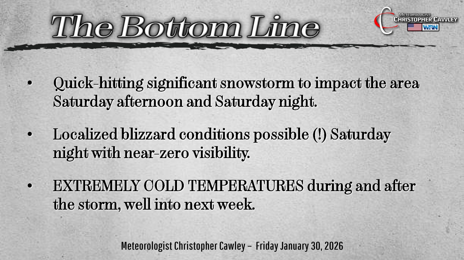
Here’s today’s Bottom Line:
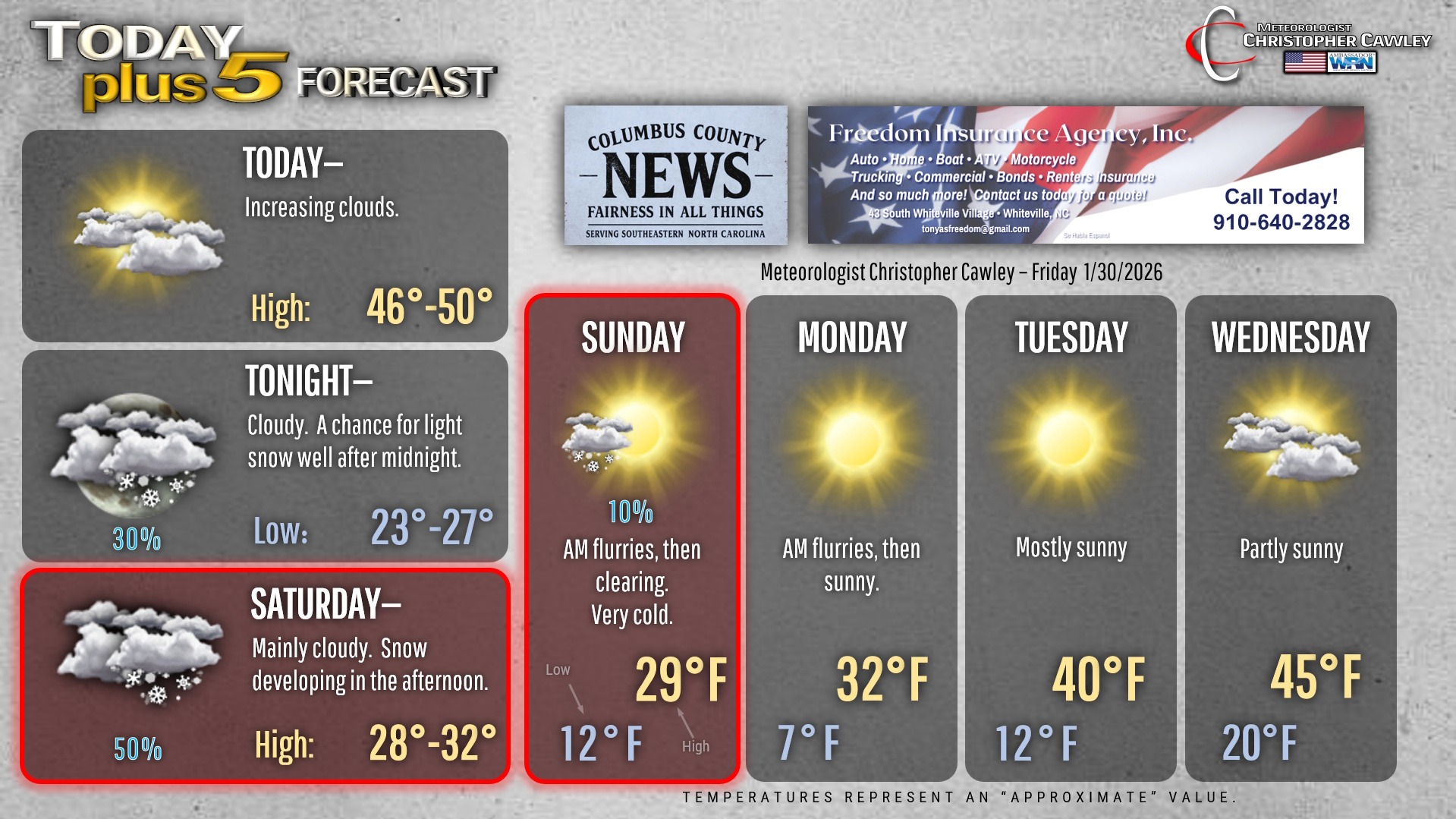
The calm before the storm today, as we’ll have benign weather with increasing clouds and highs in the upper 40s to near 50.
Some “spits” of snow may occur tonight, but there won’t be any accumulation. Really just a few passing snow showers.
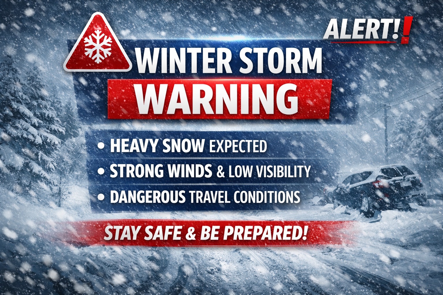
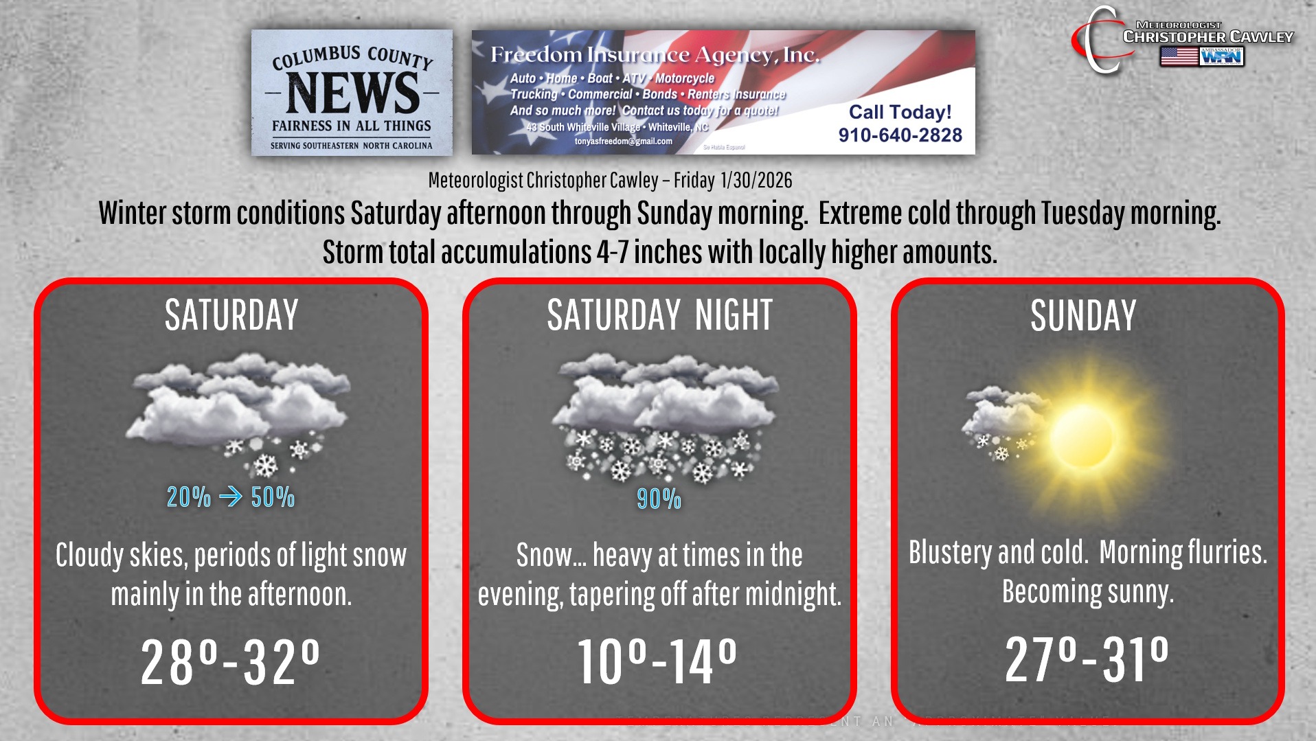
***WINTER STORM WARNING GOES INTO EFFECT 1 AM SATURDAY***
Saturday: Cloudy and becoming breezy. The much-advertised dry slot will probably dominate… much of the day may end up being dry. There’s also the chance that the dry slot fills in much quicker, so there’s a potential for snow in the afternoon. I don’t expect much in the way of accumulation, but with the very cold ground, even trace amounts of snow will cause roads to become very slick… especially secondary roads that haven’t had a brine treatment.
Saturday night: I expect the dry slot to fill in completely. Snow will fall… heavily at times in the evening… and then taper off from southwest to northeast well after midnight.
Sunday: Blustery and cold, a chance for flurries in the morning with sunshine in the afternoon.
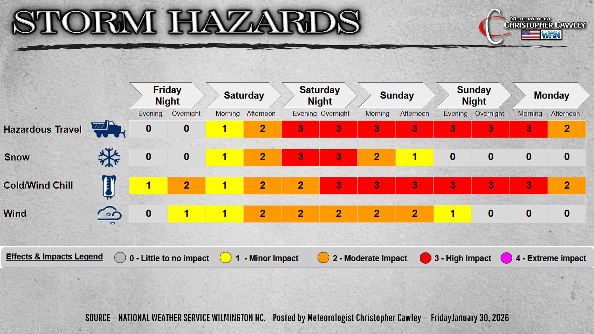
SNOW: My snowfall forecast for the area, as of the time of this writing, is in line with the National Weather Service…. 5-8 inches. Amounts will vary; snow “banding” could lead to double-digit snow totals in some areas, while other areas are relegated to the lower end of that scale (which is still “winter storm warning” criteria).
The snow will be very dry and fluffy, which, when combined with winds of 30+ mph, will lead to considerable blowing and drifting, especially Saturday night. Whiteout conditions and near-blizzard conditions are possible.
There is the POTENTIAL for much higher snow totals IF the upper level trough can wrap into the offshore low at just the right time. If everything lines up just right, and the timing is perfect, we can anticipate blockbuster snow totals. But for now, I’m splitting the difference with 5-8 inches of snow.
WIND: As mentioned, north to northwest winds 25-35 mph, with gusts possibly greater than 40 mph, will be present Saturday night into Sunday.
BITTER COLD: Actual air temperatures Saturday night will fall to between 10 and 15 degrees, with wind chill values from 5-below zero to 5-above zero. Actual air temperatures Sunday night will be between 5 and 10 above zero, with wind chills -5 to +5. Temperatures don’t really rise above freezing until sometime Tuesday afternoon, but temps dive back to around 20 Tuesday night.
ICY ROAD CONDITIONS: With the temperatures remaining well below freezing into Tuesday … with temps diving back down to around 20 Tuesday night. Significant snow totals will result in dangerous conditions on secondary roads well into the mid-week period.
Folks, this is a dangerous storm, and has the potential of being one of the more memorable storms in North Carolina history. Take it seriously.
Join me for Facebook Live on the Columbus County News FB page at 7:15 PM this evening with the latest information.
Here’s your Freedom Insurance Today-plus-Five Forecast!
–Meteorologist Christopher Cawley