CCN Weather Update for Friday February 13, 2026.
This weather update is sponsored by Freedom Insurance of Whiteville. You can trust Freedom Insurance to give you clear blue skies when it comes to home, car, boat, or whatever insurance you need. Let Freedom provide customized coverage to keep you and your family safe. Contact Freedom today at 910-640-2828!
Here’s today’s Bottom Line:
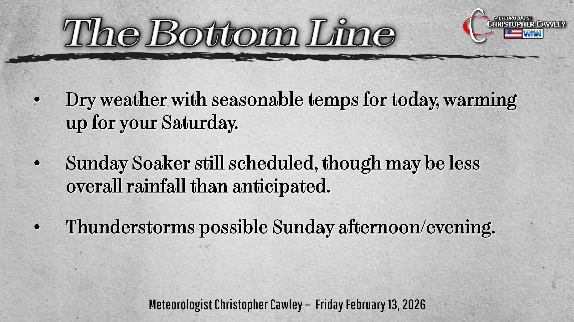
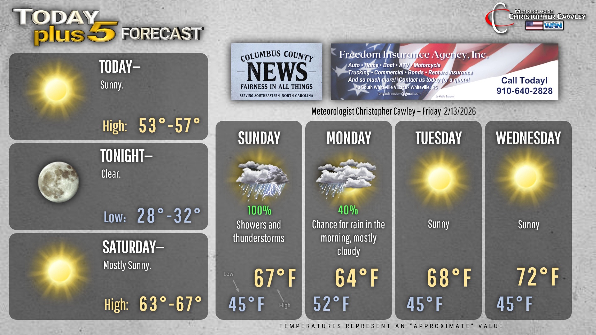
Another dry and seasonable day across Columbus County as high pressure maintains control of all things weather. We’ll have seasonable highs in the mid to upper 50s with a light wind.
Tonight will be rather cold — not unusually so for this time of year — but cold indeed with lows around 30.
Much warmer temps for Saturday as the high slips off the coast allowing for a southerly flow of more mild and moist air into the area. This is ahead of our next storm system, a significant rainmaker, slated to arrive Saturday night and last through Sunday night.
A warm front will lift north over the area early Sunday morning with an area of rain associated with the front.
Our area will then be in a “warm sector” through late morning into the afternoon hours with scattered to numerous showers likely being the rule.
Scattered thunderstorms may mix in with the shower activity Sunday afternoon and Sunday evening ahead of the low pressure center. I do not anticipate any “severe” weather with this event… but don’t be surprised if you hear a rumble or two of thunder.
Rain will continue through much of Sunday night before tapering off Monday morning.
Model blends still point to between 1 and 1.5 inches of rain across the entire area. There will be localized higher amounts wherever thunderstorms become established, and there may be a few spots that get less rainfall.
Either way, this is very beneficial — but not drought-busting rainfall.
After that system, we dry out through much of next week with temperatures running much above seasonable normal values … we’ll be deep into the 70s for the midweek period.
Here’s your Freedom Insurance Today-plus-Five Forecast!
–Meteorologist Christopher Cawley