
Columbus County NEWS Weather Update for Wednesday August 12, 2026.
This weather update is sponsored by Freedom Insurance of Whiteville. Trust Freedom Insurance to give you clear blue skies when it comes to home, car, boat, or whatever insurance you need. Let Freedom provide customized coverage to keep you and your family safe. Contact Freedom today at 910-640-2828!
Here’s today’s Bottom Line
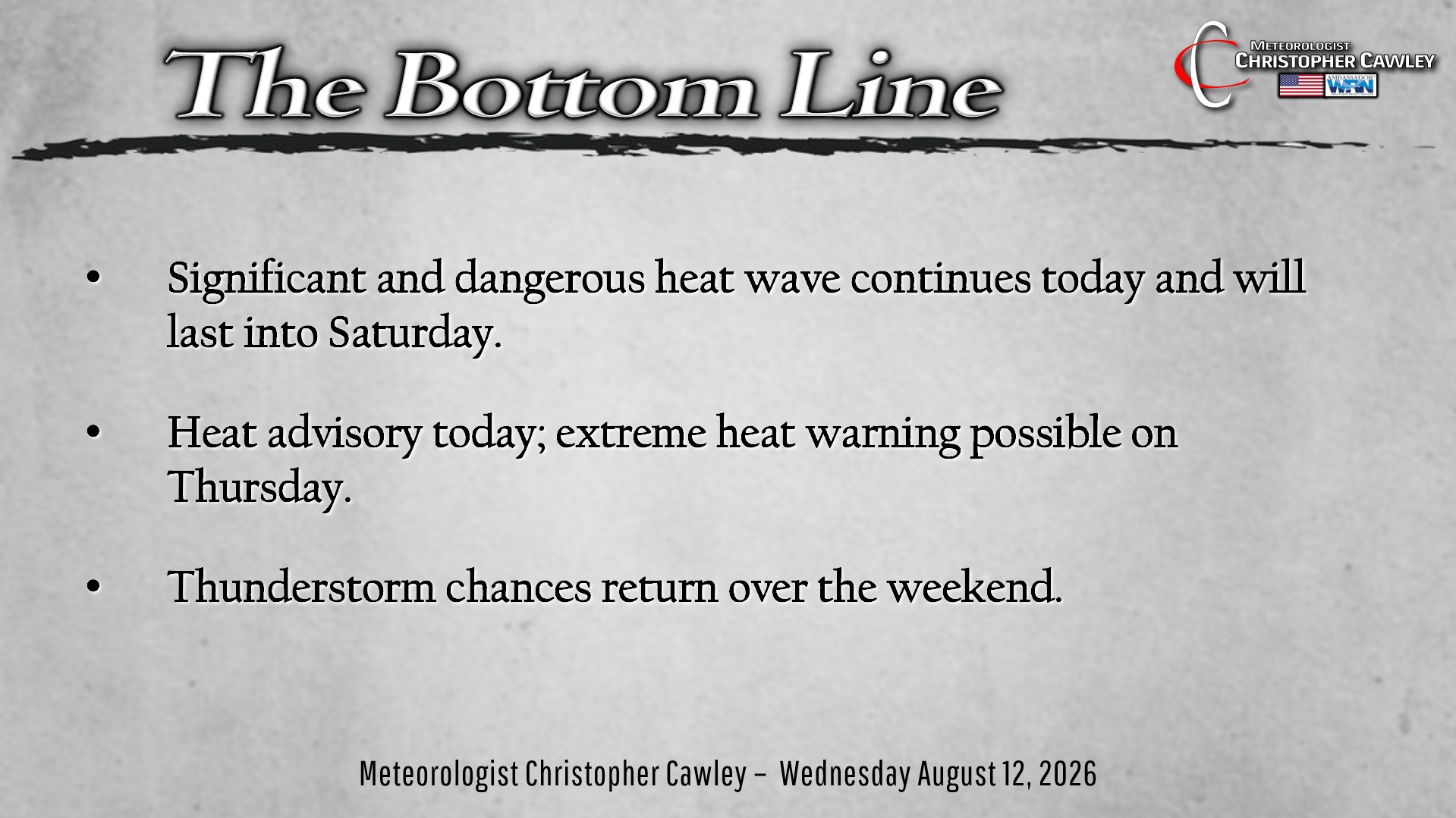
The heat wave continues…
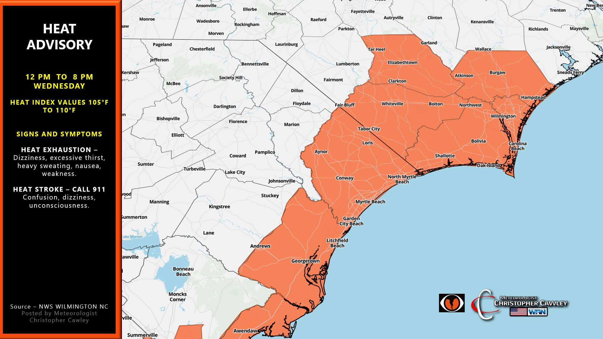
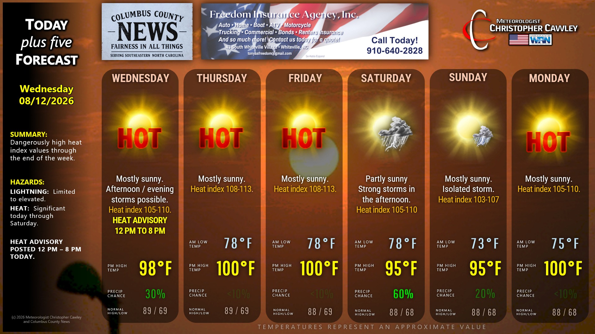
Heat advisory is in place today for heat index value between 105-110. There will almost certainly be heat advisories posted tomorrow and Friday. Heat index might be close enough to warrant extreme heat warnings on tomorrow.
A fairly significant cluster of thunderstorms dove southeast across North Carolina yesterday but by-and-large they died out before getting into Columbus County.
There’s a slight chance for another cluster of storms to push southeastward over the state again late this afternoon into tonight. The NWS Storm Prediction Center has almost all of North and South Carolina under a level 1 risk for isolated damaging winds.
A weak cold front pushes into the ridge over the weekend. Thunderstorms will be the result, especially on Saturday where some of the storms in the afternoon could pack a heavy punch.
Lower storm chances Sunday give way to a roaring return of the heat on Monday.
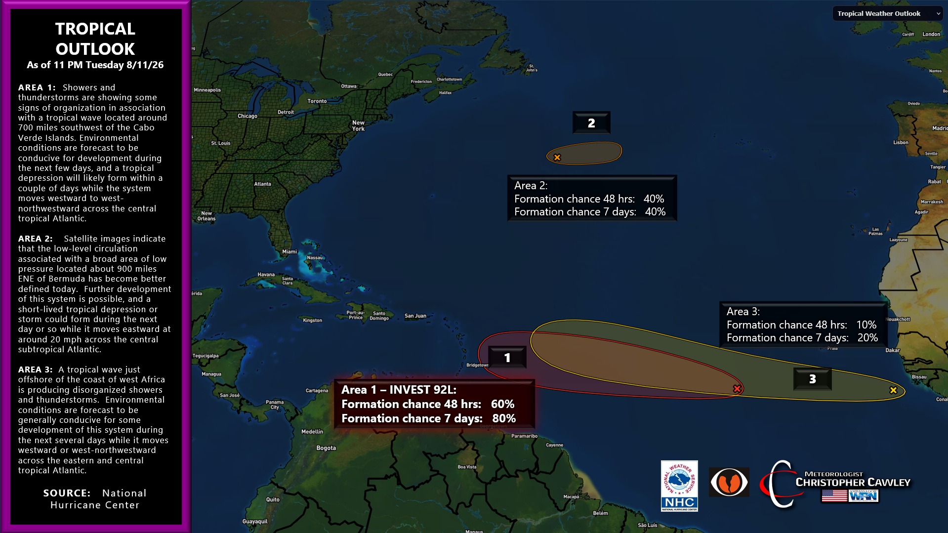
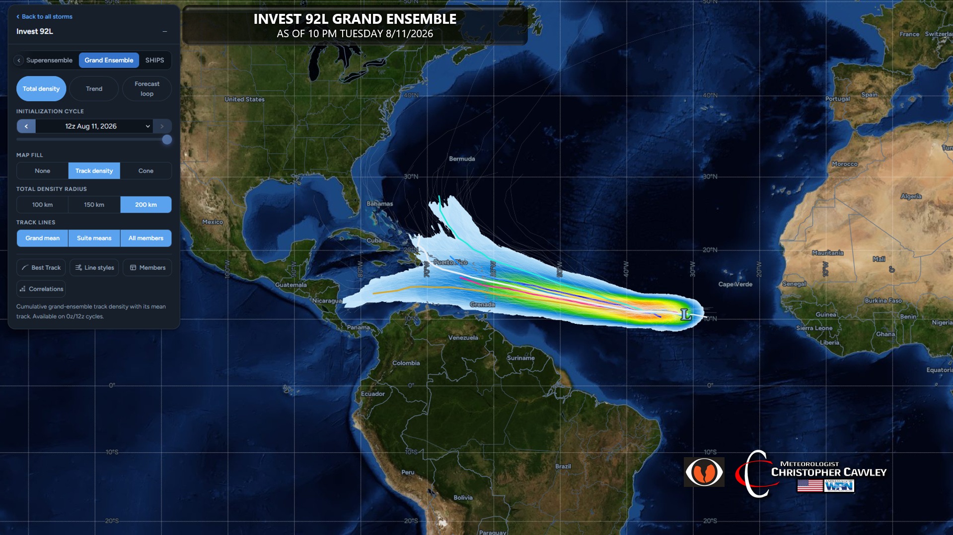
Tropics: There remain three areas of interest in the Atlantic… but the most important one is Invest 92L. This is almost certainly going to develop into a depression or a storm over the next few days. While it’s most certainly too soon to tell, ensemble modeling brings this precariously close to the US east coast. I will be watching this carefully over the next couple of days. Be careful with what you see and share on social media — the social media-ologists are already posting the doom-and-gloom.
Here is your sweltering Freedom Insurance Today-plus-Five Forecast:
–Meteorologist Christopher Cawley