
Columbus County News Weather Update for Sunday September 20, 2026.
This weather update is sponsored by Freedom Insurance of Whiteville. Trust Freedom Insurance to give you clear blue skies when it comes to home, car, boat, or whatever insurance you need. Let Freedom provide customized coverage to keep you and your family safe. Contact Freedom today at 910-640-2828!
Here’s today’s Bottom Line
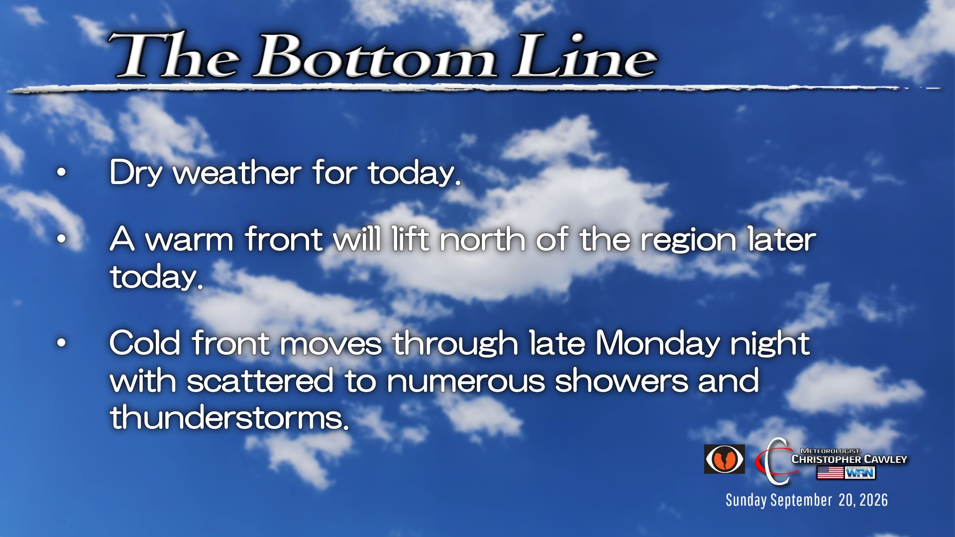
Plenty of sunshine can be expected today. It’ll be a warm one, though, especially later this afternoon as a warm front lifts north over the area. There’s the ever-so-slight chance for a thunderstorm, but not worthy enough to put on the forecast graphic down below.
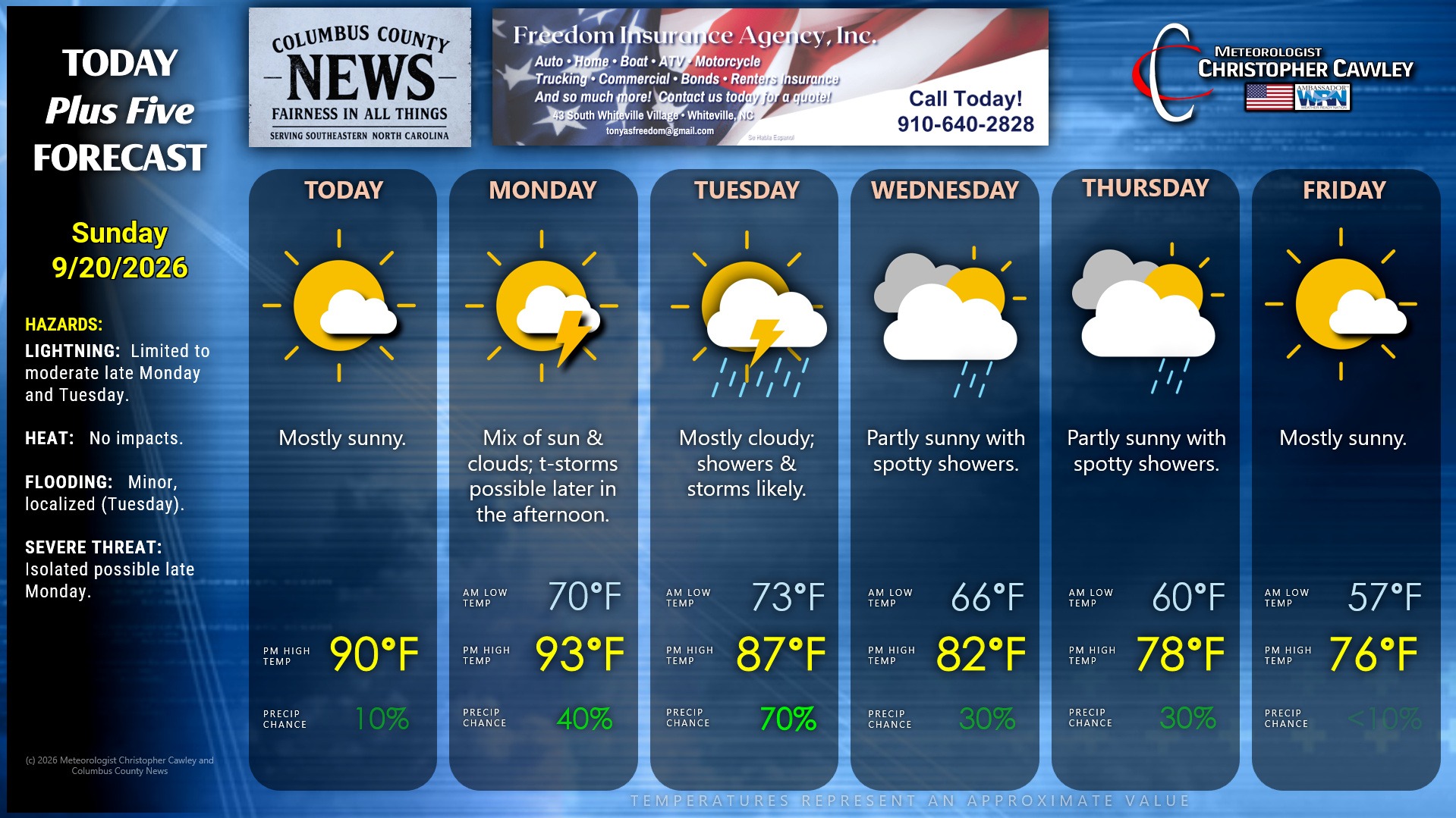
Warm front is well north of here for Monday allowing a robust southerly flow into the picture. It’s going to be hot as our temps push into the 90s with heat index values around 100 degrees. Thunderstorm chances start to increase during the afternoon as a cold front begins it’s approach.
The cold front clears the area during the overnight; scattered showers and storms are likely overnight Monday night and on Tuesday with the front in the vicinity and some instability in its wake.
Low pressure then spins up along the front by Wednesday. This is likely to become the season’s first big Nor’Easter — a non-tropical cold-core system that is typically seen in November-March. Since this low is forming along the front, I do not expect it to take on subtropical characteristics, but that can’t be ruled out, either.
Guidance has the low strengthening as it lifts northeast; however, there are discrepancies between models in the exact details. Ensemble guidance has a wide range of possible strength and various tracks, so there is uncertainty regarding the whole scenario.
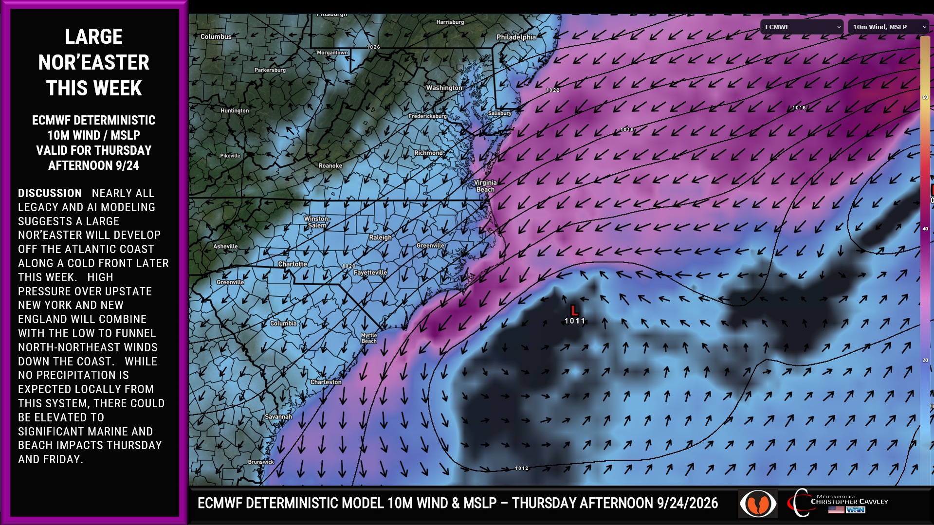
This low is expected to slowly lift northeastward, and the gradient between this low and high pressure over upstate New York or New England will tighten, funneling cool north-northeast winds to the area starting Tuesday night. These winds will also bring much cooler conditions and almost a CAD-type scenario to the area for Wednesday and Thursday. Expect considerable cloudiness, breezy conditions, and spotty showers both days.
This is all a memory on Friday with lots of sunshine… and highs BELOW normal for a change.
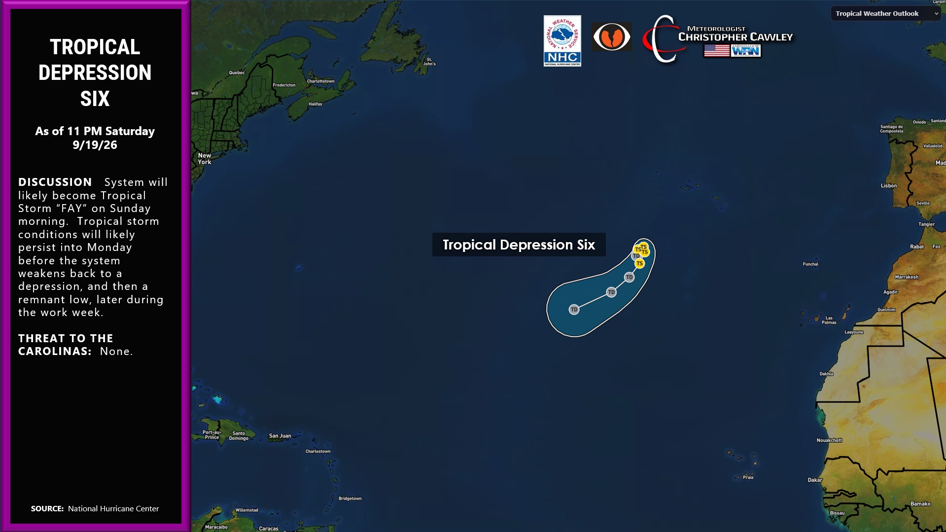
TROPICS: Tropical Depression Six — likely Tropical Storm “Fay” by the time you read this, will meander harmlessly in the east-central Atlantic. There may be a short window of time where she can strengthen (likely staying well below hurricane status)… but that window slams shut this evening thanks to dry air and increasing shear. Don’t commit the name to memory, she won’t be around long enough to matter.
Before we get to the forecast graphic, do me a favor and SHARE this and other articles across social media. Help keep CCN on the map!
Here is your Freedom Insurance Today-plus-Five Forecast:
–Meteorologist Christopher Cawley