

Columbus County News Weather Update for Thursday October 8, 2026.
This weather update is sponsored by Freedom Insurance of Whiteville. Trust Freedom Insurance to give you clear blue skies when it comes to home, car, boat, or whatever insurance you need. Let Freedom provide customized coverage to keep you and your family safe. Contact Freedom today at 910-640-2828!
Here’s today’s Bottom Line
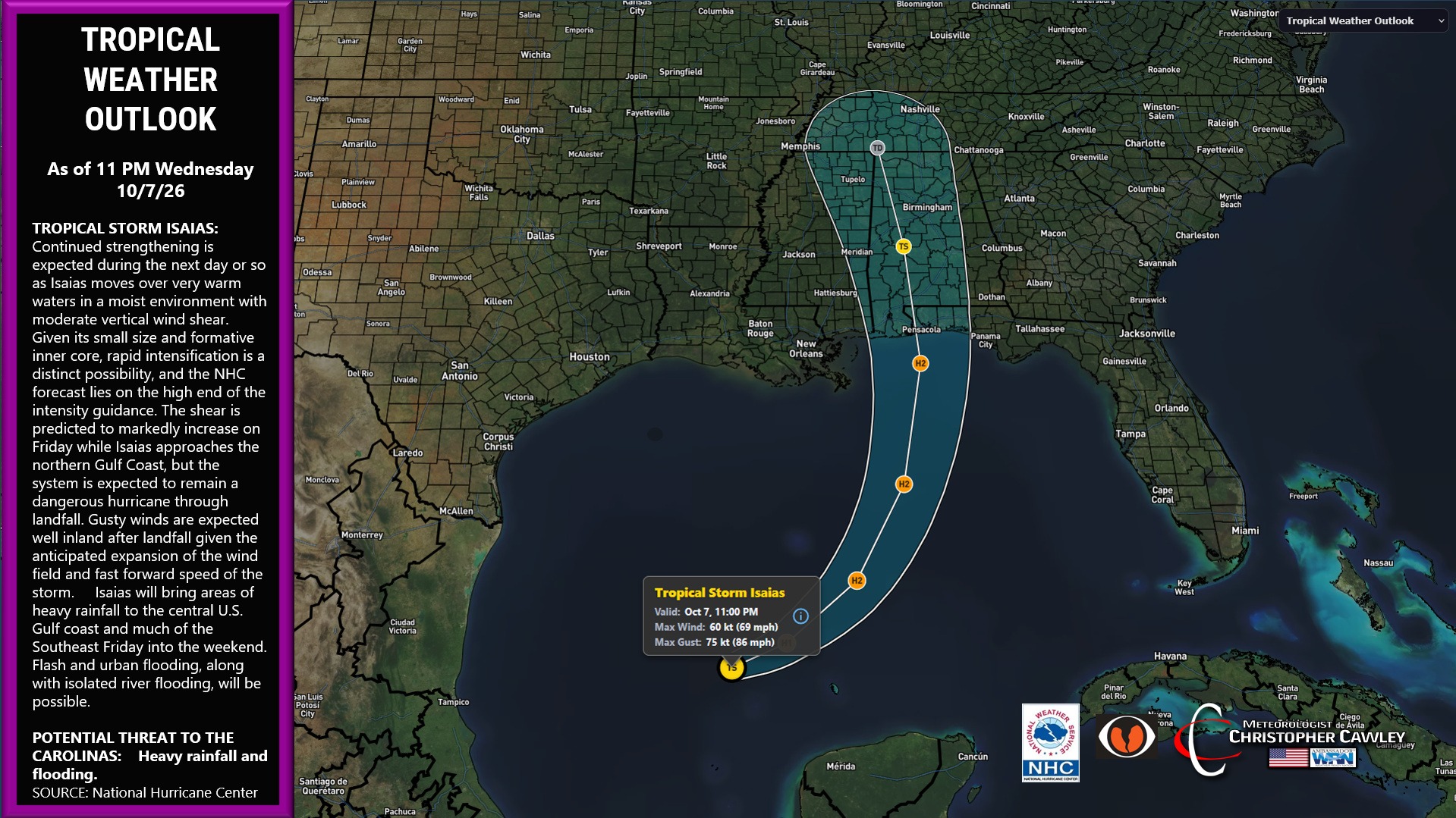
Full attention is going to be on Isaias. The track is becoming pretty clear at this time, as is the intensity. It’s likely to become a category-2 storm before encountering a good bit of shear just before landfall, likely weakening the storm just a little bit.
Abundant moisture will push quickly up the coast well east of the storm. High pressure off to the northeast will also pull in abundant Atlantic moisture, enhancing everything.
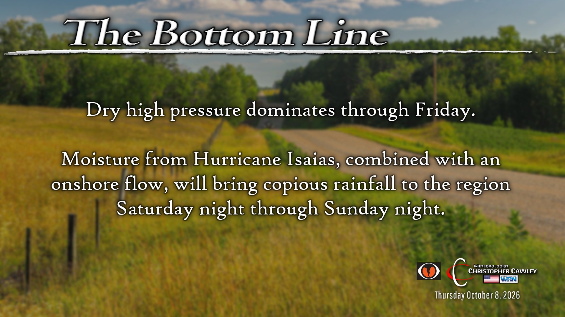
Now the uncertainties begin. This huge area of high pressure will push dry air higher in the atmosphere down the coast. This dry air could evaporate a good bit of precipitation that might try to push in on Saturday. I think the precipitation shield will win by later Saturday afternoon, but there’s enough uncertainty there that most of the day could end up dry.
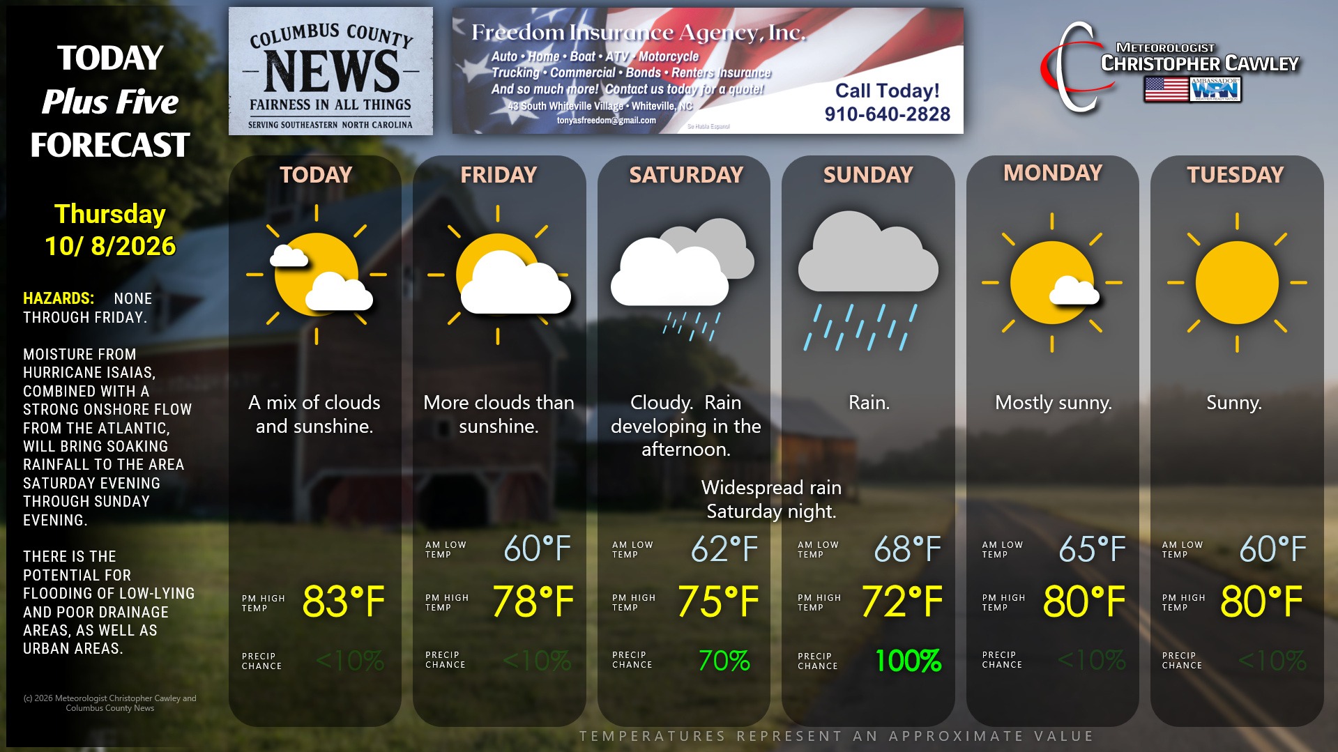
Periods of rain Saturday night and Sunday. This rain will be enhanced by streams of moisture pushing in off the Atlantic.
For rainfall amounts, the devil will be in the details. These “rivers” of moisture pushing in off the Atlantic will likely produce excessive rainfall amounts Saturday night and Sunday, while other areas remain in a light to moderate rainfall regime.
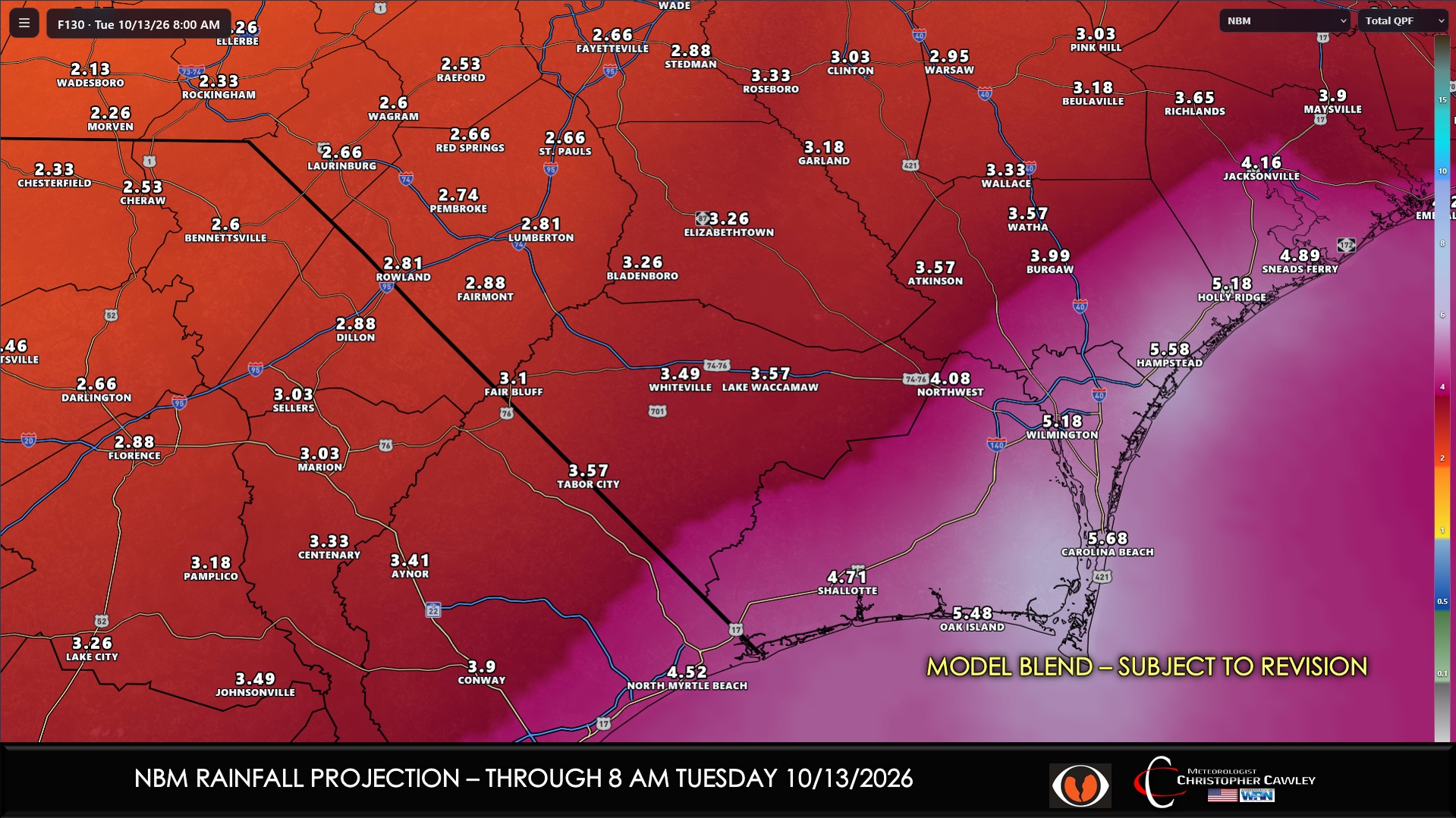
Where these bands set up won’t be known until the event is unfolding. Model blends are going rather heavy with the rainfall but I’m not quite … “confident” on those solutions. I think a general 1-3 inches of rain is a good early “first call” on the whole. Where the enhanced rain bands become established, though, amounts of 4-6 inches could occur.
This will be a fairly quick hit. Rain should start to diminish later Sunday afternoon and end Sunday evening, with clearing skies overnight. High pressure then builds back in for Monday and Tuesday with dry weather.
Key concerns with Isaias and the Atlantic “rivers” of enhanced moisture:
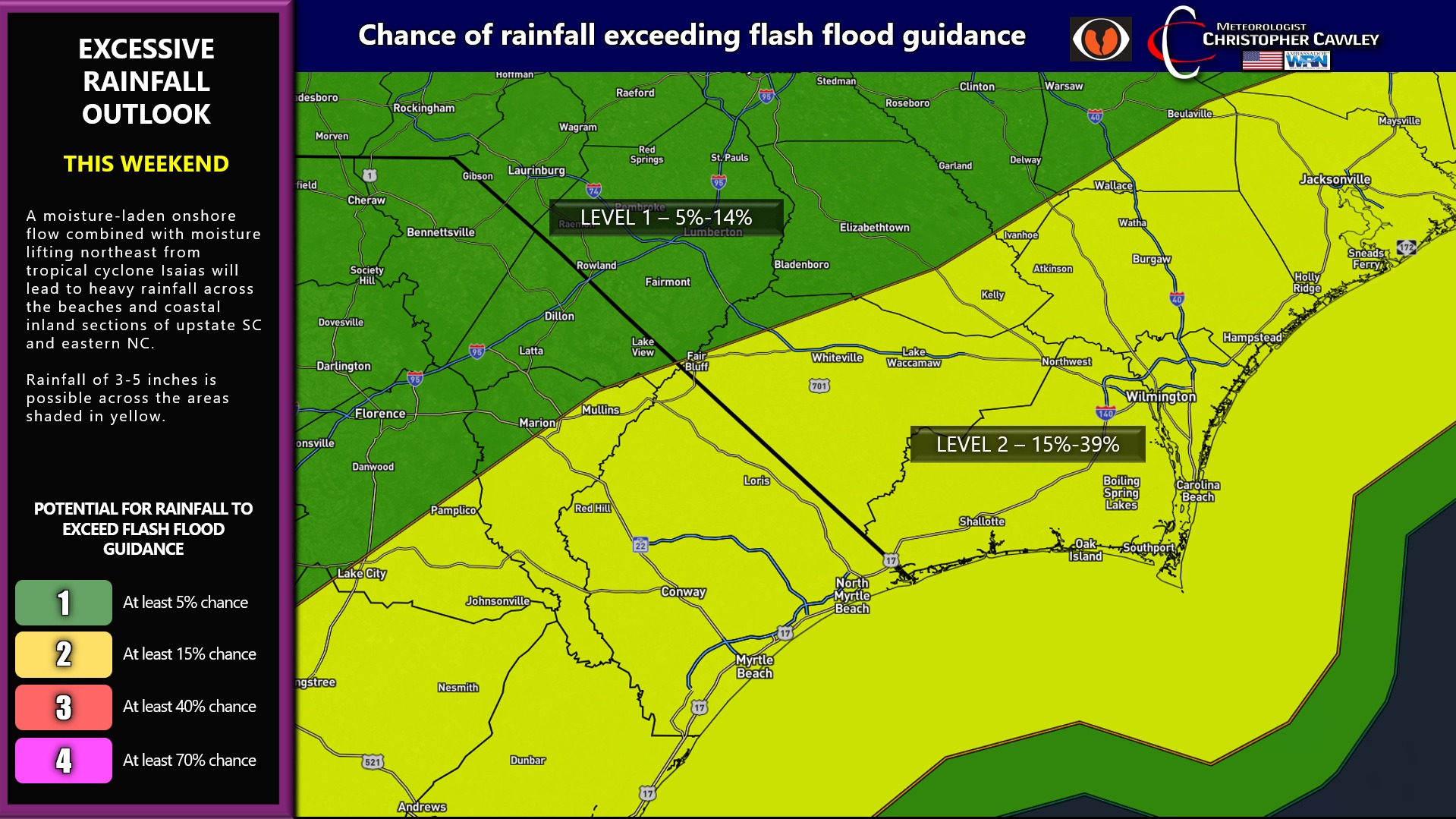
1. Areas of heavy rainfall. The NWS WPC has placed coastal areas under a 15%-39% risk for excessive rainfall leading to flash flooding, while areas farther inland are under a 5% to 14% risk of excessive rainfall.
2. Flooding. Low-lying areas, poor-drainage areas, and urban areas may see some flooding with the 1-3 inch rainfall amounts. If heavier amounts of 4-6 inches occur, we could see some more significant areas of relatively short-term flooding, possibly requiring the issuance of advisories or warnings. Heavy rain is likely to occur Saturday night during the overnight; flooded roadways are much harder to see during the nighttime hours, so any travel Saturday night needs to be undertaken with a good bit of caution.
Graphics:
As they say… “stay tuned!”
Here is your Freedom Insurance Today-plus-Five Forecast:
–Meteorologist Christopher Cawley