

Columbus County News Weather Update for Friday November 20, 2026.
This weather update is sponsored by Freedom Insurance of Whiteville. Trust Freedom Insurance to give you clear blue skies when it comes to home, car, boat, or whatever insurance you need. Let Freedom provide customized coverage to keep you and your family safe. Contact Freedom today at 910-640-2828!
Here’s today’s Bottom Line
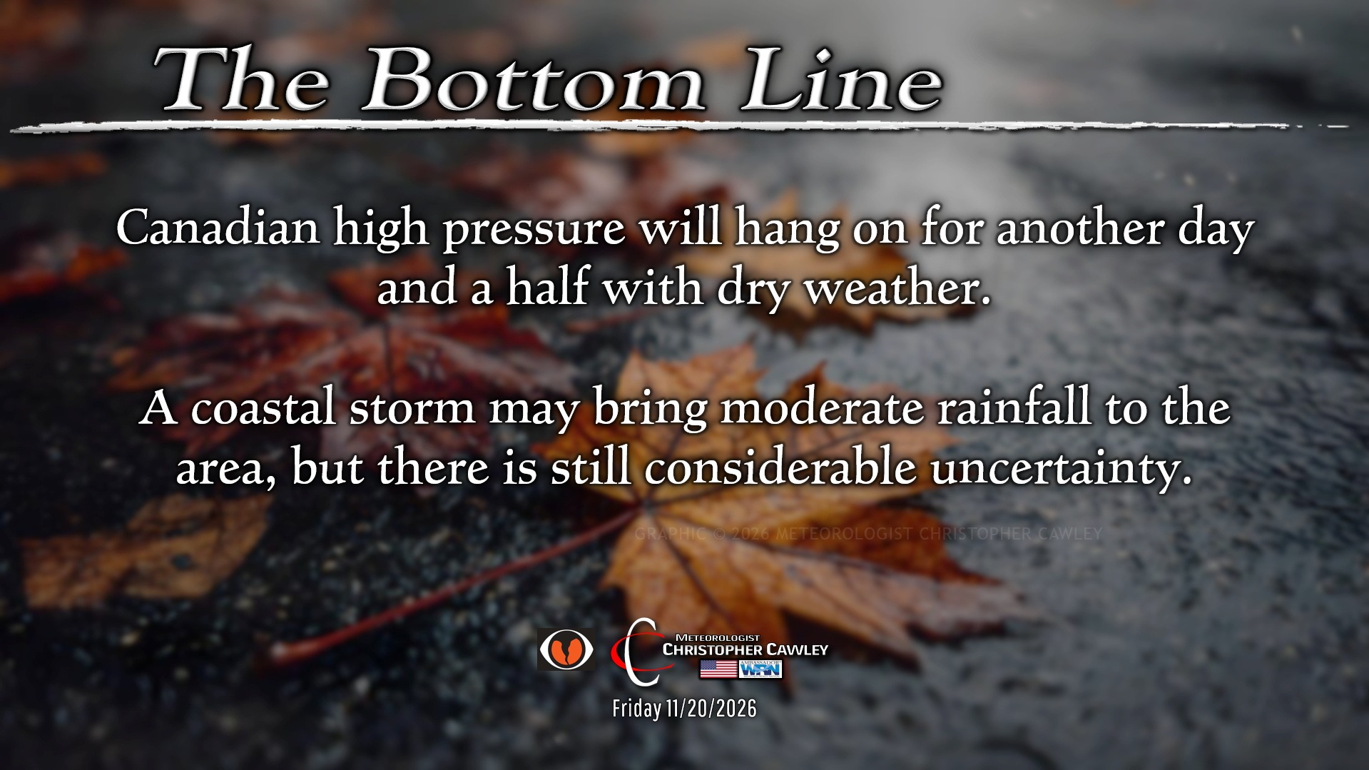
One more day of dry weather (well Saturday should be MOSTLY dry). High pressure will desperately cling to control over the area. We should see a mix of clouds and sunshine throughout the day, and variably cloudy skies will greet us all tonight was we pack Legion Stadium to cheer on the Wolfpack.

Our coastal low is taking shape off the east coast of Florida this morning. This is expected to lift generally northward through this evening. From there, our global deterministic and ensembles go into a zone coverage layout, with spreads ranging from the central Carolinas to several hundred miles off shore, and all positions in between. While this might be good for defense against the throwing game, it is miserable for weather forecasting.
Sadly I believe this event is going to fall into a “nowcasting” rather than a “forecasting” pattern, because exact impacts really won’t be known until things actually start taking shape.
Rainfall COULD be rather substantial across the area. Some areas COULD see their heaviest one-day rain totals since September.
It’s also possible that the area experiences a cloudy, but quiet weekend. I think that potential is quite a bit lower, though, based on the latest data and information.
So I am going to hedge my bets on a closer run with low pressure hugging the coast or possibly lifting north over eastern North Carolina. Skies become mainly cloudy on Saturday with some rain possibly breaking out by sunset. I believe Saturday night will feature periods of rain, not an all-nighter, but coming in intervals. The rain MIGHT be heavy at times, depending on the storm track. It may also become rather breezy to windy Saturday night.
On Sunday the low passes to our north (or northeast) and away, with any leftover rain coming to an end, and the possibility of some sunshine later in the day.
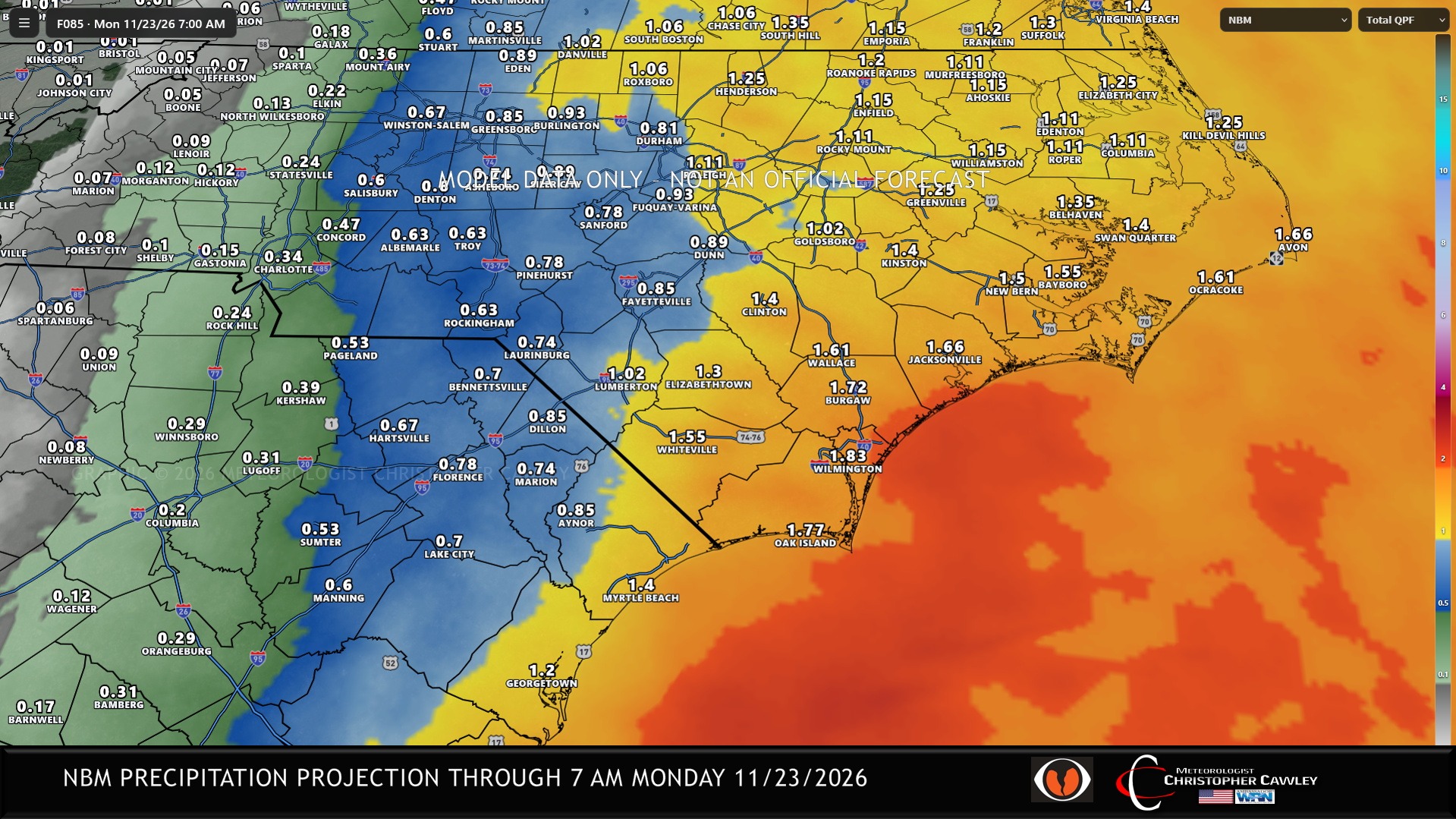
National blend of models suggests a general 1-2 inches of rain over the county. This is a BLEND of all available modeling, and is subject to refinement.
But wait… there’s more!
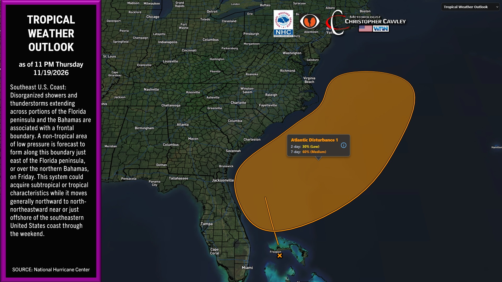
There is still a better-than-even chance that this storm system takes on subtropical or tropical characteristics if it can shed it’s surface fronts and gains some fuel from the Gulf Stream waters (which are still very warm). It’s not going to make much of a difference in terms of “real world” impacts, but it’ll be “Rain with a Name.”
Weak high pressure then builds in for the first half of the short week. Our next storm develops along the southern stream for Wednesday and Thanksgiving. I expect we’ll see some clouds and a chance for showers for the busiest travel day of the year, with showers possible on Thanksgiving day, again depending on storm track.
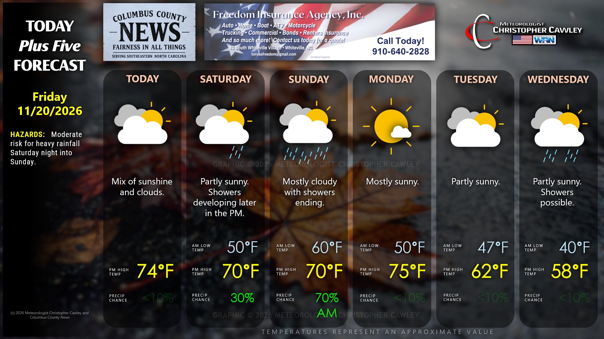
Here is your Freedom Insurance Today-plus-Five Forecast:
–Meteorologist Christopher Cawley
Copyright 2026 © Columbuscountynews.com and Southeastern Community News LLC. All rights reserved. No material may be commercially reprinted, copied or reused from this site without the express written permission of the publisher.