Hello everyone and welcome to your Monday edition of the CCN Weather Update.
This weather update is sponsored by Freedom Insurance of Whiteville. Protect what matters with Freedom Insurance. Life is full of surprises, but with Freedom Insurance, you’ll always be prepared. Whether it’s your home, car, business, or health, we provide customized coverage to keep you and your loved ones secure. Contact Freedom today at 910-640-2828!
STATISTICS FOR WHITEVILLE – Sunday March 23, 2025.
High: 77.5°F at 3:29 PM (normal is 68)
Low: 44.1°F at 7:57 AM (normal is 43)
Precip: 0.00 in
View live, real-time weather data for Whiteville on my College Street Weather Station.
Here’s today’s Bottom Line
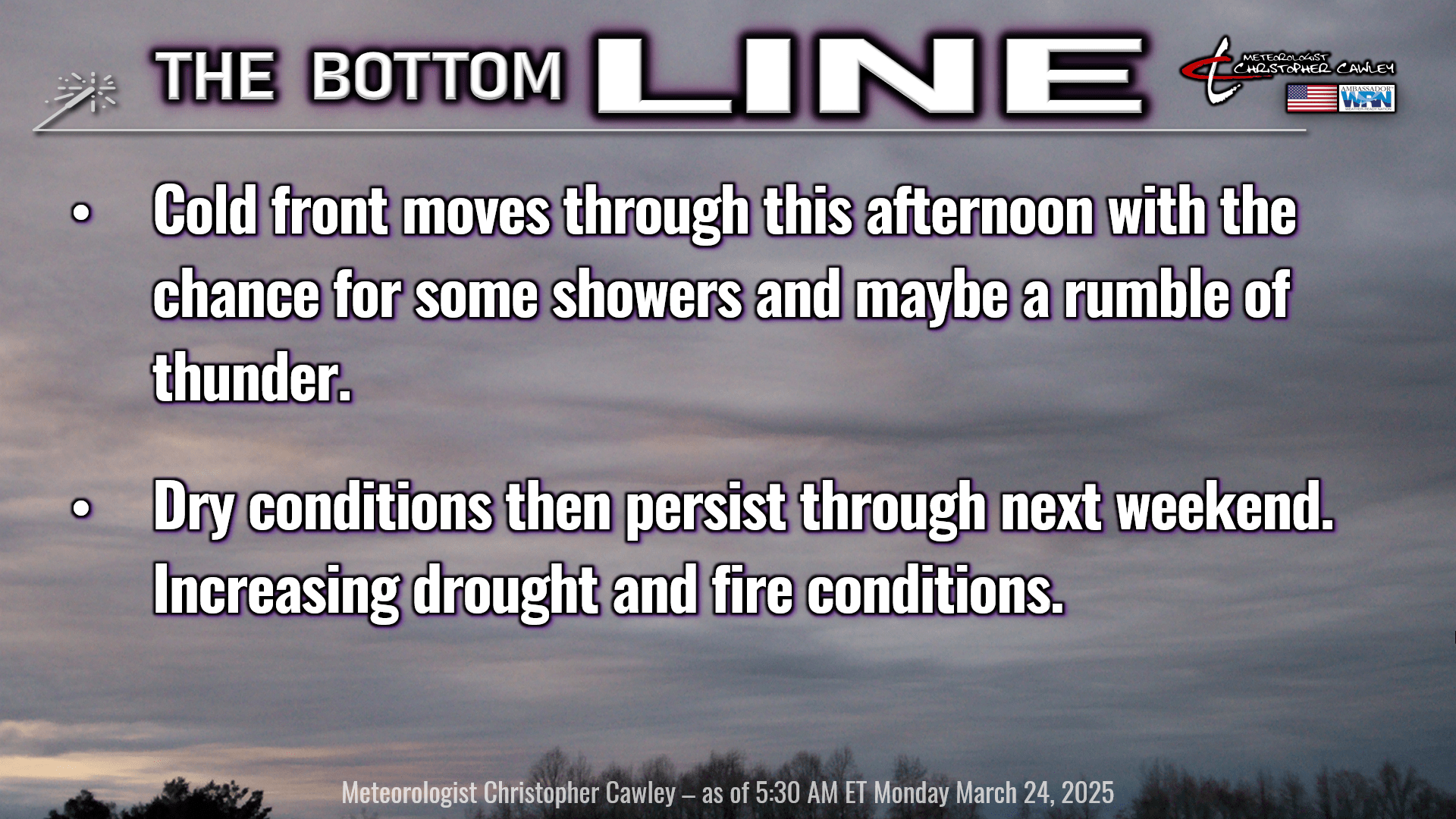
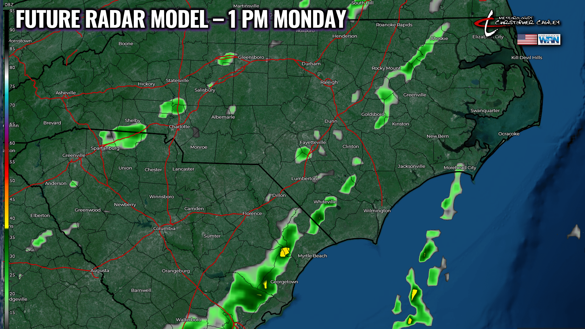
We say greetings to a “cold front,” in name only to be quite honest. Increasing cloudiness can be expected this morning… but we should receive enough sunshine to mix up the atmosphere a bit, bringing wind gusts in the 20-30 mph range. There will be a very narrow ribbon of moisture just ahead of the front that we may experience some light rain showers and maybe, maybe a rumble of thunder. Whatever we get (if anything) will be a quick hit, and won’t amount to much more than enough to wet the ground a little bit. It’s not going to be much.
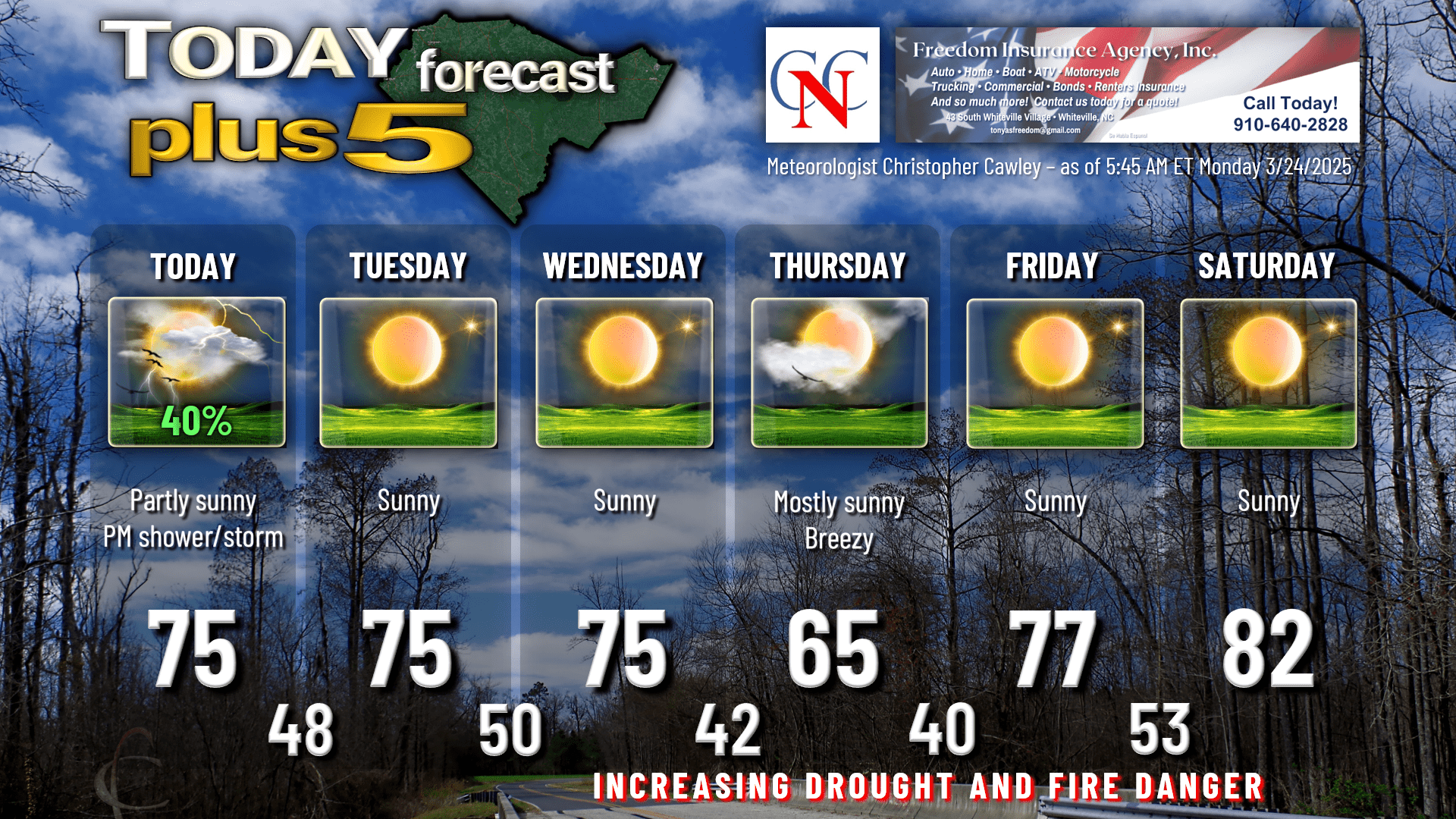
The front clears the coast tonight and high pressure starts to ridge in and will hang on through Wednesday with dry weather and temps in the 70s. There is a … “wave in the flow” for lack of a better way to phrase it … that will sweep to our north on Tuesday. If this drops farther south than the guidance suggests, there may be some cloudiness and maybe a rain drop or two. I’m really working hard here to find ANYTHING worth talking about.
Our next cold front arrives Wednesday night. What will that bring? A whole lot of nothing, other than a few clouds, some breezy conditions Wednesday night and Thursday, and a brief period of cooler temps. No rain whatsoever. Thursday will be breezy and cool with highs in the 60s… while we drop to around 40 early Friday morning. I believe some of our typically colder spots will fall into the upper 30s but at this point frost would be really isolated, if any at all.
Big warmup begins Friday through next weekend. Temps in the upper 70s on Friday should rise into the lower 80s next weekend as the first Bermuda high pressure ridge of the season becomes established. A couple of the outlying Euro ensemble members have us flirting with 90 next Sunday. I don’t think so. Model blends point to lower 80s. I don’t see any reason to deviate from that.
Looking longer term, the Bermuda high shifts farther to the east allowing a pretty vigorous frontal system to approach the east coast. The European deterministic shows quite a bit of rain here early NEXT week (March 31st-April 1st). GFS deterministic also has the frontal system in our area by April 1st, with low pressure over upstate NY and another wave of low pressure developing off the NC coast. This is a week out so I’m not putting much stock into it right now, but this would represent the first real decent chances for some soaking rainfall in quite a long time. There may be a little bit of “wishcasting” thrown in here but I will continue to watch these trends.
But for now… outside of a shower or rumble of thunder today… rain chances are essentially zero through next Sunday. And the Great Pollen Storm of 2025 will continue.
Here’s your Freedom Insurance Today-plus-Five forecast:
That will conclude today’s report. Thanks for reading, and as always, take care.
Meteorologist Christopher Cawley
Columbus County News