Welcome to the CCN Daily Weather Update for Saturday March 8, 2025.
Today’s weather update is brought to you by our friends at Freedom Insurance in Whiteville. No matter what your insurance needs happen to be, the professionals at Freedom can get you set up with the perfect policy for you. Dedicated service and friendly faces at Freedom Insurance. Call today 910-640-2828, or stop into their office near the south-end Hills in Whiteville.
STATISTICS FOR WHITEVILLE – Friday March 7, 2025.
High: 59.5°F at 4:12 PM (normal is 63)
Low: 35.5°F at 5:25 AM (normal is 38)
Precip: 0.00 in
View live, real-time weather data for Whiteville on my College Street Weather Station
Here’s your Bottom Line for today…
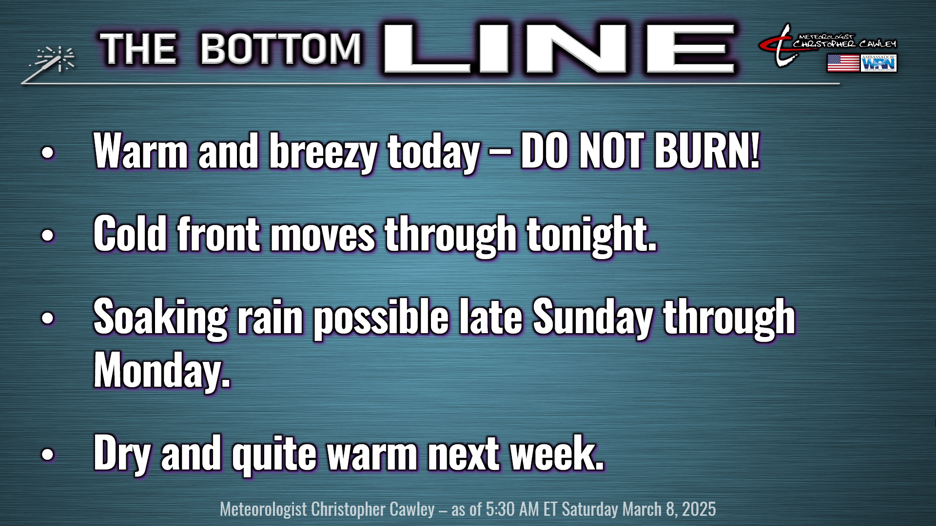
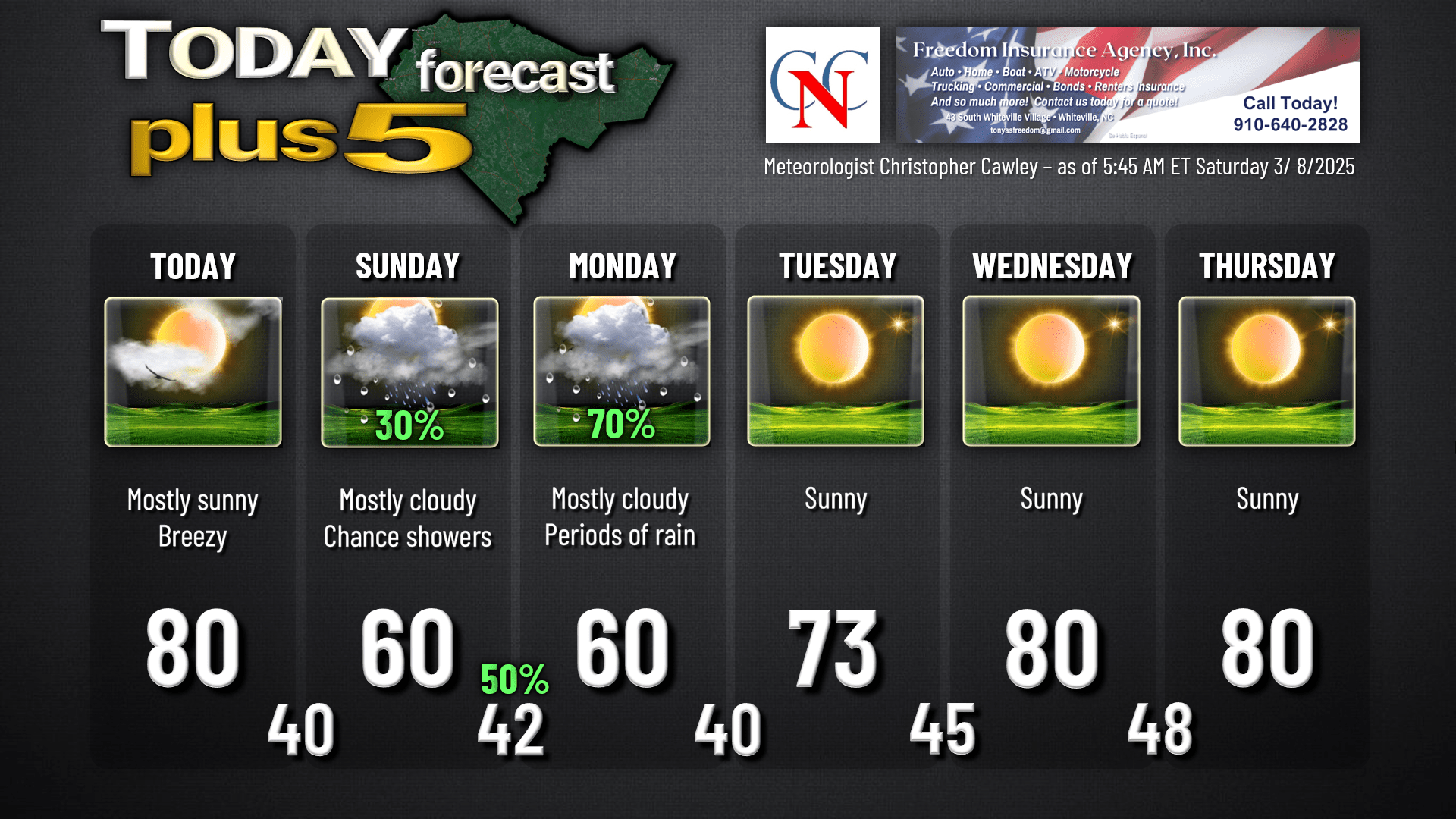
A breezy and warm day today across the county as high pressure offshore combined with an approaching cold front results in a robust southerly wind flow. Our highs will flirt with the 80-degree mark, and we’ll see increasing cloudiness later this afternoon.
Cold front drops from northwest to southeast over the area tonight, and eventually gets “slung out” from west to east over southern South Carolina to southern Georgia. The front becomes stationary as we turn to Sunday. There’s the slight chance for a rain shower Saturday night but I think the front is going to come through with little fanfare, other than a shift in wind direction.
On Sunday, a wave of low pressure is expected to form along the aforementioned front, and this will work to lift the frontal boundary northward across central South Carolina by late in the day. A few scattered showers are possible on Sunday. It will be markedly cooler behind the cold front — highs struggling to reach 60.
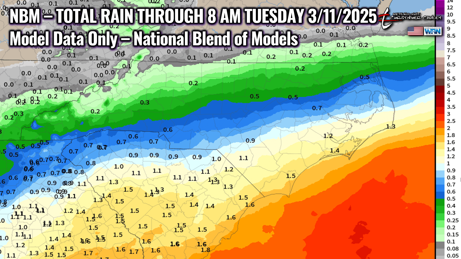
Sunday night into Monday — the low moves to the coast, hits the Gulf Stream waters, and the model guidance suggests that the low strengthens considerably. In a significant change from my forecast yesterday, Monday is likely to be a cool, rainy day across the area.
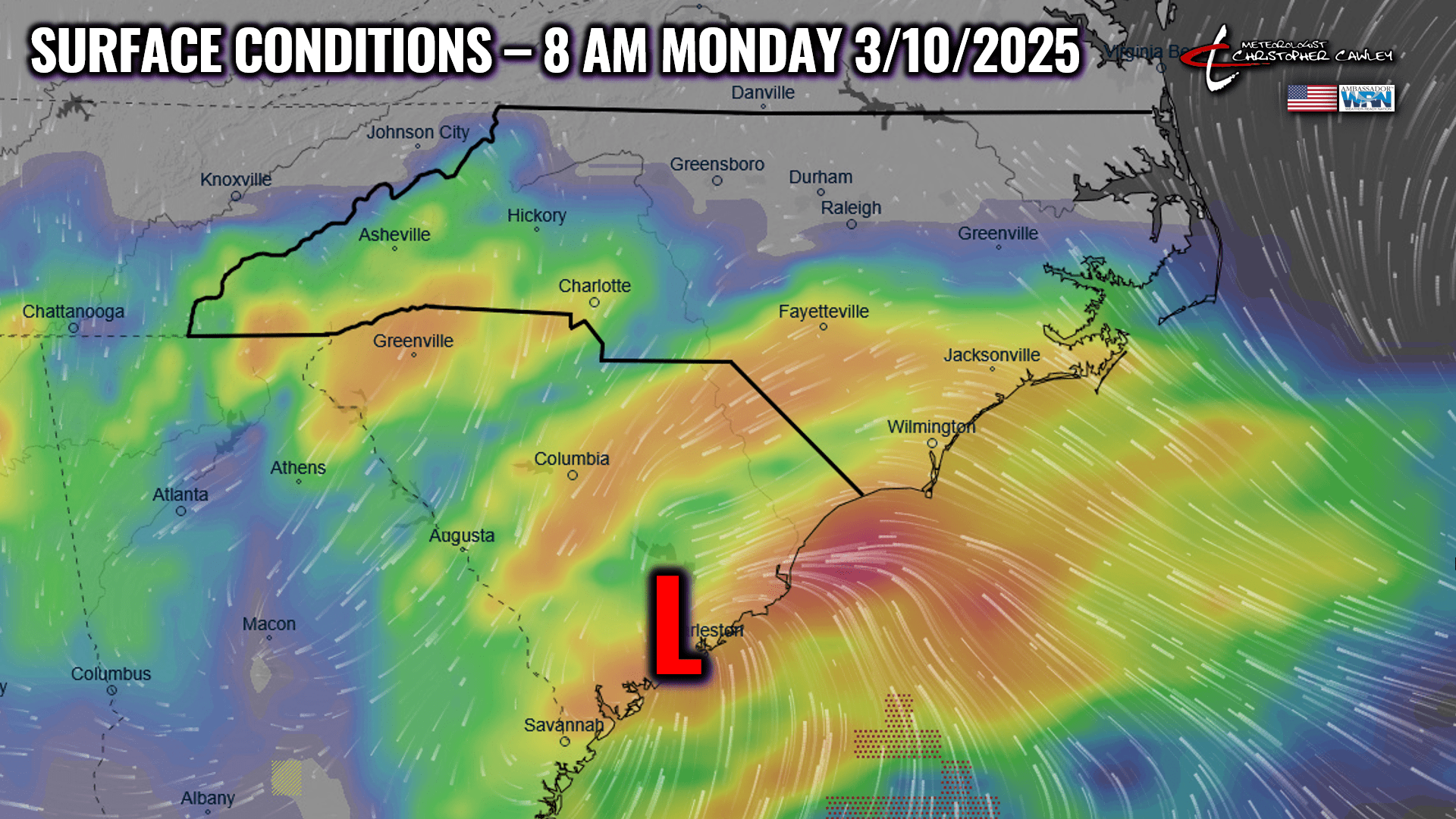
A decent rainfall is likely to occur with this system. The model blend suggests much of the county gets at least an inch of rain Sunday night into Monday… the southeastern section of the county is shown to possibly receive 1.5 inches. Note, careful with this analysis — this is the blend of all models, kind of “the average” of all the values.
That clears on out of here Monday night, and we’re left with sunny and WARM conditions Tuesday through Thursday… highs around 80 Wednesday and Thursday.
REMINDER — Set the clocks ahead tonight.
REMINDER — Total lunar eclipse visible late Thursday night. Early indications are excellent viewing conditions.
Here’s your Freedom Insurance Today-Plus-5 forecast for Columbus County.
That’ll do it for today. I hope you all have a wonderful day, and as always, take care.
~Meteorologist Christopher Cawley