Greetings, and good day to you! Here is your CCN Weather update for Thursday April 17, 2025.
This weather update is brought to you by Freedom Insurance of Whiteville. Safeguard what is important with Freedom Insurance. Life can be unpredictable, but with Freedom Insurance, you will always be ready. Whether it’s your home, vehicle, business, or health, we offer tailored coverage to ensure you and your family are protected. Reach out to Freedom today at 910-640-2828!
STATISTICS for Wednesday 4/16/2025:
High: 73.7°F at 4:04 PM (Normal 75)
Low: 44.0°F at 7:12 AM (Normal 49)
Precip: 0.00 IN
View real-time data from the weather station at College Street Weather Station.
Here’s today’s Bottom Line
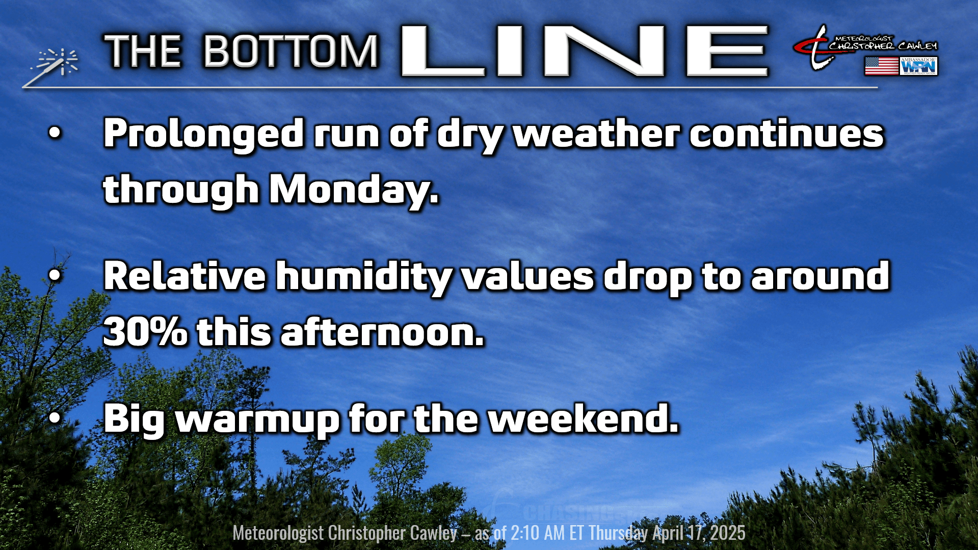
Drought conditions are increasing about the area. Strong high pressure both at the surface and at the middle levels of the atmosphere will continue to dominate our weather through the Easter holiday weekend. Rain chances are zero. Period.
Today will feature a continuation of very dry air over the area. Our humidity dropped to 26% on Wednesday afternoon, and I expect minimum humidity values to be around 30% this afternoon.
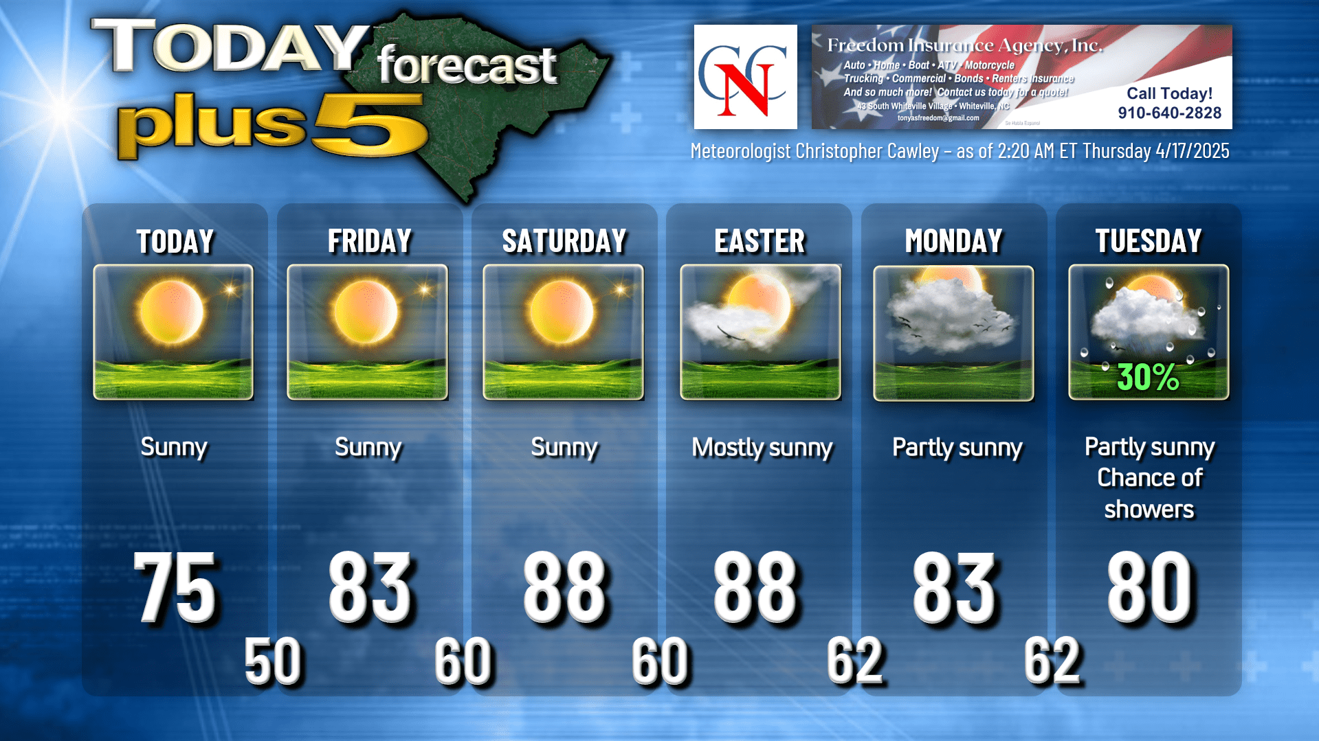
As the high ridge shifts offshore by Friday, a return flow of more humid air will take place. Southerly wind flow will push our temps well into the 80s through the holiday weekend, with heat index values at or above 90 degrees.
Carry the sunscreen as well as the sunglasses if you’re headed out. The sun angle is similar to what it would be in mid-August, and the UV index will be at the top of the chart through the weekend.
Cloudiness starts to increase by Monday as moisture and instability start to build. There is a chance that a frontal boundary pushes just far enough into the eastern Carolinas that a few scattered showers and thunderstorms develop Tuesday afternoon. Depending on the location of the high pressure ridge offshore, that front could stall over our area and keep scattered showers and storms in the forecast into the middle and later parts of next week. However, whatever showers develop won’t do much to break the drought conditions once again setting in. Deterministic Euro guidance suggests a larger-scale weather system impacting the east coast by the end of NEXT week (Friday 4/25-Saturday 4/26) but it’s way too early to really put much weight into that. But it’s something.
Here is your Freedom Insurance Today-plus-Five Forecast:
That’s going to do it for today’s report. As always, thank you for reading and for supporting Columbus County News. Have a great day!
–Meteorologist Christopher Cawley