Hello everyone, and good day to you! Here is your CCN Weather update for Tuesday April 22, 2025.
This weather update is sponsored by Freedom Insurance of Whiteville. Protect what matters most with Freedom Insurance. Life can be full of surprises, but with Freedom Insurance, you will always be prepared. Whether it’s your home, car, business, or health, we provide customized coverage to keep you and your family safe. Contact Freedom today at 910-640-2828!
STATISTICS for Monday 4/21/2025
High: 84.9°F at 3:45 PM (Normal 76)
Low: 58.6°F at 6:08 AM (Normal 50)
Precip: 0.00 IN
View real-time data from the weather station at College Street Weather Station.
Here’s today’s Bottom Line
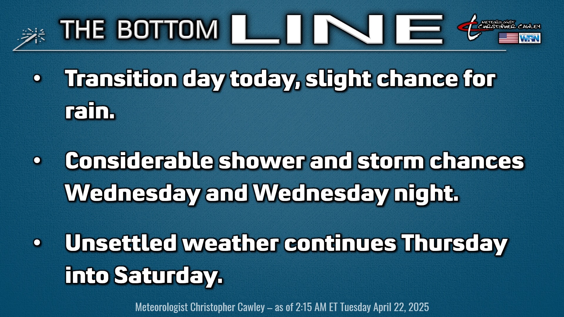
Today will be a day of transition as we go from bone-dry conditions to wet and unsettled through the end of the work week.
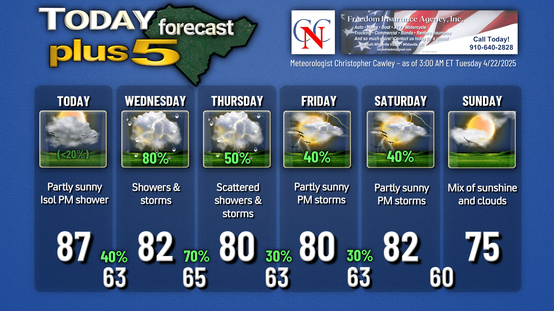
On the whole we should stay dry today, although I can’t rule out an isolated shower or thunderstorm this afternoon and this evening. It’ll be rather humid with highs reaching the upper 80s.
A cold front drops down across the state on Wednesday, becoming settled and strung-out west to east along or just south of the NC/SC state line. This frontal boundary will waffle north and south over the area through Thursday evening and will be the source for scattered to numerous showers and thunderstorms. Originally I was thinking that this wasn’t going to be that big of a deal, but the latest model guidance points to rather robust moisture over our area — precipitable water values running 1-2 inches — so that, combined with the front being the source of lift, spells good rain chances especially Wednesday and Wednesday night. It’s still going to be a “feast or famine” kind of deal as some areas get significant rainfall amounts with repeated downpours, while others barely get the ground wet.
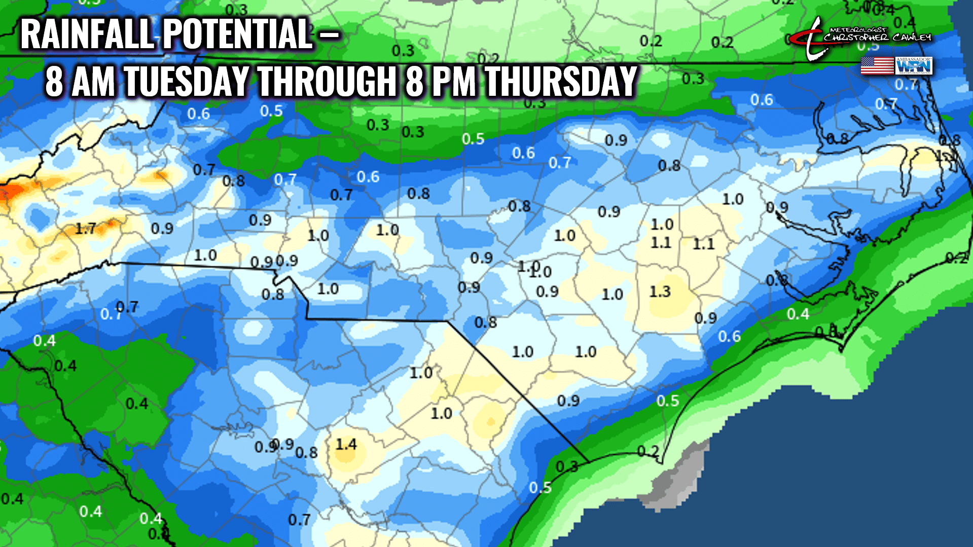
The model rainfall projections show nearly an inch of rain for the central and western part of Columbus county, with lesser amounts as you go into the eastern third or so. This is just a “projection,” a computer-generated “average.” What you get in your backyard may differ quite a bit from what’s shown on the chart.
Attention then turns to Friday and Saturday. Deep southwest flow of humid subtropical air keeps the threat for thunderstorms in the area on Friday, but I don’t think they’ll be as numerous as what we receive tomorrow and Thursday.
A new cold front then pushes through on Saturday. Guidance is pretty strong on the frontal passage being later in the afternoon. A good portion of the day will likely be dry but modeling depicts a fairly organized line of showers and thunderstorms blasting through ahead of the cold front. I put a 40% on the chart for Saturday but that likely will get bumped up as we get closer to the weekend. Cooler and less humid air pushes in for Sunday and into next week. Enjoy that cooler air because the longer-range guidance has temperatures building toward that 90-degree mark as we turn the calendar to May…
Here is your Freedom Insurance Today-plus-Five Forecast:
That’s going to do it for today’s report. As always, thank you for reading and for supporting Columbus County News. Have a great day!
–Meteorologist Christopher Cawley